


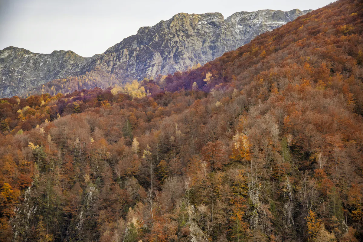
92 Miles of True Wilderness
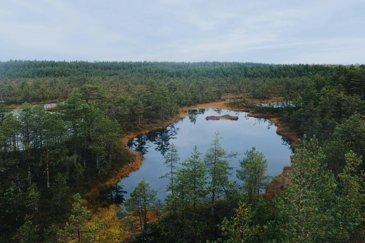
The Allagash Wilderness Waterway is a 92-mile protected corridor of lakes, rivers, and streams running through the heart of northern Maine. It was the first state-administered waterway to be designated a National Wild and Scenic River in 1970, and it remains one of the most remote wilderness experiences available east of the Mississippi.
Henry David Thoreau explored this waterway in 1857, and remarkably little has changed since. The corridor stretches from Telos Lake in the south to the town of Allagash Village in the north, passing through Chamberlain Lake, Eagle Lake, Churchill Lake, and the Allagash River. The full route takes 7 to 10 days by canoe or kayak. There are no roads crossing the waterway, no stores along the way, and no cell towers within range. You are genuinely on your own out here.
Eighty-one designated primitive campsites are scattered along the route, all first-come-first-served. No reservations. You paddle until you find an open site, pull your canoe up on the bank, and make camp. That uncertainty is part of the experience.
There is no cell phone service anywhere along the Allagash Wilderness Waterway. None. A satellite communicator (such as a Garmin inReach or SPOT device) is essential, not optional. If someone in your group has a medical emergency 40 miles from the nearest road, a satellite device is your only way to call for help.
The Route: South to North
The classic Allagash trip runs from Chamberlain Lake south to Allagash Village north. One geographic detail surprises nearly every first-timer: the river flows northward. You are paddling north the entire way, which feels counterintuitive but means the current is with you for most of the river sections.
The route breaks down into three broad sections.
The Lakes (Chamberlain, Eagle, Churchill) make up the southern portion. These are large, open bodies of water that require attention to wind and weather. On a calm day, the paddling is easy. On a windy day, whitecaps can build fast on Chamberlain and Eagle Lakes, pinning you on shore until conditions settle. Plan for weather days.
Churchill Dam to Umsaskis Lake includes Chase Rapids, approximately 9 miles of Class II whitewater below Churchill Dam. This is the most technically demanding stretch of the entire route. For experienced paddlers, it is the highlight. For everyone else, there is a portage trail that bypasses the rapids entirely. The ranger at Churchill Dam can advise on current water levels and conditions.
The Allagash River from Umsaskis to Allagash Village is the most relaxed paddling. The current carries you at a steady pace, the river narrows, and the banks close in with spruce forest. Moose sightings are common along this stretch, especially at dawn and dusk. The final miles widen out as you approach the village.
If you have solid moving-water skills, Chase Rapids is one of the best stretches of Class II in Maine. If you are uncertain, take the portage. The rapids are not dangerous for experienced paddlers, but a capsized canoe loaded with a week’s worth of gear 50 miles from a road is a serious problem. There is no shame in portaging.
Campsites
All 81 campsites are primitive. Each one has a fire ring, picnic table, a pole for hanging a shelter tarp, and an outhouse. That is the full list of amenities. There is no potable water at any campsite along the entire waterway.
Sites are first-come-first-served with no reservation system. During peak season (July and August), popular sites fill by early afternoon. The general rule is to start looking for a site by 2 or 3 PM. If your target site is taken, paddle to the next one. Having flexibility in your daily plan is important.
High Bank on Telos Lake is one of the most photographed campsites in Maine. It sits on a bluff with views south toward Katahdin on a clear day. The sunset from this site is worth building your first day’s paddle around.
Pillsbury Island in Eagle Lake has historical significance. Thoreau camped in this area during his 1857 expedition. The sites here offer good wind protection and a feeling of remoteness even by Allagash standards.
Sites along the Allagash River between Long Lake and the village tend to be smaller and more intimate, tucked into bends in the river with good moose-viewing opportunities.
Rangers patrol the waterway regularly and check in at campsites. They are a good source of information about site availability downstream, water conditions, and wildlife sightings. Be friendly and ask questions. They know the waterway better than anyone.
Fees and Checkpoints
The Allagash is not free to camp on, but it is close. Maine residents pay $6.54 per person per night. Non-residents pay $13.08 per person per night. Children under 12 are free.
Fees are collected at staffed NMW checkpoints, not at individual campsites. You will pass through at least one checkpoint during a full trip. Bring cash or a checkbook. They do not accept credit cards. This catches people off guard every year.
There is no permit system. You do not need to register in advance or submit an itinerary. Just show up, paddle in, pay your fees at the checkpoint, and camp where you find an open site.
Wildlife
The Allagash corridor has one of the highest moose densities in the eastern United States. Seeing moose is not a possibility, it is an expectation. Early morning paddling along the river section between Long Lake and Allagash Village is prime moose territory. They feed in the shallows at dawn and dusk, and it is common to round a bend and find one standing knee-deep in the river 50 yards ahead.
Bald eagles nest along the waterway with at least eight documented active nests. You will see them soaring above the lakes and perched in tall white pines along the river.
The bird life is exceptional. Over 100 species have been documented in the corridor, including loons, osprey, great blue herons, and a variety of warblers in the forest. Loon calls echoing across the lakes at dusk are the defining sound of an Allagash night.
Fishing is excellent. Brook trout and landlocked salmon are the primary species. Fishing is best from ice-out through July, when water temperatures are ideal. The Allagash is fly-fishing water at its best, with healthy native brook trout populations in the tributaries and salmon in the lakes. A Maine fishing license is required.
When to Go
Spring
Ice-out varies (mid-May). High water, cold temps. Experienced paddlers only. Blackflies emerge late May.
Summer
July-August best overall. Warmest water, longest days, most stable weather. July has fewer bugs than June.
Fall
September foliage is stunning. Fewer paddlers, cooler nights. Water drops by late September.
Winter
Waterway freezes. Snowmobile use only. Not suitable for paddling.
June is warm enough for paddling but the blackflies are brutal. They swarm in clouds, they bite through thin clothing, and they will test your commitment to the outdoors. If you have never experienced Maine blackfly season, June on the Allagash will introduce you.
July and August are the sweet spot. The blackflies die down, the weather is warmest, the days are longest, and the water levels are manageable. August water can run low in some years, requiring occasional dragging of canoes over shallow spots.
September brings foliage and solitude. The crowds (such as they are) disappear, the maples along the river turn orange and red, and you may go a full day without seeing another paddler. Nights get cold, and water levels can be low, but the beauty compensates.
If you paddle the Allagash in June, bring a head net, long sleeves, and DEET. The blackflies along the waterway are aggressive and persistent. They are worst on calm, overcast days. A head net is not an accessory in June. It is essential gear.
Getting There and Logistics
The Allagash is accessed via private logging roads, most owned by paper companies. These roads are unpaved, rough in places, and require a vehicle with decent clearance. A truck or SUV is recommended. Sedans can make it in dry conditions but will struggle after rain.
The most common put-in is at Chamberlain Bridge on Chamberlain Lake. The most common take-out is at the boat landing in Allagash Village. These two points are separated by about 100 miles of logging roads, which creates a vehicle shuttle problem.
Shuttle services operate out of towns like Greenville, Millinocket, and Allagash Village. They will drive your vehicle from the put-in to the take-out (or vice versa) while you are on the water. Book shuttles well in advance for July and August. Expect to pay $150-300 depending on distance.
Guided trips are available for $500-800 per person for a full multi-day trip. Guides provide canoes, gear, food, and expertise. For first-timers, a guided trip is a smart investment. The guide handles logistics, knows the best campsites, reads the water, and keeps the group safe. You focus on paddling and the scenery.
Book your shuttle service before you finalize your trip dates. The handful of operators that serve the Allagash fill up during peak season. Arranging the shuttle is often the hardest logistical piece of the trip.
Water and Food
There is no potable water at any campsite along the 92-mile route. You must filter or purify all drinking water from the lakes and river. Bring a reliable water filter (pump or gravity) and backup purification tablets. Waterborne parasites like giardia exist in these waters. Do not drink untreated water regardless of how clean it looks.
Pack all food for your entire trip plus one extra day as a buffer for weather delays. Resupply is not possible once you are on the water. Calorie-dense foods that travel well: oatmeal, peanut butter, dried fruit, hard cheese, pasta, rice, jerky, and trail mix. Fresh food for the first two or three days, then shelf-stable for the rest.
Bear canisters are not required by regulation but are strongly recommended. Black bears are present throughout the corridor. Hang your food bag from a tree if you do not have a canister. Never store food in your tent.
Multi-Day Paddle Trip Checklist
Allagash Trip Checklist
- Canoe or kayak suitable for multi-day loaded paddling
- Paddle plus a spare paddle
- PFD/life jacket (required by law)
- Dry bags for all gear and clothing
- Tent with rain fly rated for 3-season use
- Sleeping bag (30-40F rated, nights are cold even in summer)
- Sleeping pad
- Water filter (pump or gravity) plus backup purification tabs
- Camp stove, fuel, and lighter
- 7-10 days of food plus 1 extra day buffer
- Bear canister or rope for hanging food
- Satellite communicator (inReach, SPOT, or similar)
- Detailed waterproof map of the Allagash Waterway
- First aid kit with blister care and basic medications
- Headlamp with extra batteries
- Bug spray (DEET) and head net (essential in June)
- Sunscreen and sun hat
- Fishing rod and Maine fishing license
- Cash or check for campsite fees at checkpoints
- Rope (50 ft minimum, for lining canoe and hanging food)
- Repair kit for canoe (duct tape, epoxy)
FAQ
Do I need a permit for the Allagash?
No permit is required. Camping fees are collected at staffed checkpoints along the waterway. Maine residents pay $6.54/person/night, non-residents $13.08/person/night. Cash or check only.
Can I reserve a campsite?
No. All 81 campsites are first-come-first-served. There is no reservation system. Plan to start looking for a site by 2-3 PM during peak season. Having flexibility in your daily itinerary is important.
How long does the full trip take?
The classic Chamberlain Lake to Allagash Village route takes 7-10 days by canoe, depending on your pace, wind conditions on the lakes, and how many rest days you take. Strong paddlers in good conditions can do it in 7 days. Plan for 9-10 if you want to fish and explore.
Is the Allagash safe for beginners?
The lakes and river sections are manageable for fit beginners with some flatwater canoe experience. Chase Rapids (Class II) should be portaged by anyone without moving-water skills. The bigger challenge for beginners is the remoteness, the multi-day logistics, and the total lack of services. Consider a guided trip for your first time.
What about moose?
You will almost certainly see moose. The Allagash corridor has one of the highest moose densities in the eastern US. Dawn and dusk on the river sections are the best viewing times. Keep a respectful distance, especially from cows with calves in spring and bulls in fall.
Is there cell service anywhere on the Allagash?
No. There is zero cell service along the entire 92-mile waterway. A satellite communicator is essential for emergency contact. Do not rely on your phone for anything once you leave the put-in.
When are the blackflies worst?
June is peak blackfly season on the Allagash. They are aggressive and relentless, especially on calm, humid days. A head net and DEET are essential in June. By mid-July, blackflies mostly die off and mosquitoes become the primary nuisance, which is more manageable with repellent.