


The Mountain They Saved From a Ski Resort
Bigelow Preserve exists because Maine voters said no. In 1976, a citizen referendum blocked a proposed ski resort on Bigelow Mountain, and the state protected 36,000 acres as a wilderness preserve. It was one of the first times in the country that voters directly intervened to stop a development project on public land.
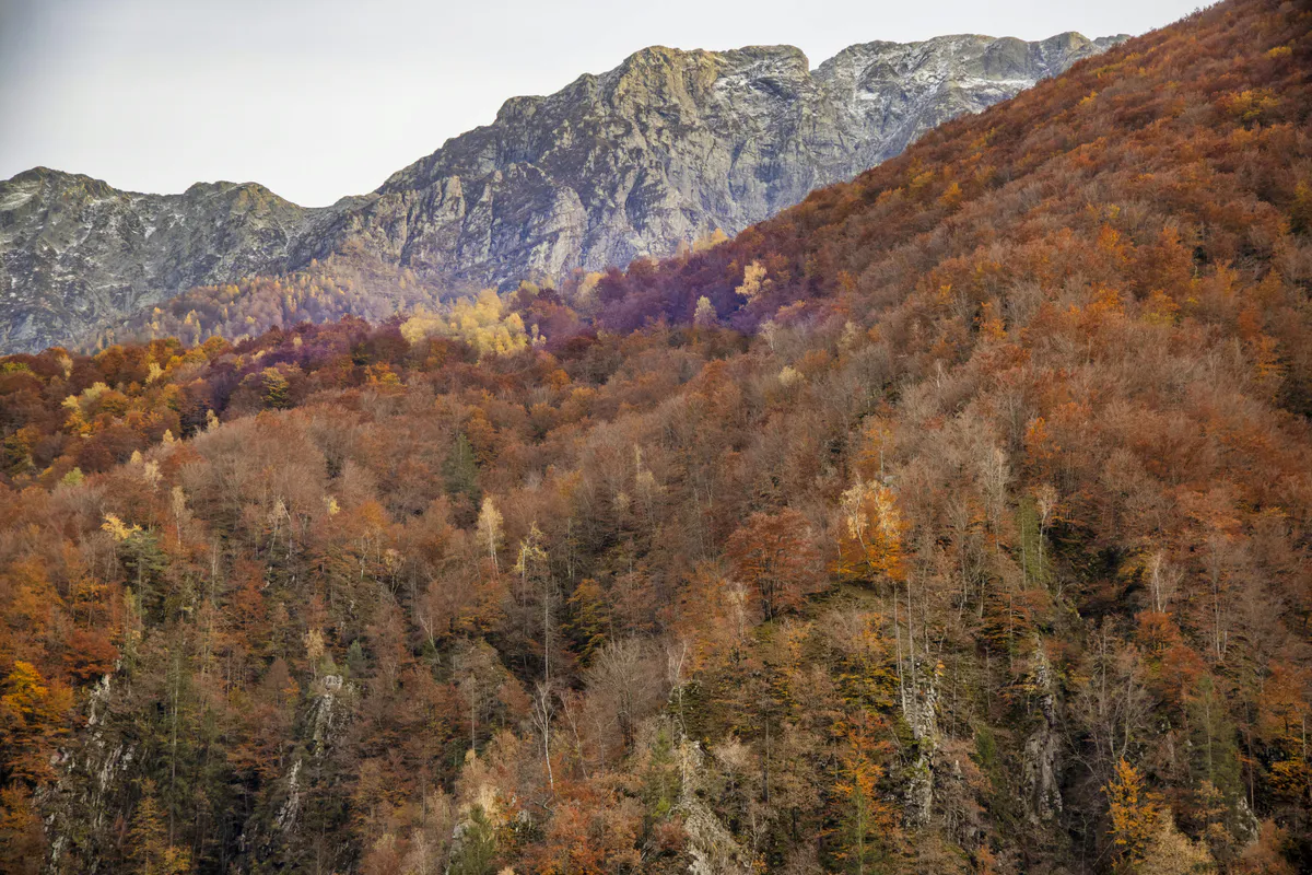
What they saved is one of the finest mountain wilderness areas in New England. The Bigelow Range runs east to west with twin peaks that both break 4,000 feet: Avery Peak at 4,150 feet and West Peak at 4,145 feet. The Appalachian Trail traverses 17.6 miles through the preserve, and all backcountry camping here is completely free.
The exposed ridgeline above treeline gets severe wind in any season. Temperatures can drop below freezing overnight even in July and August. Pack layers, a wind shell, and rain gear regardless of the forecast. People get hypothermia on this ridge in summer.
Horns Pond: The Main Backcountry Camp
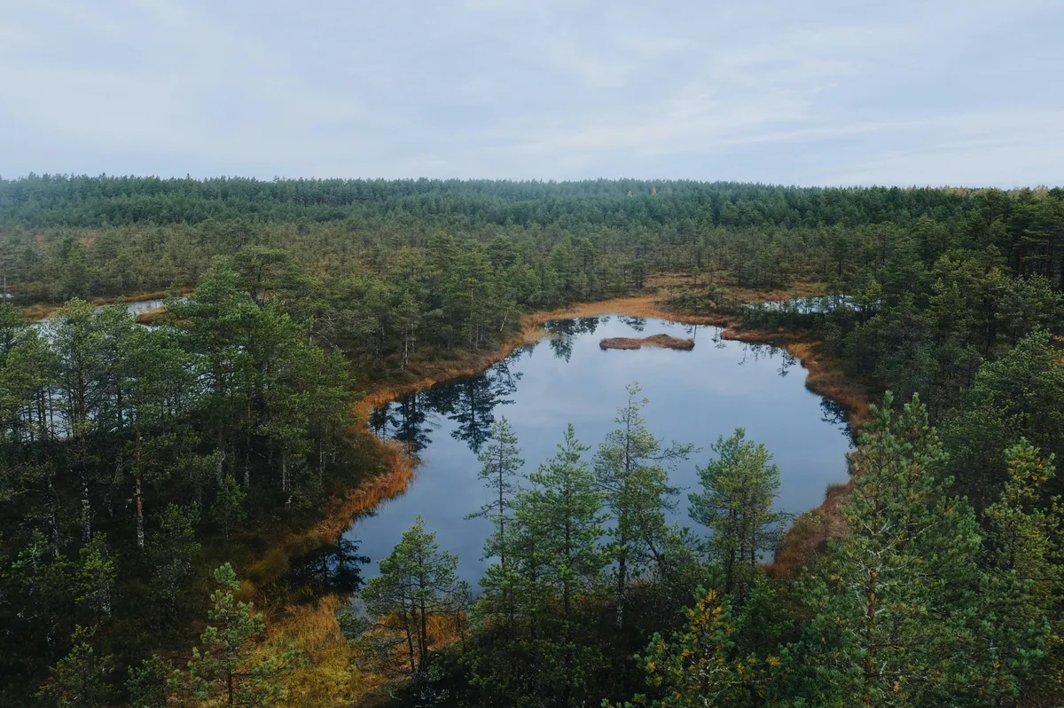
Horns Pond is a glacial tarn sitting at 3,160 feet between the two main peaks. It is the primary camping destination in the preserve and one of the highest-elevation campsites in Maine.
The site has two lean-tos and seven tent platforms. A summer caretaker is on-site from June through September to help manage the area and answer questions. There are no fees and no permits required. It is first-come, first-served.
Brook trout live in the pond. The fishing is not going to rival a stocked lake, but catching a brookie at 3,160 feet while looking up at the Horns is a different kind of experience entirely.
The lean-tos fill first, especially on summer weekends and during peak AT thru-hiker season (July-August). If you want a lean-to, arrive by early afternoon. The tent platforms are just as good and often have better views of the pond. Do not skip this trip just because the lean-tos are taken.
Trail Options
Fire Warden’s Trail is the shortest and steepest route to the ridge. It climbs about 2,000 feet in roughly 3 miles and hits the AT near Avery Peak. This is the most direct approach if you want to summit and get to Horns Pond in a single push.
Horns Pond Trail approaches from the south and is a more gradual route to the camping area. It is the better choice if you are carrying a heavy pack and want to save your knees.
The Bigelow Traverse is the signature route: a 16.4-mile point-to-point hike across the entire range. You start at one end, cross both peaks, camp at Horns Pond, and descend the other side. This requires a car shuttle or someone willing to pick you up. It is one of the best ridge walks in Maine, but plan the logistics ahead of time.
In late summer, the ridge above treeline is covered in dwarf blueberry bushes. Late July through August, you can pick wild blueberries while sitting next to a 4,000-foot summit. Bring a small container and add them to your oatmeal the next morning.
Getting There
The main trailheads are accessed from Stratton, a small town on Route 27 about 2.5 hours from Portland and just over 2 hours from Bangor. Stratton Brook Pond Road, which leads to the Fire Warden’s Trail trailhead, is rough gravel. A regular car can make it in dry conditions, but high clearance helps after rain. Check locally if you are unsure about conditions.
Stratton has a general store and a few restaurants. It is not a full-service town. Stock up on food and fuel before you arrive, especially if you are coming from the south. Farmington and Rangeley are the nearest towns with more options.
Stratton Brook Pond Road is unmaintained gravel that gets rough after rain. If you are driving a low-clearance vehicle, ask at the Stratton general store about current conditions before committing. Getting stuck miles down a logging road with no cell service is not a good start to a trip.
When to Go
Spring
Snow lingers on the ridge into late May. Muddy trails, difficult conditions. Not recommended.
Summer
Caretaker on-site. Best weather window, though storms can roll in fast. Blueberries in late July.
Fall
Spectacular foliage from the ridge. Cool nights, fewer bugs, thinner crowds. Bring cold-weather gear.
Winter
Deep snow, extreme cold, high avalanche risk on exposed terrain. Expert-only.
September is the prime month. The thru-hiker traffic has mostly passed, the bugs are gone, the foliage is starting, and the nights are cool enough for good sleeping. Weekdays in September you might have Horns Pond to yourself.
Backcountry Packing List
Bigelow Preserve Packing List
- Tent rated for wind and cold
- Sleeping bag (30F rated minimum, 20F for fall)
- Sleeping pad with good R-value
- Camp stove and fuel (no open fires above treeline)
- Water filter or purification tablets
- 3 liters water capacity minimum
- Rain jacket and wind shell
- Fleece or insulating layer
- Hiking boots with ankle support
- Trekking poles
- Headlamp with extra batteries
- Map and compass (no cell service)
- First aid kit
- Bear hang rope or bag
FAQ
Is camping at Bigelow Preserve really free?
Yes. There are no fees and no permits required. Horns Pond has two lean-tos and seven tent platforms available first-come, first-served. A summer caretaker is on-site June through September.
Can I do the Bigelow Traverse in one day?
The full 16.4-mile traverse is doable in a long day for fit, experienced hikers. Most people split it into two days with an overnight at Horns Pond. You will need a car shuttle since it is a point-to-point route.
Is there water at Horns Pond?
Yes. The pond itself is a water source, but you must filter or treat all water. The caretaker can point you to the best collection spots. Carry enough water for the climb up since sources can be unreliable on the lower trails in dry weather.
Are dogs allowed on the Bigelow Preserve trails?
Yes, dogs are allowed. Keep them leashed near the camping area and on the exposed ridge. The terrain above treeline is rough on paws, and the weather can turn dangerous quickly for an exposed dog.
Is there cell service anywhere on Bigelow?
No. There is no reliable cell service anywhere in the preserve, including the summits. Plan accordingly and leave your itinerary with someone before you go.