The Wildest River in the East
The St. John River is the longest free-flowing river in the eastern United States, and paddling it is one of the great backcountry canoe trips in North America. Starting from the headwater ponds near the Canadian border, the river runs roughly 130 miles through boreal wilderness before reaching the first village at Allagash. For most of that distance, there are no roads, no buildings, no people. Just spruce and fir forest, gravel bars, wildlife, and the sound of moving water.
This is a spring-only trip. The St. John depends entirely on snowmelt for paddleable water levels, and the window is narrow: roughly the second week of May through the first week of June in a typical year. After that, the upper river drops to a trickle and becomes impassable. Timing is everything, and every year is different.
The St. John River is not a beginner canoe trip. It involves Class I-III whitewater, remote camping with no access to help, cold water, unpredictable weather, and a narrow window of navigability. Participants should have significant canoe experience, whitewater skills, and wilderness camping competence. A swamped canoe in May in northern Maine is a survival situation, not an inconvenience.
The Route
Most guided trips and experienced paddlers put in at Fifth St. John Pond and take out at Allagash Village, a distance of roughly 100 to 120 miles depending on the exact put-in. The trip takes 6 to 8 days at a moderate pace, covering 15 to 20 miles per day.
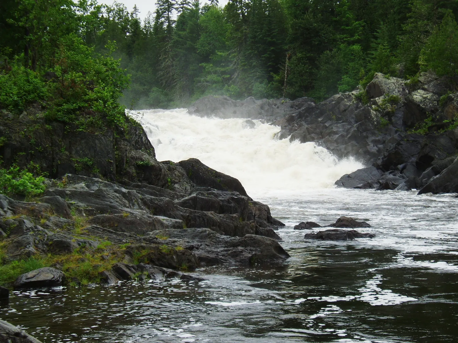
The upper river is narrow and fast, winding through dense boreal forest with frequent Class I-II rapids and some challenging Class III sections, so your paddling and kayaking gear needs to be rated for cold, moving water. Big Rapids, about 30 miles into the trip, is the most significant whitewater: three miles of Class III water that can produce three- to five-foot waves at high water levels. Scouting and portaging are options if the water is too high or your skills are not up to it.
Below Big Rapids, the river widens and the gradient eases. The middle section flows through broad valleys with views of the surrounding hills. The lower section approaches the confluence with the Allagash Wilderness Waterway and eventually reaches Allagash Village, the take-out point.
Several outfitters based in the North Maine Woods run guided St. John trips every spring. They provide canoes, gear, food, and the knowledge of how to read this specific river at current water levels. For a first trip, a guided experience is strongly recommended. The logistics alone (shuttle, food drops, timing the water) are complex enough that expert help is worth every dollar.
The Wilderness
The boreal forest along the St. John is predominantly spruce and fir, with some birch and cedar in the river valleys. This is some of the most intact northern forest remaining in the eastern United States. Moose are common and frequently seen along the riverbanks, especially in the early morning and at dusk. Black bears, otters, beavers, and bald eagles are all present.
The river corridor passes through the North Maine Woods, a vast region of private timberland that allows public recreation through a gate system. Active logging operations may be encountered on the access roads, but the river itself feels untouched.
Wildflowers bloom along the banks in late May: violets, trillium, and marsh marigolds. The black flies and mosquitoes also emerge in force. Bug protection is not optional on this trip. It is essential for sanity.
The St. John River was historically a log-driving river, and you will see remnants of the log-driving era along the banks: iron ring bolts in boulders, old boom chains, and occasional artifacts from the river drives that ended in the 1970s. Keep an eye out, especially at the rapids where logs used to jam.
Logistics
This is not a trip you can improvise. Key logistics include:
Put-in Access: Reaching Fifth St. John Pond requires driving logging roads deep into the North Maine Woods. The roads are rough, the distances are long, and the checkpoints require payment. Most people arrange shuttle service through an outfitter.
Take-out: Allagash Village, at the confluence of the St. John and Allagash rivers. Shuttle vehicles or arrangements must be in place before you start.
Food: You carry everything for 6 to 8 days. There are no resupply points on the river.
Water: The river water is generally clean but should be filtered or treated, so carry a dependable water filter. Springs and tributary streams are additional sources.
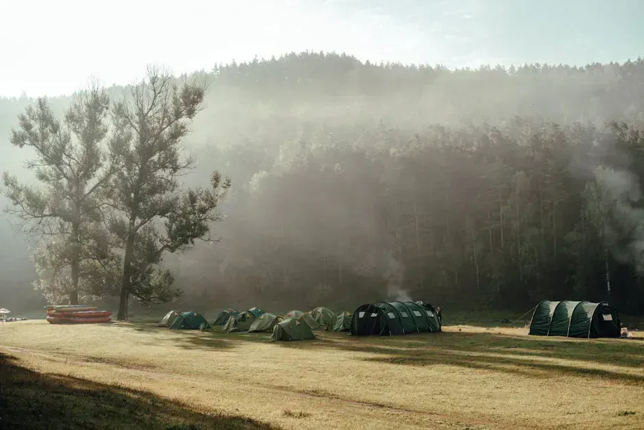
Campsites: Campsites along the river are informal gravel bars, flat spots along the bank, and occasional clearings. There are no designated sites with facilities on much of the upper river.
When to Go
Spring
The only paddleable season. Mid-May to early June. Cold, buggy, and wild. This is it.
Summer
Upper river is too low to paddle. Not navigable after mid-June in most years.
Fall
Water too low. Not a fall paddling destination.
Winter
Frozen. Roads closed. Not accessible.
The window is mid-May to early June. Late May is typically the sweet spot: enough water to float the upper river, warm enough that the cold is manageable, and the days are long. Every spring is different. Check water gauge data (USGS gauge at Ninemile Bridge) before committing to a launch date. In low-snow years, the window may open and close earlier.
The water temperature in May is dangerously cold, often in the 40s Fahrenheit. A capsized canoe means immediate cold water immersion. Dry suits or drysuits are strongly recommended for the whitewater sections. At minimum, wear layers that retain warmth when wet, and carry fire-starting materials in a waterproof container.
Packing List
St. John River Canoe Trip
- Canoe suitable for whitewater (Royalex or similar)
- PFD (personal flotation device) worn at all times on water
- Dry suit or layers for cold water immersion protection
- Paddle and spare paddle
- Dry bags for all gear
- Tent rated for wind and rain
- Sleeping bag rated to 20F
- Camp stove and fuel for 6-8 days
- Water filter
- Food for the full trip (no resupply)
- First aid kit with hypothermia treatment supplies
- Bug spray, head net, and bug jacket
- Topographic maps and compass (no cell service)
- Satellite communicator for emergencies
- Fire-starting materials in waterproof container
- Rope and throw bag for whitewater rescue
Getting There
The St. John River runs through the most remote corner of Maine. Reaching the put-in at Fifth St. John Pond requires driving deep into the North Maine Woods on gated logging roads. The drive from Bangor to the Allagash Village take-out is roughly 4 hours on paved roads, and the put-in adds several more hours of gravel driving beyond that. From Portland, figure 7 hours just to reach Allagash, plus logging-road time to the launch point.
From I-95, exit at Sherman or Houlton and pick up Route 11 north through Ashland and Portage, or continue on Route 1 to Fort Kent and then Route 161 and Route 162 southwest to the village of Allagash. North Maine Woods operates staffed checkpoints on the logging roads leading to Fifth St. John Pond. You pay the access fee (approximately $15 per vehicle for non-residents) and register at the checkpoint before proceeding. Call the North Maine Woods office at 207-435-6213 ahead of time to preregister and confirm current road conditions.
Some paddlers charter a float plane from Shin Pond or Millinocket to Fifth St. John Pond or Baker Lake rather than drive. It costs more but saves hours of rough gravel driving with a loaded canoe on the roof.
The river is paddleable only mid-May through early June, driven entirely by snowmelt. Check the USGS gauge at Ninemile Bridge (01010000) before committing. There is no cell service anywhere in the corridor. Satellite communicators are essential. The water is in the 40s Fahrenheit through May, making dry suits or robust immersion layers non-negotiable for the whitewater sections. Most first-timers use an outfitter (Canoe the Wild, Katahdin Outfitters, Allagash Guide Service) for the full shuttle, gear, and guiding package.
FAQ
When can you paddle the St. John River?
The St. John is paddleable only during spring runoff, typically mid-May through early June. After that, the upper river drops too low to navigate. The exact window varies by year depending on snowpack and spring temperatures.
How long does a St. John River canoe trip take?
Most trips cover 100 to 120 miles from Fifth St. John Pond to Allagash Village and take 6 to 8 days at a moderate pace of 15 to 20 miles per day.
Do I need whitewater experience for the St. John?
Yes. The river includes Class I-III rapids, with Big Rapids being a sustained three-mile stretch of Class III. Cold water temperatures make capsizing especially dangerous. Significant canoe and whitewater experience is required.
Are there guided trips on the St. John River?
Yes. Several outfitters offer guided St. John trips every spring, including Canoe the Wild, Katahdin Outfitters, and Allagash Guide Service. Guided trips include canoes, gear, food, and experienced guides who know the river.
Is the St. John River really the most remote river in the East?
It is widely described as the longest free-flowing river in the eastern United States and one of the most remote paddling destinations east of the Mississippi. For over 100 miles, there are no roads, bridges, or settlements along the river corridor.