A Fire Tower Hike in the Kennebec Highlands
Mount Pisgah rises 807 feet above the lake country of central Maine, just west of the town of Winthrop in Kennebec County. The summit itself is wooded, but a 60-foot Aermotor fire tower breaks above the canopy and delivers one of the best 360-degree views in the region. From the tower cab you can see Mount Washington to the west, the Camden Hills to the east, and the lakes of the Kennebec Highlands spread out below in every direction.
The 94-acre Mt. Pisgah Conservation Area is owned by the Town of Winthrop and protected by an easement held by the Kennebec Land Trust. It is part of a larger 1,100-acre conservation area and one of the most accessible hiking destinations in central Maine. The fire tower was in active use by the Maine Forest Service from 1949 to 1991 and has been maintained for public access ever since.
The Trails
Three interconnected trails loop through the conservation area, and most hikers combine two of them for a 3.3-mile loop.
The Tower Trail (0.7 miles) is the most direct route to the summit. It climbs moderately through mixed forest, passing stands of gnarly old sugar maples and stone walls from the area’s farming past. The grade is steady but never steep, and families with young children regularly complete it.
The Ledges Trail (1.4 miles) loops along the northern ridgeline and intersects with both the Tower Trail and the Blueberry Trail. It offers several viewpoints from open ledges before reaching the summit area.
The Blueberry Trail (1.3 miles) traverses the lower slopes through former farm fields now grown into mixed woodland. Stone walls line sections of the path. In winter, this trail offers views to the eastern hills.
For the best loop, go up the Tower Trail to the summit and fire tower, then continue along the Ledges Trail for the ridgeline views, and descend via the Blueberry Trail. This gives you the tower, the ledges, and the historic farmland all in about 3.3 miles.
The Fire Tower
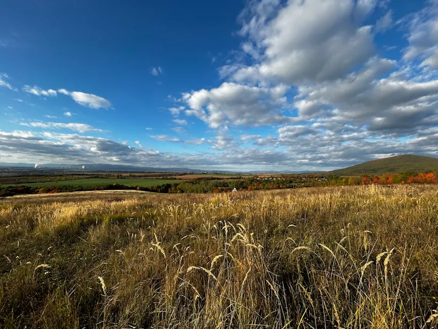
The 60-foot Aermotor tower is the main attraction. The cab at the top is open to the public, and on clear days the panorama extends well over 50 miles. Parker Pond and Torsey Pond gleam below to the west and north. The hills of the Kennebec Highlands roll away in every direction. To the west, on the clearest days, the white cone of Mount Washington is unmistakable. To the east, the Camden Hills mark the edge of the midcoast.
The tower steps are metal grating and can be slippery when wet or icy. There is no railing at the very top. Young children should be closely supervised.
The fire tower steps are metal and exposed. In winter, ice can accumulate on the steps and platform. Use extreme caution or skip the tower entirely if conditions are icy. The tower is also not a safe place during lightning.
When to Go
Spring
Trails dry out relatively early due to the low elevation. Wildflowers in the lower sections. Black flies arrive late May.
Summer
Wild blueberries ripen along the Blueberry Trail and near the summit. The tower gives a breeze on hot days.
Fall
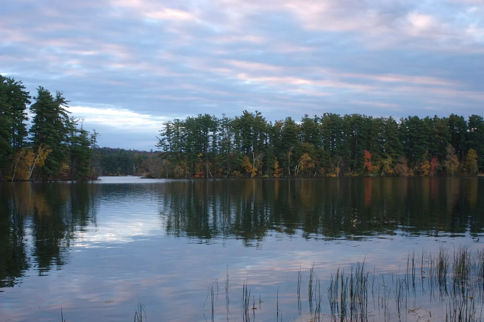
Foliage over the lake country is outstanding from the tower. Peak color typically arrives in early to mid-October.
Winter
Snowshoeable in winter. The tower is accessible but icy steps require caution. Views of the snow-covered Kennebec Highlands are striking.
Mount Pisgah is a true four-season hike. The fire tower makes every visit feel a little different because the light and weather change the view dramatically from season to season.
Practical Notes
The trailhead parking lot is on Mt. Pisgah Road, about 1.7 miles south of the turn from Route 133 in Wayne. A kiosk with a trail map marks the start. There is room for 8 to 10 vehicles.
No bathrooms at the trailhead. The nearest gas, food, and supplies are in Winthrop, about 10 minutes east.
Cell service is spotty at the trailhead. You may get a signal from the top of the fire tower.
Mount Pisgah is one of the best after-work hikes in the Augusta-Winthrop area. The Tower Trail to the summit and back takes under an hour, and the sunset views from the tower are worth the timing if you can catch them.
Packing List
Pisgah Mountain Day Hike
- 1 liter of water per person
- Snack for the tower
- Light layer for the breeze at the top
- Bug spray late spring through summer
- Camera for the tower views
- Comfortable shoes (trail is well-maintained)
Getting There
From Augusta, take Route 202 west to Winthrop, then Route 133 north toward Wayne. Turn left onto Mt. Pisgah Road and drive 1.7 miles south to the parking area on the left. The drive from Augusta is about 25 minutes.
From Portland, take the Maine Turnpike to the Augusta exit, then follow the directions above. Total drive time is about 75 minutes.
FAQ
How long does the Mount Pisgah hike take?
The Tower Trail to the summit and back takes about 45 minutes to 1 hour. The full 3.3-mile loop with the Ledges and Blueberry trails takes 1.5 to 2 hours.
Is the fire tower safe for kids?
The tower is open to the public and many families climb it. The steps are metal grating and there is no railing at the top, so younger children should be closely supervised. Use your judgment based on your child's comfort with heights.
Are dogs allowed?
Yes. Dogs are welcome on all trails at the Mt. Pisgah Conservation Area. Keep them leashed and clean up after them.
Is this part of the Kennebec Highlands trail system?
The conservation area is part of the broader Kennebec Highlands, a network of conserved lands in the lakes region west of Augusta. It is managed separately by the Town of Winthrop and the Kennebec Land Trust.
Can I see Mount Washington from the tower?
Yes. On clear days, Mount Washington is visible to the west from the top of the fire tower. The best visibility is in fall and winter when haze is lowest.
Mount Pisgah pairs well with a day exploring the lakes of the Kennebec Highlands. Parker Pond and Torsey Pond are both nearby for swimming or paddling in summer.