Coastal Views from the Georges Highland Path
Ragged Mountain rises to 1,300 feet on the Camden-Rockport town line, part of the Camden Hills that define the midcoast skyline. While Mount Battie gets the tourists and the road-accessible summit, Ragged Mountain is the hiker’s choice: a real trail with real elevation gain that earns you sweeping views of Penobscot Bay, the island-studded coast, and the rolling hills of Knox County.
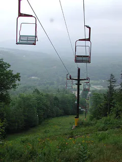
The trails on Ragged Mountain are part of the Georges Highland Path, a network of more than 50 miles of footpaths built and maintained by the Georges River Land Trust. The paths connect ridgelines, wetlands, and summits across the midcoast, and the Ragged Mountain section is the crown jewel of the system. The mountain is also home to the Camden Snow Bowl, a small community ski area on the eastern slopes that is one of the few places in the eastern United States where you can ski with ocean views.
The Trail
Several trailheads provide access to Ragged Mountain. The most popular loop starts from the Barnestown Road trailhead on the north side. The roughly 4.5-mile loop climbs to the summit ridge, traverses exposed ledge with views in every direction, and descends through forest back to the starting point.
From Barnestown Road, the trail enters the woods and climbs gradually for the first mile through mixed hardwood forest. At about 1.3 miles, a junction offers the choice of routes. Bear left to climb the steeper, more direct route to the summit ridge, or continue right for a more gradual approach.
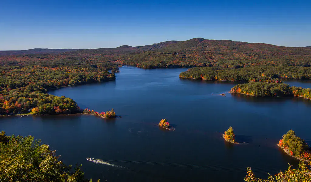
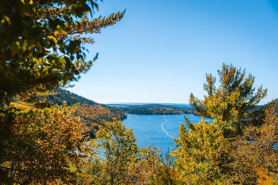
The summit ridge is the highlight. Open ledge extends for several hundred yards, with exposed bedrock and low blueberry bushes. The views open up dramatically: Penobscot Bay to the east with its islands (Islesboro, North Haven, Vinalhaven), the rounded summit of Mount Battie to the northeast, Bald Mountain to the west, and on clear days the hills of Acadia to the east.
The descent on the loop’s backside drops through spruce and fir forest before connecting back to the carriage road that returns you to the trailhead. The footing on the descent is steep in places, with loose rock that requires attention.
For a shorter option, drive to the Camden Snow Bowl and hike the ski trails to the summit. The ski area trails are open to hikers in summer and fall, and the ascent is about a mile with views the entire way. It is steep but fast.
The Summit
The summit ridge of Ragged Mountain is partially open, with exposed bedrock supporting a 40-acre acidic rocky summit plant community. A communications tower and fenced building sit on the highest point, but the views from the surrounding ledges are unobstructed.
The coastal panorama is the main draw. Penobscot Bay stretches to the horizon, dotted with islands that form the archipelago of the Maine coast. Sailboats and lobster boats are often visible in the waters below. To the west, the inland hills of Waldo and Knox counties roll away, heavily forested and sparsely settled. The contrast between the working waterfront coast and the wild interior is one of the defining characteristics of the midcoast, and you can see both from this one summit.
In late July and early August, the blueberry bushes on the summit ledges produce fruit. Hikers often stop to graze on their way across the ridge.
The summit views are at their best on fall mornings when the air is dry and clear. Haze can obscure the bay views in summer, especially in the afternoon. September and October mornings consistently deliver the sharpest visibility.
When to Go
Spring
Trails dry out by late April. Wildflowers in the lower forest. Can be muddy on the north-facing slopes.
Summer
Long days and warm temperatures. Blueberries on the summit in late July. Afternoon haze can limit visibility.
Fall
Peak foliage mid-October. Clearest views of the year. Cool hiking temperatures. The summit ridge is spectacular in autumn color.
Winter
The Snow Bowl is open for skiing. Hiking trails are accessible with microspikes or snowshoes. Summit is exposed to wind.
Practical Notes
The Barnestown Road trailhead has a small gravel parking area that holds about 15 cars. On busy fall weekends, it can fill by mid-morning. An alternative trailhead on Hope Street (Route 17) provides access from the south side.
Dogs are welcome on the Georges Highland Path trails and should be under control on the exposed summit sections.
Cell service is spotty on Ragged Mountain. You may get a signal on the summit ridge but not in the forest sections of the trail.
Packing List
Ragged Mountain Loop Hike
- 1.5 liters of water per person
- Snacks or lunch for the summit
- Wind layer for the exposed ridge
- Sturdy shoes with good grip on rock
- Sun protection
- Camera for the bay views
- Bug spray in summer
Getting There
The Barnestown Road trailhead is in Camden. From Route 1 in Camden, take John Street west to Barnestown Road. The trailhead parking area is on the left, about 1.5 miles from Route 1. From Portland, the drive to Camden is about 1 hour and 45 minutes via Route 1 or I-95 to Route 17. From Bangor, about 75 minutes via Route 1A south.
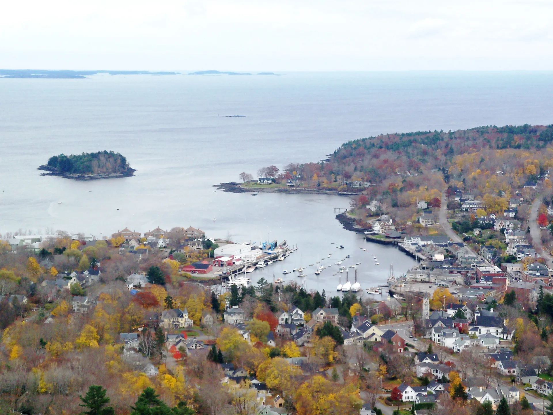
Camden village, with its harbor, restaurants, and shops, is about 10 minutes from the trailhead. It is a good base for combining a Ragged Mountain hike with a visit to the midcoast.
FAQ
How long does the Ragged Mountain loop take?
Most hikers complete the 4.5-mile loop in 2.5 to 4 hours, depending on pace and time spent on the summit ridge. The views tend to hold people longer than planned.
Is Ragged Mountain harder than Mount Battie?
Yes. Mount Battie has a road to the summit and a short trail. Ragged Mountain requires a real hike with about 1,050 feet of elevation gain and some steep, rocky sections. The reward is better views and far fewer people.
Can I hike from the Camden Snow Bowl?
Yes. The ski area trails are open to hikers in summer and fall. It is a steeper but shorter route to the summit, about a mile each way up the ski trails.
Are dogs allowed?
Yes. The Georges Highland Path allows dogs. Keep them under control on the summit ledges and be courteous to other hikers.
What is the Georges Highland Path?
A 50-plus mile network of hiking trails maintained by the Georges River Land Trust across the midcoast region. Ragged Mountain is the most popular section, but the path extends to other summits and preserves in Knox and Waldo counties.
For more in the Camden area, see our guide to Camden Hills and Mount Battie.