A Mountain Notch Full of Waterfalls
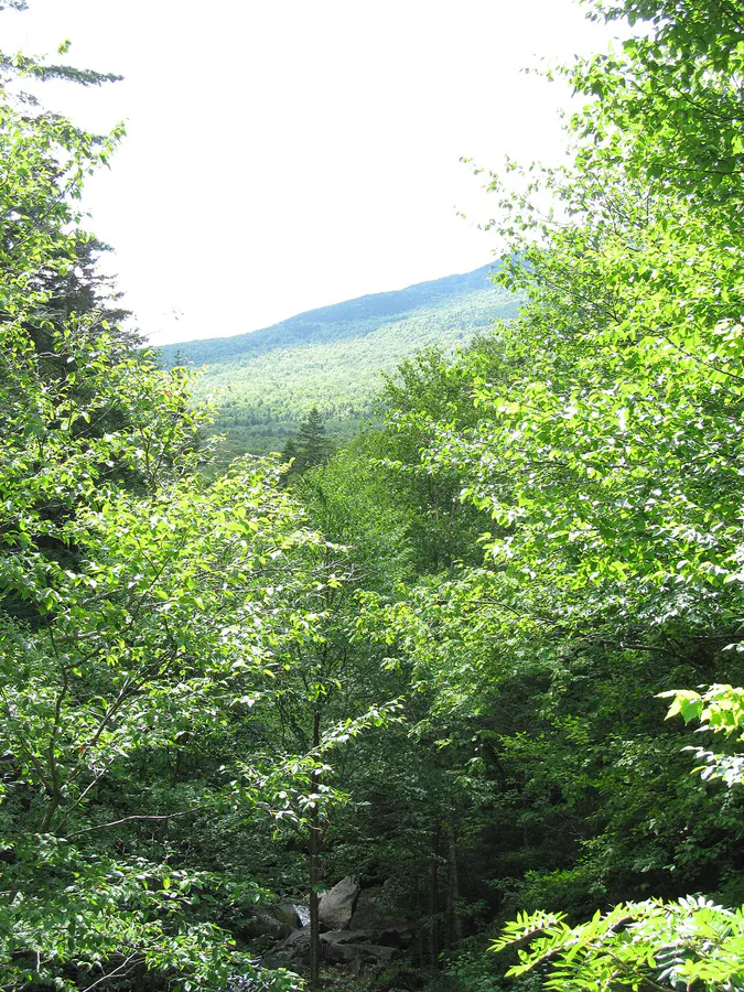
Grafton Notch State Park occupies 3,129 acres in the Mahoosuc Range of western Maine, straddling Route 26 between Bethel and Errol, New Hampshire. The Bear River carved this notch through the mountains over thousands of years, leaving behind a series of waterfalls, gorges, and sculpted rock formations that make this one of the most geologically interesting spots in the state.
The park serves double duty. For casual visitors, the roadside waterfalls and short walks are easy stops that require little more than sneakers and a few minutes. For serious hikers, Grafton Notch is the gateway to Old Speck Mountain, Table Rock, and the Mahoosuc section of the Appalachian Trail, which many thru-hikers consider the most difficult stretch of the entire AT.
The Waterfalls
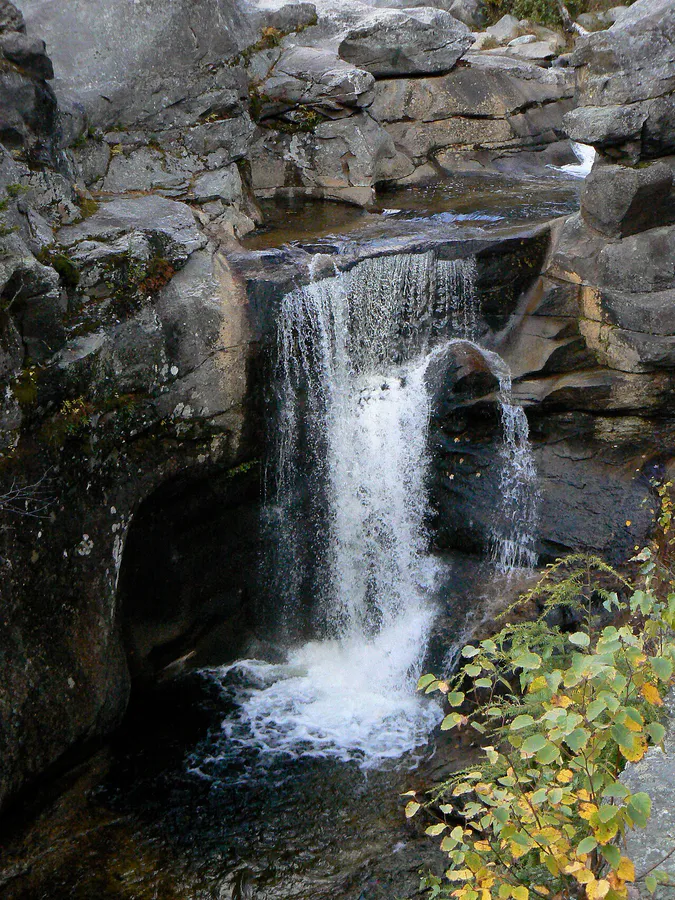
Screw Auger Falls
Screw Auger Falls is the park’s most visited feature. A 23-foot waterfall drops through a narrow gorge that the Bear River has twisted and polished into smooth, swirling channels. The walk from the parking area is about a tenth of a mile on a well-graded path with guardrails. Families with young children can reach it easily. In summer, the pools below the falls are popular for wading and swimming.
Mother Walker Falls
A short walk from a separate pullout along Route 26 leads to Mother Walker Falls, a V-shaped gorge more than 40 feet deep and nearly 1,000 feet long. The gorge itself is the attraction here, with sheer walls and moss-covered rock that feels more like a slot canyon than anything you would expect in Maine.
Moose Cave
Moose Cave is a collapsed gorge with a short, easy trail leading to a narrow cleft in the rock. It is the least dramatic of the three roadside stops but still worth a few minutes, especially if you are working your way through all the park’s features in a single visit.
Visit all three roadside features in order heading north on Route 26: Screw Auger Falls, Mother Walker Falls, then Moose Cave. The whole circuit takes about an hour with time to linger at each stop.
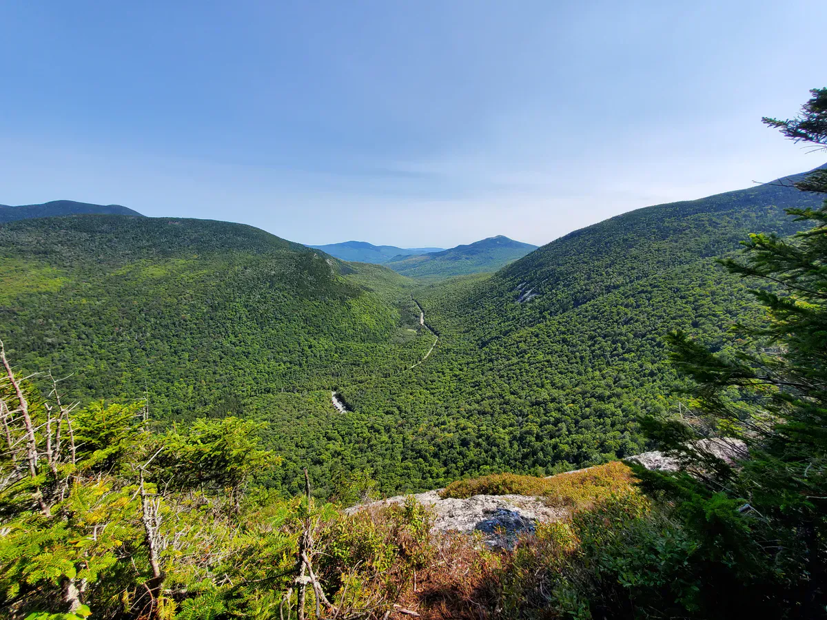
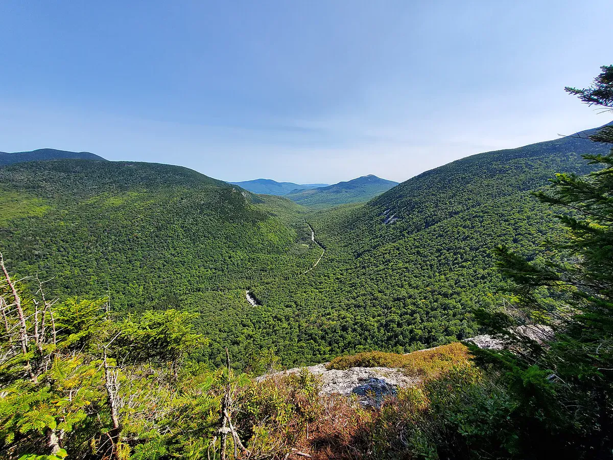
Table Rock
Table Rock is a massive flat ledge that juts out from the side of Baldpate Mountain, roughly 1,000 feet above the notch floor. The trail climbs steeply for about 1.2 miles through forest and then up a boulder cave scramble to reach the ledge. The view from Table Rock looks straight down into the notch and across to Old Speck, with the Bear River valley below.
The Table Rock Trail can be combined with a loop over the Appalachian Trail for a longer 4.6-mile circuit. The scramble through the boulder caves near the top is the highlight and is fun for confident hikers, though it requires some hands-and-knees work.
Old Speck Mountain
Old Speck is the third-highest peak in Maine at 4,170 feet. The trail from the Route 26 trailhead climbs 2,700 feet over about 3.8 miles to the summit, where a fire tower provides 360-degree views over the Mahoosuc Range, the Presidentials in New Hampshire, and the lakes of western Maine.
Old Speck is the southern end of the Mahoosuc Range and the northern end of the infamous Mahoosuc Notch, a mile-long boulder scramble that AT thru-hikers both dread and celebrate. Day hikers can climb Old Speck as an out-and-back without entering the Notch.
Old Speck is a full-day mountain hike with significant elevation gain. Start early, bring plenty of water, and check the weather before heading up. The upper mountain is exposed and conditions can change quickly.
When to Go
Spring
Waterfalls are at peak flow from snowmelt. Upper trails are muddy and snow-covered into May. Park officially opens May 15.
Summer
All trails and facilities open. The swimming holes at Screw Auger are at their best. Start hikes early to beat afternoon thunderstorms.
Fall
The notch is a corridor of color in late September and early October. Views from Table Rock and Old Speck are outstanding during foliage.
Winter
Route 26 stays open and plowed, but the park is officially closed. Trails are hikeable with snowshoes or skis for experienced winter hikers.
Fall foliage in Grafton Notch peaks a bit earlier than the coast, typically the last week of September through the first week of October. The hardwoods on the notch walls turn gold and orange while the spruce stays dark green, creating a contrast that looks best from Table Rock.
Practical Notes
Step Falls Preserve, owned by the Mahoosuc Land Trust, is just south of the park on Route 26 near Newry. It is a separate property with a short, easy trail to cascading granite waterfalls and swimming holes. Plan to hit Step Falls on the way in or out of the park for a low-effort bonus stop.
Grafton Notch has no camping, no drinking water, and limited facilities. Pit toilets and picnic tables are available at the main trailheads. The nearest services are in Bethel, about 14 miles south on Route 26. Fuel up and pack food before driving in.
Cell service is unreliable throughout the notch. Download maps and trail information before you arrive.
Packing List
Grafton Notch Day Visit
- Hiking boots with ankle support (especially for Table Rock and Old Speck)
- At least 2 liters of water per person for summit hikes
- Lunch and snacks
- Bug spray May through July
- Rain layer (mountain weather changes fast)
- Camera
- Swimsuit if visiting Screw Auger Falls in summer
- Cash for the self-service fee station
Getting There
Grafton Notch State Park is on Route 26, about 14 miles north of Bethel. From Portland, the drive takes approximately 2.5 hours via Route 26 through Norway and Bethel. From Bangor, it is about 2 hours 45 minutes via Route 2 to Bethel and then north on 26. The park entrance is well-signed along the highway.
FAQ
Do I need to be a hiker to enjoy Grafton Notch?
Not at all. Screw Auger Falls, Mother Walker Falls, and Moose Cave are all short, easy walks from roadside parking areas. You can see the park's best waterfalls and gorges in under an hour without breaking a sweat.
Can I swim at Screw Auger Falls?
Yes. The pools below the falls are popular for wading and swimming in summer. The water is cold, and the rocks can be slippery. There are no lifeguards.
How hard is the Table Rock hike?
Moderate to hard. The trail is about 1.2 miles one way with 1,000 feet of gain. The upper section includes a scramble through boulder caves. It takes most hikers 2 to 3 hours round trip.
Is there camping in the park?
No. Grafton Notch has no campground. The nearest camping options are in Bethel or at private campgrounds along Route 26.
Are dogs allowed?
Yes. Dogs are allowed on all park trails and must be kept on a leash.