Two 4,000-Footers on One Ridge
The Bigelow Range holds two of Maine’s fourteen 4,000-foot summits: West Peak at 4,145 feet and Avery Peak at 4,088 feet. They sit just over a mile apart on a high, exposed ridge that the Appalachian Trail traverses, and a long day hike or overnight can connect both summits with miles of alpine walking in between.
The mountain is protected within the Bigelow Preserve, a 36,000-acre wilderness conservation area created in 1976 by Maine voters who rejected a proposed ski resort on the ridge. The land is managed by the Maine Bureau of Parks and Lands and has remained essentially undeveloped, which is why the views from the summits feel so vast.
The Classic Loop from Stratton Brook Pond
The most popular Bigelow day hike is the loop from the Stratton Brook Pond trailhead. The route ascends the Fire Warden’s Trail to Bigelow Col, the saddle between the two summits, then tags West Peak and Avery Peak as out-and-backs from the col before descending the Horns Pond Trail or returning the way you came.
Round trip distance for the full loop is roughly 12 miles with about 3,500 feet of elevation gain, depending on which return route you take. Plan on a long day, eight to ten hours for most hikers. The terrain ranges from forested singletrack on the lower mountain to bare alpine ridge above the col, with rocky scrambling to reach each summit.
Peak Comparison
| Peak | Elevation | Notes |
|---|---|---|
| West Peak | 4,145 ft | The high point of the range. Open summit with 360-degree views toward the Carrabassett Valley and Sugarloaf. |
| Avery Peak | 4,088 ft | Named for Myron Avery, the AT's second through-hiker. Stone-walled summit shelter foundation and views over Flagstaff Lake. |
| The Horns (North & South) | 3,805 / 3,792 ft | A pair of secondary peaks on the western end of the range. Often added as an extension. |
The Alpine Ridge
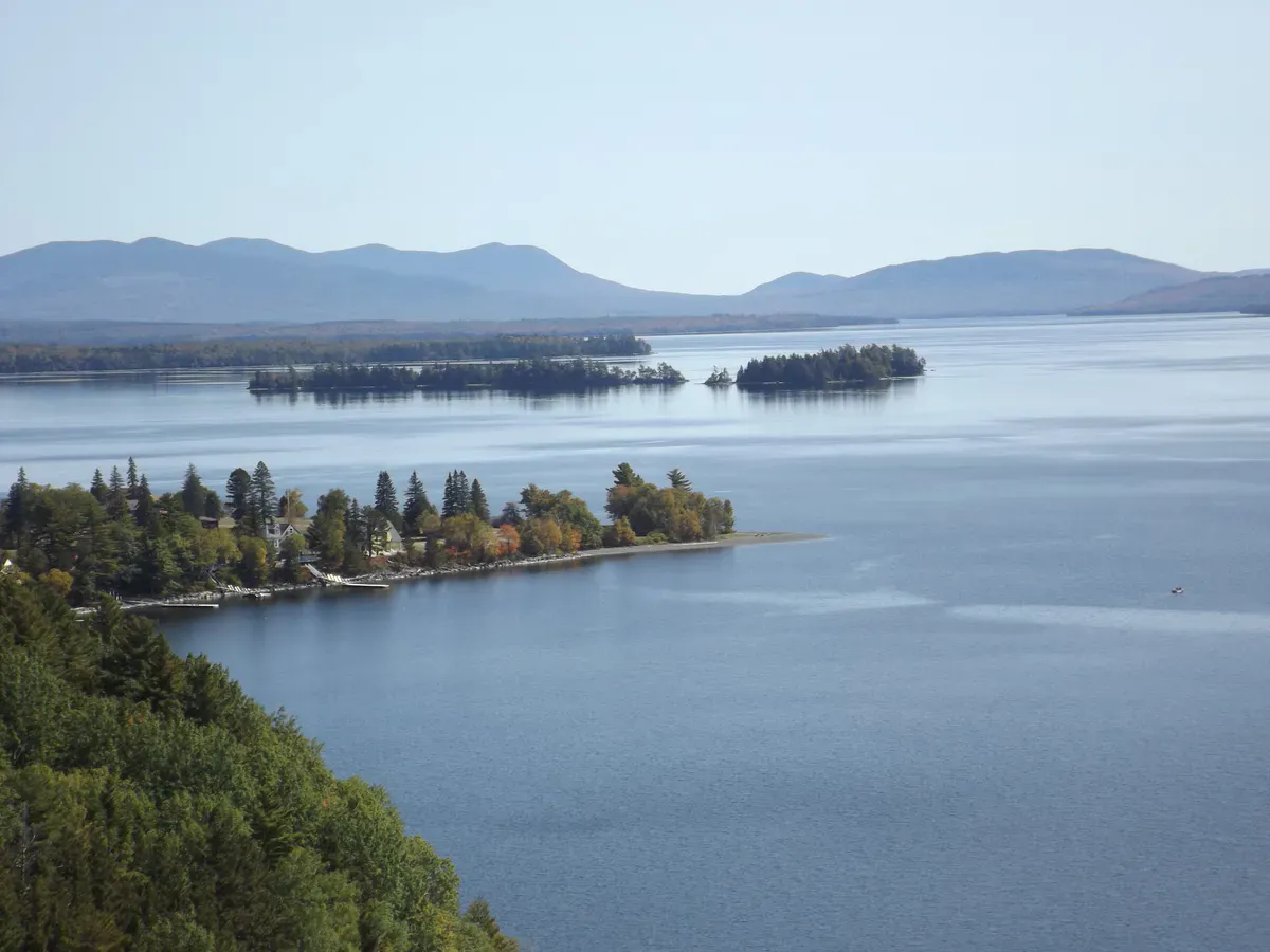
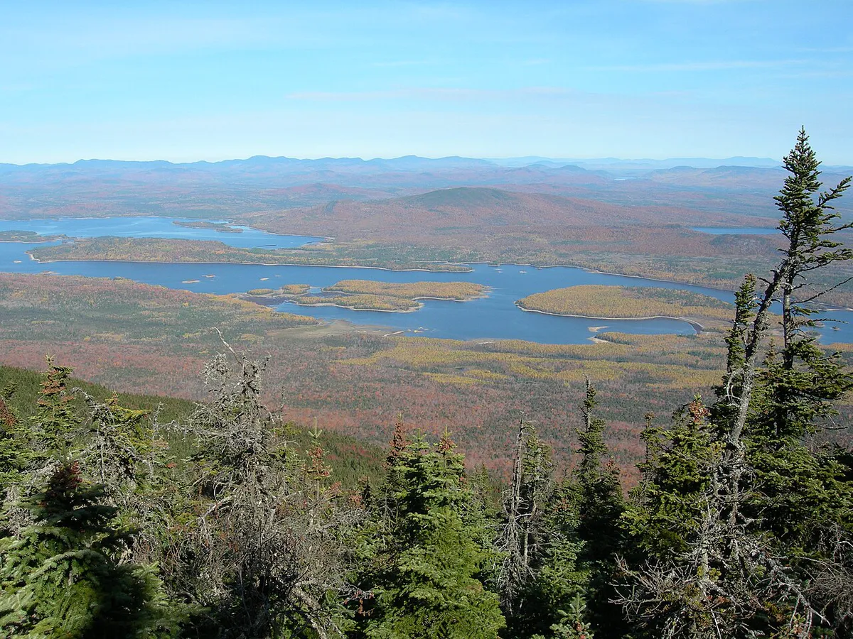
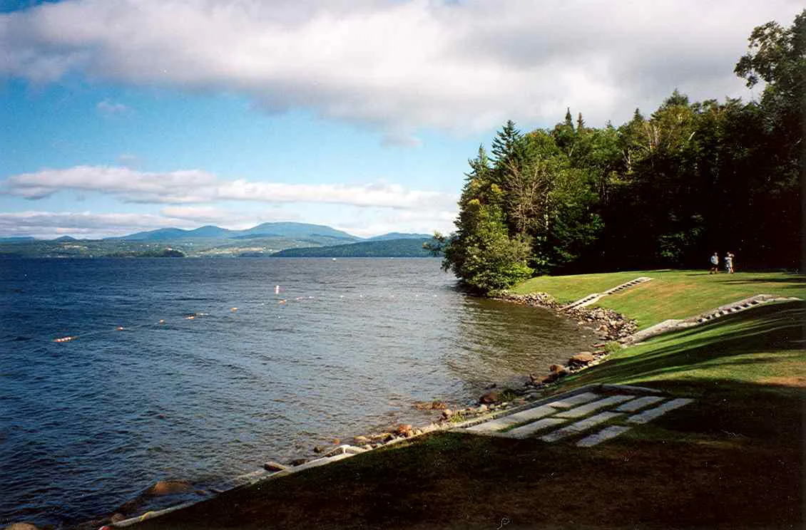
Above Bigelow Col, the trail emerges into true alpine terrain. The ridge is exposed in every direction, the wind picks up, and the views open dramatically. Flagstaff Lake spreads out to the north, an enormous body of water created by a 1950 dam that flooded the valley below. The Carrabassett River drainage drops south toward Sugarloaf, and on clear days you can see all the way to Mount Washington in the White Mountains and north to Katahdin.
The vegetation up here is fragile alpine plant communities that grow back at a rate measured in decades. Stay on the marked trail or on bare rock. There are no established campsites on the ridge itself, only at lower elevations.
Camping at Horns Pond and Bigelow Col
The Maine Appalachian Trail Club maintains backcountry shelters and tent sites at Horns Pond on the western end of the range and at Bigelow Col between the two main summits. Both fill up on summer weekends. If you want to do Bigelow as an overnight, plan on arriving early or carrying a tent and finding a flat spot at the designated tent platforms.
A two-day trip is the more enjoyable way to experience Bigelow if you can swing it. Hike in to Horns Pond or Bigelow Col on day one with a lighter daypack the next morning to tag the summits without the full pack weight.
Weather and Safety
The Bigelow ridge is genuinely alpine terrain. Weather can change in minutes, lightning is dangerous on the exposed sections, and there is no shelter between the col and the summits. Check the forecast carefully before you commit to the climb above the col, and turn around if conditions look like they will deteriorate.
The lower trails are generally fine in marginal weather, but the ridge is not. People underestimate this and get caught out in storms. The summit temperature is routinely 15 to 20 degrees colder than the trailhead, and the wind on the ridge can be brutal. Pack like you are heading into the mountains because you are.
When to Go
Spring
Snow lingers on the upper mountain into May. Lower trails are muddy. Black flies arrive mid-May.
Summer
Peak hiking season. Long days, the most stable weather windows, and the fullest views.
Fall
Cool air, fewer bugs, and foliage color in the surrounding Carrabassett Valley. Weather windows shorten quickly through October.
Winter
Bigelow in winter is a serious mountaineering objective, not a casual day hike. The ridge is committing in snow and ice.
Late June through early October is the realistic season for the full traverse. September is often the sweet spot: cool, clear, and bug-free.
Packing List
Bigelow Range Day Hike
- 3 liters of water minimum
- Calorie-dense food for a 10-hour day
- Waterproof shell and warm midlayer
- Hat and gloves (the ridge is cold and windy)
- Headlamp with fresh batteries
- Map and compass or downloaded offline map
- First aid kit
- Sun protection
Getting There
The Stratton Brook Pond Road trailhead is off Maine Route 27 a few miles south of Stratton. The access road is unpaved and can be rough but is passable for most vehicles in summer and fall. There is no fee at the trailhead and no entrance station for the Bigelow Preserve. Cell service is spotty along the access road and unreliable on the mountain.
Always check the Maine Bureau of Parks and Lands site or current trip reports before heading out, especially after big storms when blowdowns can affect the trails.
FAQ
How hard is the Bigelow Range hike?
Hard. Plan on 8 to 10 hours for the full loop covering both summits, with about 3,500 feet of elevation gain over roughly 12 miles. The alpine sections are exposed and the terrain is rocky.
Can you do Avery Peak and West Peak in one day?
Yes. The two summits are about a mile apart along the ridge from Bigelow Col. Most hikers tag both as out-and-backs from the col on a single day hike.
Is camping allowed on the Bigelow Range?
Yes, at established sites. The Maine Appalachian Trail Club maintains shelters and tent platforms at Horns Pond and Bigelow Col. Dispersed camping is not permitted on the alpine ridge.
Are dogs allowed?
Yes. Dogs are welcome in the Bigelow Preserve. They should be under control on the alpine ridge to protect the fragile vegetation.
Is there a fee?
No. The Bigelow Preserve is managed by the Maine Bureau of Parks and Lands as a public conservation area with free access.
For other big climbs in the Western Mountains, see Old Speck in Grafton Notch or the long ridge of Tumbledown Mountain.