Two Towns Under the Water
Flagstaff Lake is 20,300 acres of water covering two former towns. In 1950, the Long Falls Dam impounded the Dead River, enlarging what had been a modest natural lake into Maine’s fourth-largest body of water. The towns of Flagstaff and Dead River were evacuated and demolished. Most structures were razed, but foundations, stone walls, and the outlines of old roads remain beneath the surface.
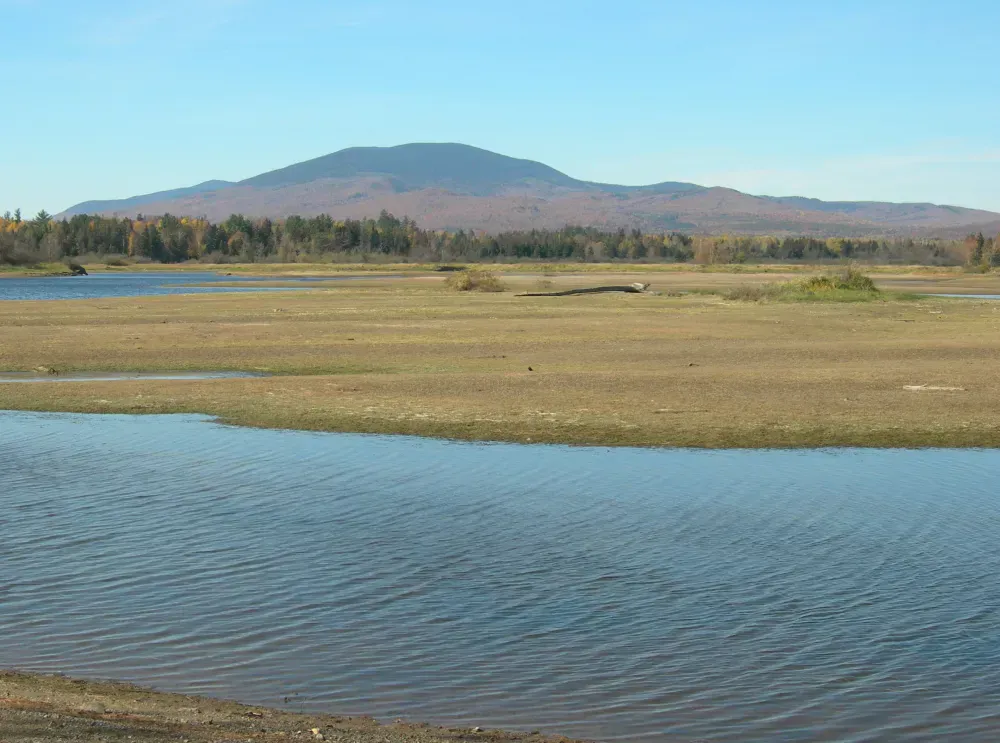
When water levels drop in late summer and fall, remnants of the old settlements sometimes become visible. Cellar holes, parts of the old road network, and bits of infrastructure emerge from the mud like a slow-motion archaeological dig. It is eerie and fascinating, a reminder that this landscape looked very different 75 years ago.
The lake takes its name from Benedict Arnold’s 1775 march to Quebec. Arnold and his troops camped in the area and reportedly raised a flag on a staff to mark their position. The town that grew up here took the name, and the lake inherited it.
On the Water
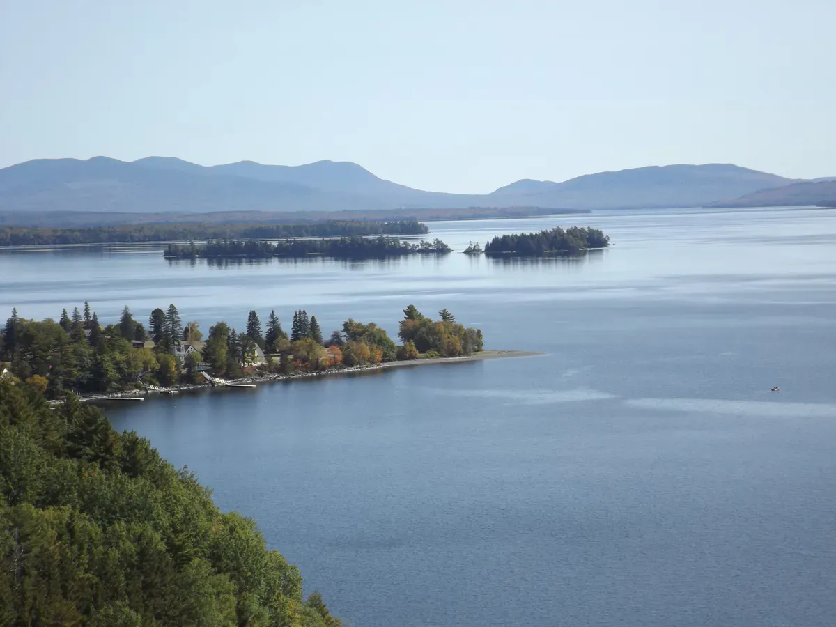
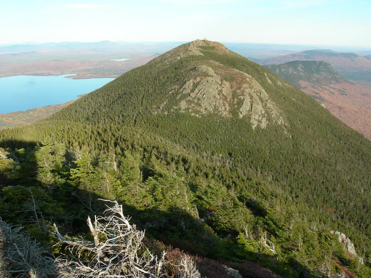
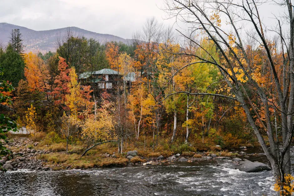
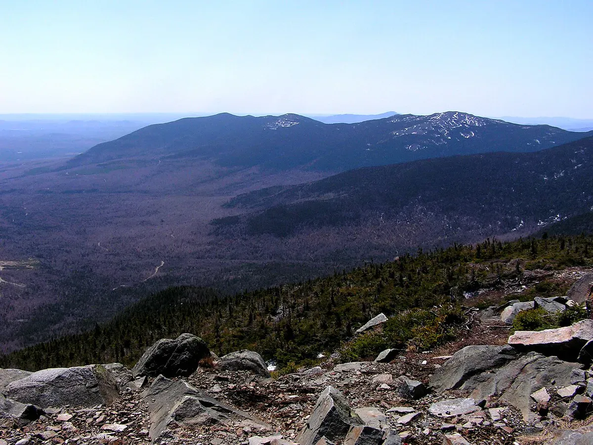
Flagstaff Lake sprawls across the valleys below the Bigelow Range, and the views are the first thing you notice. The Bigelow peaks, including Avery Peak (4,088 feet) and West Peak (4,145 feet), rise directly from the lake’s southern shore. Paddling across the open water with that ridge filling the sky is one of the better visual experiences in Maine.
There are six public boat launches spread around the lake, serving both the east and west ends. The launches are basic, typically gravel or packed earth with limited parking. This is not a developed recreation area. That is part of the appeal.
The lake is big and open, meaning wind can build quickly. Whitecaps are common on summer afternoons, and a small boat or kayak can get into trouble fast on the western basin. Check the forecast and paddle in the morning.
Flagstaff Lake is large and open with minimal shelter from wind. Afternoon storms and high winds develop quickly. Kayakers and canoeists should plan trips for calm mornings and stay close to shore. Carry a VHF radio or satellite communicator, as cell service is unreliable.
Swimming is possible anywhere along the undeveloped shoreline. There are no formal beaches, but sandy and gravelly spots exist, particularly on the islands and along the southern shore. The water is clean and warms into the upper 60s by August. For more swimming lakes across the state, see our best lakes for swimming in Maine roundup.
Island Camping
One of Flagstaff Lake’s best features is free island camping. The Round Barn campsites, managed by the Maine Bureau of Public Lands, sit on the lake’s shore and are accessible by water or a short trail from a vehicle parking lot. Sites have fire rings and pit toilets. No reservations, no fees. First come, first served.
Several islands also offer informal campsites. These are primitive: no facilities, no maintained sites. You carry in everything and carry out everything. But waking up on an island in Flagstaff Lake with the Bigelow Range catching the first light is hard to beat.
The Round Barn campsites fill on summer weekends. Arrive by Friday morning or plan a midweek trip. The island sites almost never fill because most people do not want to paddle their gear out.
Fishing
Flagstaff Lake is a serious fishing destination. The cold, deep water supports brook trout and landlocked salmon, while the shallower bays and coves hold smallmouth bass, yellow perch, and chain pickerel.
| Species | Best Season | Method | Notes |
|---|---|---|---|
| Brook Trout | May-June, September | Trolling, fly fishing | Native fish; tributaries hold wild populations |
| Landlocked Salmon | May, October | Trolling streamers, light tackle | Stocked periodically by MDIFW |
| Lake Trout (Togue) | Summer (deep), Winter (ice) | Downriggers, tip-ups | Found in the deepest sections |
| Smallmouth Bass | June-September | Soft plastics, topwater | Rocky structure throughout the lake |
| Chain Pickerel | Year-round | Spoons, live bait | Shallow bays and weed edges |
A Maine fishing license is required. The nearest place to buy one is in Stratton or Eustis. For tackle recommendations, check our best fishing gear for Maine guide.
The Dead River, which feeds Flagstaff Lake from the west, is a destination in its own right. It is one of Maine’s best whitewater rafting rivers when dam releases create high water conditions. Several outfitters run trips from spring through fall.
The Submerged History
The flooding of Flagstaff and Dead River was controversial at the time and remains a sensitive topic in the region. Residents were given little choice. The Central Maine Power Company built Long Falls Dam for hydroelectric generation, and the state authorized the taking. Families moved their houses, dismantled barns, relocated cemeteries, and said goodbye to a way of life that stretched back to the early 1800s.
The Flagstaff Memorial Chapel, moved to higher ground before the flooding, still stands in Eustis. It contains photographs, artifacts, and stories from the submerged towns. If the history interests you, this small museum is worth a stop.
When to Go
Spring
Ice-out fishing is excellent. Water levels highest. Blackflies in late May and June.
Summer
Warm enough for swimming. Island camping season. Bigelow Range hiking nearby. Bug pressure eases by July.
Fall
Vivid foliage against the Bigelow peaks. Low water may reveal old town remnants. Fewer visitors.
Winter
Ice fishing for togue and salmon. Snowmobiling on extensive trail network. Very remote and cold.
Getting There
From Portland, take Route 27 North through Farmington and Kingfield to Stratton, deep in the western mountains. The drive is about 2.5 to 3 hours. From Bangor, take Route 2 West to Farmington, then Route 27 North. Also about 2.5 to 3 hours. The last 30 miles on Route 27 are scenic, climbing through dense forest with occasional views of the mountains ahead.
Stratton is the nearest town with services: gas, a general store, a few restaurants, and lodging. Eustis, on the lake’s north shore, is smaller but has basic amenities.
Flagstaff Lake Trip Essentials
- Fishing license (if fishing)
- Bug spray (essential May-June)
- Downloaded maps and GPS (no cell service)
- VHF radio or satellite communicator
- Life jackets for everyone
- Camping gear (if island camping)
- Trash bags (carry in, carry out)
- Layers for cool mountain weather
FAQ
Can you see the submerged towns in Flagstaff Lake?
Sometimes. When water levels drop in late summer and fall, foundations, stone walls, and road outlines become visible. The visibility depends on how low the water drops in any given year. Late September and October offer the best chance.
Is there free camping at Flagstaff Lake?
Yes. The Round Barn campsites are free, first-come first-served, with fire rings and pit toilets. Several islands also offer informal primitive camping at no charge. Carry in, carry out.
What fish are in Flagstaff Lake?
Brook trout, landlocked salmon, lake trout, smallmouth bass, yellow perch, and chain pickerel. The lake is periodically stocked with salmon. Brook trout reproduce naturally in the tributaries.
Is there cell service at Flagstaff Lake?
Very limited. You may get a weak signal in Stratton or Eustis, but coverage at the lake itself is unreliable. Bring a satellite communicator or VHF radio if you plan to be on the water.
How was Flagstaff Lake created?
The Long Falls Dam impounded the Dead River in 1950, enlarging a small natural lake into a 20,300-acre reservoir. The towns of Flagstaff and Dead River were evacuated and demolished before the flooding.