Open Ridgeline Hiking Close to Portland
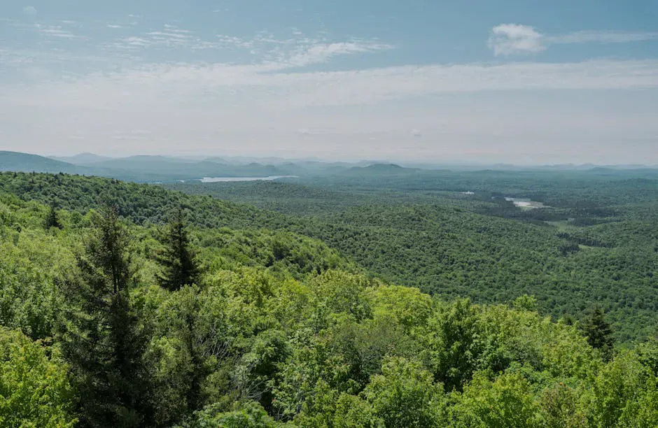
Burnt Meadow Mountain is a 1,575-foot peak in Brownfield, on the western edge of Oxford County where Maine’s foothills begin stacking up toward the White Mountains. It is less than an hour from Portland, and the amount of open ledge and ridgeline walking it offers is unusual for a mountain this close to the coast. The trail climbs steeply through forest, then breaks out onto exposed granite with views that stretch from Sebago Lake to the Presidential Range.
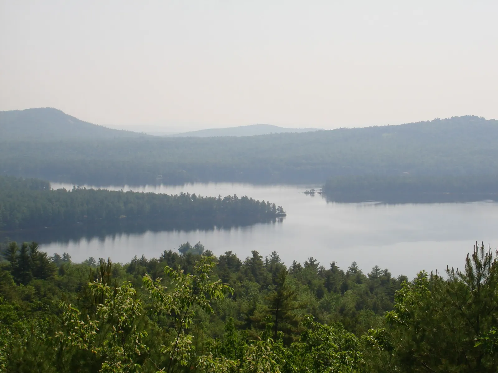
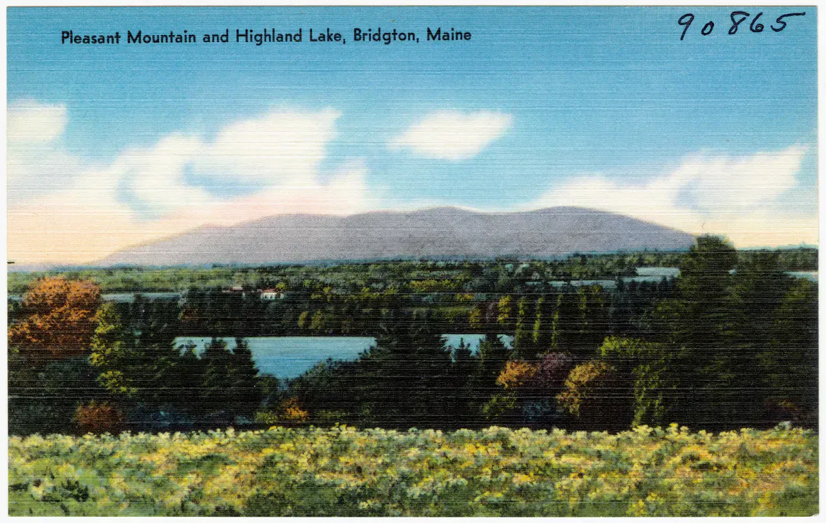
The mountain has two main peaks: North Peak and the slightly higher main summit to the south. A connecting ridge trail links the two, and the entire upper mountain is open rock and low scrub. On a clear day, you can see Mount Washington to the west, Pleasant Mountain and Sebago Lake to the south, and the peaks around Evans Notch to the north.
The Trails
Two trails climb Burnt Meadow Mountain from the trailhead on Route 160 (Spring Road) in Brownfield.
The Burnt Meadow Trail (blue blazes) is the more direct route, climbing about 1.2 miles to North Peak. This trail is steep and features rock scrambles, especially in the upper half. The grade is relentless but the trail is short, and you reach open ledge quickly.
The Twin Brooks Trail (yellow blazes) takes a more gradual approach, reaching the main summit in about 2.2 miles. It winds through the forest with a steadier grade before meeting the ridge.
Most hikers combine the two into a counterclockwise loop of about 3.7 miles: up the Burnt Meadow Trail to North Peak, across the ridge to the main summit, and down the Twin Brooks Trail.
The Burnt Meadow Trail is steep with exposed rock scrambles that are difficult when wet. If recent rain has left the rock slick, consider going up the Twin Brooks Trail instead and doing the loop clockwise.
The Ridge
The connecting ridge between North Peak and the main summit is the highlight of this hike. The trail traverses open granite slabs with views on both sides. To the west, the Presidential Range dominates the horizon. To the east, the foothills drop away toward the Saco River valley and Sebago Lake. The ridge walk takes about 20 to 30 minutes and feels exposed and alpine despite the modest elevation.
North Peak has the better views to the north and west. The main summit is slightly higher and offers a broader southern panorama. Both are excellent spots for lunch.
If you want to extend the hike, a spur trail continues south from the main summit to Stone Mountain, adding about 1.4 miles round trip. Stone Mountain has its own set of open ledges and views, and the extra distance is worth it if you have the energy.
When to Go
Spring
The steep sections are slippery with snowmelt and mud through mid-May. Black flies arrive late May.
Summer
The open ridge is hot and exposed on sunny days. Start early or go late. Wild blueberries ripen on the ledges in late July.
Fall
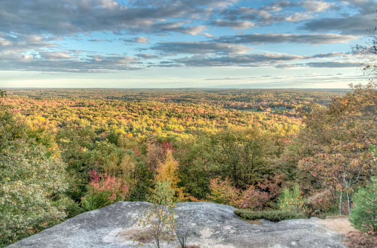
The ridge looks out over the western foothills in full fall color. Clear air sharpens the Presidential Range views. October weekends can be busy.
Winter
The steep rock on the Burnt Meadow Trail requires crampons. The ridge is very exposed to wind. Best attempted by experienced winter hikers.
October is the peak month. The foliage across the western Maine foothills lights up the views from the ridge, and the air is cool enough to make the steep climb comfortable.
Practical Notes
The trailhead parking area is a gravel pulloff on Route 160 (Spring Road) in Brownfield. There is room for about 10 to 12 cars. On busy fall weekends, cars park along the road shoulder.
No bathrooms or facilities at the trailhead. The nearest gas and supplies are in Brownfield or Fryeburg, each about 10 minutes away.
Burnt Meadow Mountain is one of the best hikes within an hour of Portland that most Portland-area hikers have never heard of. It gets a fraction of the traffic that Pleasant Mountain sees, with arguably better views from the ridge.
Cell service is spotty at the trailhead and on the lower trail. You will likely get a signal on the open ridge.
Packing List
Burnt Meadow Mountain Day Hike
- 1.5 to 2 liters of water per person
- Snacks for the ridge
- Wind layer for the exposed ridgeline
- Sun protection
- Bug spray May through July
- Sturdy hiking boots (steep rock scrambles)
- Trekking poles recommended for the descent
- Camera
Getting There
From Portland, take Route 25 west through Standish to Cornish, then Route 160 north to Brownfield. The trailhead is on Route 160 about 2 miles north of the Brownfield village center. The drive takes about an hour.
From Fryeburg, take Route 113 south to Route 160 and head south to the trailhead, about 15 minutes.
FAQ
How long does the Burnt Meadow Mountain loop take?
The 3.7-mile loop typically takes 2.5 to 3.5 hours depending on pace and time on the ridge. The steep Burnt Meadow Trail slows most hikers on the way up.
Is the trail good for beginners?
The Twin Brooks Trail is manageable for fit beginners. The Burnt Meadow Trail is steep with rock scrambles and is better suited to hikers with some experience. The loop combines both.
Are dogs allowed?
Yes. Dogs are welcome on the trails. The steep rock scrambles on the Burnt Meadow Trail can be difficult for some dogs, so the Twin Brooks Trail may be a better option for hiking with pets.
Can I see Mount Washington from the ridge?
Yes. On clear days, Mount Washington and the Presidential Range are clearly visible to the west from both North Peak and the main summit.
What is the Stone Mountain extension?
A spur trail continues south from the main summit of Burnt Meadow to Stone Mountain, adding about 1.4 miles round trip. Stone Mountain has open ledges and additional views. The total loop with the extension is about 5.1 miles.
For more hiking nearby, see Pleasant Mountain via the Ledges Trail near Bridgton or Bradbury Mountain in Pownal.