Big Views from a Little Mountain
Mount Cutler is one of those hikes that delivers far more than its modest stats suggest. Rising just 1,232 feet above the village of Hiram in Oxford County, the mountain sits at the edge of the Saco River valley where the foothills of western Maine begin to pile up toward New Hampshire. The summit ridge is a half-mile stretch of open blueberry fields and granite ledge with views in nearly every direction. To the west, the White Mountains fill the horizon. Below, the Saco River bends through its wide valley, and on clear days you can see south toward Sebago Lake.
The Town of Hiram owns the 175-acre Mount Cutler Park and Conservation Area, which includes the entire main ridge. The trail system was formally conserved in 2019 after years of community effort, and it has quickly become one of the most popular short hikes in the western foothills.
The Trail
The main Mount Cutler Trail begins from the parking area off Mount View Avenue near the railroad tracks in Hiram village. The 3.9-mile loop climbs through mixed hardwood forest on a well-worn path, gaining about 820 feet to the summit ridge. The first mile is moderate and steady. The trail steepens as it approaches the ridge, with a few rocky sections that require hands in places.
Once on the ridge, the trail opens up dramatically. The summit area is a series of open ledges and blueberry fields connected by short wooded sections. A spur trail leads to the true summit, and several viewpoints along the ridge offer slightly different perspectives of the valley below.
There is also a shorter option that takes hikers to the main viewpoint and back in about 2.5 miles, skipping the full ridge traverse.
The shorter out-and-back to the main ledge viewpoint is perfect for families with young kids or anyone looking for a quick after-work hike. You get the signature Saco River valley view without committing to the full loop.
The Views
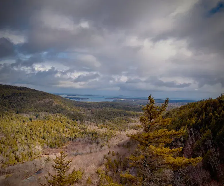
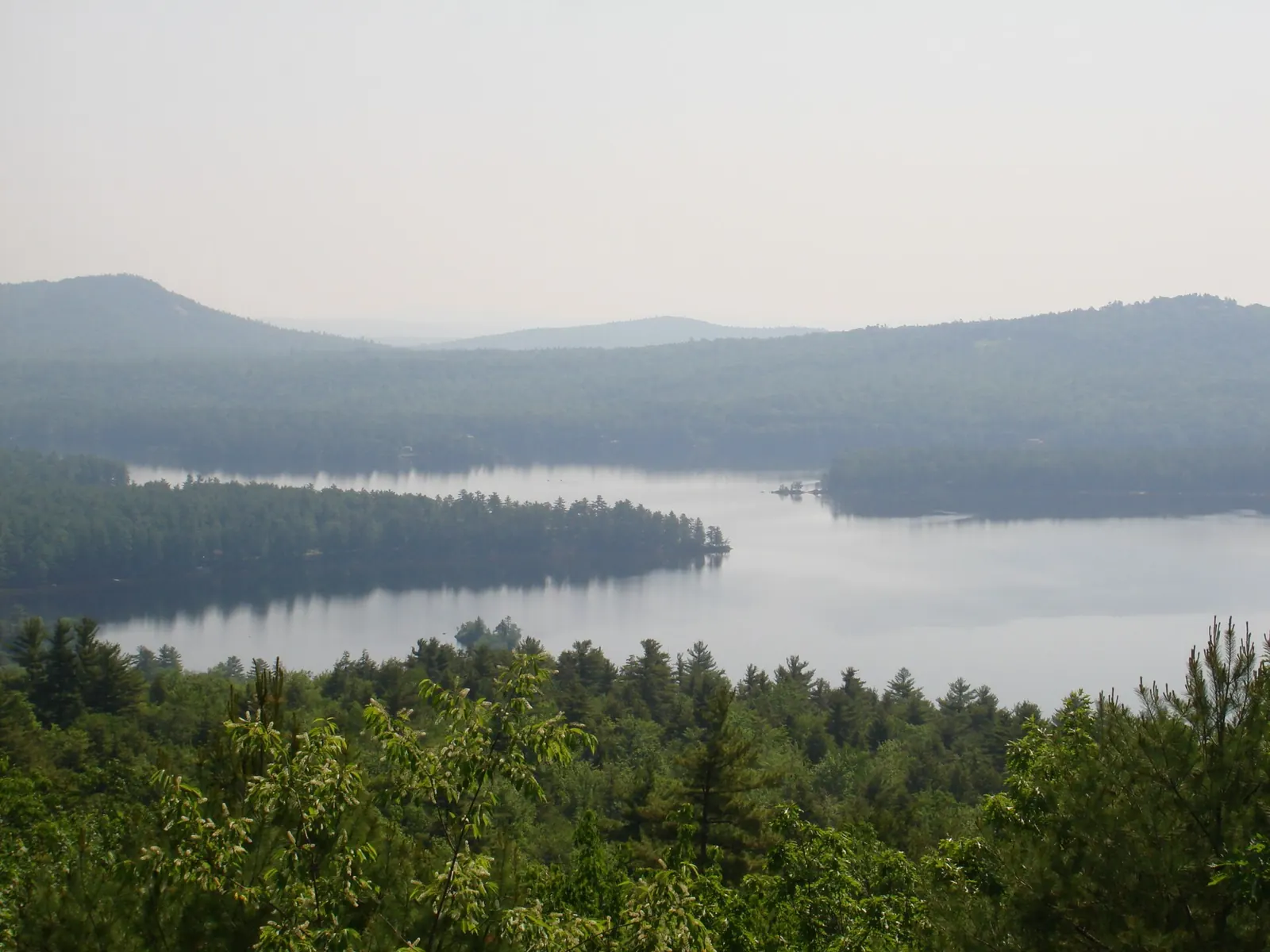
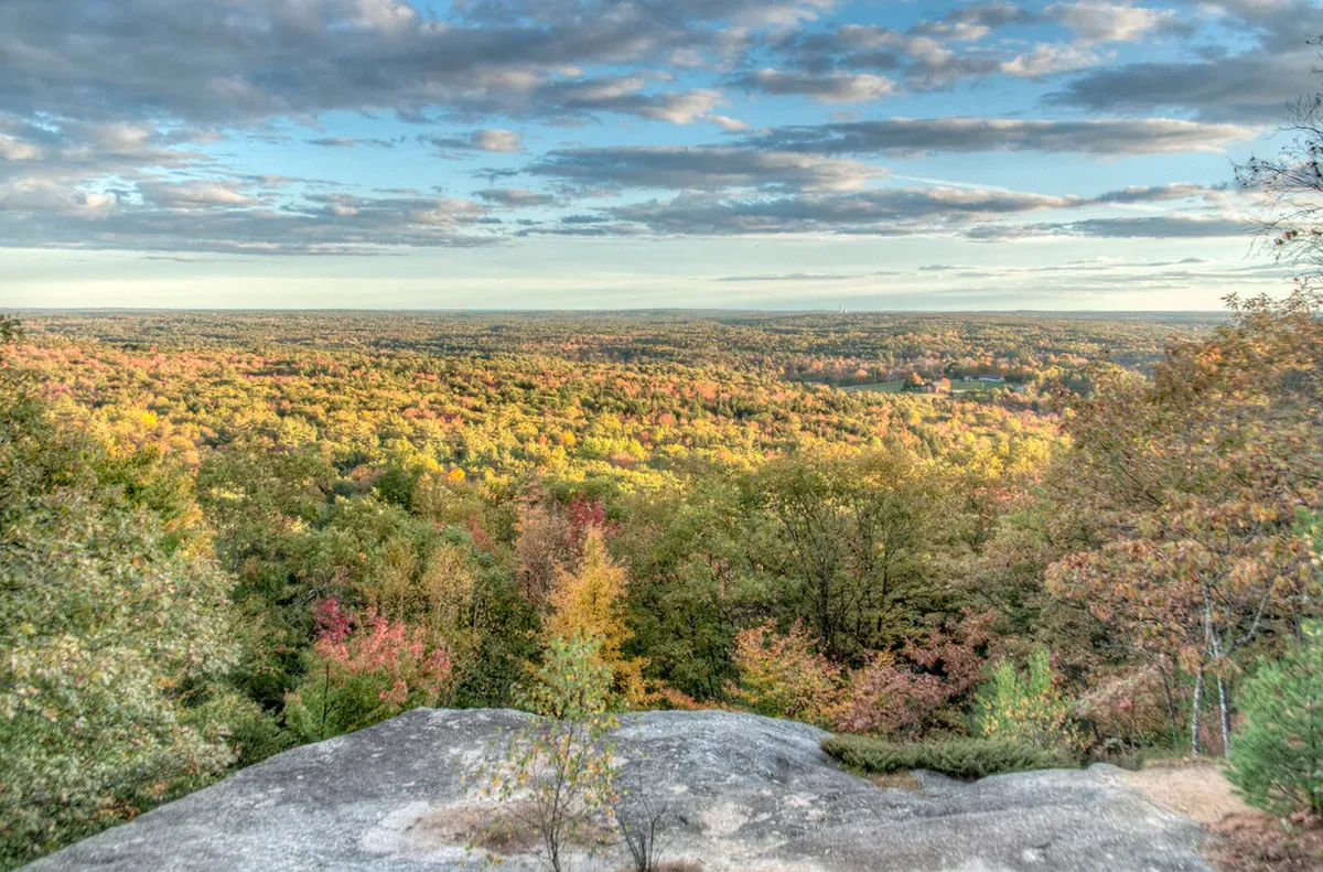
The main ledge on Mount Cutler faces west and south, giving you a front-row seat to the White Mountains. Mount Washington and the Presidential Range are clearly visible on clear days, along with the closer peaks of the Baldface Range and the hills around Evans Notch. Below the ledge, the Saco River curves through Hiram and the surrounding farmland. To the south, the view extends toward Kezar Lake and the low hills of southern Oxford County.
The open blueberry fields that cover the ridge are themselves part of the scenery. In late summer they turn red and the contrast against the granite and green forest is striking.
When to Go
Spring
Mud season clears earlier here than at higher elevations. Wildflowers in the lower forest. Black flies arrive late May.
Summer
Blueberries ripen on the ridge in late July and August. Bring sun protection as the summit is fully exposed. Early morning or late afternoon avoids the heat.
Fall
Foliage in the Saco River valley is spectacular from the ridge. Clear autumn air gives the sharpest mountain views. The blueberry fields turn crimson.
Winter
Short enough for a winter day hike with microspikes. The exposed ledges can be icy. Views of the snow-covered White Mountains are exceptional.
Mount Cutler is a three-season standout, but early October with peak foliage in the valley below is hard to beat.
Practical Notes
Parking is in a small dirt lot off Mount View Avenue, just off Route 5/113 in Hiram village. There is room for about 8 to 10 cars. The lot can fill on busy fall weekends, but the mountain rarely feels crowded on the trail itself.
No bathrooms at the trailhead. The nearest gas, food, and supplies are in the village of Hiram or nearby Cornish and Fryeburg.
After the hike, drive a few minutes to the Saco River in Hiram for swimming. The stretch near the Route 5 bridge has sandy spots that locals use all summer.
Cell service is spotty at the trailhead and on the lower trail, but you may get a signal on the open summit ridge.
Packing List
Mount Cutler Day Hike
- 1 to 1.5 liters of water per person
- Snack for the summit
- Sun protection for the open ridge
- Bug spray late spring through summer
- Sturdy shoes (rocky sections on the upper trail)
- Camera
Getting There
From Portland, take Route 25 west through Standish and Cornish to Hiram, about 75 minutes. In Hiram, turn north onto Route 5/113, cross the bridge, then take an immediate left onto River Road. Shortly after, turn right onto Mount View Avenue. The small dirt parking lot is on the right where Mount View Avenue curves left, next to the railroad tracks.
From Fryeburg, head south on Route 5/113 to Hiram, about 20 minutes.
FAQ
How long does the Mount Cutler hike take?
The full 3.9-mile loop takes about 2 to 3 hours. The shorter out-and-back to the main viewpoint takes about 1.5 hours.
Is Mount Cutler good for kids?
The shorter route to the main ledge is doable for kids ages 5 and up. The full loop has some steeper rocky sections that are better for older children.
Are dogs allowed?
Yes. Mount Cutler Park allows dogs. Keep them leashed and clean up after them.
Is there swimming nearby?
Yes. The Saco River runs through Hiram just below the mountain and has several informal swimming spots used by locals in summer.
Can I see Mount Washington from the summit?
Yes. On clear days, Mount Washington and the Presidential Range are clearly visible to the west from the main summit ledge.
For more hiking in the region, see Pleasant Mountain via the Ledges Trail or Bradbury Mountain, both within an easy drive.