A Little-Known Peak in the White Mountain National Forest
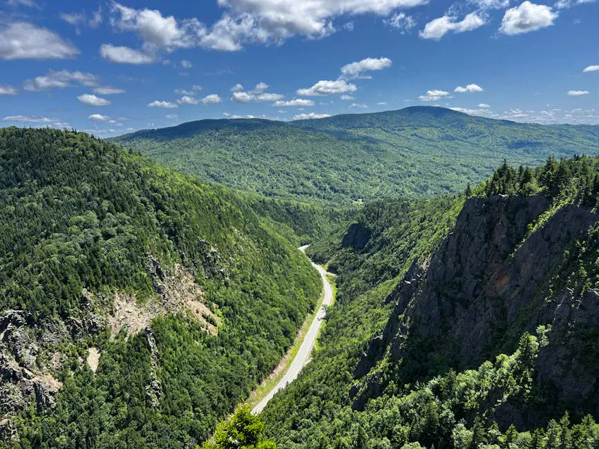
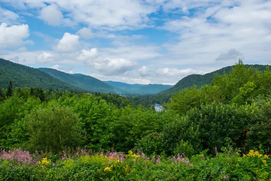
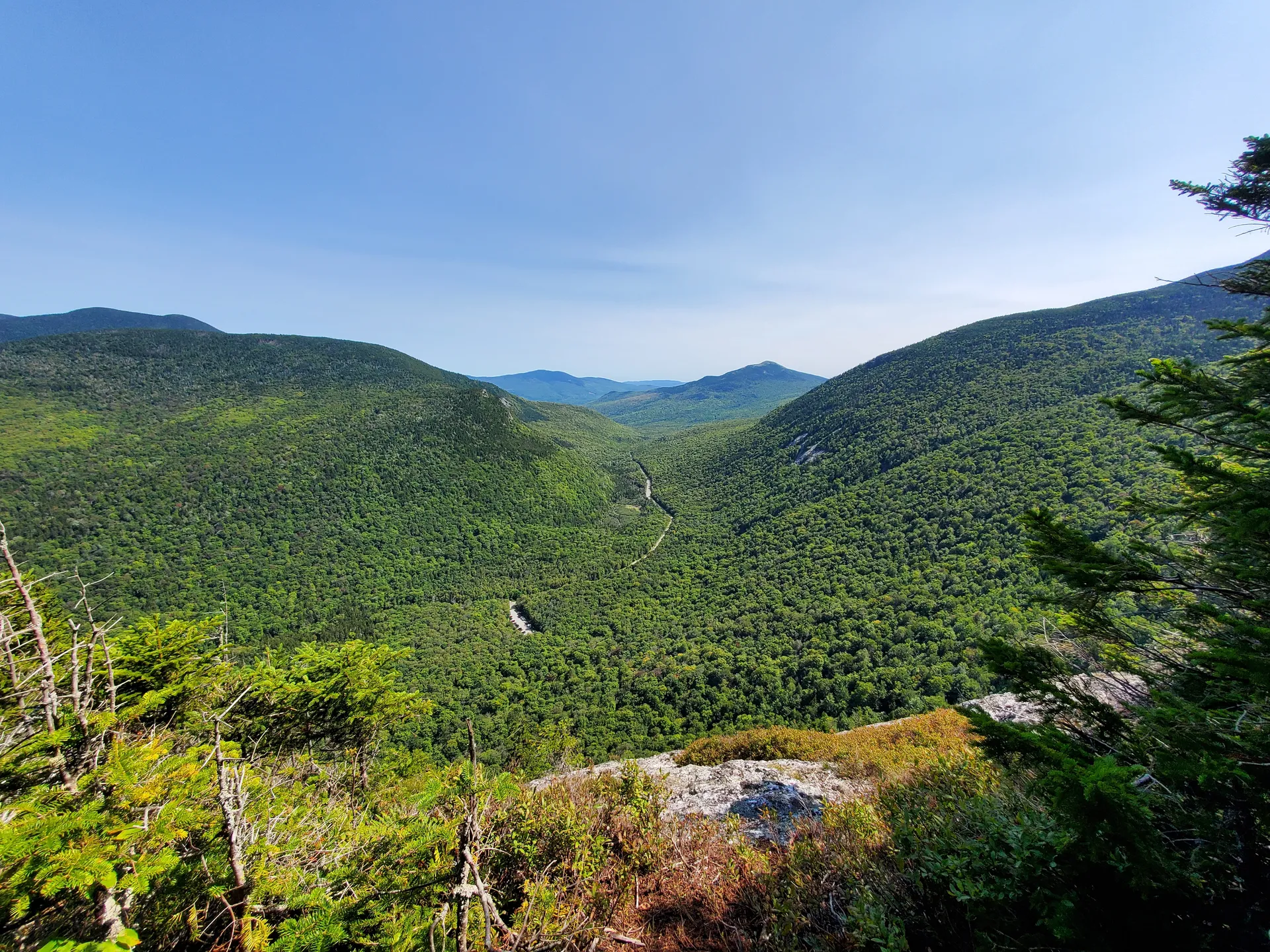
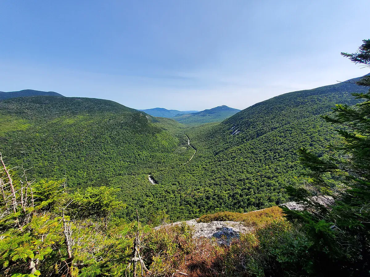
Caribou Mountain rises 2,840 feet in the Caribou-Speckled Mountain Wilderness, the portion of the White Mountain National Forest that sits on the Maine side of the border. It is the second-highest peak in the wilderness area, and its open granite summit delivers one of the best 360-degree panoramas in western Maine. The Presidential Range fills the western horizon, the Mahoosuc Range stretches to the north, and the Cold River Valley drops away below. On a clear day, the view rivals anything in the more popular sections of the White Mountains.
The mountain was named for the woodland caribou that once roamed the area. The last known caribou in this part of Maine was shot here in 1854. Today the wilderness is quiet, and the trail sees far fewer hikers than comparable peaks across the border in New Hampshire.
The Trail
The standard route is a 6.9-mile loop combining the Mud Brook Trail and the Caribou Trail, both accessible from the same trailhead on Route 113. Most hikers go up the Mud Brook Trail (about 3 miles to the summit) and return via the Caribou Trail (about 4 miles), though either direction works.
The Mud Brook Trail climbs steadily through mixed hardwood and spruce forest, crossing the brook several times. The upper mile steepens and breaks out of the trees onto open ledges below the summit. The Caribou Trail descends the mountain’s northern side and passes a series of unnamed waterfalls and cascades, some as high as 50 feet. The cascades are one of the highlights of the hike and are best seen with good water flow in spring or after rain.
Go up the Mud Brook Trail and down the Caribou Trail. This puts the steeper, more direct climb on the ascent and saves the waterfalls for the descent when you can take your time enjoying them.
The Summit
The summit of Caribou Mountain is a broad expanse of open rock with no tree cover. Views extend in every direction. Mount Washington and the Presidential Range dominate the western skyline. To the north, the Mahoosuc Range rolls toward Grafton Notch. The Carter Range and Baldface Range are visible to the southwest, and Evans Notch drops away directly to the south. On very clear days you can see all the way to Katahdin.
There is no shelter on the summit. The open rock is fully exposed to wind and weather, and conditions can change quickly at this elevation.
When to Go
Spring
Mud season runs through mid-May. Brook crossings can be high. Black flies arrive late May. Route 113 may still be gated.
Summer
Warm days with long light. Bring plenty of water as there is no reliable source above the brook crossings. Start early to avoid afternoon thunderstorms.
Fall
Foliage in the Cold River Valley is outstanding. Clear air gives the sharpest views. The cascades along the Caribou Trail are framed by color.
Winter
Route 113 is closed to vehicles in winter, adding miles of road walking. The summit is very exposed. Snowshoes or microspikes required.
Late September through mid-October is the prime window. The foliage peaks early in the higher elevations of Evans Notch, and the crisp autumn air pushes haze out of the valleys for the clearest summit views of the year.
Practical Notes
Route 113 through Evans Notch is gated and closed to vehicles from approximately late November through mid-May. Check with the Androscoggin Ranger District before planning a spring or late fall trip. When the road is closed, accessing the trailhead requires a long approach on foot or skis.
The trailhead parking area is on Route 113, roughly a mile south of the Hastings Campground. There is room for about 10 cars in the gravel pulloff. No bathrooms or facilities at the trailhead. The nearest fuel and supplies are in Bethel, about 20 minutes west.
Cell service is nonexistent at the trailhead and on the mountain. Download maps before you leave service.
Packing List
Caribou Mountain Day Hike
- 2 to 3 liters of water per person
- Lunch and snacks for a full day
- Wind layer for the exposed summit
- Bug spray May through July
- Sturdy hiking boots (rocky trail with brook crossings)
- Trekking poles recommended for the descent
- Map and compass or downloaded GPS map
- Camera
Getting There
From Bethel, take Route 2 east to Gilead, then turn south onto Route 113. The trailhead is about 10 miles south on Route 113, on the right just before Evans Brook. From Portland, the drive takes roughly 2 hours 30 minutes via the Maine Turnpike to Route 26 through Grafton Notch, then south on Route 113. From Fryeburg, head north on Route 113 through Evans Notch.
Top off your tank in Bethel or Gilead. There are no services on Route 113.
If the loop feels like too much, you can do an out-and-back on the Mud Brook Trail alone for about 6 miles round trip. You still get the full summit experience, just without the waterfalls on the Caribou Trail side.
FAQ
How long does the Caribou Mountain loop take?
Most hikers complete the 6.9-mile loop in 4 to 6 hours depending on pace and time spent on the summit and at the waterfalls.
Are dogs allowed on Caribou Mountain?
Yes. The trail is in the White Mountain National Forest and dogs are welcome. Keep them leashed at brook crossings and on the open summit.
Is there water on the trail?
Mud Brook runs along the lower portion of the Mud Brook Trail, and there are cascades on the Caribou Trail. All backcountry water should be treated before drinking.
Can I camp on the mountain?
Dispersed camping is allowed in the White Mountain National Forest following Leave No Trace principles. No camping within 200 feet of trails or water. The nearby Hastings Campground offers established sites.
When is Route 113 open?
Typically mid-May through late November. The exact dates depend on snow conditions each year. Contact the Androscoggin Ranger District for current road status.
For more hiking nearby, see Old Speck via Grafton Notch or Table Rock at Grafton Notch, both within a short drive north on Route 26.