An Appalachian Trail Summit in the Mahoosuc Range
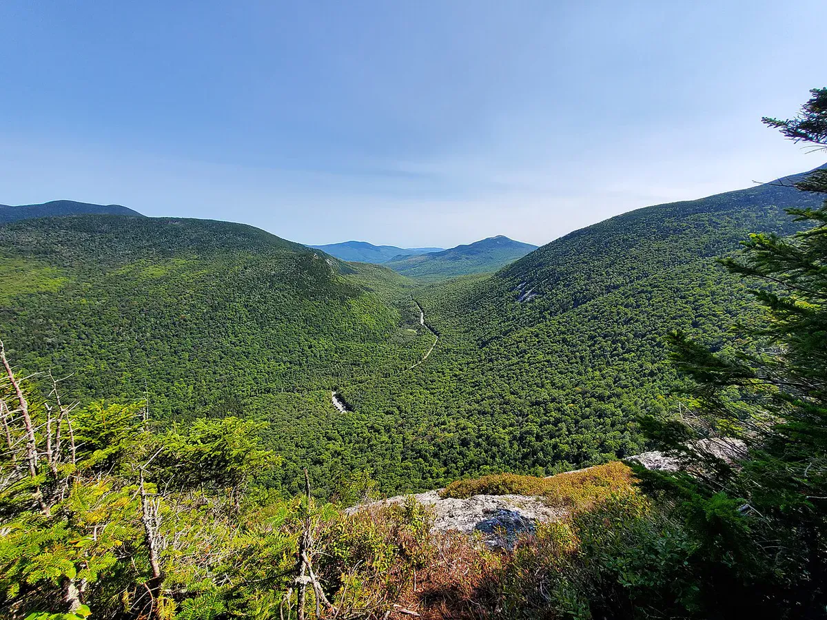
Puzzle Mountain rises to 3,133 feet in Newry, on the western edge of the Mahoosuc Range. The Appalachian Trail crosses its summit, making this one of the more accessible AT day hikes in western Maine. The open summit delivers views that rival peaks twice as popular, stretching across Grafton Notch to Old Speck and the Baldpates, south toward Sunday River, and north into the heart of the Mahoosuc Range, one of the toughest sections of the entire Appalachian Trail.
The name comes from the jumbled rock formations near the summit, which early travelers thought looked like the pieces of a jigsaw puzzle scattered across the mountaintop. The rocky summit itself is mostly bare, with low scrub and lichen-covered granite offering unobstructed views in every direction.
The Trail
The standard route follows the Appalachian Trail northbound from a trailhead on Route 26, south of Grafton Notch State Park. The round trip is approximately 5 miles with about 2,400 feet of elevation gain, making this a solid moderate hike that will test your legs on the way up.
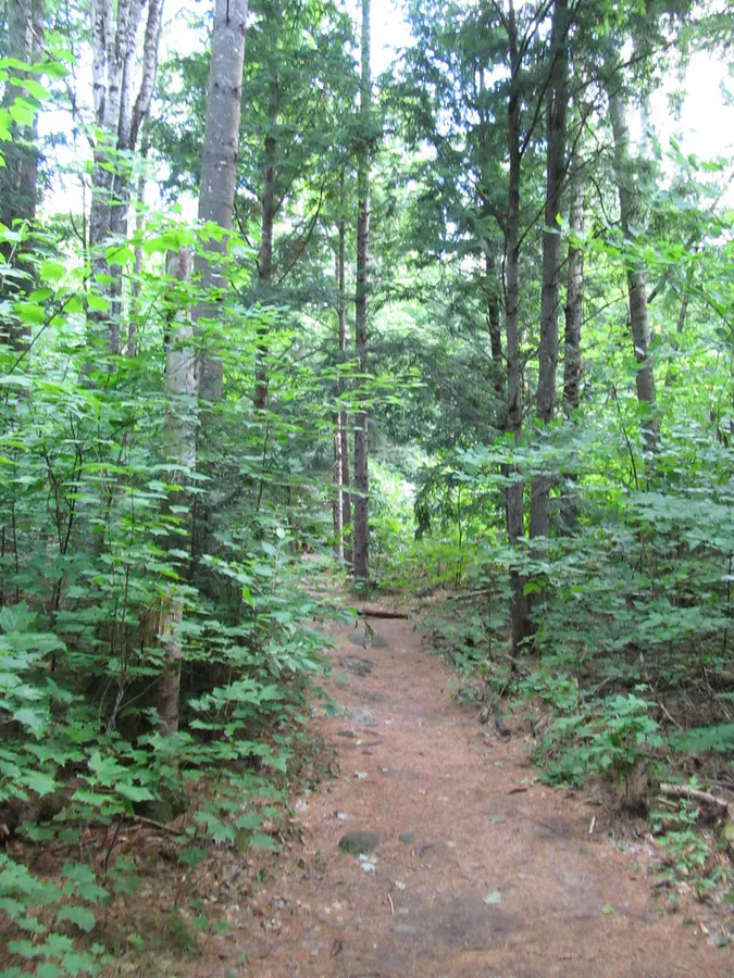
The trail starts in mixed hardwood forest, crossing a brook before beginning its steady climb. The lower mile is moderate and shaded, passing through birch, beech, and maple. As you gain elevation, the forest transitions to spruce and fir, the trail narrows, and the footing becomes rockier. The AT white blazes are well-maintained and easy to follow throughout.
The upper section steepens considerably. You’ll scramble over exposed roots and rock ledge for the final half mile before the trees thin out and the summit opens up. There are a few false summits along the way where partial views tempt you to stop, but the true summit is worth the push.
The trail passes over several exposed ledges before the summit that offer partial views to the south and east. These make excellent rest stops on the way up, and in fall the foliage views from these intermediate ledges run for miles.
The Summit
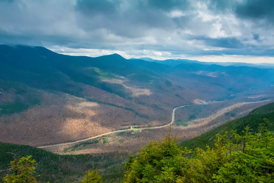
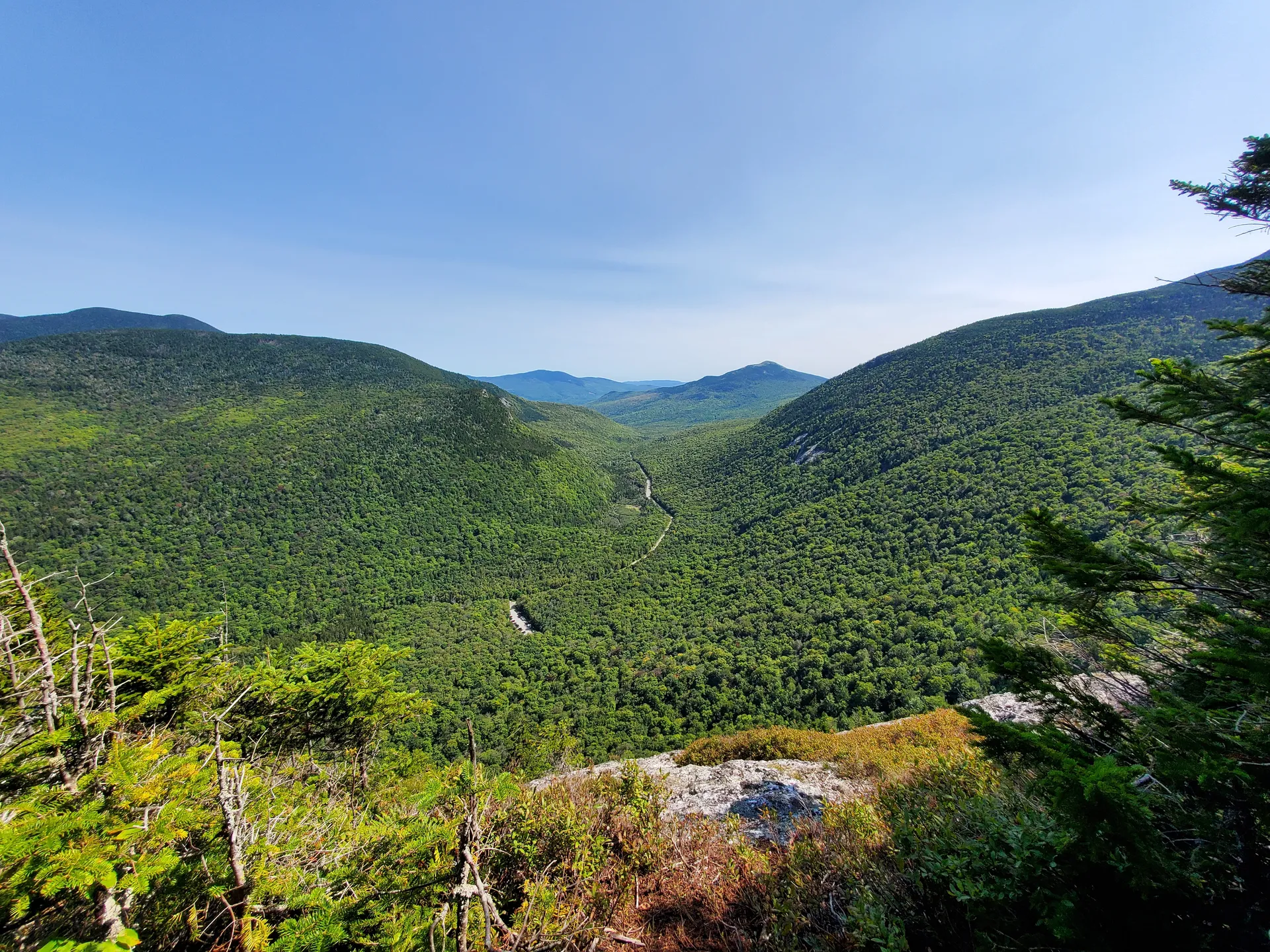
Puzzle Mountain’s summit is one of the more expansive open summits in western Maine. The bare rock and low alpine vegetation give you nearly 360 degrees of visibility. To the north, Old Speck and the Baldpate Mountains frame the far side of Grafton Notch. The Mahoosuc Range extends northeast, with the distinctive notch of Mahoosuc Arm visible on clear days. To the south and west, the peaks roll toward Sunday River Whitecap and the mountains around Bethel.
On very clear autumn days, you can see the Presidential Range in New Hampshire to the southwest. The summit has enough flat rock to spread out and eat lunch, and the AT thru-hikers who pass through are usually happy to share stories about the trail.
When to Go
Spring
Trail is often muddy and wet through late May. Black flies are fierce from late May through June. Snow may linger on the upper sections into early May.
Summer
Best conditions from July through August. Long days allow for a relaxed pace. Bring bug spray for the first half of summer.
Fall
Peak foliage in late September to early October. Clear air gives the longest views. Cool temperatures make the climb comfortable.
Winter
The summit is exposed to harsh wind and cold. Snowshoes or crampons required. Not recommended for inexperienced winter hikers.
Late September through the first week of October is the sweet spot. The Mahoosuc Range lights up with color, the air is dry and clear, and the summit views reach their maximum distance.
Practical Notes
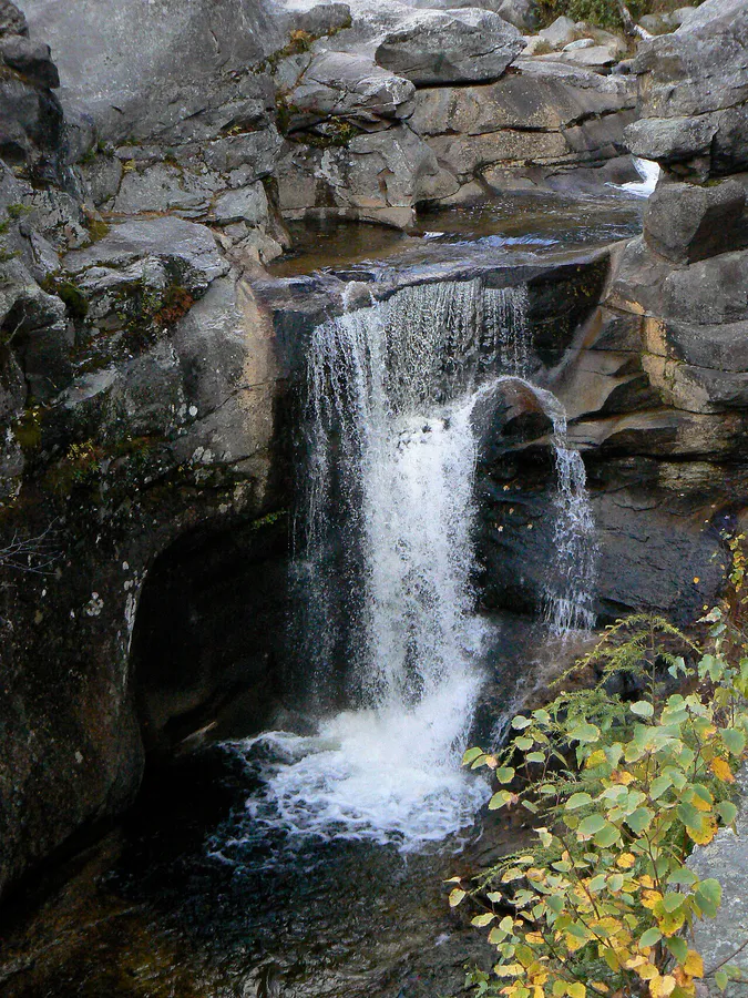
If you are hiking Puzzle Mountain as a day trip, combine it with a stop at Grafton Notch State Park on Route 26 nearby. Screw Auger Falls and Mother Walker Falls are short, easy walks right off the road that pair well with the longer summit hike.
Parking at the trailhead is a small roadside pulloff on Route 26. It holds roughly 10 cars and does not fill up on most days, though fall weekends can get busy. There are no facilities at the trailhead.
Cell service drops out as you leave Newry heading north on Route 26. Plan accordingly and bring a paper map or downloaded trail map.
Packing List
Puzzle Mountain Day Hike
- 2 liters of water per person (no reliable water on the trail)
- Lunch and snacks for the summit
- Bug spray May through July
- Wind layer and extra warm layer for the summit
- Sturdy boots with good tread for the rocky upper section
- Trekking poles (helpful on the steep descent)
- Sun protection for the exposed summit
- Downloaded trail map (no cell service)
Getting There
The trailhead is on Route 26 in Newry, south of Grafton Notch State Park. From Portland, take the Maine Turnpike to Auburn, then Route 26 north through Paris and Bethel. The drive is about 2.5 hours. From Bangor, take Route 2 west through Farmington to Rumford, then Route 2 to Bethel and Route 26 north. About 3 hours.
The town of Bethel, about 20 minutes south of the trailhead, has restaurants, gas stations, and outfitters if you need to resupply before or after the hike.
FAQ
How long does it take to hike Puzzle Mountain?
Most hikers complete the 5-mile round trip in 3.5 to 5 hours, depending on fitness level and time spent on the summit. The elevation gain of 2,400 feet makes the ascent steady and sustained.
Is Puzzle Mountain on the Appalachian Trail?
Yes. The Appalachian Trail crosses the summit. You hike northbound on the AT from the Route 26 trailhead to reach the top.
Are dogs allowed on Puzzle Mountain?
Yes. Dogs are welcome on this section of the AT. Keep them on leash near the trailhead and on the exposed summit, and bring extra water for them.
How does Puzzle Mountain compare to Old Speck?
Puzzle Mountain is shorter (5 miles vs 7.6 miles) and has a more open summit. Old Speck is taller at 4,170 feet and has a fire tower. Both offer excellent Mahoosuc Range views, but Puzzle is a less strenuous option.
Is there water on the trail?
A brook crosses the trail in the lower section, but it is not reliable in late summer. Carry all the water you need from the start.
For more hiking in the area, see our guides to Grafton Notch and Old Speck and the Mahoosuc Range.