The Hardest Mile on the Appalachian Trail
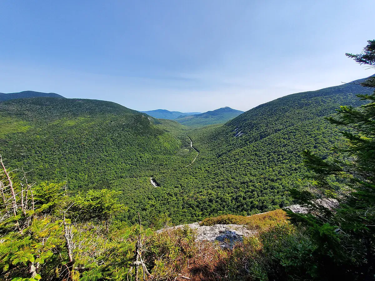
The Mahoosuc Public Reserved Land covers roughly 27,000 acres of rugged mountain terrain along the Maine-New Hampshire border in Oxford County. It is famous for one thing above all else: Mahoosuc Notch, a one-mile boulder-choked ravine that the Appalachian Trail passes directly through. AT thru-hikers, who have walked over 1,800 miles by the time they reach this point, consistently call it the most physically demanding mile on the entire 2,190-mile trail.
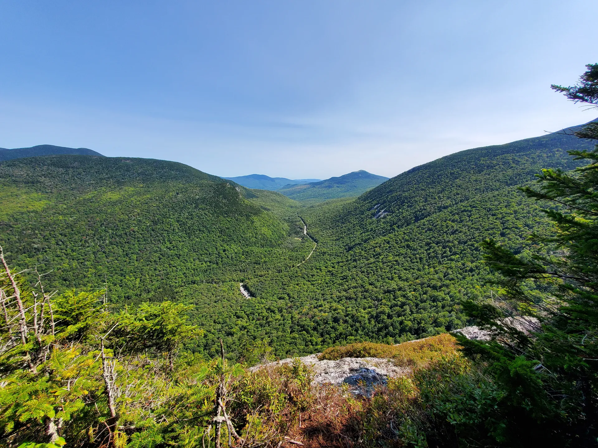
But the Mahoosucs are more than one notorious mile. The range includes Mahoosuc Arm, a brutally steep climb that many hikers find harder than the Notch itself, plus connecting trails to Old Speck Mountain in Grafton Notch State Park. Together, these form one of the most challenging and rewarding backcountry experiences in the northeastern United States.
Mahoosuc Notch and Mahoosuc Arm are serious backcountry terrain. The Notch requires climbing over, under, and between house-sized boulders for a full mile, often with a heavy pack. Ice persists in the boulder caves well into summer. Mahoosuc Arm gains over 1,500 feet in less than a mile on steep, exposed rock. Injuries are common. This is not a place for inexperienced hikers.
Mahoosuc Notch
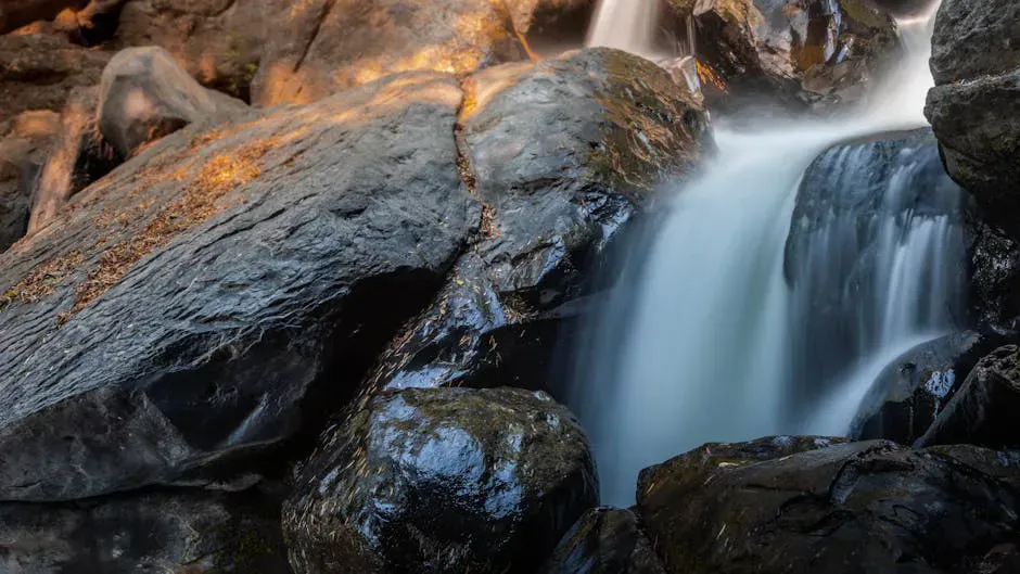
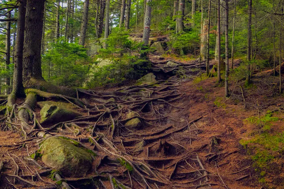
The Notch is a narrow, mile-long cleft between Mahoosuc Arm and Fulling Mill Mountain. During the last ice age, the walls of the ravine fractured and filled the bottom with enormous boulders, some the size of houses. The Appalachian Trail runs through this jumble, and “hiking” is not really the right word for what you do here.
You climb over boulders. You squeeze through gaps between them. You lower yourself into dark crevices and climb back out the other side. You take your pack off and push it ahead of you through passages too narrow to wear it. Grippy, ankle-supporting hiking boots make a real difference on the wet rock. Some of the crevices still hold ice and snow well into July, and the rocks are slick with moisture year-round.
Most hikers take 1.5 to 3 hours to cover this single mile. Speed depends on your size (smaller people fit through gaps more easily), your pack weight, and your comfort with uneven, exposed rock. The deeper boulder caves are genuinely dark, so a hands-free headlamp is worth carrying even on a day trip. It is exhausting, exhilarating, and unlike anything else on the AT.
If you are doing the Notch as part of a longer backpacking trip, consider setting up a base camp at the Notch campsite and day-hiking through the Notch with just a daypack. The experience is dramatically more enjoyable without a 40-pound pack catching on every boulder.
Mahoosuc Arm
If the Notch is the famous mile, Mahoosuc Arm is the one hikers remember with a grimace. The Arm is the steep ascent on the south side of the Notch, climbing over 1,500 vertical feet in less than a mile. The trail goes almost straight up, with sections of exposed rock slab, root ladders, and hand-over-hand scrambling.
For northbound AT thru-hikers, the Arm comes immediately before the Notch, making for one of the hardest days on the entire trail. For day hikers or weekenders approaching from Grafton Notch, the Arm is usually the return climb after completing the Notch, which means you hit it when you are already tired.
There is no easy way around it. The Arm is part of the experience.
Connecting to Old Speck
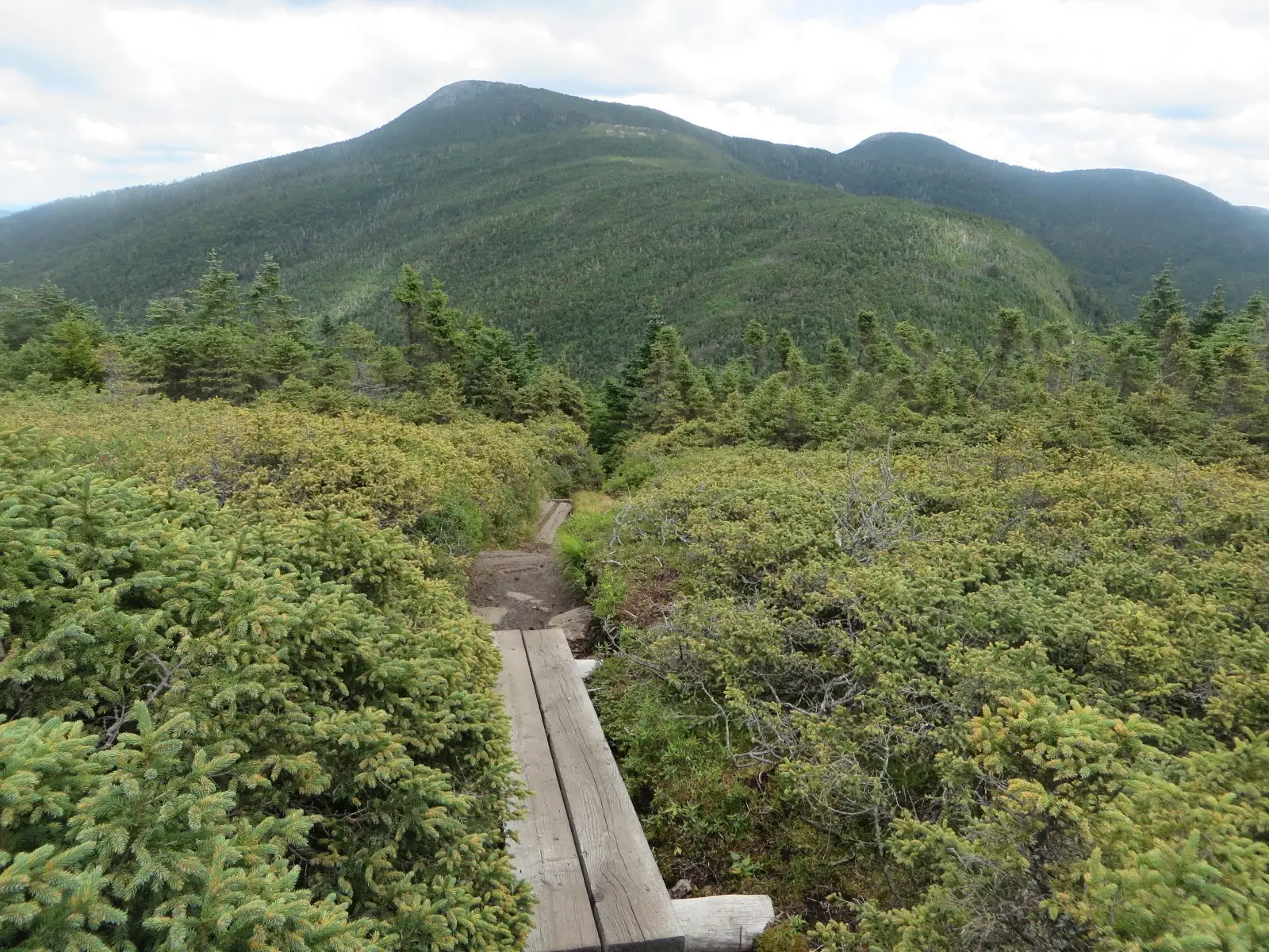
The Mahoosuc Trail connects the Notch area to Old Speck Mountain in Grafton Notch State Park, Maine’s fourth-highest peak at 4,170 feet. A fire tower on the summit gives 360-degree views over the Mahoosuc Range and the White Mountains. Linking Old Speck with a Notch traverse makes for a demanding two-day backpacking trip that covers some of the finest mountain terrain in New England.
The full traverse from the Success Pond Road trailhead (north end) to the Grafton Notch trailhead (south end) is roughly 14 miles and involves significant elevation gain and loss. Most parties take two days with a camp near the Notch.
The Success Pond Road approach from the north is a long, rough logging road from Berlin, New Hampshire. The Grafton Notch approach from the south is paved and easy. If you are doing a point-to-point traverse, starting from Success Pond Road and finishing at Grafton Notch puts your car shuttle on the better road.
Campsites
Several backcountry campsites and shelters are scattered along the AT through the Mahoosucs. The Notch campsite sits at the south end of the Notch and is the most popular overnight spot. It has tent platforms and a water source. Full Goose Shelter is another option farther south along the ridge.
All camping is free and first-come, first-served. During peak AT thru-hiker season (July and August), the shelters can be crowded. Bring a tent as backup.
Getting There
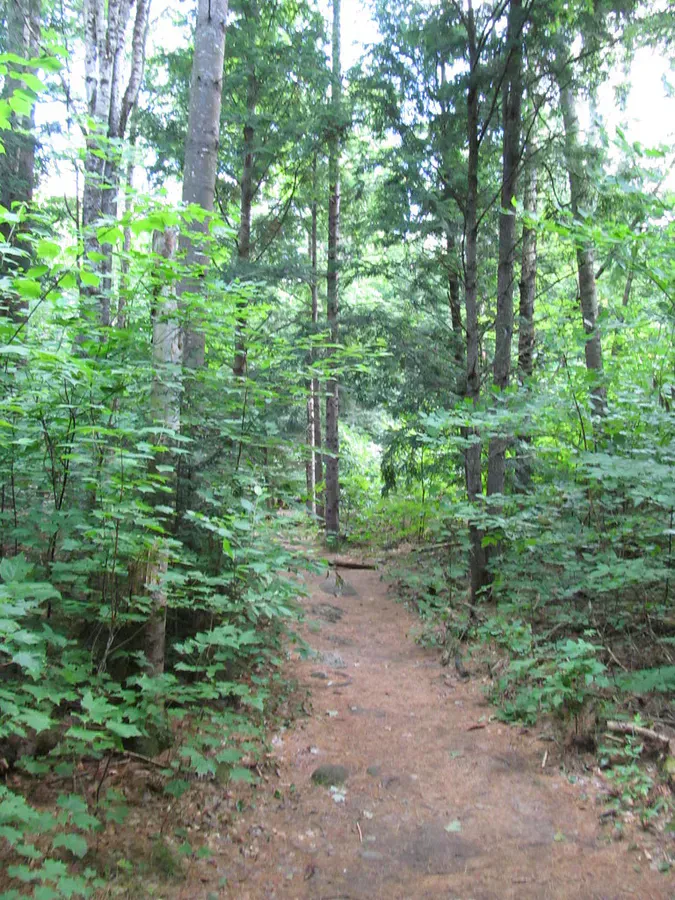
The most common approach for day hikers and weekenders is from Grafton Notch State Park on Route 26, about 2.5 hours from Portland. The Old Speck trailhead has parking, restrooms, and a maintained trail that connects to the Mahoosuc Trail.
The northern approach via Success Pond Road from Berlin, New Hampshire is longer and rougher but puts you closer to the Notch itself. This road is active logging territory. Drive carefully and yield to trucks.
Bethel is the nearest town with full services, about 30 minutes from Grafton Notch. Stock up on food and fuel there.
When to Go
Spring
Snow and ice persist in the Notch into June. The boulder scrambling is extremely dangerous when wet or icy. Not recommended.
Summer
Driest conditions in the Notch. Ice may still linger in deep crevices into July. AT thru-hikers pass through July and August.
Fall
Foliage is spectacular from the ridges. Cool weather. The Notch boulders can be slick with fallen leaves.
Winter
The Notch is filled with ice and snow. Mahoosuc Arm is an ice climb. Expert mountaineers only.
Late July through mid-September offers the best conditions. The Notch boulders are at their driest, the weather is warmest, and the days are long enough to allow time for the slow passage through the boulder field.
Packing List
Mahoosuc Notch Trip
- Hiking boots with excellent ankle support
- Helmet (optional but smart for the Notch)
- Trekking poles (stow them in the Notch, useful elsewhere)
- Headlamp (the boulder caves are dark)
- Gloves for scrambling on cold rock
- 2 to 3 liters of water
- Compact pack that fits through tight spaces
- Rain gear (weather changes fast on the ridge)
- First aid kit with supplies for scrapes and bruises
- Map of the Mahoosuc Trail
FAQ
How hard is Mahoosuc Notch really?
It is genuinely the hardest mile on the Appalachian Trail. You will climb over, under, and between house-sized boulders for a full mile. Most people take 1.5 to 3 hours. It is physically exhausting but manageable if you are fit, patient, and comfortable on rock.
Can I bring a dog through the Notch?
It is not recommended. The boulder scrambling requires squeezing through tight gaps, lowering yourself into crevices, and navigating terrain that most dogs cannot handle safely. Leave your dog at home for this one.
Is there ice in the Notch in summer?
Yes. Ice and snow persist in the deep crevices between boulders well into July some years. The shade and depth of the boulder field keep temperatures low. Watch your footing.
Can I do the Notch as a day hike?
Yes, but it is a long, hard day. The shortest approach is from Grafton Notch via the Mahoosuc Trail, which involves climbing Old Speck or using the Mahoosuc Trail cutoff. Allow a full day of 8 to 10 hours minimum.
What is harder, the Notch or the Arm?
Opinions vary. The Notch is more technical and unique, requiring boulder scrambling. The Arm is a brutal steep climb that tests your legs and lungs. AT thru-hikers often say the Arm is worse because it comes right before or after the Notch when you are already spent.