One of Western Maine’s Best Kept Summits
Rumford Whitecap Mountain sits on a 751-acre preserve managed by the Mahoosuc Land Trust, just outside the mill town of Rumford in Oxford County. At 2,214 feet, the summit is a broad dome of bare granite covered in wild blueberry bushes, with unobstructed views in every direction. On a clear day the panorama stretches from Mount Washington and the Presidential Range to the southwest, across the Mahoosuc Range to the north, and over the rolling hills of the Oxford County interior to the east.
The mountain does not show up in most guidebooks, which keeps the crowds small even on peak weekends. Locals consider it one of the finest day hikes in western Maine, and for good reason. The combination of open summit, excellent views, and moderate difficulty makes this a standout.
The Trails
Two trails lead to the summit from the lower parking area on East Andover Road. The Iles Trail is marked with red and orange flags and covers about 2.7 miles to the summit. The Starr Trail, marked with yellow blazes, takes a slightly different route and is roughly 2.6 miles. The two trails merge just below the summit ridge, and most hikers combine them into a loop of about 5.3 miles.
The Iles Trail is the more popular route up. It climbs steadily through mixed forest, passing through stands of birch and maple before entering the spruce zone near the summit. The final push breaks out onto open ledge, and the views begin well before you reach the top. The Starr Trail is a bit steeper in places but offers a more direct line to the summit.
Hike up the Starr Trail and down the Iles Trail for a counterclockwise loop. The Starr Trail is steeper but shorter, and the Iles Trail makes for a pleasant, gradual descent through the hardwoods.
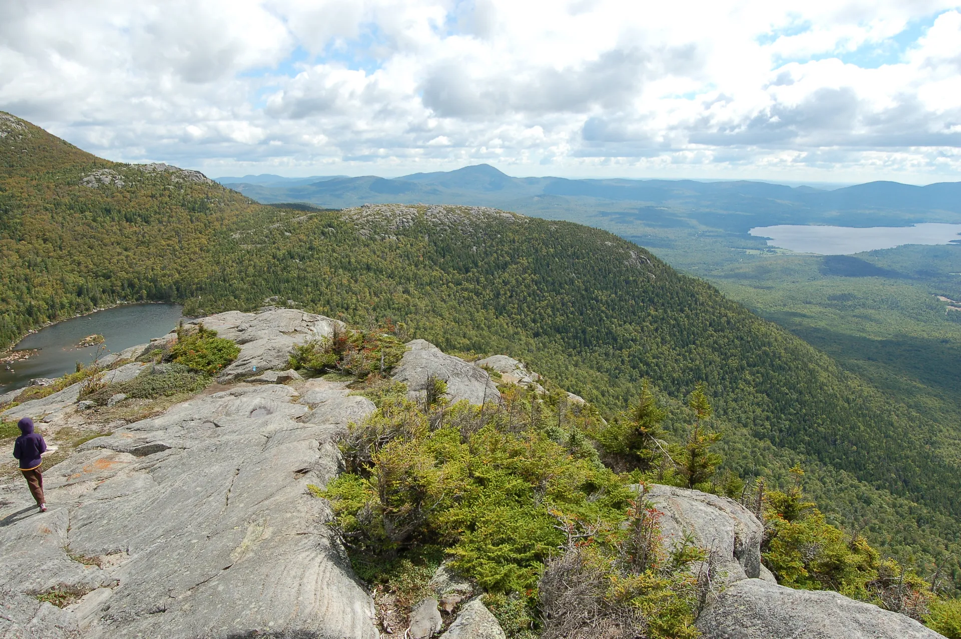
The Summit
The summit of Rumford Whitecap is unlike most peaks in Maine. Instead of a wooded top with a small clearing, the entire upper mountain is open granite slabs dotted with blueberry bushes, reindeer lichen, and low scrub. In late July and August, the blueberries are ripe and hikers can graze their way across the summit.
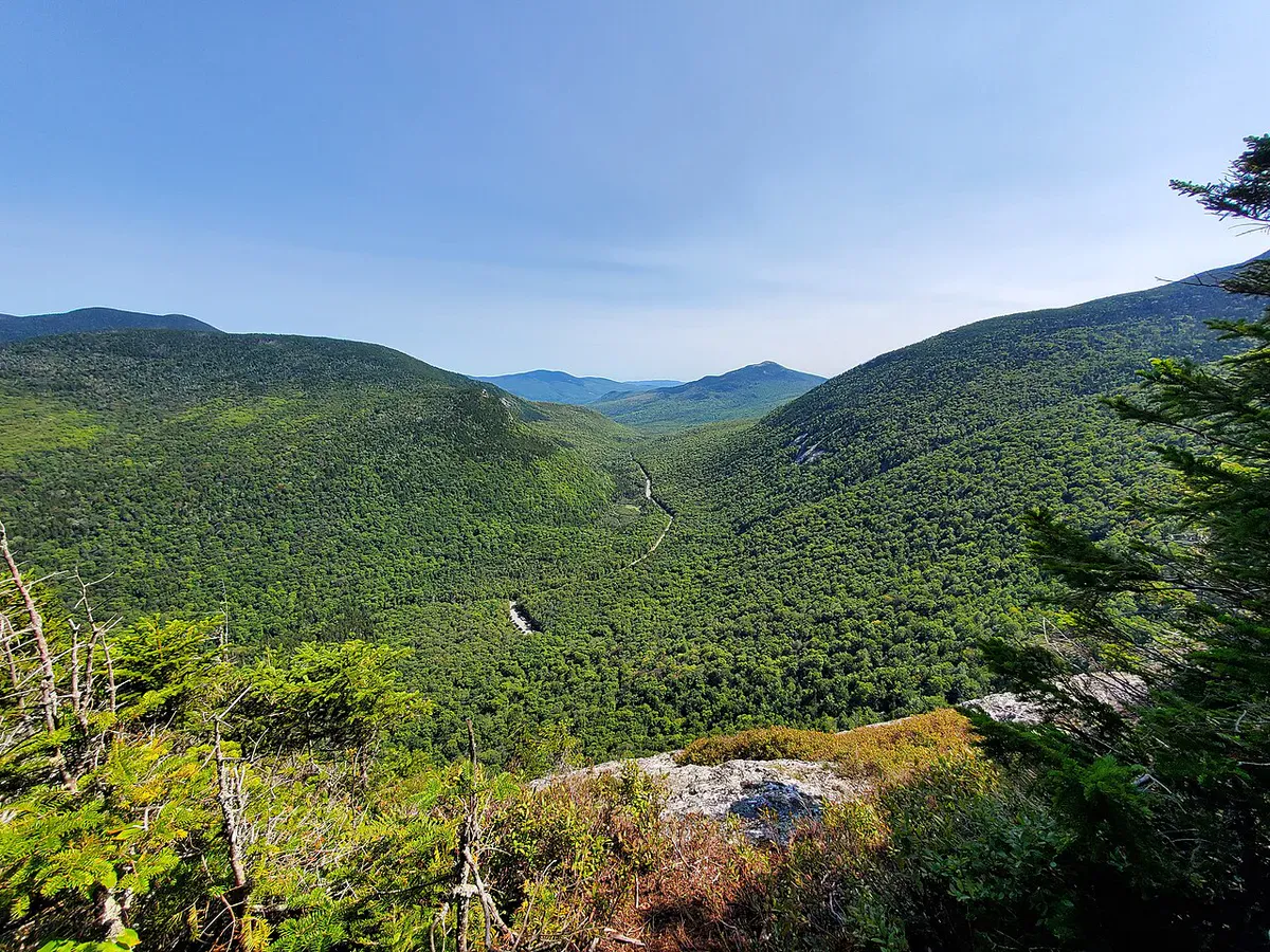
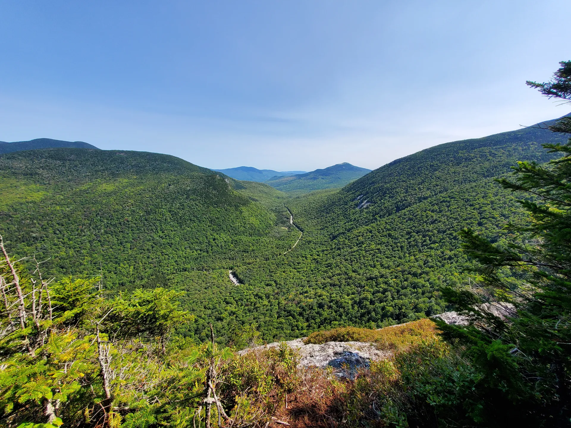
The 360-degree views include Black Mountain and the Mahoosuc Range to the north, the peaks of Grafton Notch to the northwest, and the rolling western Maine foothills stretching south. On the clearest days, the towers of Mount Washington are visible to the southwest.
There is no shelter on the summit. The open rock is exposed to wind from every direction, and weather moves in fast from the west.
When to Go
Spring
Muddy conditions persist into May. The upper sections can be slippery when wet. Black flies are heavy late May through June.
Summer
Blueberries ripen in late July and August. Bring sun protection for the exposed summit. Start early on hot days.
Fall
Foliage peaks in late September and early October. The hardwood forest below the summit is spectacular. Clear, cool air gives the best views.
Winter
Popular with snowshoers. The open summit is beautiful in snow but very exposed to wind. The access road may not be plowed to the upper lot.
August is the month for blueberries. October is the month for views. Both are excellent reasons to make the drive to Rumford.
Practical Notes
The trailhead parking area is on East Andover Road, a few miles from downtown Rumford. There are two parking areas: a lower lot and an upper lot closer to the trailheads. The upper lot is a gravel road that may not be maintained in winter. No bathrooms at the trailhead.
Cell service is spotty at the trailhead and generally unavailable on the trail. You may pick up a signal on the open summit.
The granite slabs near the summit can be extremely slippery when wet. If rain is in the forecast, bring trekking poles and take extra care on the upper ledges. Avoid the summit during thunderstorms as there is no cover.
Packing List
Rumford Whitecap Day Hike
- 2 liters of water per person
- Snacks and lunch for the summit
- Sun protection (the summit is fully exposed)
- Wind layer even on warm days
- Bug spray May through July
- Sturdy shoes with good grip on granite
- Container for blueberries in late summer
- Camera
Getting There
From Portland, take the Maine Turnpike north to Auburn, then Route 4 north through Livermore Falls and Dixfield to Rumford. The drive takes about 2 hours. From Bethel, head south on Route 2 to Rumford, about 25 minutes. The trailhead on East Andover Road is well-signed from the Rumford side.
Rumford has gas stations, restaurants, and a grocery store for supplies. The mountain is a short drive from town.
FAQ
How long does the Rumford Whitecap hike take?
The 5.3-mile loop typically takes 3.5 to 4.5 hours including time on the summit. The out-and-back via the Iles Trail alone is about 5.4 miles and takes 3 to 4 hours.
Are dogs allowed?
Yes. Dogs are welcome on the preserve trails. Keep them under control and clean up after them.
When are the blueberries ripe?
Wild blueberries on the summit typically ripen in late July and peak through August. The open granite ledges are covered in low-bush blueberry plants.
Is the trail well marked?
Yes. The Iles Trail uses red and orange markers, and the Starr Trail uses yellow blazes. Both are well maintained by the Mahoosuc Land Trust.
Can I snowshoe Rumford Whitecap?
Yes. The mountain is popular with snowshoers in winter. The open summit offers dramatic winter views. Bring layers for the wind and check road conditions for the access road.
For more hiking in the area, see Old Speck Mountain at Grafton Notch or Tumbledown Mountain, both within an hour’s drive.