Big Views from the Oxford Hills
Singepole Mountain rises 1,414 feet in Paris, Maine, in central Oxford Hills. The mountain is one of those places that delivers far more than its modest stats suggest. A short climb through mixed forest leads to open south-facing ledges where the views stretch across the rolling countryside of Oxford County, over Pleasant Mountain and the lakes of western Maine, and on clear days all the way to the White Mountains on the New Hampshire border.
The most popular route starts from Hall Pond, where a loop trail circles the pond before a spur trail breaks off and climbs steeply to the summit ledges. The combination of a peaceful pond walk and an open summit view makes this a satisfying outing that punches well above its weight.
The Trail
The Hall Pond and Singepole Mountain Trail starts from a small parking area near the boat launch on Hall Pond. The Pond Loop Trail heads north along the shore, passing through groves of hemlock and white pine with views across the water. This section is flat, easy, and pleasant.
About a quarter mile in, the Singepole Mountain trail departs the pond loop and begins climbing. The ascent is short but steep, covering about half a mile with roughly 500 feet of elevation gain. The trail has slippery rock banks, narrow ledges, and one tight squeeze beneath an overhanging boulder. The footing demands attention, but the technical sections are brief.
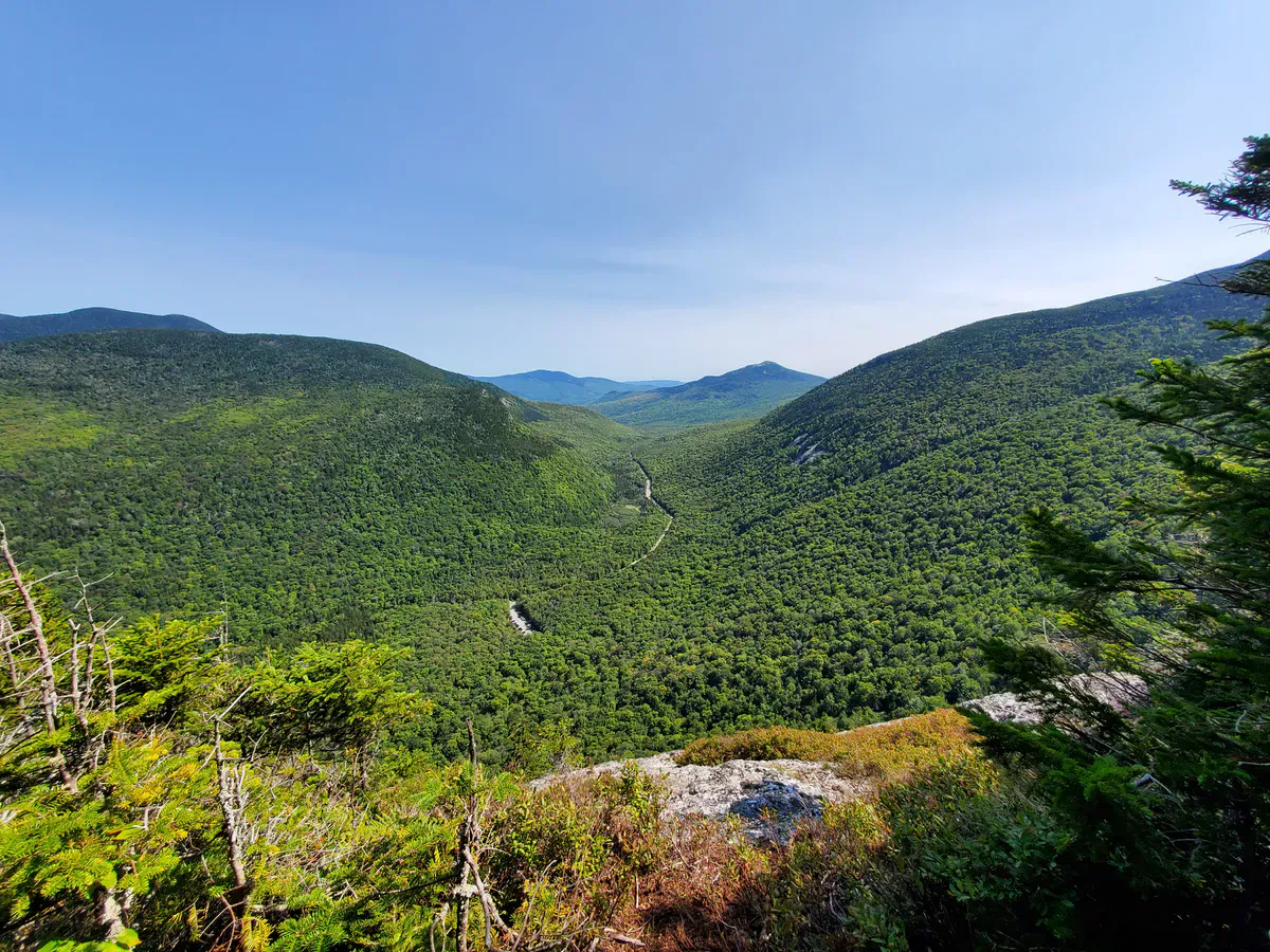
The trail emerges onto the southern false summit, where the first views open up. A short walk along the ridge leads to the true summit and the best panorama. To the south and west, Pleasant Mountain and the Oxford Hills lakes spread below. Towns, farms, and forest patchwork fill the middle distance. On the western horizon, the White Mountains form the skyline.
An alternate route via the Durrell Hill Road trailhead on the western side of the mountain offers a less steep and slightly longer approach at about 1.4 miles. This is a good option for hikers who prefer a gentler grade.
When to Go
Spring
Muddy and slippery through April and May. The pond is pretty but the steep sections are treacherous when wet.
Summer
Full leaf canopy provides shade on the climb. The ledges are warm and sunny for lounging. Bring bug spray for the pond loop.
Fall
Foliage in the Oxford Hills is excellent. The open ledges give a front-row seat to the color across the valley. October is peak.
Winter
Short enough for a winter outing with microspikes. The steep section is icy and requires caution. Views of snow-covered mountains are beautiful.
If you want a quieter approach, use the Durrell Hill Road trailhead on the west side. Most hikers start from Hall Pond, so the western route is less traveled. The grade is also more moderate.
Practical Notes
Parking at the Hall Pond trailhead is in a small lot near the boat launch. There are no restrooms or facilities. The trail is maintained by local volunteers and is generally in good shape, but it is not staffed or managed by a land trust.
Cell service is spotty in the area and unreliable on the mountain. The nearest services are in South Paris and Norway, both a short drive away on Route 26.
Hall Pond itself is a pleasant body of water and worth exploring. The pond loop trail is flat and easy, and the views from the shore are peaceful. If you have young children who cannot manage the steep summit trail, the pond loop alone is a nice walk.
Packing List
Singepole Mountain Day Hike
- 1 liter of water per person
- Snacks for the summit ledges
- Shoes with good traction (slippery rock sections)
- Bug spray May through August
- Camera for the summit views
- Binoculars (nice for identifying distant peaks)
Getting There
From Portland, take Route 26 North through Gray and Oxford to South Paris. The Hall Pond trailhead is off Route 26, about an hour from Portland. Look for signs to Hall Pond.
From the Durrell Hill Road trailhead, take Durrell Hill Road from Route 26 in South Paris. The trailhead is about 1.4 miles up the road.
From Bangor, take I-95 South to the Maine Turnpike, then Route 26 North through Oxford. The drive is about 2 hours and 15 minutes.
FAQ
How long does the Singepole Mountain hike take?
The Hall Pond and Singepole Mountain loop takes about 1.5 to 2 hours, including time at the summit. The trail is only 2.2 miles total, but the steep section slows most hikers down.
Is it good for kids?
Older kids who are comfortable on steep, rocky terrain will enjoy the summit. The Hall Pond loop is flat and easy and makes a good alternative for younger children who cannot manage the climb.
Are dogs allowed?
Yes. Dogs are welcome on the trail. The steep rocky section and the tight squeeze under the overhanging boulder may be challenging for large dogs.
Can I see the White Mountains from the summit?
Yes. On clear days the White Mountains are visible on the western horizon. The south-facing ledges also offer views of Pleasant Mountain, the lakes region, and the Oxford Hills.
Is there a fee?
No. The trailhead and trail are free and open to the public.
For more hiking in the Oxford Hills, explore the trails around Pleasant Mountain or drive north toward Bethel for access to the western Maine mountains.