The Edge of the Country
Quoddy Head State Park occupies 541 acres at the tip of a peninsula in Lubec, the easternmost town in the United States. Stand at the trail’s end on the rocky headland and you are closer to Africa than you are to Chicago. The Bay of Fundy stretches east to Nova Scotia, and on clear mornings Grand Manan Island sits on the horizon like a low blue ridge. This is where the sun first touches the continental United States, and the light here has a quality that photographers and painters have been chasing for generations.
The park is defined by three things: the West Quoddy Head Lighthouse, a red-and-white striped tower that is one of the most photographed in the country; five miles of hiking trails that wind through coastal spruce forest, along dramatic cliffs, and through two subarctic bogs; and a sense of remoteness that is hard to find on the eastern seaboard. Lubec is a four-hour drive from Portland, and most visitors to Maine never make it this far. Those who do find one of the most distinctive landscapes in the state.
The Lighthouse
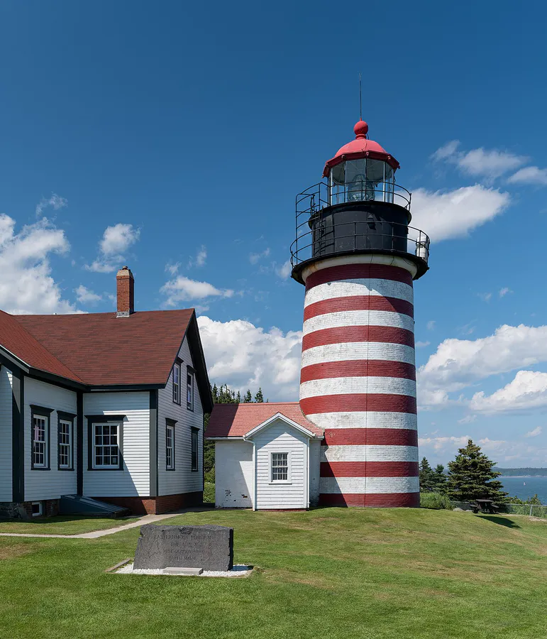
West Quoddy Head Light was first established in 1808 under President Thomas Jefferson. The current tower, built in 1858, stands 49 feet tall with the distinctive candy-stripe pattern of red and white horizontal bands. The lighthouse is automated and still active, guiding vessels through the Bay of Fundy’s notoriously strong tides and fog.
The lighthouse grounds include the tower (exterior viewing only; the interior is not open to the public), the former keeper’s house (which serves as a visitor center and museum operated by the West Quoddy Head Light Keepers Association), and a gift shop. The museum covers the history of the lighthouse, local maritime heritage, and the natural history of the area.
The best photographs of the lighthouse come from the rocky shore below and to the south, where you can frame the striped tower against the ocean and the distant coast of New Brunswick. Morning light is ideal. The fog that often wraps the headland in summer can create atmospheric shots, but be patient and wait for it to lift if you want the full scene.
The Trails
The park has five main trails totaling about five miles, each offering something different:
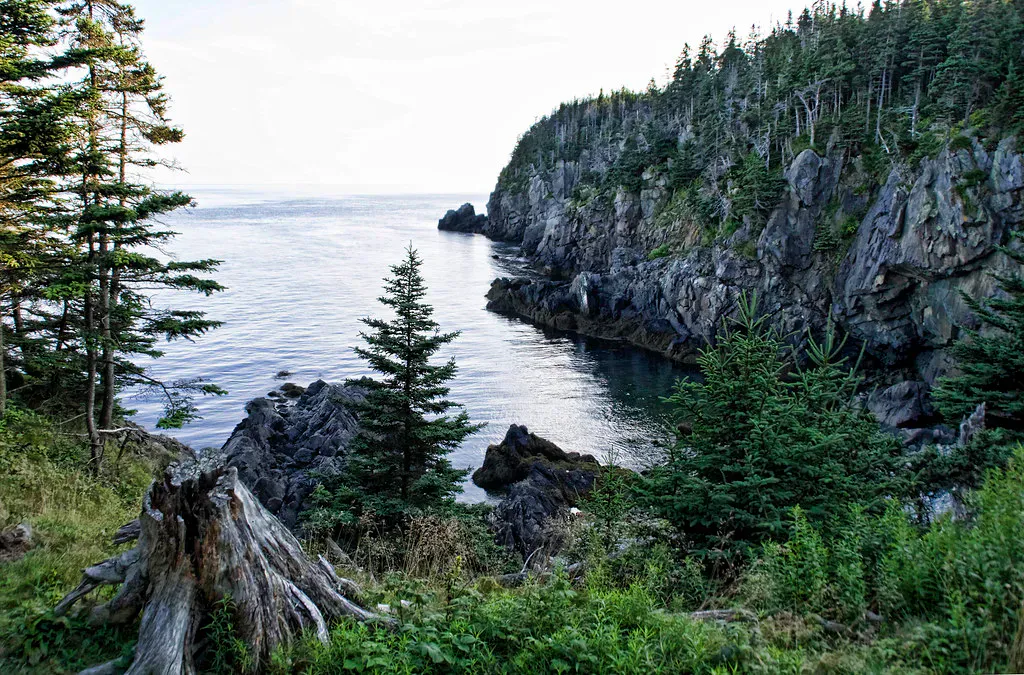
Coastal Trail (4 miles round trip, moderate): The signature hike. Follows the coastline south from the lighthouse through spruce forest and along exposed cliff edges. Three highlights along the way: Gulliver’s Hole, a dramatic chasm in the cliff face where the ocean surges in and out; High Ledge, a cliff-top viewpoint with sweeping ocean panoramas; and Green Point, the turnaround point with views of Carrying Place Cove. The trail is rooty, rocky, and exposed in places.
Coast Guard Trail (1 mile, easy to moderate): A shorter out-and-back leading to a high cliff overlook. Good option if you do not have time for the full Coastal Trail.
Inland Trail (0.75-mile loop, easy): Winds through dense conifer forest with thick moss carpets and lichen-covered boulders. A peaceful, sheltered walk that feels like a different world from the exposed coastline.
Bog Trail (1 mile round trip, easy): Branches off the Inland Trail and leads to the park’s most unusual feature: a subarctic peat bog.
Thompson Trail (1.25 miles, easy): Connects the Bog Trail to the Coastal Trail through the forest, enabling loop options.
The Bogs
Quoddy Head State Park contains two peat bogs that support subarctic and arctic plant species rarely found south of Canada. The Arctic Bog Boardwalk, accessible from the Bog Trail, crosses the larger bog on a raised wooden walkway with interpretive panels explaining the ecology.
The bog is a sphagnum mat suspended over water, soft and spongy underfoot. The plants are tiny and specialized: sundews (carnivorous), pitcher plants, Labrador tea, bakeapple (cloudberry), and several species of orchid. These species survive here because the coastal fog and cold Bay of Fundy air create microclimate conditions similar to northern Canada.
The bogs bloom in late June and July. Pitcher plants flower with dramatic red-purple blooms, and the sundews glisten with the sticky droplets they use to trap insects. Walk the boardwalk slowly and look closely at the ground. Everything interesting is small.
Stay on the boardwalk. The bog mat is fragile, and stepping off the boards damages plants that take decades to establish.
Carrying Place Cove
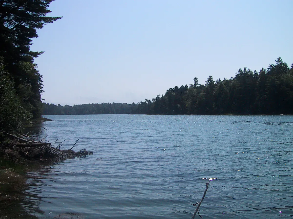
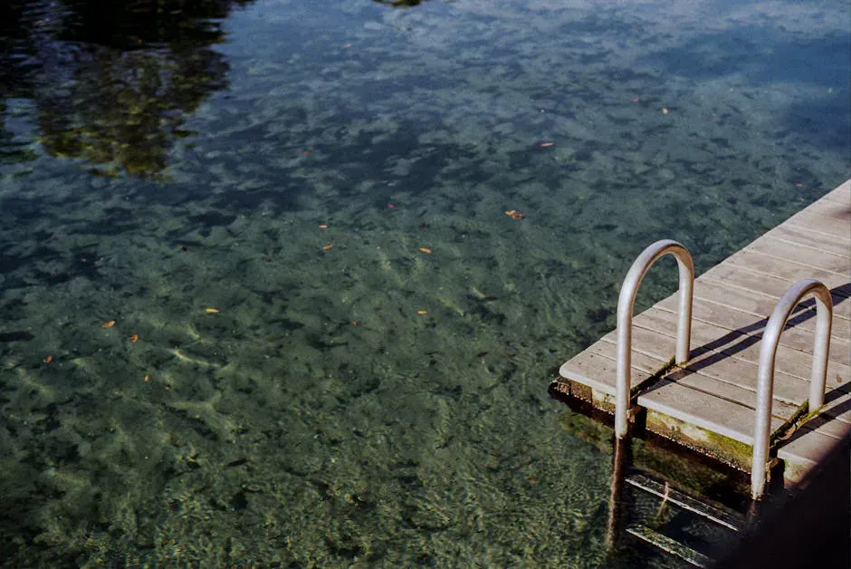
At the far end of the Coastal Trail, Carrying Place Cove offers about 1,200 feet of sandy beach. It is one of the few sand beaches on this section of coast and is a natural turnaround point for the hike. The cove also has the park’s second bog nearby. Swimming is possible but the water is extremely cold (low to mid-40s even in summer) and there is no lifeguard.
Practical Details
Quoddy Head State Park is open from May 15 through October 15. Entrance fees are $4 for Maine residents and $6 for non-residents, collected at a self-service gate. Cash or check only. Children under 5 and seniors 65 and older are free.
The park has portable restrooms near the parking area, picnic tables, and a few grills. No food vendors. The visitor center in the keeper’s house has exhibits and a small gift shop.
Dogs are allowed on leash throughout the park, including on all trails.
Trails are accessible year-round, even when the park is officially closed. Park outside the gate and walk in during the off-season. The gate area is plowed in winter but not always promptly.
Getting There
Lubec is at the far eastern end of Route 189, off Route 1 in Whiting. From the center of Lubec, follow South Lubec Road about four miles to the park entrance. From Bangor, the drive is about 2 hours and 15 minutes. From Portland, about 4 hours via I-95 and Route 1.
Cell service is spotty. Verizon has intermittent coverage. AT&T is unreliable. Download offline maps before you arrive.
When to Go
Spring
Park opens May 15. Cool and often foggy. Trails can be muddy. Birdwatching picks up in May with migratory species.
Summer
Bog flowers peak late June-July. Longest days for hiking all the trails. Fog is frequent, so have a backup plan. Whale watching from the cliffs is possible.
Fall
Fog decreases, views improve. Fewer visitors. Fall color in the surrounding forest. Park closes October 15.
Winter
Park officially closed but trails accessible. Dramatic winter ocean. Very cold and windy. Only for experienced winter hikers.
Quoddy Head Essentials
- Sturdy hiking shoes (roots and wet rock on Coastal Trail)
- Layers and windbreaker (coastal wind and fog)
- Camera with waterproof protection
- Binoculars (whales, seabirds, Grand Manan Island)
- Bug spray (summer, especially near the bogs)
- Cash for entrance fee (self-service, no cards)
- Water and snacks (no vendors)
- Offline maps (spotty cell service)
FAQ
Is Quoddy Head really the easternmost point in the US?
Yes. West Quoddy Head in Lubec, Maine is the easternmost point in the contiguous (continental) United States. It is not the easternmost point in all US territory, which includes Alaska and various Pacific islands.
Can you go inside the West Quoddy Head Lighthouse?
The lighthouse interior is not open to the public. You can view the exterior and visit the former keeper's house, which serves as a museum and visitor center operated by the West Quoddy Head Light Keepers Association.
How long does it take to hike the Coastal Trail?
The full Coastal Trail is about 4 miles round trip from the lighthouse to Green Point and back. Allow 2 to 3 hours, depending on your pace and how long you stop at the viewpoints.
Are there really subarctic plants at Quoddy Head?
Yes. The park's peat bogs support species like sundews, pitcher plants, Labrador tea, and cloudberry that are normally found in northern Canada. The cold, foggy maritime climate creates conditions that allow these plants to survive much farther south than their usual range.
Is Quoddy Head worth the drive?
If you appreciate dramatic coastal scenery, quiet trails, and unique natural features, yes. It is a long drive from Portland (4 hours), but the combination of the lighthouse, the cliffs, and the subarctic bogs is unlike anything else on the Maine coast.