Where the Tides Run Wild
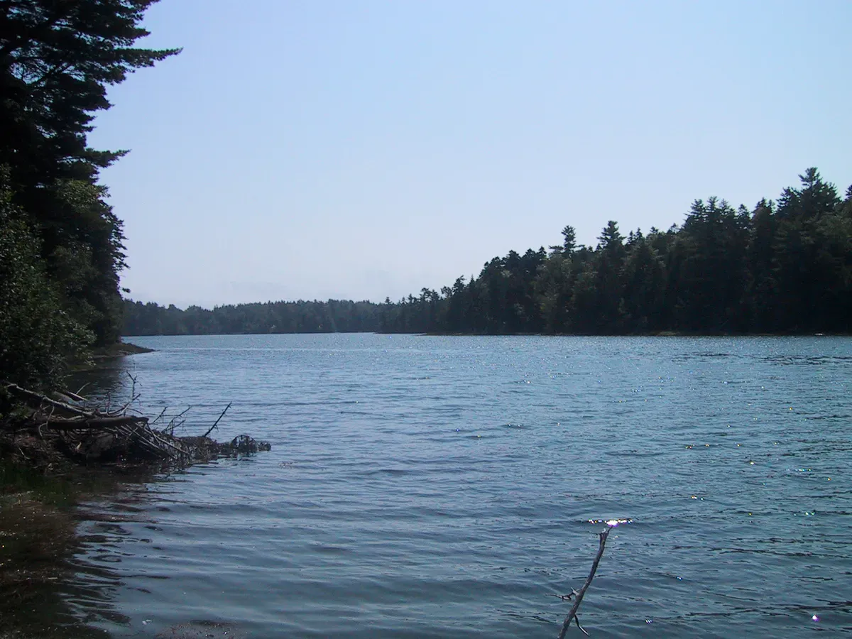
Cobscook Bay State Park sits on 888 acres along the shores of Whiting Bay, a sheltered inlet within the larger Cobscook Bay in Washington County. The name Cobscook comes from the Maliseet-Passamaquoddy word for “boiling tides,” and the description fits. Tides here average 24 feet and can reach 28 feet during spring tides, compared to a 9-foot average along Maine’s southern coast.
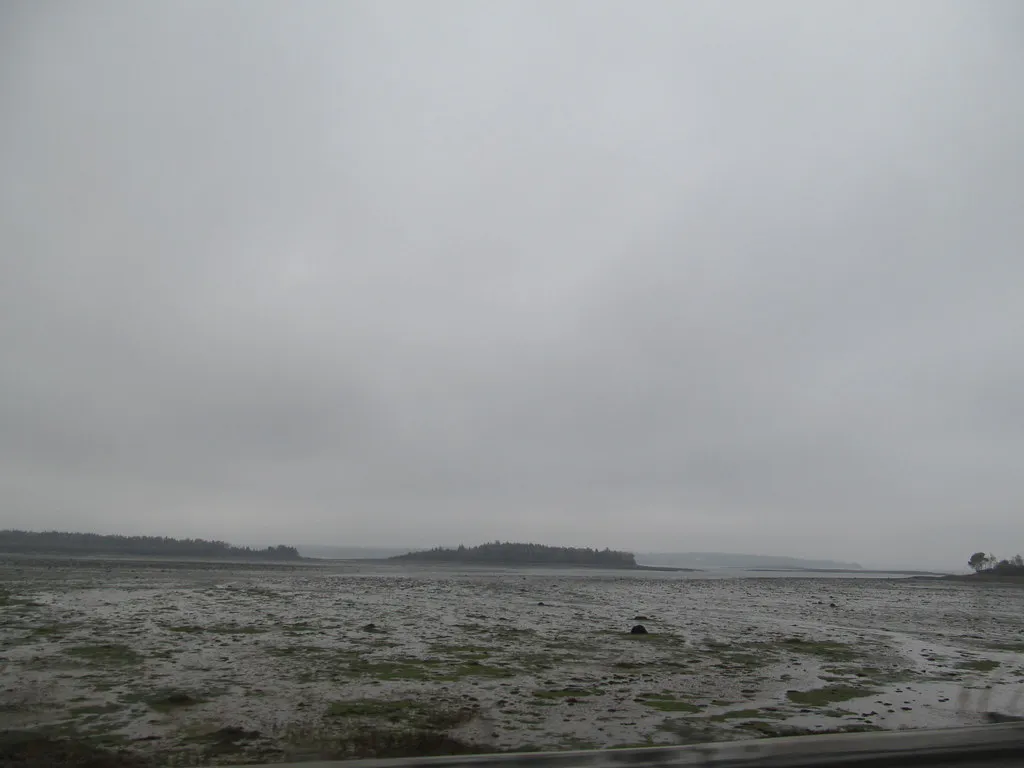
Twice a day, billions of gallons of seawater rush in and out of the bay’s narrow passages, exposing vast mudflats at low tide and filling the coves to the tree line at high tide. The landscape transforms so completely between tides that the same viewpoint looks like two different places six hours apart.
The park sits deep in the Downeast coast, one of the least developed and least visited regions in the state. This is remote Maine. The nearest city of any size is Machias, about 25 miles west. The Canadian border at Calais is about 25 miles north.
The Tides
The tides at Cobscook Bay are the main event. The range here is among the largest on the eastern seaboard, second only to the Bay of Fundy just across the border in New Brunswick. The effect is dramatic and visible: waterfront campsites that overlook deep water at high tide face exposed mudflats stretching hundreds of yards at low tide.
Check the tide chart before your visit and plan to be on the shore during the transition. Watching the tide come in at Cobscook is remarkable. The water rises visibly, filling channels and creeping across the flats at a pace you can actually track in real time.
The tidal flats are productive habitat for shorebirds, clam worms, and marine invertebrates. At low tide, great blue herons, sandpipers, and eagles work the exposed flats for food. The biodiversity here is exceptional for a state park.
Trails
The park has two short trails that are appropriate for walkers of all ages and abilities.
Nature Trail
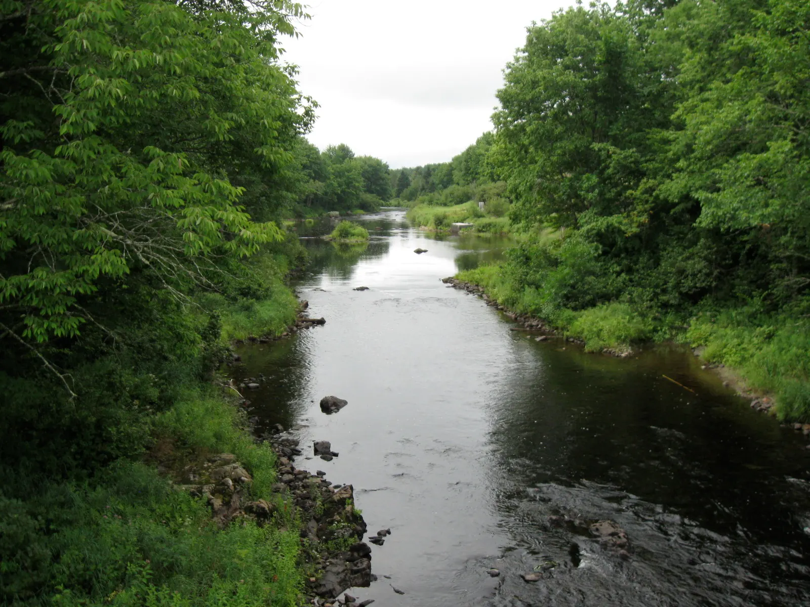
The Nature Trail begins near the park entrance and winds for about one mile through mixed forest, past a brook, and up to two scenic overlooks with views over Whiting Bay and Burnt Cove. The trail is easy and well-maintained with interpretive signs explaining the local ecology.
Shore Trail
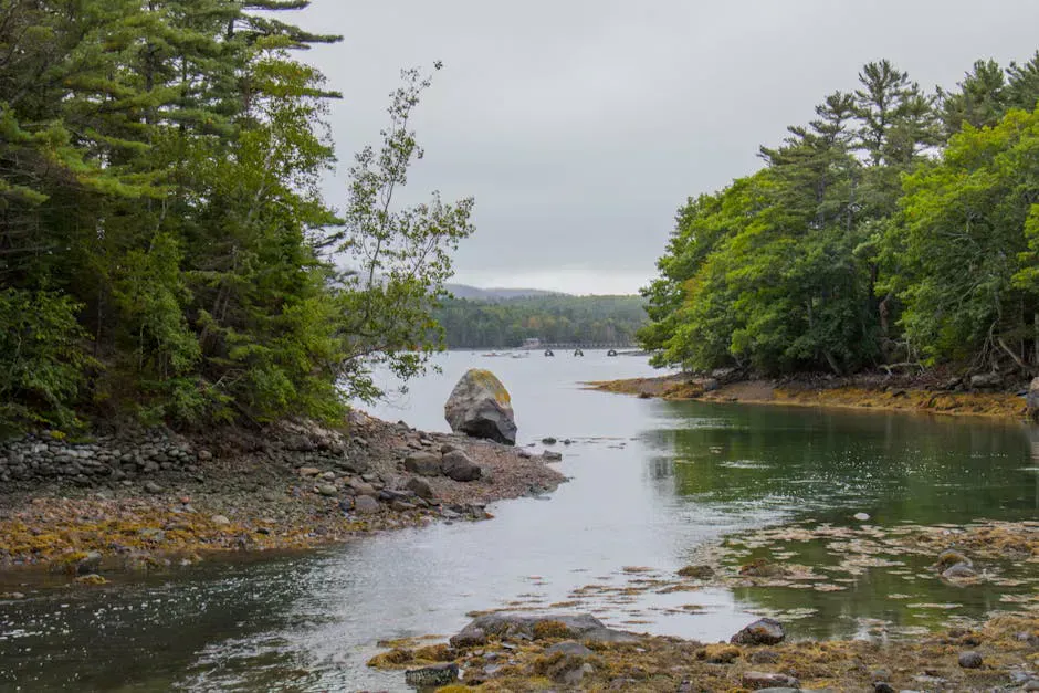
The Shore Trail (also called the Anthony’s Beach Trail) is a 0.75-mile loop that begins beside campsite 17 and follows near the shore to the boat launch, then loops back through the woods. It gives close-up views of the tidal shoreline and is the best walk in the park for seeing the tide’s effect on the landscape.
Walk the Shore Trail at both high and low tide during a multi-day camping stay. The transformation is striking, and you will see different wildlife at each tide stage. Low tide brings the shorebirds. High tide brings the seals and diving ducks.
Camping
The campground has 106 sites for tents and RVs, many of which border Whiting Bay with direct water views. The sites are large, well-spaced, and surrounded by trees, giving a sense of privacy that is hard to find in a large public campground. Each site has a picnic table, fire ring, and access to nearby water spigots and pit toilets.
Cobscook Bay State Park is undergoing infrastructure improvements. For the 2026 season, the park is operating with primitive camping and day-use access only. Drinking water, flush toilets, and showers will not be available. Vault toilets are provided. Bring your own drinking water. Check the Maine Bureau of Parks and Lands website for current status before booking.
Even in a normal year, the campground is one of the best values on the Maine coast. The sites are affordable, the setting is spectacular, and the Downeast location means it rarely fills the way midcoast and Acadia-area campgrounds do.
Wildlife
Cobscook Bay is one of the most important shorebird habitats in Maine. The tidal flats support migrating sandpipers, plovers, and dowitchers in huge numbers during late summer and fall. Bald eagles are resident year-round and are commonly seen from the campground and trails. Harbor seals haul out on exposed ledges at low tide.
The bay’s cold, nutrient-rich waters also support a healthy population of harbor porpoises, which are occasionally visible from shore. Bring binoculars to get the most out of the wildlife viewing here.
When to Go
Spring
The park opens mid-May. Spring comes late to Downeast Maine. Days are cool and the water is cold, but migratory birds are arriving.
Summer
Long days, the warmest weather the region gets, and peak wildlife activity. Nights are cool even in July. Bring warm layers for evenings.
Fall
Shorebird migration peaks in August and September. Foliage arrives late September. The campground is quiet and the coast is spectacular.
Winter
The park is closed for camping. The roads and area remain accessible, but services are extremely limited in Washington County during winter.
Practical Notes
The park is on Route 1 in Edmunds Township, about midway between Machias and Calais. The Bold Coast Trail in Cutler, roughly 30 miles south, offers some of the most dramatic coastal hiking in Maine and pairs well with a camping stay at Cobscook. The town of Lubec and Eastport are both short drives away and worth exploring. Services in this part of Maine are limited. Fuel up and buy groceries in Machias or Calais before driving in. The nearest hospital is in Machias.
Cell service in the park is unreliable. Download maps and confirm your reservation details before arriving.
Packing List
Cobscook Bay State Park Visit
- Binoculars (essential for birding and wildlife)
- Warm layers for cool Downeast evenings
- Rain gear
- Drinking water (especially during 2026 construction season)
- Bug spray
- Tide chart (download before you lose cell service)
- Camera
- Kayak or canoe if you have one (boat launch available)
Getting There
From Bangor, take Route 1A east to Ellsworth, then Route 1 east through Machias to Edmunds Township. The drive is about 2 hours. From Portland, the drive is roughly 4.5 hours. The park entrance is on Route 1 and is well-signed.
FAQ
How big are the tides at Cobscook Bay?
The tidal range averages 24 feet and can reach 28 feet during spring tides. This is among the largest tidal ranges on the US Atlantic coast.
Can I swim in the bay?
Swimming is not practical here. The water temperature rarely exceeds the mid-50s, the tidal currents are strong, and the shoreline is rocky mudflat rather than sand beach.
Is the campground open in 2026?
The park is operating with primitive camping and day-use access for 2026 due to infrastructure improvements. Vault toilets are available but there is no drinking water, flush toilets, or showers. Bring your own water.
Are dogs allowed?
Yes. Dogs must be on a leash. Keep dogs away from nesting shorebird areas during spring and summer.
What is nearby?
The Bold Coast Trail in Cutler is about 30 miles south and offers some of the most dramatic coastal hiking in Maine. Quoddy Head State Park with the iconic red-and-white lighthouse is about 20 miles southeast. Eastport, the easternmost city in the US, is 20 miles north.