The Gateway to Katahdin’s Great Basin
The Chimney Pond Trail is the most-traveled route into the heart of Mount Katahdin. Starting from Roaring Brook Campground at about 1,500 feet, this 3.3-mile trail climbs steadily through dense spruce-fir forest to Chimney Pond at 2,914 feet, where a small lean-to campground and ranger station sit at the base of one of the most spectacular glacial cirques east of the Rockies.
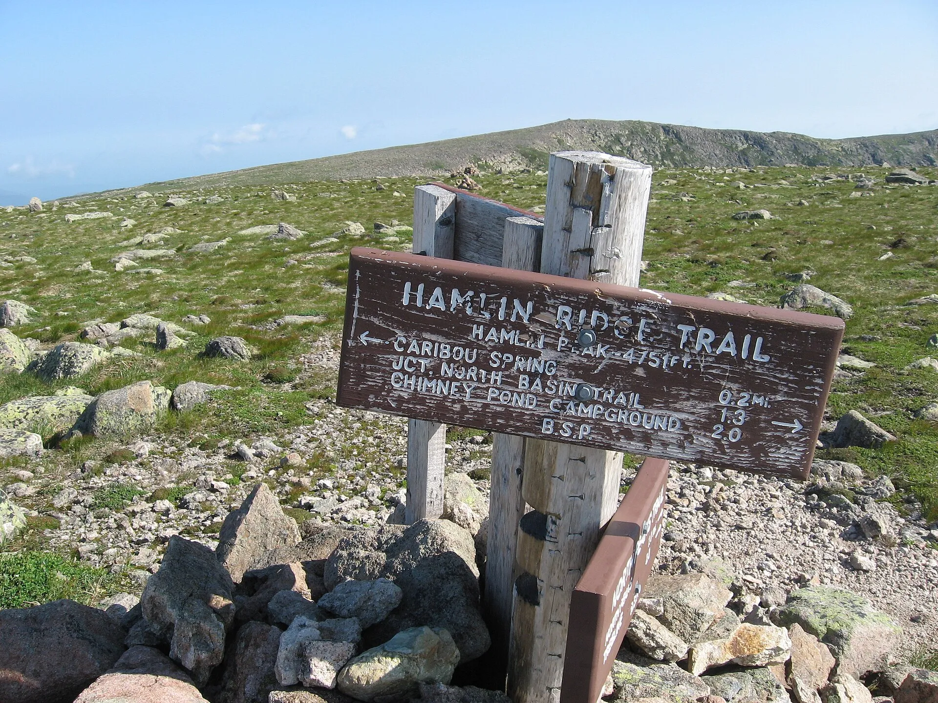
Chimney Pond itself is not a destination hike in the traditional sense. It is the launching point. From the pond, trails fan out to Katahdin’s Baxter Peak via the Cathedral and Saddle Trails, across the Knife Edge from Pamola Peak, and up to Hamlin Peak along the exposed Hamlin Ridge. But even if you never set foot on the summit, the walk to Chimney Pond and back rewards you with old-growth forest, rushing brooks, and one of the most dramatic mountain views in New England: the granite walls of the Great Basin rising 2,000 feet directly above the dark pond.
This trail sees heavy use in summer, and for good reason. It is the most efficient approach to Katahdin’s eastern routes, and the campground at Chimney Pond is one of the most coveted backcountry sites in the Northeast.
The Trail
The trail begins at the Roaring Brook Campground trailhead, where a ranger station marks the start. For the first mile, the path is relatively gentle, following the course of Roaring Brook through a mixed forest of birch, spruce, and fir. The footing is a mix of packed earth and rock, well-maintained by Baxter State Park crews.
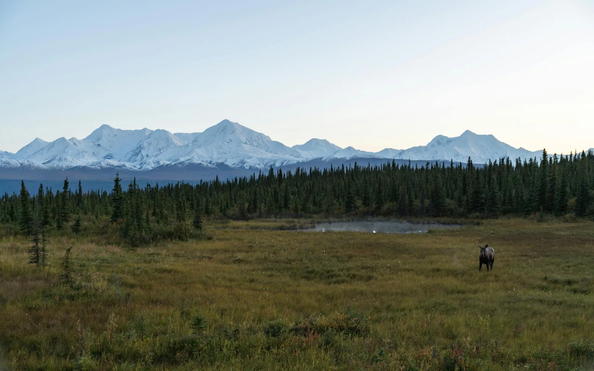
At roughly 1.1 miles, you pass the junction with the South Turner Mountain Trail on the right and the trail to Sandy Stream Pond. If it is early morning, a brief detour to Sandy Stream Pond is worth the five minutes, moose feed in the shallows here with startling regularity.
Beyond the junction, the trail steepens. You climb through increasingly dense boreal forest, the canopy closing in with balsam fir and red spruce. The trail surface becomes rougher, exposed roots, rock steps, and occasional muddy sections after rain. Several small brook crossings are easily managed on rocks, though they can be tricky during spring runoff.
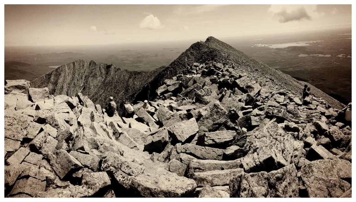
The final mile to Chimney Pond is the steepest, gaining roughly 800 feet through tight switchbacks and rock scrambles. The forest thins as you gain elevation, and glimpses of the cirque walls appear through the trees. When you break into the clearing at Chimney Pond Campground, the view is immediate and staggering: the sheer headwall of the Great Basin, with the Knife Edge ridgeline silhouetted against the sky above.
Start early, before 7 AM if possible. The Chimney Pond Trail is the primary approach for Katahdin summit hikes, and the parking lot at Roaring Brook fills by mid-morning in July and August. An early start also gives you the best chance of calm weather on the upper mountain if you are continuing to a summit.
What You’ll See
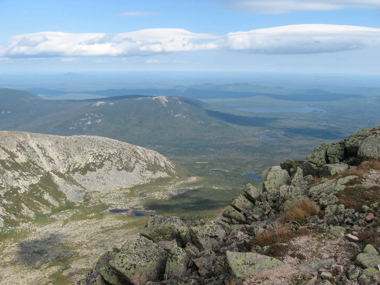
The Great Basin is the star attraction. This glacial cirque was carved during the last ice age, and its headwall rises roughly 2,000 feet above Chimney Pond in a near-vertical sweep of granite. The Cathedral Trail climbs directly up the headwall through a series of massive boulders, and you can often spot hikers inching their way up the face from the pond shore.
Wildlife is abundant along the trail. Moose sightings are common near Sandy Stream Pond and in the boggy areas of the lower trail. Red squirrels and gray jays are constant companions, particularly near the campground. In summer, the boreal forest hosts black-throated green warblers, boreal chickadees, and spruce grouse. Peregrine falcons nest on the cirque walls, and you may see them hunting above the pond.
The forest itself is notable. Much of the lower trail passes through mature growth that has not been logged, and the upper sections feature stunted krummholz fir that shows the effects of Katahdin’s harsh alpine winds.
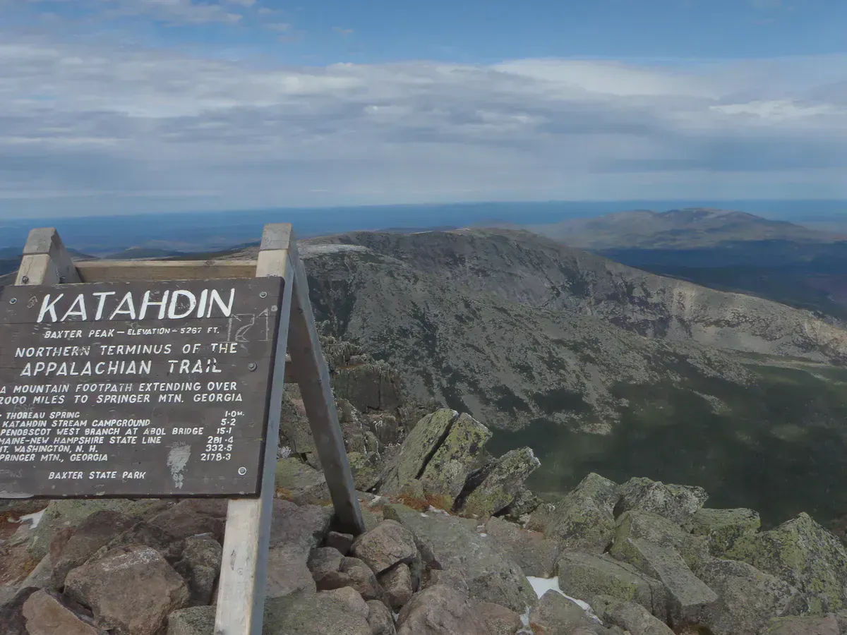
Chimney Pond sits at the base of Katahdin’s most technical routes. If you plan to continue to any summit from here, be prepared for significantly harder terrain. The Knife Edge, Cathedral Trail, and Hamlin Ridge all involve exposed scrambling and above-treeline travel. Weather on Katahdin can change from clear to whiteout conditions in under an hour. Do not attempt summit routes in thunderstorms, high wind, or poor visibility.
When to Go
Spring
Late May and early June can still have snow on the upper trail. Mud season makes footing slippery. The park may restrict access to the upper mountain.
Summer
July and August offer the most reliable conditions. Expect company. This is the busiest trail in the park. Start very early for parking.
Fall
September brings deep fall color in the hardwoods and fewer crowds. October weather is unpredictable, and the park may close access after mid-October.
Winter
The park road closes in winter. Winter access requires snowshoeing or skiing from the gate. Only experienced winter mountaineers should attempt this.
Getting There
From Millinocket, take Route 11/157 north, then follow signs to Baxter State Park’s Togue Pond Gate. The drive from Millinocket to the gate takes about 20 minutes. From the gate, follow the Perimeter Road east for approximately 8 miles to Roaring Brook Campground. The gravel road is well-maintained but narrow and winding.
From Bangor, take I-95 north to Exit 244, then follow Route 11 north through East Millinocket to Millinocket. Total drive time is about 1 hour 35 minutes to the Togue Pond Gate.
If you are staying overnight at Chimney Pond lean-tos, book your reservation the moment they open. These are among the hardest backcountry sites to secure in the Northeast. A night at the pond transforms the experience. You wake up with the Great Basin headwall directly overhead and have the trails to yourself at dawn before the day-hikers arrive from Roaring Brook.
Packing List
- Sturdy hiking boots with ankle support
- 2-3 liters of water per person
- Rain jacket and extra warm layer
- Trail snacks and lunch
- Map of Baxter State Park (no cell service)
- Headlamp with fresh batteries
- First aid kit
- Insect repellent (black flies are fierce in June)
- Sunscreen and sunglasses
- Trekking poles for the steep descent
FAQ
How long does the Chimney Pond Trail take?
Plan 2 to 3 hours for the ascent and 1.5 to 2.5 hours for the descent. Most hikers spend 4 to 6 hours round trip, not counting time at the pond.
Do I need a reservation to hike to Chimney Pond?
You need a vehicle reservation to enter Baxter State Park during peak season (June through October). Day-use parking at Roaring Brook is limited and fills early. Overnight stays at Chimney Pond lean-tos require a separate reservation.
Can I swim in Chimney Pond?
Swimming is discouraged. The pond is the water supply for the campground, and the water is extremely cold year-round.
Is the Chimney Pond Trail suitable for beginners?
The trail to Chimney Pond is rated moderate. It is steep in sections with rough footing, but it does not involve scrambling or exposure. Reasonably fit hikers with basic trail experience can complete it. However, the summit routes that continue from the pond are significantly harder.
Are dogs allowed on the Chimney Pond Trail?
No. Dogs are not permitted anywhere in Baxter State Park.