The Quiet Side of Baxter
Doubletop Mountain is a 3,489-foot peak in the interior of Baxter State Park, well away from the popular Katahdin trailheads that draw most of the park’s visitors. The mountain has two summits, North Peak (3,489 feet) and South Peak (3,455 feet), separated by a wooded saddle. The trail from Nesowadnehunk Field Campground climbs about 6 miles round trip with 2,352 feet of elevation gain, making it one of the more demanding day hikes in the park outside of Katahdin itself.
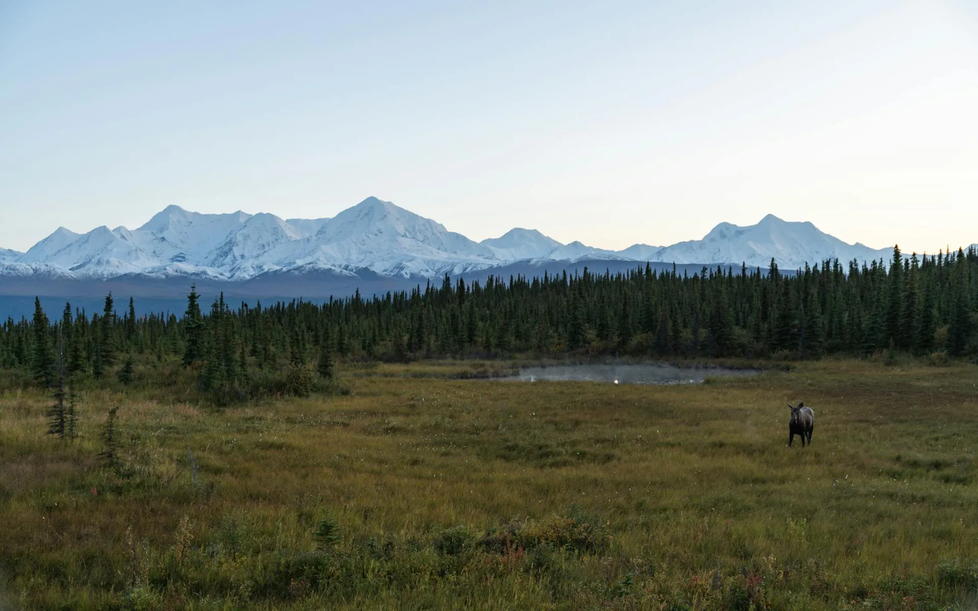
What draws hikers to Doubletop is the combination of solitude and views. On a busy summer day when the Katahdin trails have hundreds of hikers, Doubletop might see a dozen. And the view of Katahdin from Doubletop’s North Peak is one of the best in the park: a head-on look at the great mountain across the Klondike, a glacial valley that separates the two peaks.
The Trail
From Nesowadnehunk Field
The standard route starts from Nesowadnehunk Field Campground on the park’s Perimeter Road. The trail begins with about 3 miles of easy walking through mixed forest on a well-worn path. The grade is gentle and the footing is good, passing through birch, maple, and spruce stands.
Then the mountain gets serious. The upper mile gains over 900 feet in 0.8 miles up a steep, rocky headwall. This section is a sustained, hands-on scramble over rock slabs and through narrow chimneys. It is physically demanding and technically engaging, requiring both fitness and route-finding skills.
The upper headwall on Doubletop is one of the steepest maintained trails in Baxter State Park. The rock is often wet and slippery. Use three points of contact on the steepest sections. This trail is not appropriate for inexperienced hikers or young children. Allow extra time for the descent, which can be harder than the climb on the steep rock.
North Peak comes first and has the better views. A short walk through the saddle leads to South Peak, which is slightly lower and more wooded. Most hikers make the crossing to tag both summits.
The Traverse Option
Experienced hikers can do a full traverse of Doubletop, starting from Nesowadnehunk Field and descending to Kidney Pond, or vice versa. This is an 8-mile point-to-point route that requires a car shuttle or bicycle stashed at the other end. The traverse covers both peaks and gives you the full character of the mountain.
If you do the traverse, start from Nesowadnehunk Field. The north side ascent is steep but shorter. Descending the gentler south side to Kidney Pond is easier on the knees and finishes at one of the prettiest ponds in the park.
The Views
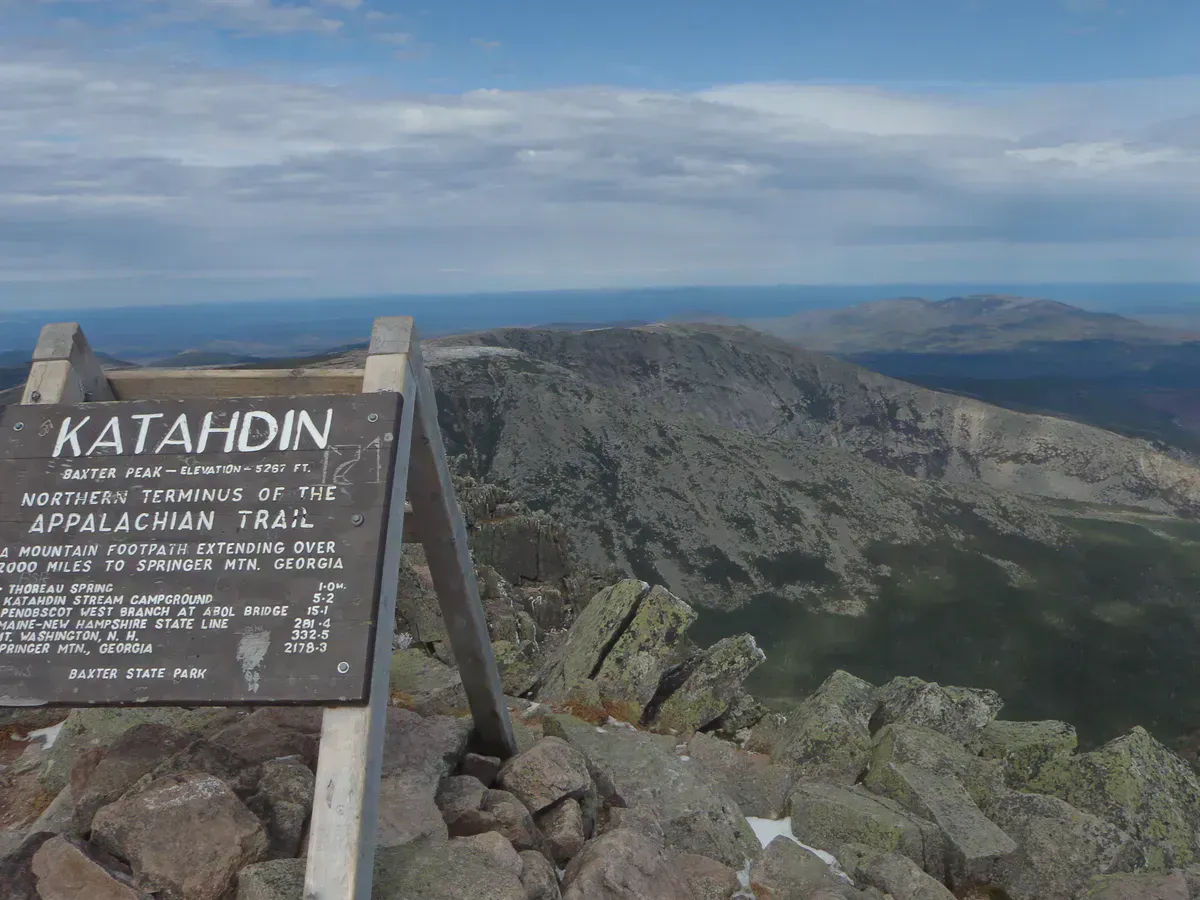
North Peak’s summit is partially open with granite ledges that face southeast toward Katahdin. The view is commanding. Katahdin’s massive bulk rises across the Klondike, with the Knife Edge, Baxter Peak, and the South Basin all visible. It is a perspective on Katahdin that you cannot get from the mountain itself, and many hikers consider it the best view of Maine’s highest peak.
To the west, the Nesowadnehunk valley stretches away toward the West Branch of the Penobscot. To the north, the rolling interior of Baxter fades into the North Woods. On clear days, the view extends well beyond the park boundaries.
When to Go
Spring
Snow and ice linger on the headwall into late May. Baxter's seasonal road opens mid-May but upper trails may be closed or extremely hazardous.
Summer
The trail is fully clear by late June. Long days give ample time for the climb. Start early and bring bug spray.
Fall
Foliage in Baxter peaks in late September. Clear fall days offer the best visibility from the summit. The park closes October 15.
Winter
Baxter State Park has limited winter access. Doubletop's headwall is extremely dangerous in winter conditions. For experienced winter mountaineers only.
Doubletop is one of the best alternatives when the Katahdin reservation system is full. The mountain delivers a serious climb, outstanding views, and genuine wilderness solitude. It is the hike that Baxter regulars recommend to people who want the park experience without the Katahdin crowds.
Practical Notes
Baxter State Park requires vehicle reservations for day-use access during peak season. Reserve well in advance through the park’s website. The park gate opens at 6 AM and all hikers must be back at their vehicle before dark. Cell service does not exist anywhere in the park.
Nesowadnehunk Field Campground is on the Perimeter Road, roughly 18 miles from the Togue Pond gatehouse (south entrance). The road is gravel, narrow, and has a 20 mph speed limit. Allow at least 45 minutes to drive from the gate to the trailhead.
Dogs are not allowed on any trails in Baxter State Park.
Packing List
Doubletop Mountain Day Hike
- Sturdy hiking boots with ankle support (mandatory for the headwall)
- At least 2 liters of water per person
- Lunch and high-energy snacks
- Rain jacket and warm layer
- Headlamp (in case you are on the mountain longer than planned)
- Map of Baxter State Park trail system
- Bug spray June through August
- Camera
Getting There
From Millinocket, follow signs to Baxter State Park. Enter at the Togue Pond gatehouse and take the Perimeter Road west to Nesowadnehunk Field Campground. The drive from the gatehouse to the trailhead takes about 45 minutes on the gravel park road. From Bangor, the drive to the Togue Pond gatehouse is about 1 hour 45 minutes.
FAQ
How hard is Doubletop?
Hard. The 6-mile round trip from Nesowadnehunk Field gains 2,352 feet, with the upper mile being an extremely steep scramble. This is a demanding hike for fit, experienced hikers.
Do I need a reservation to hike in Baxter?
During peak season (June through October), Baxter State Park requires vehicle reservations for day-use access. Reserve in advance at the park's website.
Are dogs allowed?
No. Dogs are not allowed on any trails in Baxter State Park. This is a strict rule with no exceptions.
How does Doubletop compare to Katahdin?
Doubletop is shorter and less famous, but the upper headwall is very steep and the mountain demands respect. It is a good choice for hikers who want a hard climb with solitude and excellent views of Katahdin from across the Klondike.
Is there cell service?
No. There is no cell service anywhere in Baxter State Park. Download maps and communicate your plans before entering the park.