The Last Great Wilderness in the East
Baxter State Park is 209,644 acres of wilderness in northern Maine. No gift shops. No paved scenic drives. No cell service. Percival Baxter, the former governor who personally purchased and donated the land over several decades, wanted it kept “forever wild.” The park authority has taken that mandate seriously.
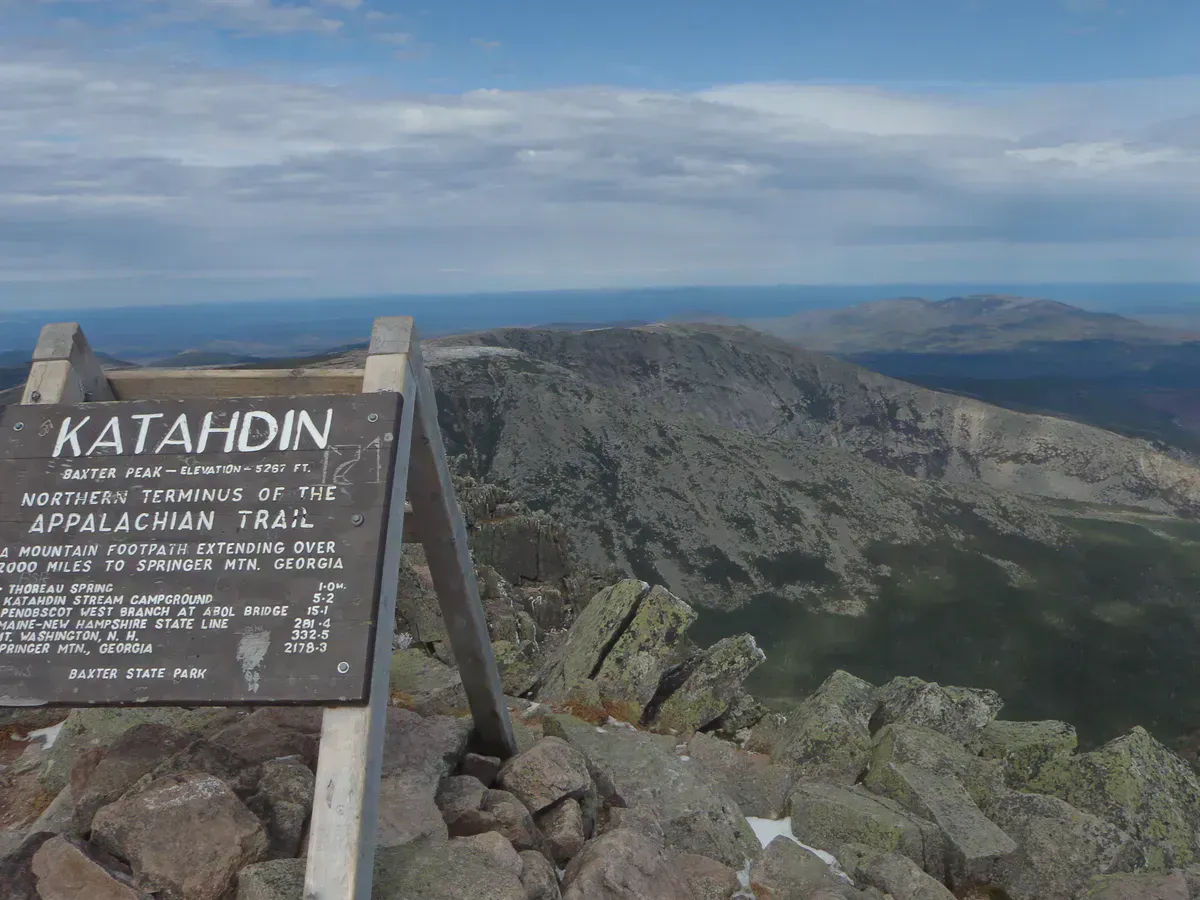
When you drive through the Togue Pond gatehouse and onto the park’s gravel roads, you leave the modern world behind. The forest is thick and unbroken. Moose outnumber people on most trails. At the center of it all stands Mount Katahdin, the highest peak in Maine at 5,267 feet and the northern terminus of the Appalachian Trail.
Katahdin is a serious mountain. People die here. Do not attempt the Knife Edge or upper trails in rain, fog, or high wind. The park closes trails in bad conditions and rangers enforce it. Turn around if weather deteriorates. There is no cell service to call for help.
Climbing Katahdin
Katahdin dominates the park and the imagination of everyone who visits. There are several routes to the summit. None of them are easy. Every route involves significant elevation gain, rock scrambling, and exposure to weather that can change within the hour.
| Route | Distance (RT) | Elevation Gain | Difficulty | Time | Best For |
|---|---|---|---|---|---|
| Hunt Trail (AT) | 10.4 mi | 4,188 ft | Strenuous | 8-12 hrs | AT thru-hikers, most popular route |
| Knife Edge traverse | 0.9 mi (ridge) | Minimal (ridge) | Expert | 1-2 hrs | Experienced scramblers, clear weather only |
| Saddle Trail | 10 mi | 3,600 ft | Strenuous | 7-10 hrs | Avoiding the most technical terrain |
| Cathedral Trail (via Chimney Pond) | 9.4 mi | 3,800 ft | Strenuous | 8-11 hrs | Views of the cirque, steep rock slabs |
| Abol Trail | 7.6 mi | 3,980 ft | Strenuous | 7-10 hrs | Shortest route, relentless rockslide climb |
The Hunt Trail is the most popular route and follows the final stretch of the Appalachian Trail from Katahdin Stream Campground to Baxter Peak. The upper sections involve steep rock scrambles and exposed slabs that require hand-over-hand climbing. Plan for 8 to 12 hours depending on your pace.
The Abol Trail is the shortest route but also the steepest, with a punishing climb up a massive rockslide. The Saddle Trail offers a somewhat less technical approach via Chimney Pond and is the common choice for hikers who want to reach the summit without the most exposed scrambling.
Knife Edge: What You Need to Know
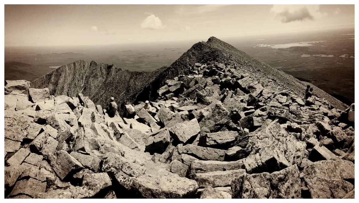
The Knife Edge is Katahdin’s legendary ridge traverse: 0.9 miles of exposed arete connecting Pamola Peak to Baxter Peak with drops of over 1,500 feet on either side. In clear, calm weather, it is one of the most exhilarating hikes in the eastern United States. In anything less than ideal conditions, it is genuinely dangerous.
The traverse takes most people one to two hours. The footing is uneven rock the entire way, with sections where the ridge narrows to a few feet wide. There are places where you are straddling the ridge with nothing but air on both sides. Wind is the biggest hazard. A gust on an exposed section can put you in serious trouble.
Minimum conditions for the Knife Edge: Clear skies, wind under 15 mph, dry rock. The park will turn hikers away if conditions are poor, and they are right to do so. If you are not comfortable with significant exposure and Class 3 scrambling, take a different route.
Most hikers who do the Knife Edge start at Roaring Brook Campground, ascend Helon Taylor Trail to Pamola Peak, traverse the Knife Edge to Baxter Peak, and descend via the Saddle Trail or Hunt Trail. This makes for a very long day (10+ hours).
Day-Use Parking Reservations
Day-use parking at Katahdin trailheads requires a reservation from May through October. Reservations release on a rolling basis. Check baxterstatepark.org for exact dates and release windows. Katahdin reservations are competitive and often book up within minutes.
The park gates open at 6 AM, but the line at Togue Pond starts forming earlier. Without a reservation, you will be turned away from Katahdin trailhead parking. Other areas of the park (non-Katahdin trailheads) are less competitive but still fill on busy summer weekends.
Park roads are unpaved, narrow, and have a 20 mph speed limit. The road from the gatehouse to Roaring Brook Campground takes about 45 minutes. High-clearance vehicles are preferred, though most cars can make it in dry conditions. After rain, some sections get rough.
Blackfly Season
Late May through mid-June: blackflies are brutal in Baxter. Head nets and DEET are essentials, not suggestions. The bugs are worst at lower elevations near water. They thin out above treeline, but the lower trail miles will test your patience.
Blackfly season overlaps with some of the first good hiking weather of the year. If you are planning a late May or June trip, pack a head net, long sleeves treated with permethrin, and strong DEET or picaridin repellent. Mosquitoes join the party by mid-June and persist into August. See our bug protection gear guide for specific product recommendations.
Beyond Katahdin
Most visitors come for Katahdin, but the park has over 200 miles of trails connecting dozens of peaks, ponds, and remote backcountry campsites. The Brothers, Doubletop Mountain, and the Traveler range all provide excellent hiking with far fewer people.
South Turner Mountain is a popular shorter hike (4 miles round trip from Roaring Brook Campground) that delivers one of the best views of Katahdin’s entire massif, including the cirque at Chimney Pond. It is a strong choice on days when Katahdin is socked in with clouds.
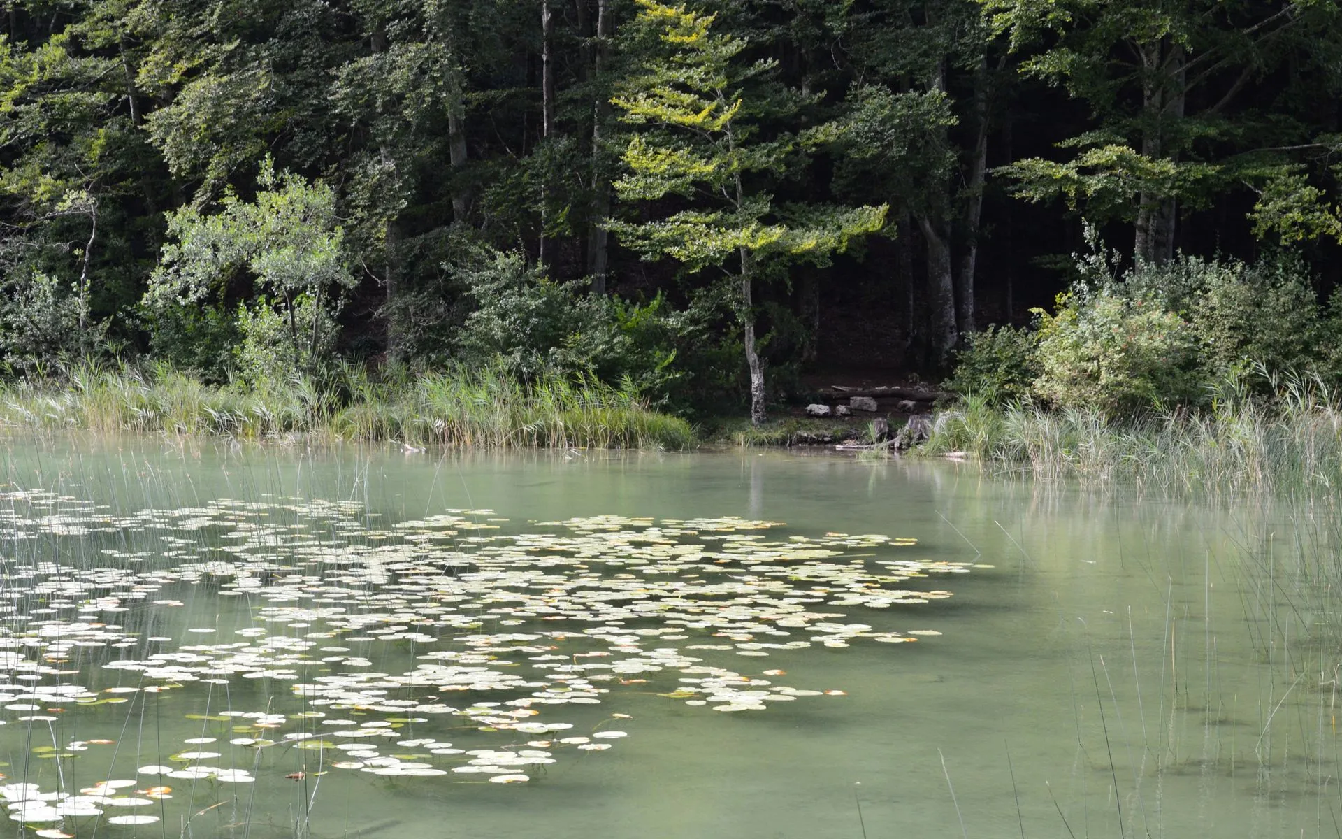
The park’s ponds and streams hold native brook trout. Russell Pond, Wassataquoik Lake, and the smaller ponds scattered through the backcountry offer some of the best wild brook trout fishing in the state. Motorized boats are banned, so the water stays quiet.
For visitors who are not interested in climbing Katahdin, the park still delivers. Daicey Pond is a peaceful spot for canoeing with a view of Katahdin reflected in the water, and Katahdin Lake in the eastern corner of the park gives you one of the most famous reflected views of the mountain at the end of a quiet hike or paddle. The nature trails around South Branch Pond in the northern part of the park are flat and scenic. Wildlife watching, especially for moose, is excellent at dawn and dusk near ponds and wetland areas throughout the park.
Emergency procedures: With no cell service anywhere in the park, self-reliance is critical. Leave your itinerary with someone outside the park. If you need help on the trail, send someone to the nearest ranger station or campground. Rangers patrol actively, but response times are longer than what you would expect in more developed parks.
Rules and Reservations
Baxter operates under strict rules designed to protect the wilderness experience:
- No pets. Anywhere. Not even in vehicles. No exceptions.
- No motorized boats. Canoes and kayaks only.
- Group size limits on trails and at campsites.
- Gates open at 6 AM. The park closes when day-use parking fills.
- Carry in, carry out. No trash receptacles in the park.
The park’s approach can feel restrictive if you are used to national parks with visitor centers and gift shops. But it works. The trails are uncrowded. The wildlife is abundant. The silence is real.
Katahdin Day Hike Packing
- Water (3L minimum, no reliable sources on upper mountain)
- Food for a full day (8-12 hours)
- Layered clothing (summit is 20-30F colder than base)
- Rain gear (weather changes fast)
- Headlamp with fresh batteries
- Paper trail map (no cell service for apps)
- First aid kit
- Trekking poles (helpful on descent)
When to Go
Spring
Snow lingers on Katahdin into June. Blackflies brutal May-June. Limited access.
Summer
Warmest, most stable weather. Highest parking demand. Book early.
Fall
Foliage starts high, fewer visitors. September is prime. Frost possible at summit.
Winter
Requires separate application. Alpine conditions on Katahdin. Experts only.
The park road is open May 15 through October 15, though snow can linger on Katahdin’s upper sections well into June. July and August offer the warmest weather but the highest competition for parking reservations. September is prime: fall foliage begins in the higher elevations, the bugs are gone, and the crowds thin.
Winter access requires a separate application and approval from the park authority. Winter Katahdin is a serious mountaineering objective with full alpine conditions, and the park treats it accordingly.
Getting There
Baxter is remote. From Bangor, it is about 90 minutes to the southern Togue Pond entrance. From Portland, plan on four and a half hours. Millinocket is the nearest town with gas, groceries, and a few restaurants. Stock up before entering the park because there are no services inside.
For camping options and campground details, see our full Baxter camping guide.
FAQ
How much does it cost to enter Baxter State Park?
Maine-registered vehicles enter for free. Out-of-state vehicles pay a $20 day-use fee per vehicle (raised from $16 in January 2025), and a non-resident season pass is also available. Camping fees vary by site type and location.
Is the Knife Edge dangerous?
Yes, it can be. The Knife Edge is a narrow exposed ridge with 1,500-foot drops on both sides. In clear, calm weather with dry rock, it is manageable for experienced hikers comfortable with exposure. In wind, rain, fog, or on wet rock, it is genuinely dangerous. The park closes it in bad conditions.
Do I need a reservation to hike Katahdin?
You need a day-use parking reservation from May through October. Reservations are booked through baxterstatepark.org on a rolling basis and are competitive, especially for summer weekends. Without a reservation, you will be turned away at the gate.
Is there cell service in Baxter State Park?
No. There is zero cell service anywhere in the park. Download offline maps before you arrive, leave your itinerary with someone, and be prepared to be self-sufficient.
Can I bring my dog to Baxter?
No. Pets are not allowed anywhere in Baxter State Park, including in vehicles. This rule is absolute and strictly enforced.