A Quick Summit in Rafting Country
Mosquito Mountain rises 2,215 feet above the forests of The Forks, a small crossroads village where the Dead River meets the Kennebec. The area is best known for whitewater rafting, but Mosquito Mountain offers one of the best short hikes in the region. The trail covers less than 1.5 miles to the summit, gaining about 1,200 feet along the way. The open, bare summit delivers views of Moxie Pond, Moxie Bald Mountain, Big Moose Mountain, and the ridges that define the Kennebec highlands.
The hike is short enough for a midday trip between other activities, and the summit is one of the best spots in the area for sunrise or sunset. Despite its small stature on paper, the open summit and the views it commands make this mountain feel much bigger than its numbers suggest.
The Trail
The trail begins from a small roadside pulloff and climbs through mixed forest. The lower section is moderate and well-defined, working its way through birch, beech, and maple. As you climb, the forest transitions to spruce and fir, and the terrain becomes rockier with exposed roots.
The trail is fairly technical in places, with rocky sections that require careful footing. Good boots with ankle support are worth wearing here. The climb is sustained but never truly exposed until you near the summit.
Near the top, the trees thin and the trail emerges onto open ledges. The final push to the bare summit is over rock and low scrub, with the views expanding in every direction as you gain the last few hundred feet.
The Summit Views
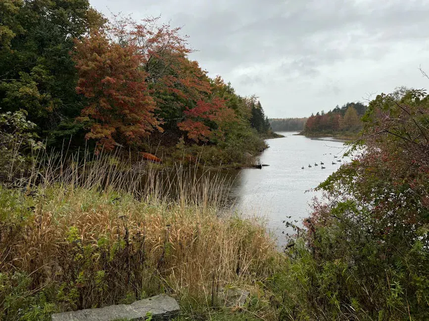
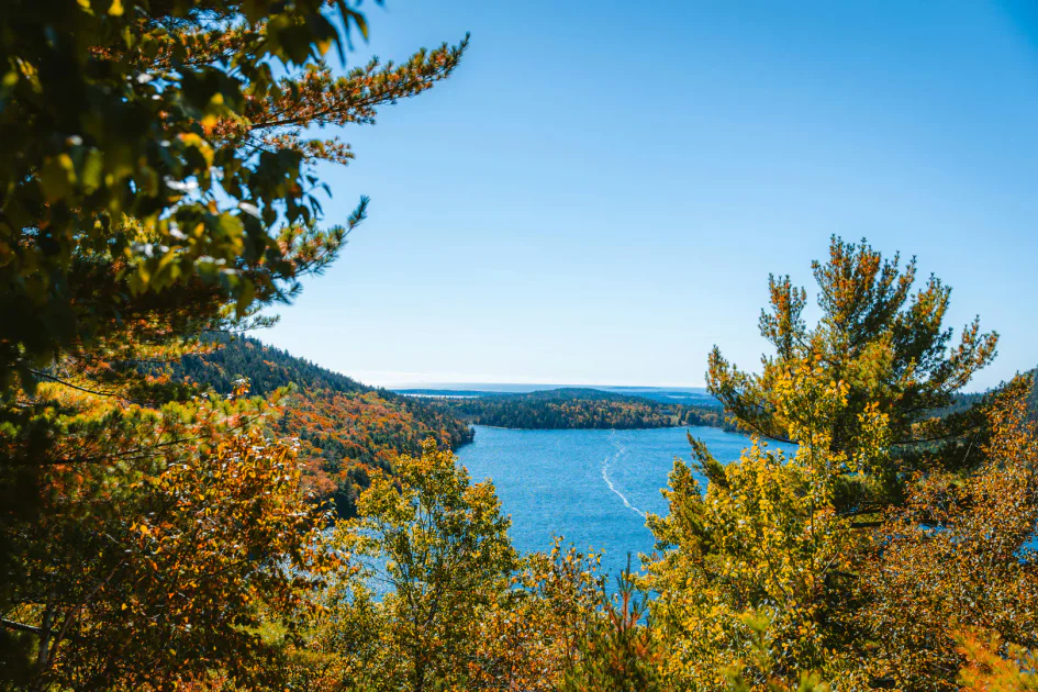
The bare summit is the reward. Moxie Pond fills the view to the east, a long, narrow body of water framed by forested hills. Moxie Bald Mountain, a 2,630-foot peak that the Appalachian Trail crosses, rises behind the pond. Big Moose Mountain is visible to the north. To the west and south, the Kennebec River valley and the hills around The Forks and West Forks create a layered landscape of ridges and river corridors.
The summit is fully exposed with no shelter or shade. On windy days, the gusts on top can be strong.
When to Go
Spring
Muddy and buggy through May and into June. The early season black flies in this part of Maine are especially fierce. Wait for summer.
Summer
Warm weather, long days, and blueberries on the summit from late July on. Pair the hike with a rafting trip on the Kennebec or Dead River.
Fall
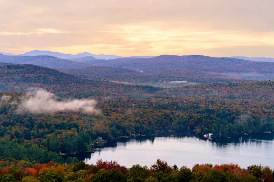
Foliage in the surrounding valleys is exceptional. Cool air, no bugs, and the clearest views. Mid-September to mid-October is prime time.
Winter
Accessible with snowshoes or microspikes, but the road access may be limited and the exposed summit is brutally cold and windy.
Practical Notes
The Forks is the whitewater rafting capital of Maine, and Mosquito Mountain makes a perfect complement to a day on the river. Most rafting outfitters in the area can point you to the trailhead. It is also an excellent pre-dinner hike if you are staying at one of the sporting camps or lodges along Route 201.
Parking is at a small roadside pulloff near the trailhead. There are no restrooms, no facilities, and no cell service. The Forks and West Forks, both a short drive away on Route 201, have fuel, food, and lodging.
Dogs are welcome on the trail. The rocky sections are manageable for most trail-experienced dogs.
Packing List
Mosquito Mountain Day Hike
- 1.5 liters of water per person
- Snacks for the summit
- Sturdy hiking boots (rocky terrain throughout)
- Bug spray May through August
- Wind layer for the exposed summit
- Container for blueberries (late July through September)
- Camera
Getting There
From The Forks, the trailhead is a short drive on local roads. Ask locally for current directions, as the access is not prominently signed. From Bingham, drive north on US Route 201 for about 25 miles to The Forks. From Portland, the drive takes about 3 hours via I-95 and Route 201. From Bangor, roughly 1 hour and 45 minutes via Route 15 and Route 201.
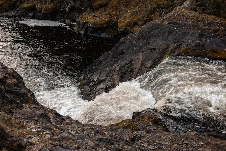
Moxie Falls, the tallest waterfall in Maine, is nearby and makes an excellent pairing with this hike.
FAQ
How long does the Mosquito Mountain hike take?
Most hikers take 1.5 to 2.5 hours round trip. The trail is short but steep and rocky, so it takes longer than the distance suggests.
Are there really blueberries on the summit?
Yes. Wild lowbush blueberries grow on the upper slopes and summit. They ripen from late July through early September and are excellent.
Is the trail well-marked?
The trail is generally well-defined but not heavily blazed. Pay attention to your route, especially on the descent where side paths can cause confusion.
Are dogs allowed?
Yes. Dogs are welcome on the trail. The rocky sections are manageable for most dogs, though small or inexperienced dogs may need help in places.
Can I combine this with rafting?
Absolutely. The Forks is the center of Maine whitewater rafting, with trips on the Kennebec and Dead Rivers. Mosquito Mountain is a great addition to a rafting weekend.
For more in the area, see Moxie Falls and our guide to the Moosehead Lake region.