The Precipice Trail is the most dangerous maintained trail in Acadia National Park. The NPS classifies it as a “non-technical climbing route,” not a hike. It involves vertical iron ladders up to 20 feet tall, narrow cliff ledges with hundreds of feet of exposure, and sustained scrambling on sheer granite. People have been seriously injured and killed here. Do not attempt this trail if you are uncomfortable on the Beehive Trail, in wet conditions, or with young children.
This Is Not a Hike
I want to be direct about the Precipice. This trail climbs the sheer east face of Champlain Mountain using iron rungs, metal ladders, and wooden bridges bolted into near-vertical granite. The National Park Service posts warning signs at the trailhead, and a trail register asks you to sign in before starting. Those are not formalities.
The Precipice is Acadia’s hardest maintained route. It gains 900 feet in under a mile of climbing, and the exposure is sustained. Unlike the Beehive Trail where the scary parts come in short bursts, the Precipice puts you on the edge of the cliff and keeps you there. If you discover halfway up that you cannot handle it, turning around is often more dangerous than continuing to the top.
All of that said: for hikers with scrambling experience and solid comfort with heights, the Precipice is one of the most intense and rewarding trail experiences on the East Coast.
When Is the Precipice Trail Open?
Here is the problem. The Precipice Trail is closed for peregrine falcon nesting every year, typically from mid-March through mid-August. Some years the closure extends into late August or September if the birds fledge late. That means the trail is unavailable during most of the prime hiking season.
The peregrine falcons were nearly wiped out by DDT in the mid-20th century. Their return to Champlain Mountain’s cliffs is one of Acadia’s conservation success stories, and the park takes the closures seriously. Rangers monitor the cliffs, and the closures are non-negotiable.
Your hiking window is narrow: late August through November, with September and October offering the most reliable access and the best weather.
Call the Hulls Cove Visitor Center at 207-288-3338 or check the Acadia NPS website for real-time closure status before making the trip. The closure dates shift every year based on when the falcons nest and fledge. Driving three hours from Portland or Bangor to find the trail roped off is a bad day.
Spring
Closed for peregrine falcon nesting. Closure begins mid-March.
Summer
Closed through mid-August, sometimes later. Use Champlain North Ridge instead.
Fall
Trail opens late Aug/Sept. Fewer crowds, cool temps, foliage. Peak: late Sept to mid-Oct.
Winter
Not maintained. Ice on ladders and granite makes this trail lethal in winter.
The Route
The trail starts from a dedicated parking lot on Park Loop Road, north of the Sand Beach entrance. There is a trail register at the trailhead. Sign in. If something goes wrong, it helps search and rescue find you faster.
Talus Field Approach
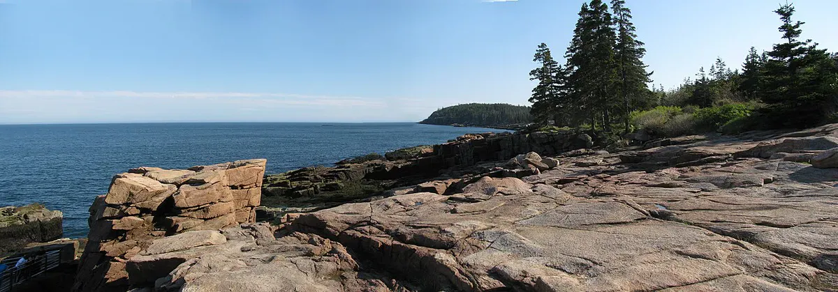
The trail begins in a field of massive talus boulders at the base of the cliff. Rocky switchbacks gain elevation through the rubble. This section is steep but the footing is reasonable. You can see the cliff face looming above you, and if you look carefully, you will spot climbers on the iron rungs ahead.
First Iron Rung Section
The rungs begin abruptly. One moment you are scrambling over boulders, the next you are pulling yourself up iron handholds drilled into vertical granite. The first ladder section is roughly 10 feet tall. The rock is exposed to the east, meaning morning sun can heat the iron but also means you get views immediately. Below you, the trees get smaller fast.
Cliff Traverse and Vertical Ladders
This is the crux. You will sidestep along narrow granite ledges with nothing between you and a long fall. Some ledges are barely shoulder-width. Vertical iron ladders span 15 to 20 feet of sheer rock. Some sections have iron handrails, but many have only the rungs themselves. The exposure is constant. There is no place to rest where you are not acutely aware of the drop.
Upper Scramble to Summit Ridge
The angle eases slightly as you approach the ridge, but the exposure does not fully relent until you top out on the open granite summit. The last few rungs feel almost casual compared to what came before. When you step onto flat rock and the wind hits you, the relief is physical.
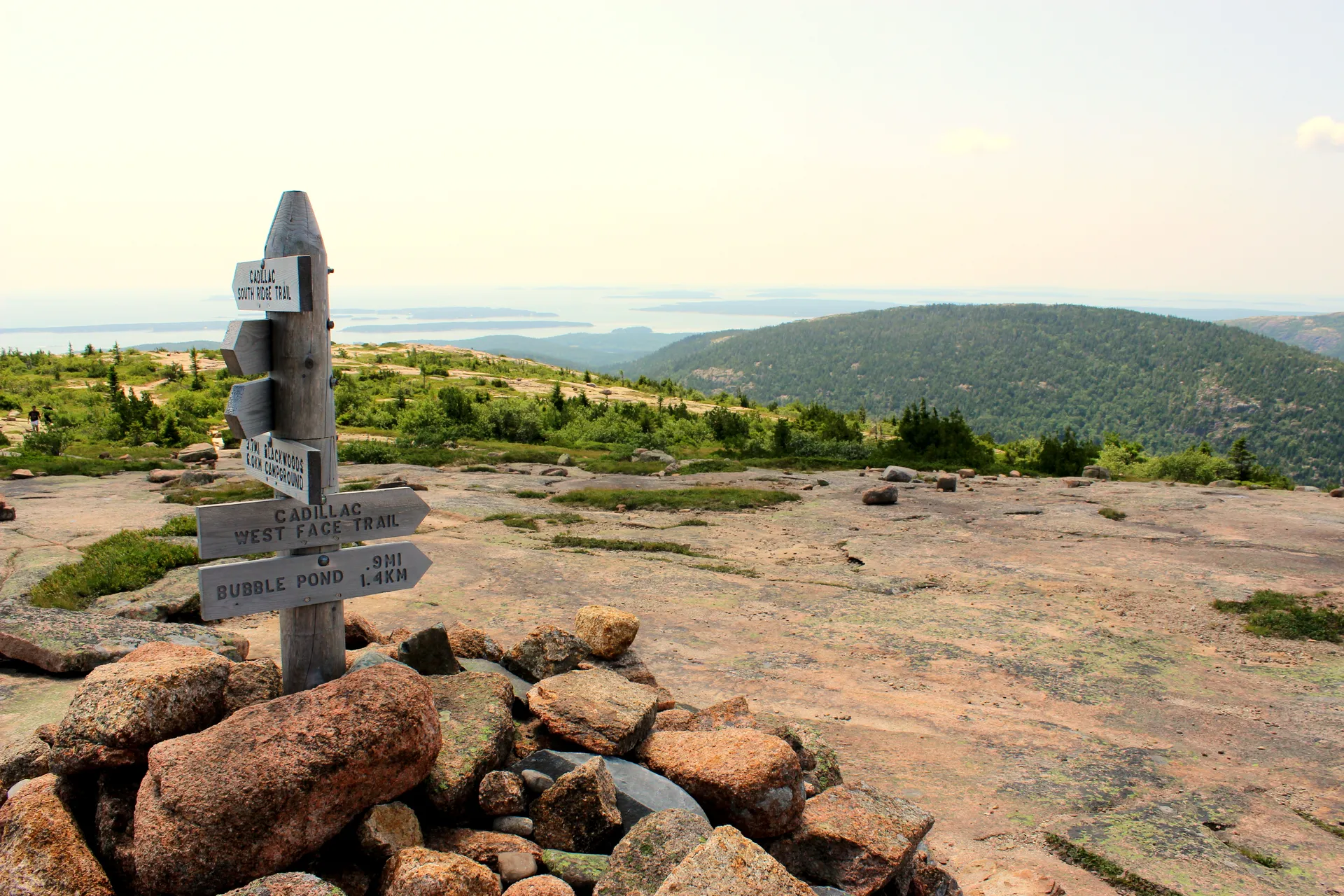
The Summit
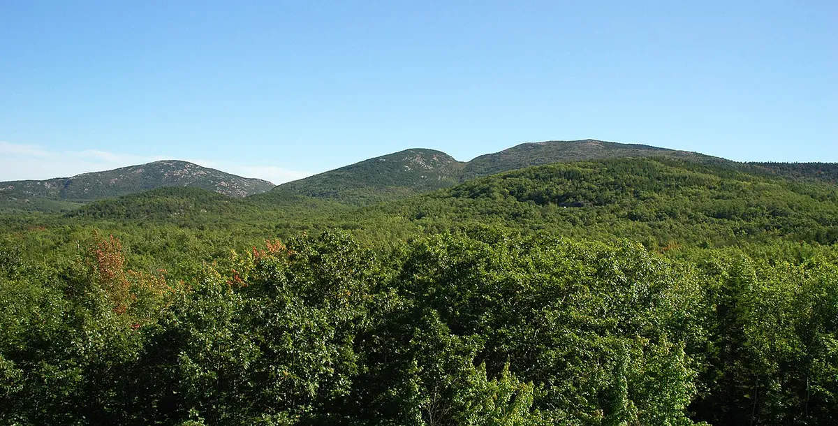
Champlain Mountain tops out at 1,058 feet. The summit is open granite with panoramic views in every direction. Frenchman Bay and the Porcupine Islands spread out to the north. You can see Sand Beach and the Beehive below you to the south. On clear days, the Schoodic Peninsula is visible to the east and the peaks of Mount Desert Island line up to the west.
The wind at the top can be fierce, even on warm days. Bring a layer. Most hikers spend 15 to 30 minutes on the summit before starting the descent.
Descent Route
You cannot descend via the Precipice. The trail is effectively one-way up. Instead, you have three options:
Orange and Black Path (recommended): From the summit, follow the Orange and Black Path north along the ridge and down to the Park Loop Road. This is the most direct descent, roughly 30 to 45 minutes, with moderate terrain and no iron rungs. It deposits you about 0.5 miles north of the Precipice parking lot along the road.
Champlain North Ridge Trail: A longer descent to the north side parking area. Steep in places but straightforward.
Bear Brook Trail: Descends the west side through forest. The most sheltered option, but also the longest way back to your car.
Plan for the descent to add 30 to 45 minutes to your total trip time. The total outing, including the climb and descent, typically takes 2 to 3 hours.
What to Bring
What to Bring
- Sturdy hiking boots (not trail runners)
- Lightweight gloves with grip (cold iron rungs)
- 1-2 liters of water
- Small daypack (hands must be free)
- Wind layer for the summit
- Phone with secure strap
- Snack for the summit
- Park pass ($35/vehicle or America the Beautiful)
Leave trekking poles in the car. You need both hands free, and poles become a serious hazard on the narrow ledges. Good hiking boots are essential here. Trail runners do not provide enough grip or ankle support for the wet granite you may encounter on the descent.
Gloves are worth packing. On fall mornings the iron rungs can be painfully cold, and grip gloves help your confidence on the vertical sections.
Precipice vs Beehive
| Feature | Precipice | Beehive |
|---|---|---|
| Difficulty | Expert | Hard |
| Distance | 1.6 miles (one-way up) | 1.5 miles (loop) |
| Elevation Gain | 900 ft | 450 ft |
| Summit Elevation | 1,058 ft | 520 ft |
| Iron Rung Sections | Long, sustained exposure | Short, intense bursts |
| Typical Closure | Mid March - mid/late August | Late March - mid August |
| Hike Time | 2-3 hours (with descent) | 60-90 minutes |
| Descent | Must use alternate trail | Bowl Trail (easy loop) |
| Best For | Experienced scramblers only | First iron-rung experience |
If you have not done the Beehive yet, do that first. The Beehive is a good test. If you moved through the iron rung sections without freezing up and wanted more, the Precipice is the next step. If the Beehive pushed your limits, the Precipice will exceed them.
Alternative Routes Up Champlain
When the Precipice is closed (which covers most of the summer), you can still reach the Champlain summit:
Champlain North Ridge Trail starts from the north side parking area and climbs steeply through open ledges. No iron rungs. Great views throughout. This is the most popular alternative.
Champlain South Ridge Trail approaches from the south through open granite with views of the Beehive and Sand Beach. Longer but less steep.
Bear Brook Trail climbs the forested west side. The most sheltered option and the easiest route to the summit.
All three are solid hikes on their own. You do not need the Precipice to enjoy Champlain Mountain.
Practical Details
Parking: The Precipice trailhead lot is small, maybe 30 spaces. On fall weekends when the trail is open, it fills by 7:00 AM. The Island Explorer shuttle stops nearby.
Line waits: On busy fall days, expect a line at the base of the iron rung sections. Hikers naturally space out on the ladders, and you may wait 10 to 20 minutes for the group ahead to clear. Do not try to rush past other hikers on the exposed sections.
Cell service: Good throughout the route, which provides some comfort given that rescue from the cliff face would be complicated.
Time: Plan 1.5 to 2.5 hours for the ascent plus 30 to 45 minutes for the descent via an alternate trail.
FAQ
When is the Precipice Trail open?
Typically late August through November, though exact opening dates vary by year depending on peregrine falcon nesting. Call the Hulls Cove Visitor Center at 207-288-3338 for current status. September and October offer the most reliable access.
Is the Precipice Trail harder than the Beehive?
Significantly. The Precipice has twice the elevation gain, longer sustained exposed sections, vertical ladders up to 20 feet tall, and no easy loop descent. The Beehive's scary parts come in short bursts. The Precipice keeps you on the edge of the cliff for extended stretches.
How do you get down from the Precipice Trail?
You cannot descend via the Precipice. Most hikers take the Orange and Black Path north along the summit ridge and back down to Park Loop Road, which adds about 30 to 45 minutes. The Champlain North Ridge Trail and Bear Brook Trail are also options.
Has anyone died on the Precipice Trail?
Yes. People have been seriously injured and killed on the Precipice Trail. Falls from the exposed sections are potentially fatal. The NPS posts warning signs and maintains a trail register for a reason. Hike only in dry conditions, know your limits, and take the warning signs seriously.
How long does the Precipice Trail take?
Plan for 2 to 3 hours total. The climb itself runs about 1.5 to 2.5 hours depending on crowds on the ladders, and because you cannot descend the Precipice, the Orange and Black Path descent adds another 30 to 45 minutes. Going early avoids backups on the single-file rung sections.
How hard is the Precipice Trail?
It is rated expert and is Acadia's most demanding maintained trail. It climbs about 900 feet over 1.6 miles up the sheer east face of Champlain Mountain, with sustained exposure, vertical iron ladders up to 20 feet, and narrow ledges. It is not the place to learn iron-rung hiking. Do the Beehive first and only attempt the Precipice if that felt comfortable.
Where is the Precipice Trail and where do I park?
The trailhead and its parking lot are on the one-way section of Park Loop Road in Acadia, a short drive north of Sand Beach and about 10 minutes from Bar Harbor. The lot is small and fills early, so arrive by 7:30 AM or take the free Island Explorer shuttle. Entry is the $35 Acadia vehicle pass or an America the Beautiful pass.
Is the Precipice Trail dog-friendly?
No. Dogs are not allowed on the Precipice. The vertical ladders and exposure make it impossible and dangerous for pets. For a dog-friendly day in Acadia, use the carriage roads or the Ocean Path.
Can beginners or kids do the Precipice Trail?
No. This is an expert-only route and is not appropriate for young children or anyone without prior scrambling and iron-rung experience plus a genuine comfort with heights. Beginners should start with the Beehive, and if that felt like too much, skip the Precipice entirely.
Getting There
The Precipice trailhead is on Park Loop Road in Acadia National Park, north of the Sand Beach entrance and south of the Champlain Mountain / Bear Brook trailhead.
From Bar Harbor: 10 minutes south on Park Loop Road. The Precipice lot is on the left (east side) before you reach Sand Beach.
Parking: Small lot, roughly 30 spaces. $35 park entry fee. Fills early on fall weekends.
Shuttle: Island Explorer stops nearby. Free with park pass. Runs late June through Columbus Day.