Above Treeline in the Rangeley Region
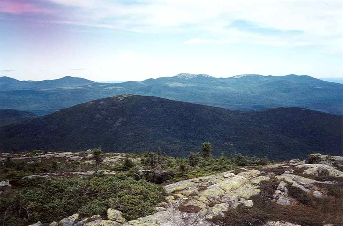
Saddleback Mountain stands 4,120 feet above the lakes and forests of western Maine, making it one of the state’s twelve peaks over 4,000 feet. But elevation alone is not what sets Saddleback apart. The mountain holds Maine’s third-largest alpine zone: a 3-mile ridgeline of fragile tundra, low-growing alpine plants, and exposed rock that extends from the summit across to The Horn (4,041 feet). Less than 50 miles of alpine terrain like this exists in all of New England, and Saddleback has a significant share of it.
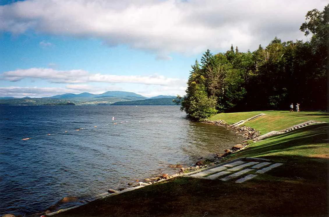
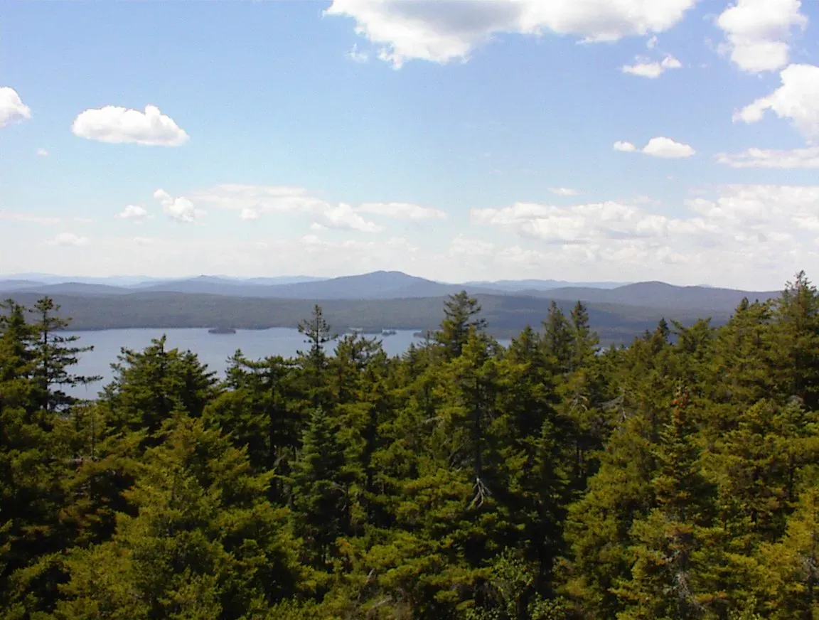
The Appalachian Trail crosses the summit and runs along the exposed ridge, providing one of the finest above-treeline walks on the entire AT. The 360-degree views from the summit take in Rangeley Lake, the Bigelow Range, Sugarloaf, and on clear days, Mount Washington in New Hampshire.
The Trail
The most common day hike starts from the Saddleback ski area base lodge on Saddleback Mountain Road. The route follows the ski trails and then picks up the Appalachian Trail for the push to the summit. The total distance is about 10 miles round trip with approximately 2,600 feet of elevation gain.
The first few miles follow the ski area access and are moderate. As you gain the upper slopes, the trail steepens and eventually breaks through treeline into the alpine zone. The transition from dense spruce-fir forest to open tundra is abrupt and dramatic.
Above treeline, the AT is marked by rock cairns across open granite and low vegetation. The summit itself is a broad, rounded dome with views in every direction.
The alpine zone on Saddleback is incredibly fragile. The plants growing on the ridge are slow-growing species that take decades to recover from foot traffic damage. Stay on the marked trail and step only on rock, not vegetation. Follow the cairns carefully. If visibility drops, retrace your steps rather than wandering off trail.
The Horn Extension
Strong hikers can continue beyond the Saddleback summit along the AT to The Horn (4,041 feet), adding about 2.4 miles and 600 feet of additional gain round trip. The ridge walk between the two peaks is the highlight of the entire route, with continuous above-treeline hiking across open tundra. The views along the ridge are extraordinary.
If you have the fitness and daylight, the extension to The Horn is worth every step. The ridge walk between Saddleback and The Horn is one of the finest stretches of above-treeline hiking in Maine, comparable to the Knife Edge on Katahdin but less technical and far less crowded.
The Views
The summit of Saddleback offers one of the broadest panoramas in Maine. To the south, Rangeley Lake stretches across the valley. To the east, the Bigelow Range and Sugarloaf are prominent. To the north, the mountains of the Boundary Region and the forests of the North Woods. On exceptionally clear days, the Presidential Range in New Hampshire is visible to the southwest.
The alpine flowers bloom in June and early July. Look for Diapensia, alpine azalea, Bigelow’s sedge (named for the nearby Bigelow Range), and mountain sandwort. These are tiny, ground-hugging plants that are easy to miss if you are not looking down.
When to Go
Spring
Snow lingers in the alpine zone through May and into June. Trail is muddy and eroded in the lower sections. Not recommended.
Summer
The alpine zone is snow-free by late June. Alpine flowers bloom in late June and July. Start early to avoid afternoon thunderstorms above treeline.
Fall
Clear days in September and October offer the longest views. Foliage on the lower slopes is beautiful. The alpine plants turn red and gold.
Winter
The alpine zone is extremely exposed and dangerous in winter. High winds, ice, and whiteout conditions are common. Winter ascent is for experienced mountaineers only.
The Saddleback ski area base lodge is the standard starting point, but check current access before you go. The ski area underwent significant ownership changes in recent years and access policies may vary. Call ahead or check the Saddleback Maine website for trailhead parking information.
Practical Notes
This is a long, hard day hike. Plan for 6 to 8 hours round trip to the summit and back, longer if you add The Horn. Carry at least 2 liters of water per person. There are no reliable water sources above the lower slopes. Weather above treeline can change rapidly; bring rain gear and a warm layer even on clear days.
The nearest services are in Rangeley, about 10 miles from the trailhead. Fuel up and pack food before heading to the mountain.
Packing List
Saddleback Mountain Day Hike
- Sturdy hiking boots with ankle support
- At least 2 liters of water per person
- Lunch and high-energy snacks
- Rain jacket and warm layer (conditions change above treeline)
- Trekking poles (helpful on the steep sections)
- Map and compass or GPS (in case of fog above treeline)
- Sunscreen and sunglasses (no shade in the alpine zone)
- Camera
Getting There
From Rangeley, take Route 4 south to Dallas Hill Road, then turn onto Saddleback Mountain Road. Follow signs to the Saddleback ski area. The trailhead parking is at the base lodge. From Portland, the drive is approximately 3 hours via Route 4 through Farmington. From Bangor, it is about 3 hours via Routes 2 and 4.
FAQ
How hard is the Saddleback hike?
Hard. The 10-mile round trip gains about 2,600 feet and includes sustained steep sections and an exposed alpine ridge. This is a full-day mountain hike for fit, experienced hikers.
Is there an alpine zone?
Yes. Saddleback has Maine's third-largest alpine zone, with 3 miles of fragile tundra along the ridge. Stay on the trail and step only on rock to protect the vegetation.
Can I hike to The Horn?
Yes. The Horn adds about 2.4 miles round trip beyond the Saddleback summit. The ridge walk between the two peaks is above treeline the entire way and is one of the best stretches of the AT in Maine.
Is there a ski resort on Saddleback?
Yes. Saddleback Maine is an alpine ski area on the mountain. The trailhead for the hiking route starts from the base lodge area.
Are dogs allowed?
Yes, on the trail, but use judgment in the alpine zone. Dogs can damage fragile vegetation. Keep your dog on the trail and on rock surfaces above treeline.