A 90-Foot Plunge in the Woods
Angel Falls is a 90-foot plunge waterfall on Mountain Brook in Township D, an unorganized territory northwest of the village of Houghton in Franklin County. The water drops from a narrow gap near the top of a cliff face that rises about 115 feet, and when the flow is right, the cascading water fans out as it descends into a shape that people say resembles an angel’s wing. That is where the name comes from.
Unlike Moxie Falls, which you view from above, Angel Falls puts you at the base looking up. You stand in a boulder field at the bottom of a cliff and watch the water fall the full 90 feet to the rocks in front of you. The scale of it only registers when you are there. Photos rarely capture how tall the cliff actually is or how the sound fills the narrow hollow.
The hike is short but not a stroll. It crosses Mountain Brook three times, and the crossings involve rock-hopping that can be tricky after rain. The total distance is about 1.1 miles round trip with roughly 200 feet of elevation gain. Most people can reach the falls in 20 to 30 minutes.
The trail crosses Mountain Brook three times. In normal summer conditions, these are straightforward rock-hops. After heavy rain or during spring snowmelt, the stream can rise significantly, making crossings difficult or impossible. Do not attempt the crossings if the water is above ankle-deep and moving fast. People have been stranded on the wrong side of the brook during high water.
The Hike
The trailhead is a gravel pit off Bemis Road, a rough logging road that leaves Route 17 south of Houghton. A large boulder with graffiti marks the parking area. There is room for maybe six or eight cars.
From the parking area, follow the red blazes along what starts as a logging path. The trail crosses Berdeen Stream early on, then follows Mountain Brook upstream. The three crossings of Mountain Brook are the only real challenge. In low water, you can hop across on exposed rocks without getting your feet wet. In higher water, you will get wet.
The trail climbs gradually through mixed forest, following the brook. The final approach to the falls is through a rocky area where the sound of falling water gets louder with each step, and boots with solid ankle support and grippy soles make the rock-hopping and the slick boulders at the base far safer. The forest opens up and you are standing at the base of the cliff, looking straight up at the falls.
There is no formal viewing platform. You are standing on rocks and dirt at the base of the cliff. The spray zone extends 20 to 30 feet from the falls, so expect to get misted if you approach closely during high water.
Angel Falls depends heavily on rainfall and snowmelt. In a dry August, the flow can thin to a trickle, which is disappointing after the effort of getting there. The best displays happen in May and June, or after a significant rainstorm. Check recent weather conditions before making the trip. If it has not rained in two weeks, temper your expectations.
The Falls Up Close
The cliff face surrounding Angel Falls is roughly 115 feet tall, with the water dropping from a gap near the top. The rock is dark and usually wet from spray and seepage, covered in moss and lichens. In spring, when flow is at its peak, the water fills the gap and fans out as it descends, creating the angel-wing shape that gives the falls its name.
By late summer, Mountain Brook often carries much less water, and the falls can reduce to a narrow stream sliding down the rock face. It is still a beautiful spot, but the drama is diminished. Some years, after a particularly dry stretch, the falls barely trickle.
The cliff and surrounding forest create a natural amphitheater that amplifies the sound of the water. Even at moderate flow, the noise is impressive. At full spring flow, it roars.
Angel Falls and Moxie Falls are both approximately 90 feet and are frequently cited as the tallest waterfalls in Maine. Some sources give a slight edge to one or the other depending on how the measurement is taken, but both are among the tallest in all of New England.
When to Go
Spring
Peak water flow. Stream crossings may be difficult. Access road may have mud and ruts.
Summer
Easiest trail conditions and stream crossings. Water flow decreases as the season progresses.
Fall
Low water flow. Foliage is nice but the falls may be a trickle. Access road can be rough.
Winter
Logging road not maintained. Not accessible in winter.
Late May through June is the prime window. Snowmelt keeps the falls running strong, the forest is green, and the weather is warming up. The trade-off is that stream crossings are harder and black flies are relentless.
July and early August work well if there has been recent rain. The stream crossings are easiest at this time, and the trail is in good condition. Late August and September can be disappointing if the summer has been dry.
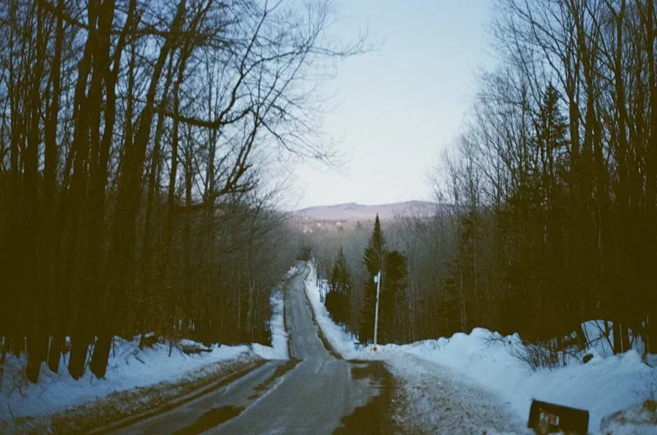
The logging road to the trailhead is not maintained in winter, and deep mud can make it impassable in early spring (April and early May). A vehicle with decent ground clearance is helpful any time of year. Passenger cars can make it in good conditions, but the road has ruts and washouts.
Practical Notes
The turnoff from Route 17 onto Bemis Road is easy to miss. Look for a dirt road on the left (heading south from Houghton) about 3 miles south of the village. The parking area is roughly 3.5 miles down Bemis Road. Cell service is nonexistent here and for miles in every direction. Download your map and directions before you leave town. Rangeley, about 20 miles north, is the closest place for gas, food, and supplies.
There are no fees, no permits, and no facilities at the trailhead. No restrooms, no trash cans. Pack out everything you bring in, which is easier with a comfortable daypack to carry water, snacks, and a rain layer for the spray zone.
Dogs are allowed on the trail. The stream crossings may be challenging for small dogs, and the rocks at the base of the falls can be slippery.
Packing List
Angel Falls Visit
- Hiking boots with good ankle support (rocky trail and stream crossings)
- Water shoes or sandals for stream crossings (optional but helpful)
- Camera with wide-angle capability (the falls are tall and close)
- Water and snacks
- Bug spray (June especially)
- Rain jacket (the spray zone at the base is wet)
- Downloaded map or GPS (no cell service)
Getting There
From Rangeley, head south on Route 17 for about 20 miles. Turn right (west) onto Bemis Road, a logging road. Follow Bemis Road for approximately 3.5 miles to the gravel pit parking area on the left. Look for the large boulder.
From Rumford, take Route 2 west to Route 17 north. The Bemis Road turnoff is about 10 miles north of the Houghton area.
From Portland, the total drive is about 3 hours via the Maine Turnpike to Auburn, then Route 4 north to Rangeley, then Route 17 south. From Bangor, expect about 3 hours via Routes 2 and 17.
The logging road is rough. Drive slowly and watch for potholes, washboards, and logging trucks. High clearance helps but is not required in good conditions.
GPS coordinates for the falls: 44.7832, -70.7096 GPS coordinates for the trailhead parking: 44.7882, -70.7068
FAQ
How tall is Angel Falls?
Angel Falls drops approximately 90 feet (27 meters) from a gap in a cliff face that is about 115 feet tall. It is a plunge-style waterfall where the water fans out as it descends the rock.
Is Angel Falls the tallest waterfall in Maine?
Angel Falls and Moxie Falls are both approximately 90 feet and are often cited as the tallest waterfalls in Maine. Some sources give a slight edge to one or the other depending on how the measurement is taken. Both are among the tallest in New England.
How hard is the hike to Angel Falls?
The trail is 1.1 miles round trip with 200 feet of elevation gain. The main difficulty is three stream crossings that require rock-hopping. In low water, the crossings are simple. In high water, they can be challenging. The rest of the trail is a moderate walk through the woods.
Can you visit Angel Falls in winter?
Effectively, no. The logging road to the trailhead is not maintained in winter and is typically impassable. Even if you could reach the trailhead, the frozen stream crossings and snow-covered trail would make the hike dangerous.
Is there water flowing at Angel Falls year-round?
Angel Falls depends on rainfall and snowmelt. In a wet year, there is some flow from spring through fall. In dry late-summer periods (August and September), the falls can slow to a trickle or stop entirely. The best flow is May through June.