An Island You Walk To
Vaughan Island Preserve is a 96-acre island off the coast of Kennebunkport that belongs to the Maine Coast Heritage Trust and is accessible to the public free of charge. The catch: you can only reach it on foot at low tide, when a gravel bar connects the island to the mainland at the end of Turbats Creek Road. This tidal access creates a natural crowd filter. You need to plan your visit around the tides, which means most people never go. Those who do find one of the most atmospheric coastal preserves in southern Maine.
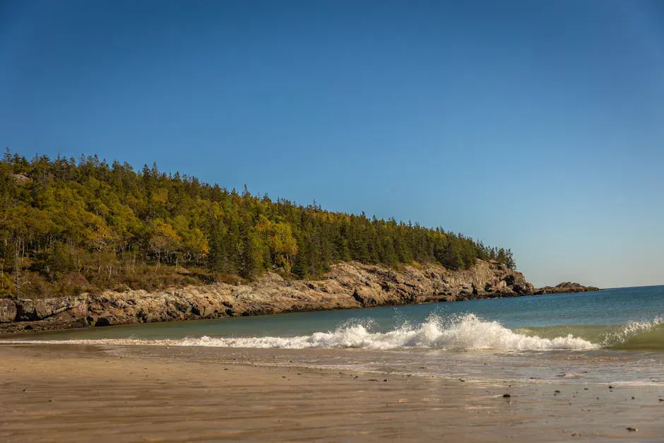
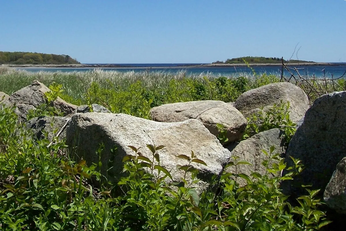
The island is a mix of mature spruce forest, wildflower meadows, rocky shoreline, and tidal pools. A rough trail system covers about two miles, looping through the interior and along the shore. The preserve feels genuinely remote despite being minutes from one of Maine’s most popular tourist towns. On a weekday at low tide, you may have the entire island to yourself.
The island is managed for conservation, and its isolation has allowed wildlife to thrive. Harbor seals haul out on the offshore ledges, eider ducks nest in the spruce, and the tide pools on the seaward side are rich with marine life.
The gravel bar connecting Vaughan Island to the mainland floods completely at mid-tide. You have a window of roughly three to four hours around low tide to cross safely. Check the Kennebunkport tide tables before visiting and set an alarm to leave in time. Getting stranded on the island means waiting approximately six hours for the next low tide. There is no shelter and no cell service guaranteed.
Getting to the Island
The gravel bar is exposed for approximately three to four hours around low tide. Arrive about one hour before low tide to maximize your time on the island. The crossing is roughly 200 yards across an exposed gravel and sand bar. Wear water shoes or boots that you do not mind getting wet. Even at low tide, a few inches of water may cover the lowest sections of the bar.
Park at the small pulloff at the end of Turbats Creek Road. Walk down to the shore and cross the bar. The trail on the island begins at the opposite shore, marked by a MCHT sign.
Plan to leave the island at least one hour before mid-tide to ensure a safe crossing. The water rises quickly once it starts to flood the bar, and what was ankle-deep can become waist-deep within 30 minutes.
Cell service on the island can be spotty. Set an alarm on your watch before crossing to remind you when it is time to leave. A good rule is to be back at the gravel bar no later than two hours after low tide. Do not rely on your phone for tide information once you are on the island.
Exploring the Island
The trail system is informal, worn paths through the forest and along the shore rather than blazed and maintained trails. The main loop circles the island’s interior through a dark, atmospheric spruce forest with a thick carpet of moss and needles underfoot. Side trails lead to the shore at several points.
The seaward (eastern) side of the island faces open ocean and has the most dramatic scenery. Rocky ledges drop to the water, and at low tide the exposed rocks reveal tide pools full of sea urchins, periwinkles, hermit crabs, and starfish. The western side, facing Turbats Creek and the mainland, is more sheltered with a cobblestone beach and calmer water.
The interior meadows bloom with wildflowers in summer, including beach roses, goldenrod, and asters. The meadows provide open views across the island and are the most likely spots for bird watching.
Bring a lunch and eat it on the eastern ledges overlooking the open ocean. On a clear day, you can see the Isles of Shoals to the south and the Cape Elizabeth coastline to the north. The sense of solitude, sitting on a tidal island eating a sandwich while waves break below, is hard to match anywhere in southern Maine. Just watch your tide window.
When to Visit
Spring
Cool weather, wildflowers beginning. Muddy trails on the island. Eider nesting season.
Summer
Warm weather, wildflower meadows in bloom, best tide pool viewing.
Fall
Foliage, cool air, migrating birds, fewer visitors. Beautiful atmospheric light.
Winter
Cold, exposed, and the tidal crossing is uncomfortable. Not recommended.
Summer offers the warmest conditions and the best tide pool viewing. Fall is beautiful with the spruce forest providing an evergreen backdrop to the changing hardwoods. Visit on a weekday for the best chance at solitude.
Practical Information
There are no facilities on the island, no restrooms, no water, no shelter. Bring everything you need and take everything out. The island is a preserve and all visitors are expected to practice leave-no-trace principles.
Dogs are not allowed on the island to protect nesting birds and other wildlife. The trails are not suitable for strollers or wheelchairs.
Parking at the end of Turbats Creek Road is limited to about five cars. Do not block the road or driveways.
Packing List
Vaughan Island Visit
- Water shoes or boots for the gravel bar crossing
- Watch with alarm set (do not rely on phone)
- Tide chart (printed)
- Water and snacks (no facilities on island)
- Binoculars for seal and bird viewing
- Camera
- Layers (island is exposed and can be windy)
- Sunscreen
- Trash bag (pack out everything)
Getting There
Turbats Creek Road is off Route 9 in Kennebunkport, near Cape Porpoise. From Portland, take I-95 south to Exit 25 (Kennebunk), then Route 35 south and Route 9 east toward Cape Porpoise. Turn onto Turbats Creek Road and follow it to the end. The drive from Portland is about 35 minutes.
GPS coordinates for parking: 43.3440, -70.4520
FAQ
How long can I spend on the island?
You have approximately 3-4 hours around low tide before the gravel bar floods. Plan to arrive 1 hour before low tide and leave no later than 2 hours after low tide.
What happens if I get stranded?
You will need to wait approximately 6 hours for the next low tide. There is no shelter on the island. This is uncomfortable but not dangerous if you have water and warm layers. You can also be retrieved by kayak.
Are dogs allowed?
No. Dogs are prohibited on the island to protect nesting birds and wildlife.
Is there a trail map?
The MCHT sign at the island entrance has a basic map. The trail system is informal. The island is small enough that you cannot get seriously lost.
Can I kayak to the island?
Yes. You can kayak to the island at any tide stage and pull up on the shore. This eliminates the tidal access constraint.