Deep in the Rangeley Backcountry
Bemis Falls sits on Bemis Stream in Township D, Franklin County, set among the forested hills south of Mooselookmeguntic Lake in the Rangeley Lakes region. The falls are part of a longer hiking loop that connects the Appalachian Trail with the Bemis Stream Trail, making this a destination for hikers who want more than a quick roadside stop.
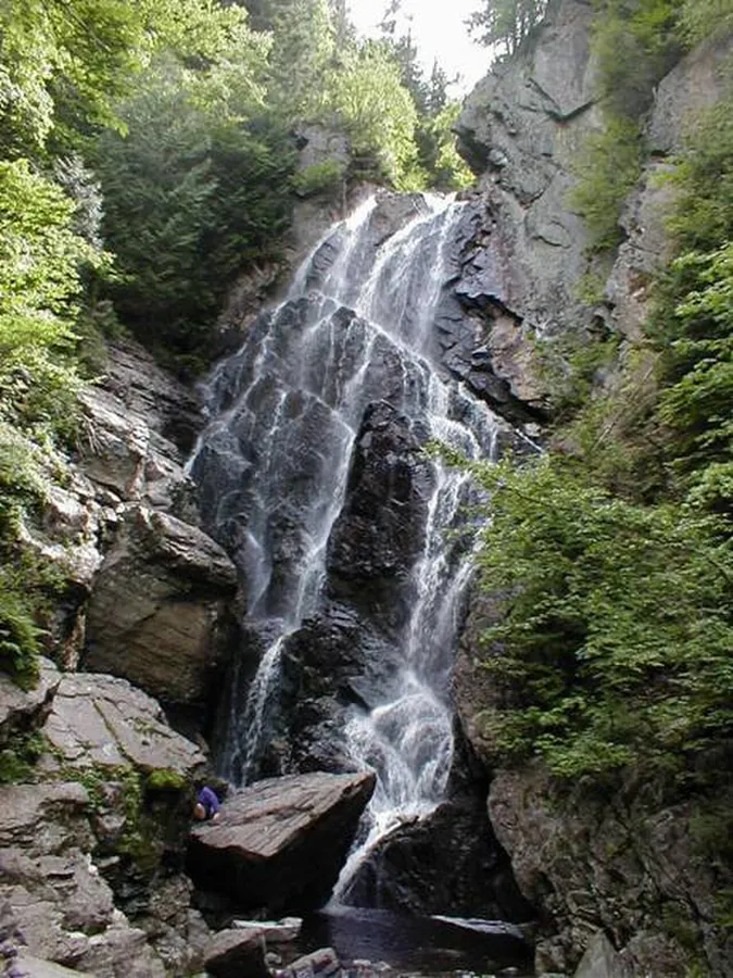
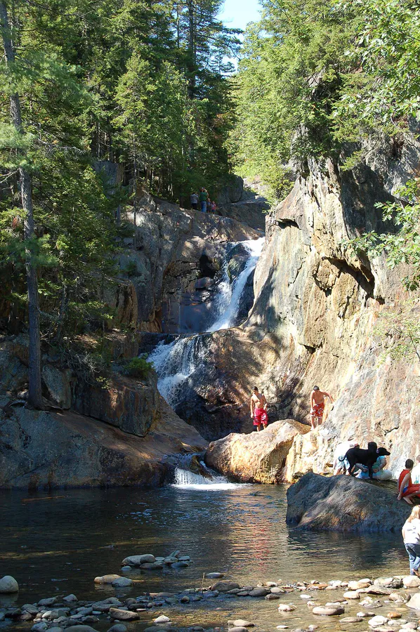
The cascade drops through a narrow channel carved into bedrock, tumbling over a series of ledges in the dense forest. The setting is completely wild. There is no parking lot, no signage at the falls, and no other visitors on most days. You earn this one with your legs.
The Hike
The most common approach follows the Bemis Stream Trail, which departs from Route 17 near the Height of Land overlook. The full Bemis Loop, which combines the Appalachian Trail and Bemis Stream Trail, covers roughly 11 miles plus a 1-mile road section. This is a strenuous full-day hike.
For a more direct route to the falls, follow the Bemis Stream Trail from its trailhead. The trail descends along Bemis Stream through mixed forest, crossing the brook several times. The falls are roughly 2.5 miles in from the Route 17 end of the trail. The crossings can be tricky during high water in spring, so trekking poles are helpful.
The trail is well blazed but sees moderate traffic. Roots, rocks, and mud are standard throughout, so waterproof hiking boots with aggressive tread will keep your footing sure and your feet dry through the crossings. Expect the hike to the falls and back to take three to four hours at a steady pace.
Bemis Stream must be crossed multiple times on the trail. In spring and after heavy rain, these crossings can be knee-deep and fast-moving. Use trekking poles for balance and wear waterproof boots. If the water is too high, turn back.
The Falls
Bemis Falls is not a single towering drop but a sustained series of cascades where the stream slides and plunges over bedrock ledges through a narrow gorge. The total elevation change across the cascade section covers roughly 30 feet. The rock is dark metamorphic stone, and the surrounding forest is a thick mix of spruce, fir, and birch.
During spring snowmelt, the stream carries impressive volume and the cascades roar through the gorge. By August, the flow is calmer and you can explore the ledges more closely. The pools between the drops hold native brook trout, and the fishing along Bemis Stream is considered some of the best in the Rangeley region for those willing to hike in.
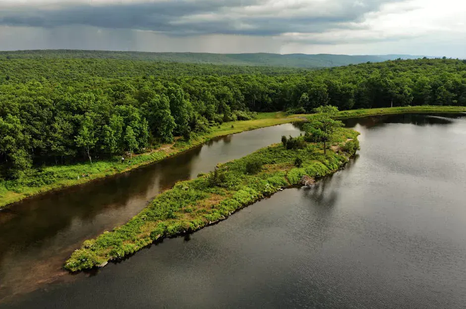
The trailhead for the Bemis Stream Trail is near the Height of Land overlook on Route 17, one of the most photographed viewpoints in western Maine. Mooselookmeguntic Lake stretches out below with the mountains behind it. Stop here before or after your hike for the view.
When to Visit
Spring
Strongest water flow from snowmelt. Stream crossings can be difficult. Snow may linger into May at higher elevations.
Summer
Warmer weather, easier stream crossings. Water volume decreases. Good fishing in the pools.
Fall
Spectacular foliage in the Rangeley region. Cool hiking temperatures. Moderate water flow.
Winter
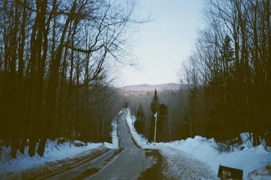
Trail is snow-covered and stream crossings are hazardous. Snowshoe access only. Not recommended for most hikers.
Late May through June offers peak water volume, though the stream crossings are most challenging then. September and early October bring foliage that lights up the hardwoods along the stream, and the combination of fall color and cascading water is a sight worth the trip.
Oquossoc and Rangeley have full services including restaurants, gas stations, and outfitters. The Rangeley Lakes region is a popular summer destination, so lodging fills up on summer weekends. Book ahead if you are staying overnight.
Practical Notes
There are no fees or permits required for the trail. Parking is along Route 17 at the Height of Land pulloff or at designated trailhead spots. There are no restrooms or facilities at the trailhead.
This is a longer hike through remote terrain. Bring enough water for several hours, food, and rain gear, all of which ride comfortably in a well-fitted daypack for a half-day on the trail. Cell service is nonexistent along the trail.
Packing List
Bemis Falls Hike
- Waterproof hiking boots (stream crossings required)
- Trekking poles (essential for stream crossings)
- Water (at least 2 liters)
- Trail snacks or packed lunch
- Camera
- Bug spray (May through July)
- Rain jacket
- Map of the trail system
Getting There
Bemis Falls is in Township D, south of Mooselookmeguntic Lake in the Rangeley Lakes region of Franklin County. Oquossoc and Rangeley are the nearest towns with full services, including restaurants, gas stations, and outfitters. Plan to stock up before heading to the trailhead.
The approach is from Route 17, which runs between Rumford and Oquossoc and is one of western Maine’s most scenic drives. The Bemis Stream Trail trailhead is along Route 17 near the Height of Land overlook. Parking is at the Height of Land pulloff or at gravel pulloffs designated for the trail. There are no restrooms or other facilities.
From the trailhead, the Bemis Stream Trail descends along Bemis Stream, crossing the brook multiple times. The falls are roughly 2.5 miles in. GPS coordinates for the falls are approximately 44.8200, -70.7100. The full Bemis Loop connecting the Appalachian Trail and Bemis Stream Trail is about 11 miles plus a 1-mile road section.
Stream crossings can be knee-deep and fast-moving in spring and after heavy rain, and snow can linger at higher elevations into May. Cell service is nonexistent along the trail, so download offline maps and let someone know your plans before you head out.
FAQ
How long is the hike to Bemis Falls?
From the Bemis Stream Trail trailhead on Route 17, the falls are roughly 2.5 miles in. The round trip takes three to four hours. The full Bemis Loop via the Appalachian Trail is about 11 miles.
Is Bemis Falls on the Appalachian Trail?
The falls are near the Appalachian Trail but accessed more directly via the Bemis Stream Trail, which connects to the AT. You can include the falls in a loop hike that uses both trails.
Can you fish at Bemis Falls?
Yes. Bemis Stream holds native brook trout, and the pools near the falls offer good fly fishing. A Maine fishing license is required.
Is the trail to Bemis Falls difficult?
The trail is rated moderate. It involves multiple stream crossings, roots, rocks, and some elevation change. It is not technical but requires reasonable fitness and sturdy footwear.
Where do I park for Bemis Falls?
Park at the Height of Land overlook pulloff on Route 17 or at the Bemis Stream Trail trailhead. Both are on the road with gravel pulloffs.