A Serious Ridge Walk in the Rangeley Lakes Region
Bemis Mountain stands at 3,592 feet in the western mountains of Maine, part of a long ridge that the Appalachian Trail crosses between Route 17 and Bemis Road south of Mooselookmeguntic Lake. The traverse covers roughly 11 miles and crosses three summits along the way, with sustained elevation gain that adds up to over 3,500 feet by the time you are done. This is not a casual day hike. It is a full-day effort through remote terrain with real exposure and limited escape routes.
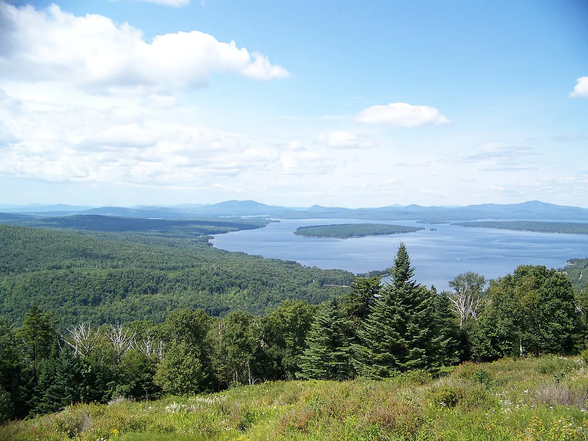
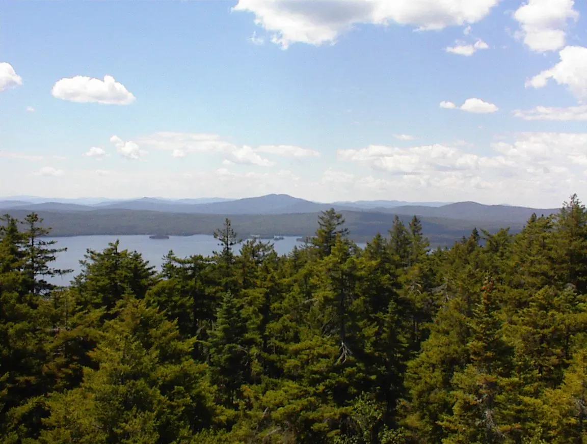
The reward is proportional to the effort. From the open ledges along the Bemis Ridge, you look down over Mooselookmeguntic Lake and across the entire Rangeley Lakes chain. On clear days the views extend to the Bigelow Range, Saddleback, and beyond. The ridge itself is classic Maine AT terrain: spruce and fir forest, exposed granite, blowdowns, and long stretches of solitude.
The Route
Most hikers approach from the south, starting at Route 17 near the Height of Land scenic overlook. The trail climbs steeply from the road through mixed forest before reaching the first views on the ridge. From there, the AT follows the ridgeline north over Bemis Mountain’s three peaks: the main summit at 3,592 feet, Second Peak, and Third Peak. The trail alternates between scrubby spruce corridors and open ledges with views in multiple directions.
The full traverse ends at Bemis Road, a gravel logging road south of Oquossoc. You will need a car shuttle or a second vehicle at the far end. Some hikers choose to hike in from Bemis Road and return the same way, cutting the mileage roughly in half but still gaining significant elevation.
This is a point-to-point hike that requires a car shuttle. Bemis Road is a rough gravel logging road accessible to most vehicles in summer but not always maintained. Check conditions locally before committing to the shuttle plan.
The Bemis Mountain Lean-to sits near the ridge between the second and third peaks. Many hikers split this into a two-day trip, camping at the lean-to and enjoying the sunset and sunrise views from the ridge. The lean-to is first-come, first-served and has a privy nearby.
The Views
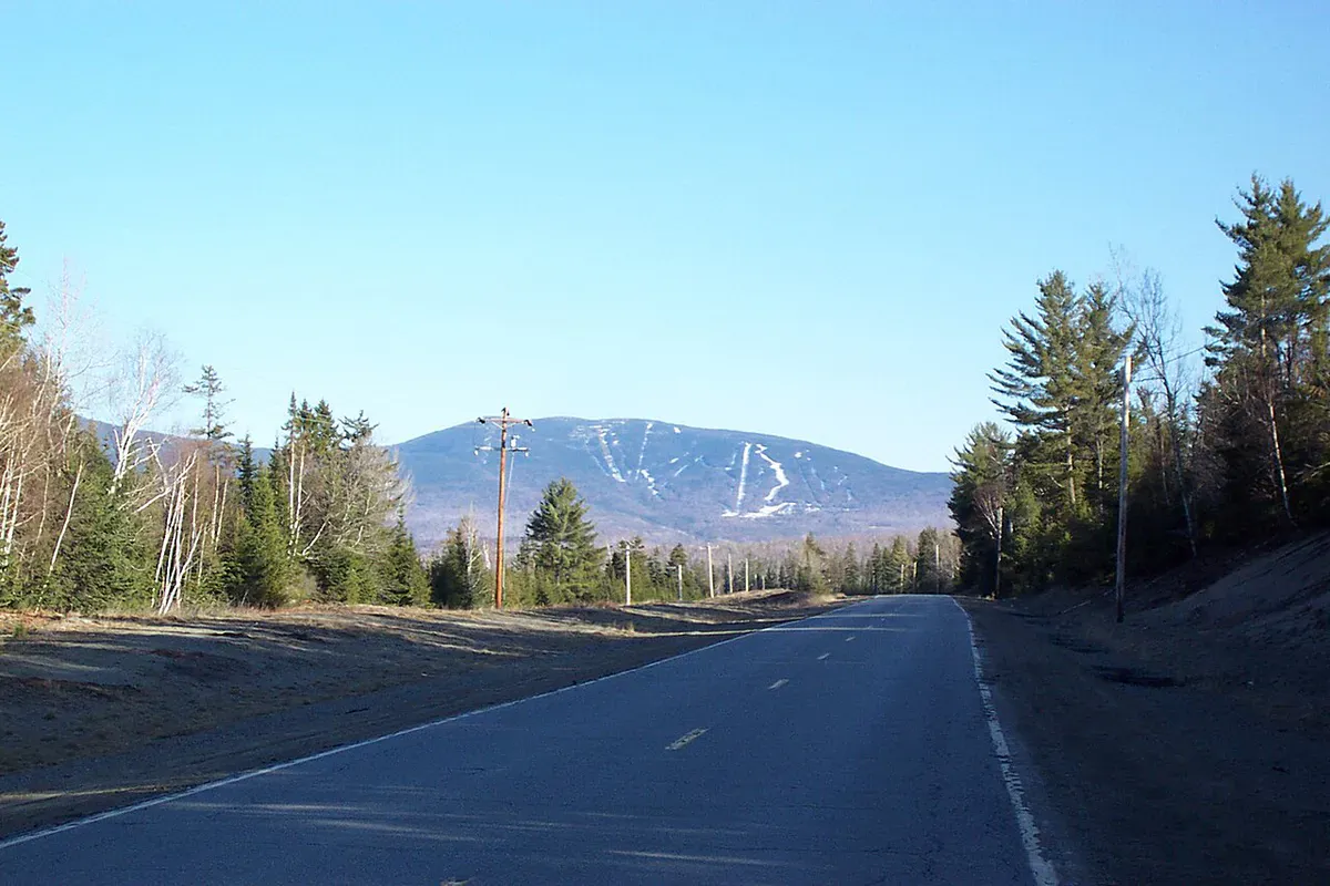
The open ledges on the main summit and along the ridge face south and west, giving you a panorama over Mooselookmeguntic Lake, the largest of the Rangeley Lakes. On clear autumn days, the lake is ringed by color and the water catches the light in a way that makes you stop walking and just look. To the east, you can pick out Saddleback Mountain and its ski trails. To the south, Old Blue and Elephant Mountain mark the continuation of the AT toward Andover.
The Height of Land overlook on Route 17, near the southern trailhead, is one of the most photographed viewpoints in Maine. Even if you do not hike the full ridge, the overlook alone is worth the drive.
When to Go
Spring
Snow lingers on the ridge into May. Mud season makes the approach trail soggy. Black flies arrive in late May.
Summer
Long days allow the full traverse. Bring plenty of water as there are limited sources on the ridge. Bug spray essential through July.
Fall
Peak foliage in late September lights up the lakes below. Cool air, clear views, and fewer bugs make this the ideal window.
Winter
Requires snowshoes or skis, winter camping experience, and careful planning. Beautiful but committing.
Late September is the standout. The hardwood slopes below the ridge turn gold and red while the spruce along the summit stays dark green. The contrast over the blue lake is spectacular.
Practical Notes
Many AT thru-hikers consider the Bemis Ridge one of the harder stretches in Maine south of the 100-Mile Wilderness. The footing is rough, the ups and downs are relentless, and the ridge is exposed to weather. Do not underestimate this hike based on mileage alone. The terrain makes every mile feel longer than it is.
There is no cell service anywhere on the ridge or at either trailhead. The nearest town with services is Oquossoc, about 20 minutes from Bemis Road, or Rangeley, about 30 minutes. Fill up on gas and supplies before heading in.
Water is scarce on the ridge itself. There are a few seasonal streams in the cols between peaks, but they can dry up in late summer. Carry at least three liters per person.
Bemis Mountain Day Hike
- 3+ liters of water per person (limited sources on ridge)
- Lunch and plenty of snacks for a long day
- Map and compass or GPS (no cell service)
- Rain gear and a warm layer for exposed ridge
- Trekking poles (steep and rocky terrain)
- Bug spray May through July
- Headlamp in case the day runs long
- Car shuttle plan or second vehicle at Bemis Road
Getting There
The southern trailhead is on Route 17, about 10 miles south of Oquossoc, at or near the Height of Land overlook. Look for the white AT blazes and a small parking pulloff. The northern terminus is on Bemis Road, a gravel road accessible from Route 16 south of Oquossoc. From Portland, the drive to Route 17 takes about 2 hours and 45 minutes through Farmington and Rumford. From Bangor, it is a similar distance via Route 2 West.
FAQ
How long does the Bemis Mountain traverse take?
Most strong hikers need 8 to 10 hours for the full 11-mile traverse. The terrain is rough and the elevation gain is sustained. Many hikers split it into two days using the Bemis Mountain Lean-to.
Do I need a car shuttle?
Yes, for the full traverse. The hike starts on Route 17 and ends on Bemis Road about 20 minutes away by car. You can also do an out-and-back from either end to avoid the shuttle.
Is the trail well marked?
Yes. The route follows the white-blazed Appalachian Trail the entire way. Navigation is straightforward in good visibility, but the ridge can be disorienting in fog.
Can I camp on the ridge?
The Bemis Mountain Lean-to is located on the ridge between the second and third peaks. It is free and first-come, first-served. Tenting is also possible near the lean-to. Leave No Trace rules apply.
Is this hike good for beginners?
No. The Bemis Ridge is a full-day or overnight effort with significant elevation gain, exposed ridge walking, rough footing, and no easy bailout points. It is best suited for experienced hikers comfortable with remote backcountry terrain.
For more in the area, see our guides to Mooselookmeguntic Lake, Bald Mountain in Rangeley, and Saddleback Mountain.