A Steep Little Peak North of Greenville
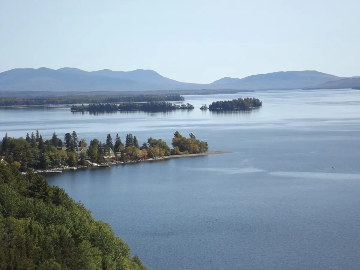
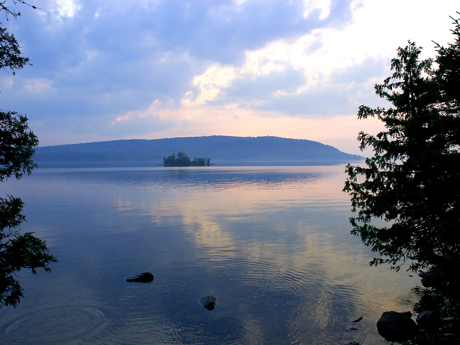
Number 4 Mountain stands in Frenchtown Township in the woods northeast of Greenville and the Kokadjo crossroads, deep in Moosehead Lake country. At 2,890 feet it is not a giant, but the trail does not waste much time getting to the top, and the open ledges near the summit pay off the effort with broad views over the surrounding forest, ponds, and the long shoulder of nearby Baker Mountain.
The round trip runs roughly 4.2 miles out and back, with about 1,480 feet of climbing. The first mile or so eases upward through young forest and a series of bogs, then the trail turns serious and gains most of its elevation in a short, steep stretch. The summit area once held a fire tower; today the open ledges are the draw.
The Trail
From the trailhead the path meanders gently for the first stretch, crossing boggy ground on the way to the base of the real climb. Then it pitches up, gaining several hundred feet quickly over rough, rooty, sometimes ledgy footing. Take your time on the steep section, especially when it is wet, because the rock can be slick.
Up top, the ledges open to the north and west. On a clear day you can pick out Moosehead’s expanse to the southwest and a sweep of unbroken North Woods in every other direction. It is a quiet summit; this is not a peak that draws crowds.
Icy trails & winter hiking
The Baker Mountain Extension
Strong hikers can continue past the summit toward Baker Mountain (3,528 feet) on a trail extension. Be honest with yourself about the commitment: the full out-and-back to Baker and back runs close to 14 miles, Baker’s summit is wooded with limited views, and the terrain between the two is rugged. Most day hikers are well served by turning around at Number 4’s ledges.
This is remote country with no cell service and active logging roads on the approach. The steep upper trail is slick when wet and the footing is rough throughout. Carry a paper or offline map, start early enough to be down before dark, and tell someone your plan. If you attempt the Baker traverse, treat it as a long, full-day backcountry effort, not a casual add-on.
The drive in uses gravel logging roads off the Lily Bay Road corridor past Kokadjo. Conditions change with logging activity and weather, so ask locally in Greenville about current road status before you commit, and yield to log trucks. A higher-clearance vehicle makes the approach more comfortable.
When to Visit
Spring
Muddy approach roads and boggy lower trail. Black flies arrive in May and the steep section can hold ice early.
Summer
Trail and roads are at their best, though bugs persist in the woods. Good views on clear days.
Fall
Cool, bug-free hiking and North Woods foliage from the ledges. The standout season here.
Winter
Logging roads go unplowed. Reaching the trailhead in winter is impractical for most.
Packing List
Number 4 Mountain
- Sturdy boots with good traction for slick ledge
- Paper or downloaded offline map (no cell service)
- 2 liters of water minimum
- Bug spray for the boggy lower trail
- Warm layer and shell for the open summit
- Headlamp in case the day runs long
- Extra food if you are eyeing the Baker extension
- Trash bag to pack everything out
Getting There
From Greenville, follow the Lily Bay Road north toward Kokadjo, then continue on the gravel logging roads that branch toward the Number 4 Mountain trailhead in Frenchtown Township. Road conditions vary with logging and weather, so confirm the current route locally in Greenville before heading out. Greenville is about an hour and 45 minutes north of Bangor and roughly four hours from Portland.
FAQ
How long is the Number 4 Mountain hike?
About 4.2 miles round trip with roughly 1,480 feet of elevation gain. Plan on two and a half to three hours of hiking, plus the gravel-road drive.
Is it a hard hike?
Moderate overall, but the upper section is steep and rough, gaining most of the elevation quickly. Wet rock makes the steep part slick.
Can you continue to Baker Mountain?
Yes, a trail extension runs to Baker Mountain, but the full out-and-back is close to 14 miles and Baker's summit is wooded. Treat it as a long, full-day backcountry trip.
Is there still a fire tower?
No standing tower to climb; the summit area once held a fire tower and now offers open ledges with the views.
How do you get to the trailhead?
Via gravel logging roads off the Lily Bay Road north of Greenville and Kokadjo. Conditions change, so check locally and yield to log trucks.
For another remote peak in this region, see Number 5 Mountain near Jackman or Big Spencer Mountain above Moosehead.