A Fire Tower in the Far Woods
Number 5 Mountain rises southwest of Jackman in the kind of country where the hardest part of the hike is getting to the trailhead. The 3,183-foot summit sits in the Leuthold Forest Preserve, a roughly 17,000-acre tract that The Nature Conservancy assembled from former timberland. The peak separates Attean Pond and the Moose River to the north from Spencer Lake and Stream to the south, and its open ledges still hold an intact fire tower erected in 1933.
The trail itself is short and well graded for a remote North Woods peak, climbing through forest before emerging onto ledgy summit rock. Most parties make the round trip in two to three hours of walking once they are out of the truck. The catch is everything that comes before the walking.
The Drive Is the Crux
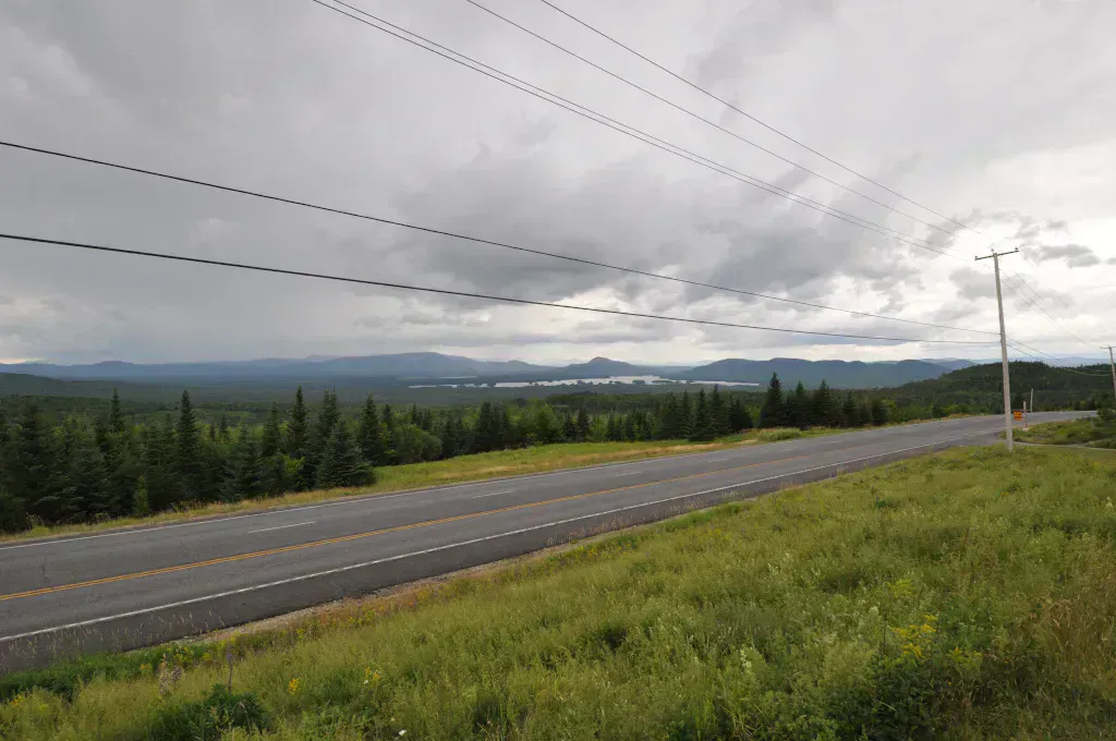
Getting to the trailhead means roughly 17 miles of gravel logging road off Route 201. From Jackman, you follow the Spencer Road (also signed as Hardscrabble Road) about 16.6 miles to a small Nature Conservancy trail sign. Most vehicles should park there and walk the final half mile up a rough jeep track to the trail kiosk rather than risk the last rocky stretch.
These are active logging roads with no services, no cell signal, and log trucks that have the right of way. Carry a paper map or a downloaded offline map, top off your fuel in Jackman, and bring a spare tire you trust. Tell someone your plan before you go. Do not climb the old fire tower; The Nature Conservancy warns it is not safe to ascend.
Night hikes & camping
The Climb and the View
From the kiosk the path stays in the woods, gaining a little over 1,100 feet across about 2.9 miles to the summit. The grade is steady rather than brutal, a forgiving pitch for a mountain this remote. Near the top the trees give way to open ledge, and the fire tower marks the high point.
The reward is a wide North Woods panorama: Attean Pond and the Moose River country to the north, the Spencer Lake basin to the south, and ridgelines running off toward Canada and the Bigelow Range. On a clear day this is one of the best big views in the Jackman area, and because the drive scares off casual visitors, you may well have it to yourself.
Go in late September or early October for the foliage and to dodge the worst of the bugs. Spring and early summer in this country mean serious black flies and mosquitoes, and the logging roads can stay soft and rutted well into June.
When to Visit
Spring
Roads are muddy and rutted into June, and bugs are at their worst. Snow can linger on the upper mountain.
Summer
Roads firm up and the trail is in good shape, though black flies and mosquitoes persist in the woods.
Fall
Crisp air, fewer bugs, and North Woods foliage. The best window for the long drive and the open summit.
Winter
The logging roads are unplowed and effectively impassable. This is not a winter trailhead.
Packing List
Number 5 Mountain
- Paper map and a downloaded offline map (no cell service)
- Full tank of gas and a reliable spare tire
- Sturdy hiking boots for ledge and root
- 2 liters of water minimum
- Bug spray, heavy on it in spring and summer
- Warm layer and a shell for the exposed summit
- Headlamp in case the drive runs long
- Food and trash bag to pack out
Getting There
From Jackman on Route 201, turn onto the Spencer Road (Hardscrabble Road) and follow it roughly 16.6 miles to the marked Nature Conservancy trailhead. Park at the sign and walk the last half mile up the jeep track to the kiosk. Jackman is about two and a half hours north of Bangor and around four hours from Portland via Route 201 through Bingham and The Forks. Fuel and supplies are limited past Jackman, so stock up there.
FAQ
How hard is Number 5 Mountain?
The hike is moderate and short, a little over 1,100 feet of gain across roughly 2.9 miles each way. The real difficulty is the long gravel-road drive to the trailhead.
Can a regular car reach the trailhead?
Most vehicles can drive the Spencer Road to the trail sign at about mile 16.6, then park and walk the final rough half mile. Higher clearance makes the drive easier and safer.
Is there a fee?
No. The Leuthold Forest Preserve is owned by The Nature Conservancy and there is no trail fee.
Can you climb the fire tower?
No. The Nature Conservancy warns visitors not to climb the old tower. Enjoy the open ledges around it instead.
Is there cell service?
No. There is no signal at the trailhead or on the road. Carry a paper or offline map and tell someone your plan.
For another remote Moosehead-region peak, see Number 4 Mountain near Greenville.