Maine’s Forgotten Wilderness
Deboullie Public Lands is one of Maine’s best-kept secrets, a 21,871-acre block of state-managed wildland in the far northern reaches of Aroostook County. The landscape here was sculpted by the last ice age, and it shows. Glacial ponds, boulder fields, ice caves that hold frost into August, and a geological diversity that makes this place unlike anywhere else in the state. It is also one of the most remote camping areas you can drive to in Maine.
The area centers on Deboullie Pond, Pushineer Pond, and several smaller water bodies tucked into a landscape of rocky ridges and boreal forest. The terrain is dramatic, Deboullie Mountain itself is a striking volcanic remnant that rises sharply from the pond shore. At the base of the mountain’s talus slopes, ice caves formed in the jumbled rock persist cold enough to hold ice well into summer, a geological oddity that draws the curious few who know about it.
Getting here requires commitment. Deboullie is accessed via logging roads from the St. John Valley, and the drive from the nearest town of Eagle Lake takes about 45 minutes on rough, unpaved roads. There are no services, no ranger stations, and no cell signal. But for those willing to make the journey, the reward is wilderness camping at its most raw and beautiful, pristine ponds, solitude, and a night sky untouched by light pollution.
The Campground
“Campground” is a generous term. Deboullie has approximately 20 primitive campsites scattered around Deboullie Pond and Pushineer Pond. Each site is a cleared spot in the forest with a fire ring, and some have picnic tables. That is the full extent of the amenities. There are no toilets, no water spigots, no dumpsters, and no electricity. You carry in everything you need and carry out everything you produce.
The sites vary in quality and setting. The best are on the pond shores, where you can pull a canoe up to your campsite and fall asleep to the sound of loons. Others are set back in the forest along the logging road. First-come, first-served is the only system. There are no reservations and no fees. You simply drive in, find an open site, and set up.
Water must be filtered from the ponds. The ponds are clean but not treated, and giardia is present in Maine’s backcountry water. A quality water filter is not optional here. It is essential. Pack out all trash, bury human waste at least 200 feet from water, and leave no trace. This is public land managed for conservation, and maintaining its wildness depends on every camper treating it with respect.
The sites on the south shore of Deboullie Pond, near the base of Deboullie Mountain, are the most scenic and give you direct access to the ice caves trail. Arrive by midday on summer weekends to have your pick, by late afternoon, the best lakeside sites may be taken.
Things to Do
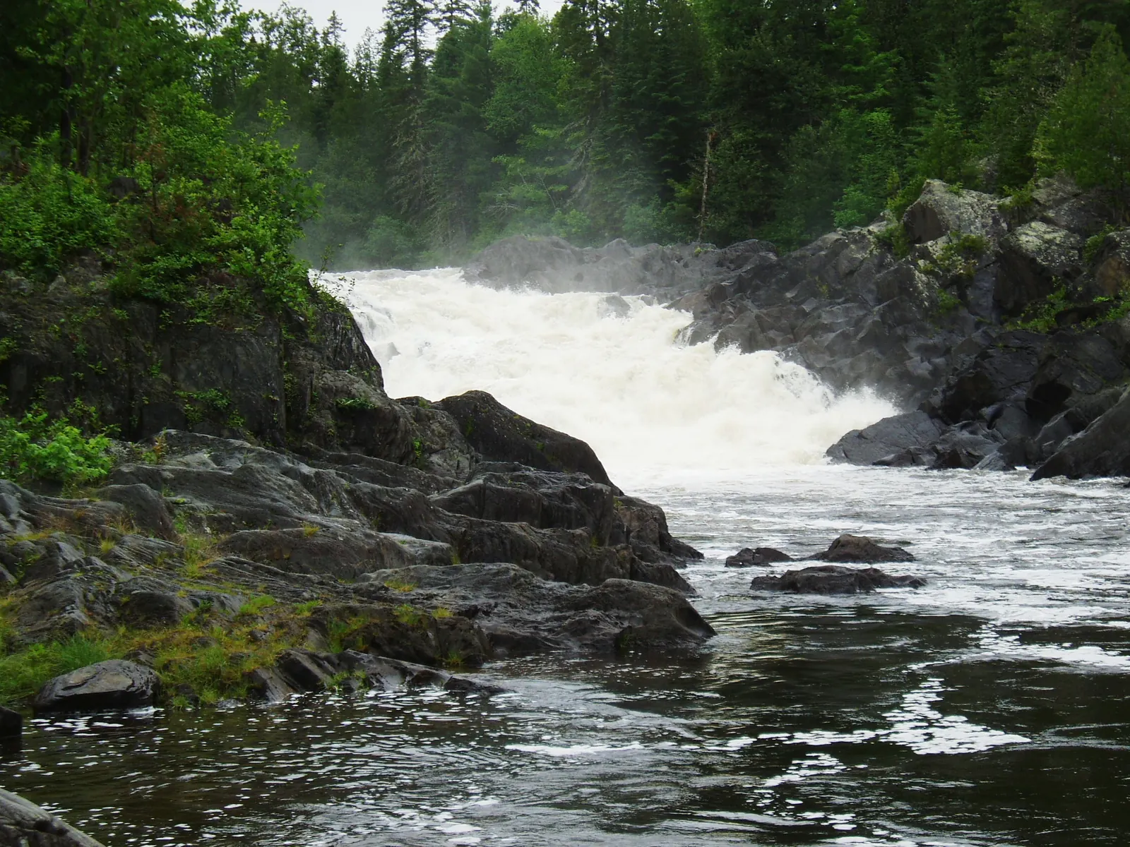
Deboullie Mountain is a 1.5-mile hike from the pond shore to a summit at 1,981 feet. The trail is steep but short, passing through mossy boreal forest before emerging onto rocky ledges with panoramic views of the pond system and the vast, unbroken forest of northern Aroostook. On clear days, you can see into Canada. The ice caves at the base of the mountain’s talus slope are worth exploring, temperatures inside stay near freezing even in summer, and ice formations persist into August.
Fishing is the other major draw. Deboullie Pond, Pushineer Pond, Gardner Pond, and several other water bodies in the unit hold native brook trout and landlocked salmon. The fishing is excellent, particularly in spring and early summer. Fly fishing from a canoe at dawn is productive and peaceful. You need a Maine fishing license and should follow catch-and-release practices to preserve the fishery.
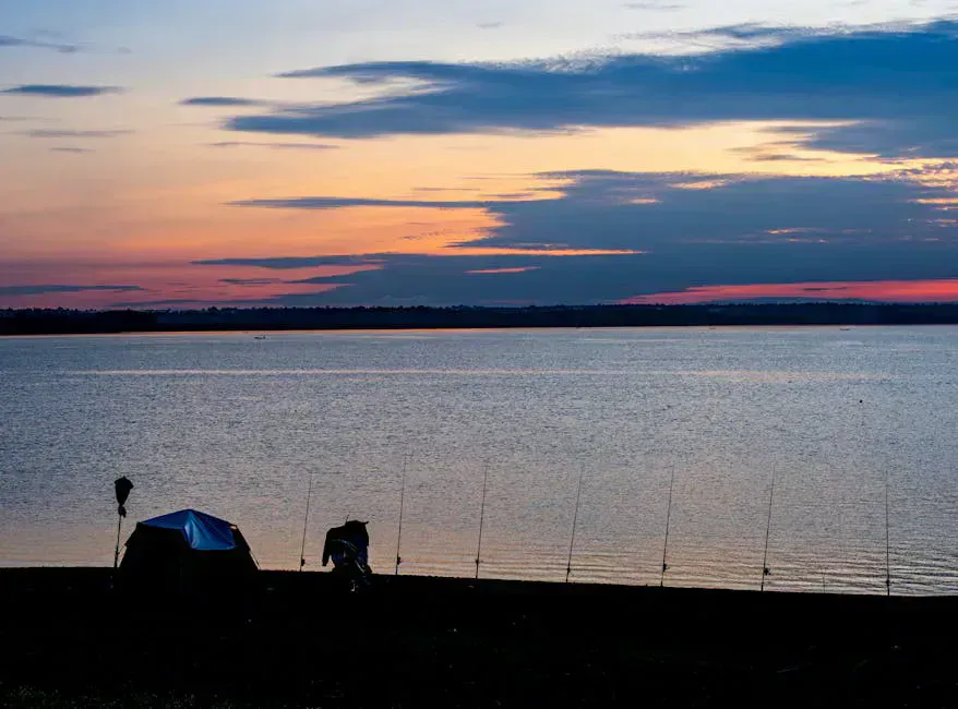
Paddling the ponds is a highlight in itself. Deboullie Pond covers about 200 acres of clear, deep water surrounded by unbroken forest. On a calm morning, the reflections are extraordinary, and wildlife, loons, osprey, moose, beavers, is abundant. Bring your own canoe or kayak; there are no rentals.
The access roads to Deboullie are active logging roads. Logging trucks have the right-of-way and do not always slow down. Drive with headlights on, pull over for oncoming trucks, and carry a full-size spare tire. Road conditions vary seasonally, spring mud can make the roads impassable until late May or early June.
When to Go
Spring
Roads may be gated or impassable until late May. Black flies are brutal through mid-June. Fishing is excellent once ponds ice out.
Summer
July and August offer the best overall conditions. Warm days, swimmable ponds, and the ice caves are at their most accessible. Mosquitoes taper by late July.
Fall
September foliage is spectacular in the boreal forest. Nights are cold but bugs are gone. Roads remain open through October.
Winter
Roads are not maintained and deep snow makes access extremely difficult. Only experienced winter campers with proper gear should consider it.
Getting There
From Eagle Lake on Route 11, take the Red River Road west. Follow signs for Deboullie Public Lands, the roads are logging roads maintained to varying degrees. The last section requires crossing a checkpoint gate (no fee) and navigating roughly 10 miles of gravel road to the pond area. A high-clearance vehicle is recommended. Total drive from Eagle Lake is about 45 minutes.
From Bangor, the drive is approximately four hours via I-95 north to Route 11. From Portland, plan six to seven hours. The nearest gas station and services are in Eagle Lake or Fort Kent, so fill up before you head in. There is nothing at Deboullie, no camp store, no emergency services, nothing.
The ice caves are not well-signed. From the south shore campsites, hike toward Deboullie Mountain and look for the talus field, a jumbled mass of boulders at the mountain’s base. The caves are openings in the talus where cold air sinks and persists. Bring a headlamp to explore the deeper recesses where ice formations last into August. Watch your footing, the rocks are slippery.
Deboullie Primitive Camping Packing List
- Tent with full rainfly and bug mesh
- 25-degree sleeping bag (northern Maine nights are cold)
- Water filter, no potable water available
- Camp stove and extra fuel (no camp store nearby)
- Canoe or kayak (no rentals available)
- Life jacket and paddle
- Fishing rod, flies, and Maine license
- Trash bags for pack-out waste
- Full-size spare tire for logging roads
- Bug spray and head net (essential June-July)
FAQ
Is camping at Deboullie really free?
Yes. Deboullie Public Lands is managed by the Maine Bureau of Parks and Lands, and the primitive campsites are free to use on a first-come, first-served basis. No reservations, no fees, no permits.
Do I need a special vehicle?
A high-clearance vehicle is recommended but not always strictly necessary. The logging roads are rough and have potholes, rocks, and washboard sections. Low-clearance sedans may struggle, especially after rain.
Are there bears?
Yes. Black bears are present throughout northern Maine. Hang your food from a tree at least 10 feet high and 4 feet from the trunk, or use a bear canister. Never store food in your tent.
Is there cell service?
No. There is zero cell service at Deboullie or anywhere in the surrounding area. The nearest signal is in Eagle Lake or Fort Kent, over 20 miles away.
Can I bring my dog?
Yes. Dogs are allowed on Maine Public Lands. Keep them under control, pick up waste, and be aware of wildlife, especially moose, which can be aggressive toward dogs.