Maine’s Largest and Most Remote Waterfall
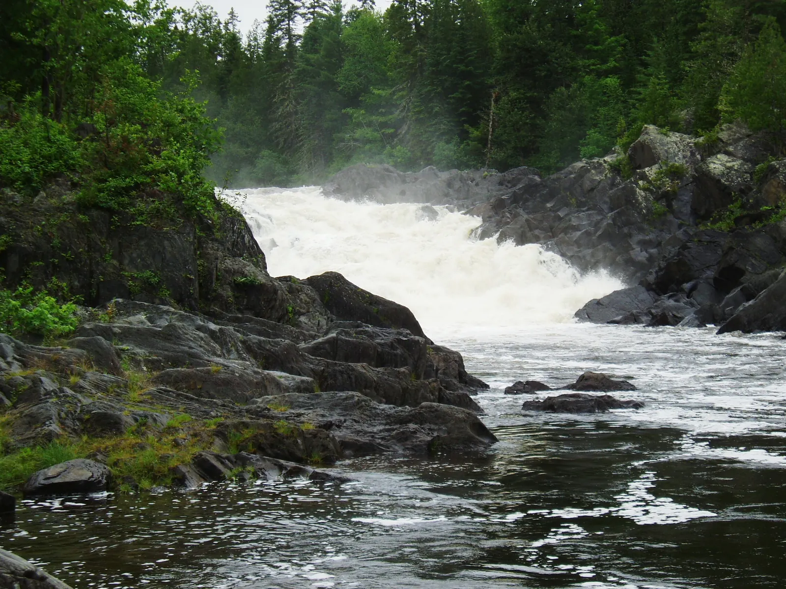
Grand Falls on the St. John River is the largest waterfall by volume in Maine and one of the most remote significant waterfalls in the eastern United States. Located in T14R16 WELS, deep in the unorganized territories of northern Aroostook County, the falls drop roughly 40 feet in a sweeping horseshoe shape that invites comparison to a miniature Niagara. At peak spring flow, the volume of water pouring over the lip is enormous, and the roar carries for more than a mile through the surrounding spruce forest.
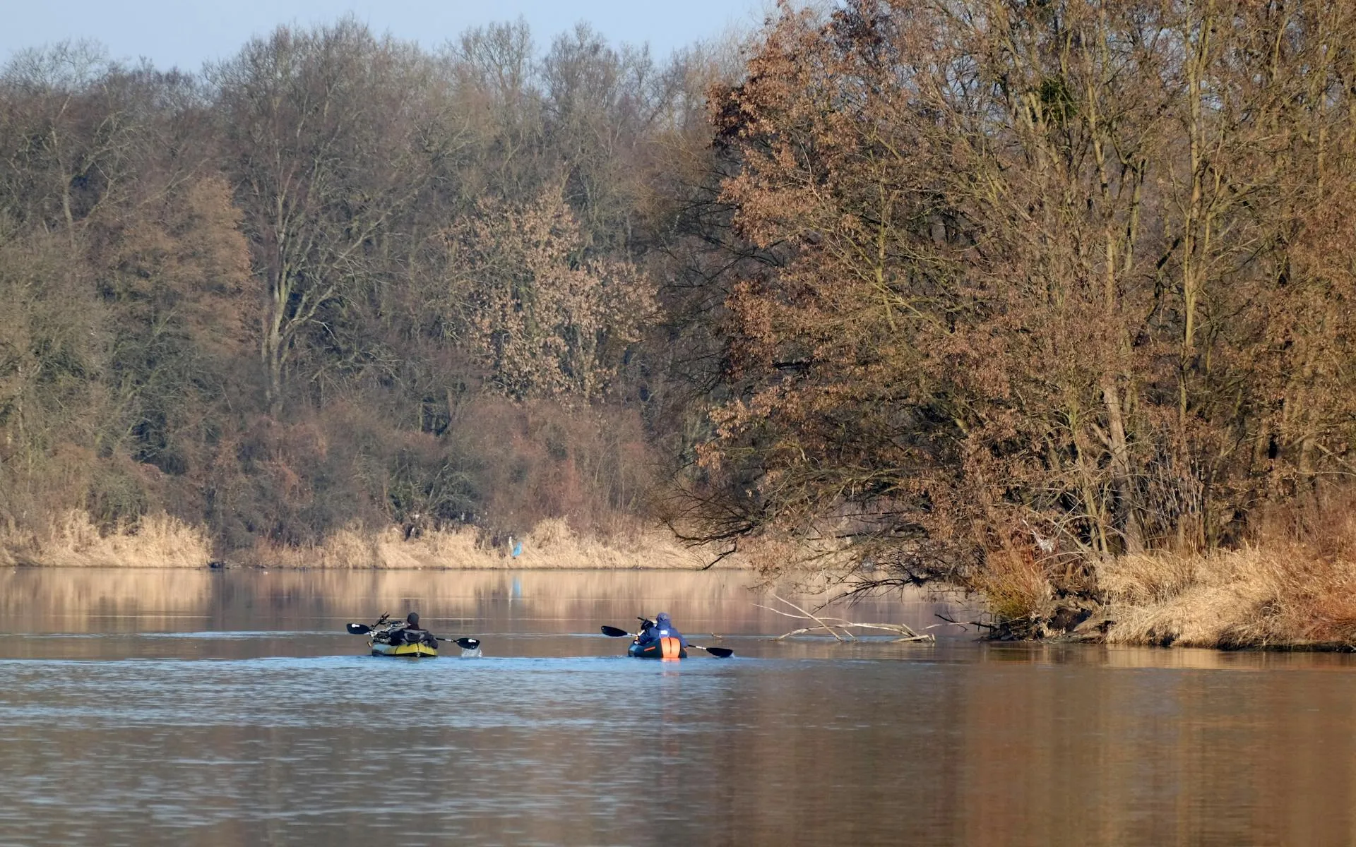
Getting to Grand Falls requires serious effort. There are no paved roads within 20 miles. The traditional approach is by canoe on the St. John River, which makes Grand Falls a highlight of one of the premier multi-day wilderness canoe trips in the Northeast. The alternative is a long drive on remote logging roads followed by a rugged hike through the woods. Either way, you earn this waterfall.
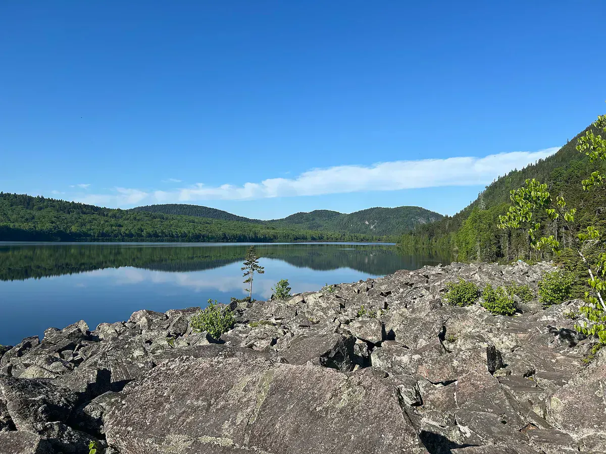
The St. John River at this point is already a substantial waterway, having collected flow from dozens of tributaries across the vast North Maine Woods. The river is roughly 150 feet wide above the falls, and the entire volume funnels over a horseshoe-shaped ledge of volcanic rock. Below the falls, the river churns through a gorge of dark rock before settling into a deep pool. The setting is completely wild: unbroken boreal forest stretches in every direction, with no buildings, no power lines, and no evidence of human presence beyond an occasional logging road.
Grand Falls is in one of the most remote locations in the eastern United States. There is no cell service, no nearby roads, and no rescue infrastructure. The nearest hospital is in Fort Kent, over 50 miles away on rough logging roads. If you are approaching by canoe, the falls represent a mandatory portage with serious consequences if missed. If hiking in, carry emergency supplies and leave a detailed trip plan with someone at home.
Approaching by Canoe
The classic way to see Grand Falls is as part of a multi-day canoe trip on the St. John River, one of the last free-flowing rivers in the Northeast. The standard trip covers roughly 60 miles from Baker Lake or Fifth St. John Pond downstream, with Grand Falls appearing on day two or three depending on pace.
The portage around Grand Falls is mandatory and not optional. The falls are lethal. The portage trail runs about a third of a mile along the north bank. It is well-worn but rough, with exposed roots and a steep descent back to the river below the falls. Lining or running the falls has killed canoeists and is never appropriate.
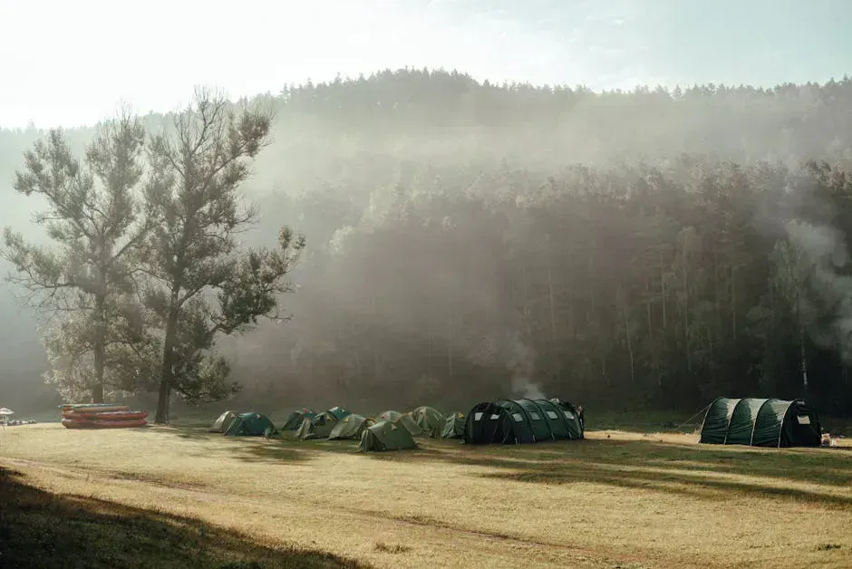
The best camping near Grand Falls is on the flat ground above the north bank, where a cleared area provides room for several tents. The campsite offers a view of the falls and the gorge below. Staying a night here to experience the falls at different times of day is one of the great camping experiences in Maine, provided you carry reliable backcountry camping gear and a water filter to treat river water for the trip.
Grand Falls is at its most spectacular during spring runoff, typically late May through early June. The St. John River is uncontrolled by dams at this point, so its flow depends entirely on snowmelt and rainfall. In a good spring, the volume over the falls is staggering. By late summer, the flow drops dramatically, and in dry years the falls can shrink to a fraction of their spring power.
Approaching by Land
For those who do not want to commit to a multi-day canoe trip, Grand Falls can be reached by vehicle and foot. Drive the network of private logging roads from the Allagash or St. Francis area to within a few miles of the falls. The final approach is on foot through the woods, roughly two to three miles depending on the road conditions and how far you can drive.
The logging roads are private and may be gated. A North Maine Woods day-use fee (currently about $10-15 per person) is required. Road conditions change frequently depending on logging activity. Contact North Maine Woods Inc. for current road information before making the drive.
The hike from the nearest drivable road to the falls is unmarked and follows old logging tracks and game trails. GPS navigation is essential. Do not attempt this approach without a topographic map, GPS device, and compass.
If driving in, call the North Maine Woods gatehouse at the Allagash or Six Mile checkpoint for current road conditions. Some roads are impassable after heavy rain or during spring breakup. The gatehouses can also tell you which roads are actively being logged, as logging trucks have the right of way and the roads are narrow.
When to Go
Spring
Peak flow from snowmelt. Late May and early June offer the most spectacular volume. Cold water, black flies, and muddy conditions.
Summer
Easier access. Warmer conditions. Water flow drops significantly by August. Best for the hiking approach.
Fall
Low water reduces the falls to a shadow of their spring power. Beautiful foliage. Cold nights.
Winter
Access roads are closed. Deep snow. The falls partially freeze but are not safely accessible.
Late May through June is the only time to see Grand Falls at its best. The uncontrolled St. John River depends entirely on snowmelt, and the difference between spring and late-summer flow is dramatic. If you are making the effort to reach these falls, time your visit for spring.
Packing List
Grand Falls Expedition
- Topographic map and GPS device (no cell service for navigation)
- Compass as backup navigation
- Water filter or purification tablets
- Bug spray and head net (black flies in June are severe)
- Rain gear and warm layers (weather changes fast in the North Woods)
- Camera with extra batteries (no charging opportunities)
- First aid kit with emergency supplies
- Food for the full duration of your trip plus one extra day
- Emergency communication device (satellite messenger recommended)
- Bear-proof food storage (hang or canister)
Getting There
Grand Falls is in T14R16 WELS, Aroostook County. The nearest village is Allagash, on Route 161, approximately 50 miles from Fort Kent. From Allagash, private logging roads penetrate south into the St. John River watershed. The drive from Allagash to the nearest road access to Grand Falls takes one to two hours on rough gravel roads.
From Bangor, the drive to Allagash is roughly 4.5 hours via Interstate 95 to Houlton, then Route 1 to Fort Kent, and Route 161 west to Allagash. From Portland, expect 7 hours.
For canoe approaches, the standard put-in is at Baker Lake or Fifth St. John Pond, both reached by logging roads from the Allagash area.
GPS coordinates for Grand Falls: 47.0580, -69.1420
FAQ
How tall is Grand Falls?
Grand Falls drops approximately 40 feet in a horseshoe-shaped cascade. It is not the tallest waterfall in Maine, but it is the largest by volume, carrying the entire flow of the St. John River over the drop.
Can I drive to Grand Falls?
You cannot drive directly to the falls. The nearest drivable road is 2-3 miles away on private logging roads. From there, an unmarked hike through the woods is required. GPS navigation is essential. The alternative is a multi-day canoe trip on the St. John River.
Is Grand Falls worth the effort to reach?
If you value remote, unspoiled wilderness and want to see one of the most powerful natural features in the eastern United States, yes. At peak spring flow, Grand Falls is an awe-inspiring sight. At low summer flow, the impact is diminished.
Can I swim at Grand Falls?
Swimming at the base of Grand Falls is extremely dangerous due to powerful currents, recirculating hydraulics, and cold water. The gorge below the falls is not safely accessible. Do not enter the water near the falls.
Do I need a permit?
Access through private timberlands requires a North Maine Woods day-use fee, currently about $10-15 per person. No additional permit is required. Register at the gatehouse when entering the road system.