Maine’s Boldest Coastline
The Cutler Coast Trail traverses the most dramatic stretch of coastline in Maine. The full Fairy Head Loop covers 9.7 miles through the Cutler Coast Public Reserved Land, a 12,234-acre tract of protected wilderness managed by the Maine Bureau of Parks and Lands. The route follows the edge of the Bold Coast, where dark volcanic cliffs rise 100 feet or more straight from the Atlantic, dropping into water so deep that whales swim within sight of the cliff tops.
This is the Maine coast stripped of postcards and gift shops. There are no lighthouses, no quaint harbors, no lobster shacks at the trailhead. There is only spruce forest, fog, cliff, ocean, and silence. The Bold Coast earned its name honestly: it is the most exposed and powerful section of the Atlantic seaboard in the northeastern United States, where storms from the open ocean hit the continent head-on.
The full loop is a serious day hike. At 9.7 miles with rough, root-covered terrain and about 800 feet of cumulative elevation change, it demands proper preparation. A shorter out-and-back option to the coast and back covers about 4 to 5 miles and gives you the cliff experience without the full loop commitment. Either way, this is a place that rewards the effort of getting here.
The Trail
The trailhead is on Route 191 about 4 miles south of the tiny village of Cutler. A gravel parking area holds 20 to 25 cars. A trail register at the kiosk logs hikers in and out.
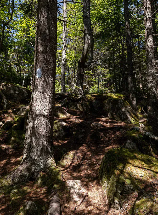
The trail enters a dense spruce-fir forest immediately. For the first 1.5 miles, the path heads generally south through the woods on a mix of packed dirt, exposed roots, and bog bridges. The forest is thick and quiet, the canopy filtering the light into shades of green and grey. In wet weather, the root-covered sections are slippery and demand careful foot placement.
At about 1.5 miles, the trail reaches the coast. The transformation is sudden and complete. The forest opens and you are standing at the edge of a cliff 80 to 100 feet above the Atlantic. The rock is dark volcanic basalt, fractured into columns and blocks. Waves crash against the base of the cliff in plumes of white spray, the sound echoing off the rock face. The view extends south and east to Grand Manan Island in New Brunswick, Canada.
The coastal section of the trail follows the cliff edge for about 2 miles, dipping into spruce headlands and emerging at viewpoint after viewpoint. Three cobblestone pocket beaches are accessible by short side trails, their rounded stones polished smooth by the surf. These beaches make excellent lunch spots and rest areas.
At Fairy Head, the trail’s southernmost point, you reach the most dramatic cliff in the preserve. The headland juts into the ocean with vertical walls on three sides and views that stretch to the open Atlantic. This is the turnaround point for the shorter out-and-back option.
The full loop continues from Fairy Head, turning inland and following an interior trail back through the forest to the parking area. This inland section is quieter and less dramatic than the coastal stretch, passing through mixed forest and crossing several small streams on log bridges.
Hike the loop clockwise, taking the coastal trail first and returning via the inland route. This puts the cliffs and ocean views in the first half of the hike when your energy is fresh and your legs are strong. The inland return is easier terrain for tired legs.
What You’ll See
The sea cliffs are the centerpiece. The dark basalt columns, some standing 100 feet above the churning ocean, create a landscape that looks more like Iceland or Scotland than the stereotypical Maine coast. In fog, which is common, the cliffs take on an almost otherworldly quality, with waves appearing and disappearing in the mist below.
The cobblestone beaches are distinctive to this stretch of coast. Rather than sand, the beaches are covered in rounded basalt cobbles, polished smooth by the surf. The stones range from fist-sized to basketball-sized, and walking on them requires balance and produces a satisfying clacking sound with each step. Some beaches also contain ancient sea stacks, isolated pillars of rock that have been separated from the cliff by erosion.
Whales are regularly spotted from the cliffs, particularly in summer and early fall. Humpback whales, minke whales, and finback whales feed in the nutrient-rich waters of the Bold Coast. Harbor seals haul out on the lower rocks, and harbor porpoises are frequently seen in the offshore waters. Bald eagles nest in the tall spruce along the coast, and puffins breed on Machias Seal Island offshore.
The spruce forest that covers the inland portions of the trail is classic Downeast boreal habitat: dense, dark, and teeming with birds during migration. Boreal chickadees, red crossbills, spruce grouse, and various warblers occupy the forest. The forest floor is carpeted with bunchberry, goldthread, and various mosses.
The cliff edges are unprotected and the rock can be loose and crumbly. Stay well back from the edge, especially in wet conditions or fog. The cliffs are 80 to 100 feet high with vertical drops to rock and surf below. A fall would be fatal. Cell service is nonexistent along the entire trail. The nearest medical facility is over an hour away. Carry a first aid kit and tell someone your plans before hiking.
When to Go
Spring
Trails are very wet and muddy through May. Blackflies are intense in June. Spring storms produce dramatic seas, but the trail can be miserable underfoot.
Summer
Fog is common but adds atmosphere. Whale watching from the cliffs is best July through September. Wildflowers bloom in the coastal meadows.
Fall
Clear dry days with less fog. Migrating birds and whales. Fewer bugs. The spruce forest stays green while mainland foliage peaks.
Winter
The trail is open but snow and ice on the root-covered sections make travel slow. Storm watching from the cliffs can be spectacular. Absolute solitude.
Getting There
From Portland, take I-95 north to Bangor, then Route 1A east to Ellsworth. Continue on Route 1 east through Machias to East Machias. Turn right onto Route 191 south toward Cutler. The trailhead parking area is on the left about 4 miles south of Cutler village. Total drive from Portland is about 5 hours.
From Bangor, take Route 1A to Route 1 east through Machias, then Route 191 south. About 2 hours 45 minutes.
The gravel parking lot holds 20 to 25 cars. It rarely fills even on busy summer weekends due to the remote location.
Plan your Cutler Coast hike as part of a Downeast weekend. Stay in Machias or Lubec and combine the Bold Coast with Quoddy Head, the easternmost point in the United States. The two hikes together give you the definitive Downeast coastal hiking experience. Stock up on food and water in Machias because there are no services in Cutler.
Packing List
- Waterproof hiking boots (trail is wet and rooty)
- 2-3 liters of water (long trail, no water sources)
- Lunch and snacks for a full-day hike
- Rain jacket and layers (fog and rain are common)
- Bug spray (essential May through July)
- Map of the Cutler Coast trail system
- First aid kit
- Trekking poles for rocky and rooty terrain
- Binoculars for whales and seabirds
- Camera for cliff scenery
FAQ
How long does the full Fairy Head Loop take?
Plan for 5 to 7 hours for the full 9.7-mile loop, including time for lunch and exploring the coast. Some hikers take all day. The shorter out-and-back to the cliffs takes 2.5 to 3.5 hours.
Is there a shorter option than the full loop?
Yes. Hike 1.5 miles to the coast, explore the cliff section, and return the way you came. This 4 to 5-mile out-and-back gives you the best views without the full loop distance.
Can I camp on the Cutler Coast?
Yes. There are three designated primitive campsites along the coastal trail. Camping is free, first-come first-served, and limited to designated sites. No campfires are allowed.
Is there cell service on the trail?
No. There is no cell service anywhere along the Cutler Coast Trail or in much of the surrounding area. Plan accordingly and tell someone your itinerary.
Are the cliffs as dramatic as they look in photos?
More so. Photos cannot capture the scale of the cliffs, the sound of the waves hitting the rock, or the feeling of standing 100 feet above the open Atlantic with nothing between you and Europe. It is one of the most powerful landscapes on the East Coast.