Downeast Maine’s Overlooked Coastal Preserve
Great Wass Island Preserve is one of the finest and least-visited nature preserves on the Maine coast. Managed by The Nature Conservancy since 1978, the 1,540-acre preserve protects a remarkable landscape at the southern tip of Great Wass Island in the town of Beals, connected to the mainland by a bridge through Jonesport. The 4.8-mile loop trail passes through coastal raised peat bogs, stands of jack pine found nowhere else this far south on the Atlantic coast, dense spruce forest, and a wild, rocky shoreline where the Downeast coast meets the open Gulf of Maine.
This is not a trail for everyone. The terrain is rough, the footing is often wet and uneven, and the island’s remote location in Washington County means you are a long drive from anywhere. Cell service is nonexistent. The nearest hospital is over an hour away. But for hikers who want to experience the wild, uncontrived beauty of the Downeast coast without another soul in sight, Great Wass Island is as good as it gets.
The preserve protects one of the most ecologically significant landscapes in Maine. The combination of maritime fog, poor acidic soils, and extreme exposure to Atlantic storms has created plant communities found almost nowhere else in the continental United States. Botanists come from across the country to study the bake-apple berry (cloudberry), the coastal plateau bogs, and the jack pine stands that thrive here.
The Trail
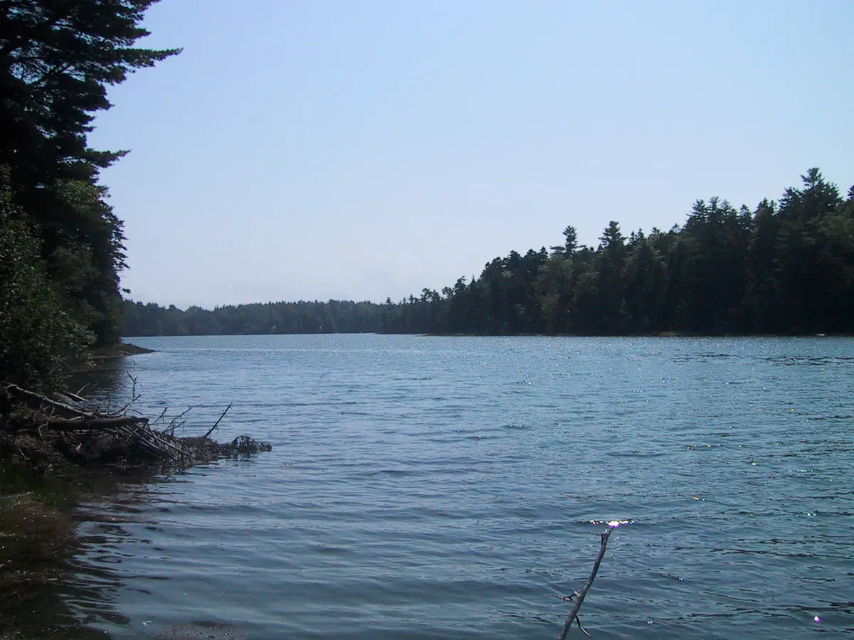
Two trails form a loop through the preserve. The Mud Hole Trail departs from the parking area and heads south through dense spruce-fir forest before reaching the eastern shore. The Little Cape Point Trail heads southwest to the western shore. Most hikers walk the loop clockwise, starting on the Mud Hole Trail and returning via Little Cape Point.
The Mud Hole Trail follows a narrow, root-covered path through the forest for about a mile before reaching the first peat bog. Wooden boardwalk sections cross the wettest areas, but the boards can be slippery and some are deteriorating. The bog itself is extraordinary: a raised peat plateau covered in sphagnum moss, sundews, pitcher plants, bake-apple berry, and rhodora. In June, the rhodora blooms in brilliant pink, transforming the bog into a garden.
Beyond the bog, the trail continues through jack pine woodland. These are Maine’s southernmost jack pines on the Atlantic coast, stunted and wind-sculpted trees that rarely exceed 20 feet in height. The forest floor is carpeted with reindeer lichen, giving the landscape an almost arctic appearance.
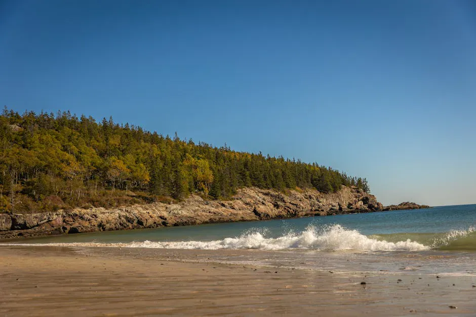
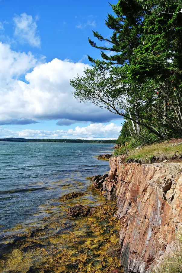
At Mud Hole, the trail reaches the coast. The shoreline here is a jumble of dark volcanic rock, smoothed and fractured by waves, with deep tidal channels and cobblestone pocket beaches. The trail follows the coast south to a headland where the view opens to the outer islands and the open Gulf of Maine. On clear days, you can see to Petit Manan Island and its lighthouse.
The return via the Little Cape Point Trail follows the western shoreline before turning inland through more spruce forest and bog. The trail is less well-defined in spots and requires attention to blue trail blazes. The full loop typically takes 3 to 4 hours.
Wear waterproof hiking boots, not trail runners. The trail is wet in sections year-round, and the boardwalk crossings through the bogs are often partially submerged. Expect wet feet at some point regardless of your footwear. Gaiters help.
What You’ll See
The coastal raised peat bogs are the ecological highlight. These bogs receive all their water from precipitation rather than groundwater, creating acidic conditions that support a unique community of plants. Sundews and pitcher plants are carnivorous species that supplement the poor soil nutrients by capturing insects. Bake-apple berry (cloudberry) produces amber-colored fruit in July that is highly prized in Scandinavian cuisine and nearly impossible to find in the United States outside of Downeast Maine and parts of Alaska.
The jack pine barrens look transplanted from northern Canada. Jack pine is a boreal species that typically grows hundreds of miles north of here. On Great Wass, the combination of thin, acidic soil, fog, and fire history has created conditions that allow it to persist at the extreme southern edge of its Atlantic range. Walking through these ghostly stands feels like stepping into the subarctic.
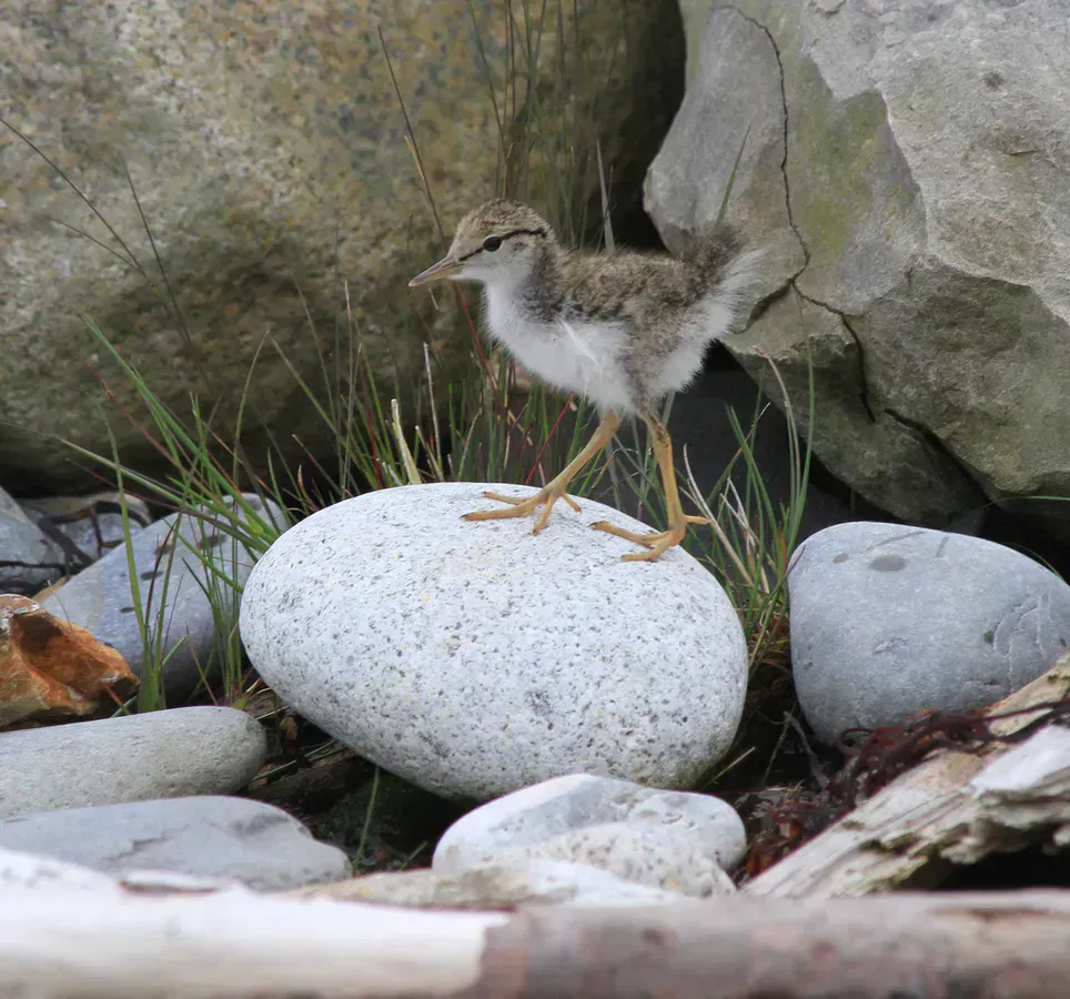
The rocky shoreline supports a rich intertidal community. Rockweed, kelp, blue mussels, sea urchins, and periwinkles cover the lower rocks. Harbor seals haul out on the outer ledges. Eider ducks raft in the coves. Bald eagles and ospreys patrol the coast. In migration season, warblers and sparrows move through the spruce forest in large numbers. The island’s isolation and diverse habitats make it an important birding destination.
Great Wass Island has no cell service, no restrooms, and no facilities of any kind. The trail can be difficult to follow in sections, especially along the coast where cairns mark the route over bare rock. Fog can roll in quickly and reduce visibility to near zero. Carry a map, compass, and all the water and food you need. The rocky shoreline is slippery and dangerous when wet. Stay well back from the water’s edge, as waves can surge unexpectedly.
When to Go
Spring
Rhodora blooms in June are spectacular. Trails are very wet. Blackflies and mosquitoes can be intense in May and June.
Summer
Bake-apple berry ripens in July. Fog is common. The coolest hiking conditions of any time. Fewer bugs than spring.
Fall
Fall colors in the bogs and forest. Clear days with excellent visibility. Trail is drier. Migrating birds in the forest and along the coast.
Winter
The preserve is open year-round. Trails can be icy and snow-covered. Solitude is complete. Wintering seabirds on the coast.
Getting There
From Portland, take I-95 north to Bangor, then Route 1A east to Ellsworth and Route 1 east to Jonesport. At Jonesport, cross the bridge to Beals Island, then follow the road through Beals village. Continue across a second bridge onto Great Wass Island and follow the road approximately 3 miles to the preserve parking area at the end. Total drive from Portland is about 4.5 hours.
From Bangor, take Route 1A to Route 1 east through Ellsworth and Machias to Jonesport. About 2 hours 15 minutes.
The parking area holds about 15 cars. It rarely fills due to the remote location.
Stop in Jonesport before or after your hike. The town is a working lobster port and one of the most authentic fishing villages on the Maine coast. You can buy fresh lobster directly from the fishermen at the dock. The area is also known for the annual Jonesport-Beals Lobster Boat Races held in July, the biggest event of the year in this corner of Downeast Maine.
Packing List
- Waterproof hiking boots (trail is wet)
- Gaiters for bog sections
- 2 liters of water (no water sources)
- Lunch and snacks for a 3-4 hour hike
- Rain jacket (fog and rain are common)
- Bug spray (essential in spring and early summer)
- Binoculars for seabirds and seals
- Map and compass (no cell service for GPS)
- Warm layers (coastal fog keeps temperatures cool)
- Camera for bog plants and coastal scenery
FAQ
How long does the Great Wass Island loop take?
Most hikers complete the full 4.8-mile loop in 3 to 4 hours, depending on how much time they spend exploring the coast and bogs.
Are dogs allowed on Great Wass Island?
No. The Nature Conservancy does not allow dogs on the Great Wass Island Preserve to protect the sensitive ecological communities.
Is the trail well-marked?
The trail is marked with blue blazes in the forest and cairns on the coast. Some sections, particularly along the shoreline, require attention. The trail can be easy to lose in fog.
What is bake-apple berry?
Bake-apple berry is the local Maine name for cloudberry (Rubus chamaemorus), a circumpolar berry that grows in peat bogs. It ripens in July, producing a tart, amber-colored fruit. Great Wass Island is one of the few places in the eastern United States where it grows.
Is Great Wass Island worth the long drive?
For hikers and naturalists who appreciate wild, uncommercialized landscapes, absolutely. It is one of the most ecologically unique places on the Maine coast. For casual hikers looking for a quick outing, the distance may not justify the trip.