Beaches at the Edge of the World
The pocket beaches of Cutler Coast Public Reserved Land are among the most remote and dramatic shoreline in Maine. They are not the kind of beaches where you lay out a towel and read a novel. They are cobblestone coves set into clefts between 100-foot sea cliffs, accessible only by hiking trails through dense spruce forest, on a stretch of coast known as the Bold Coast for good reason.
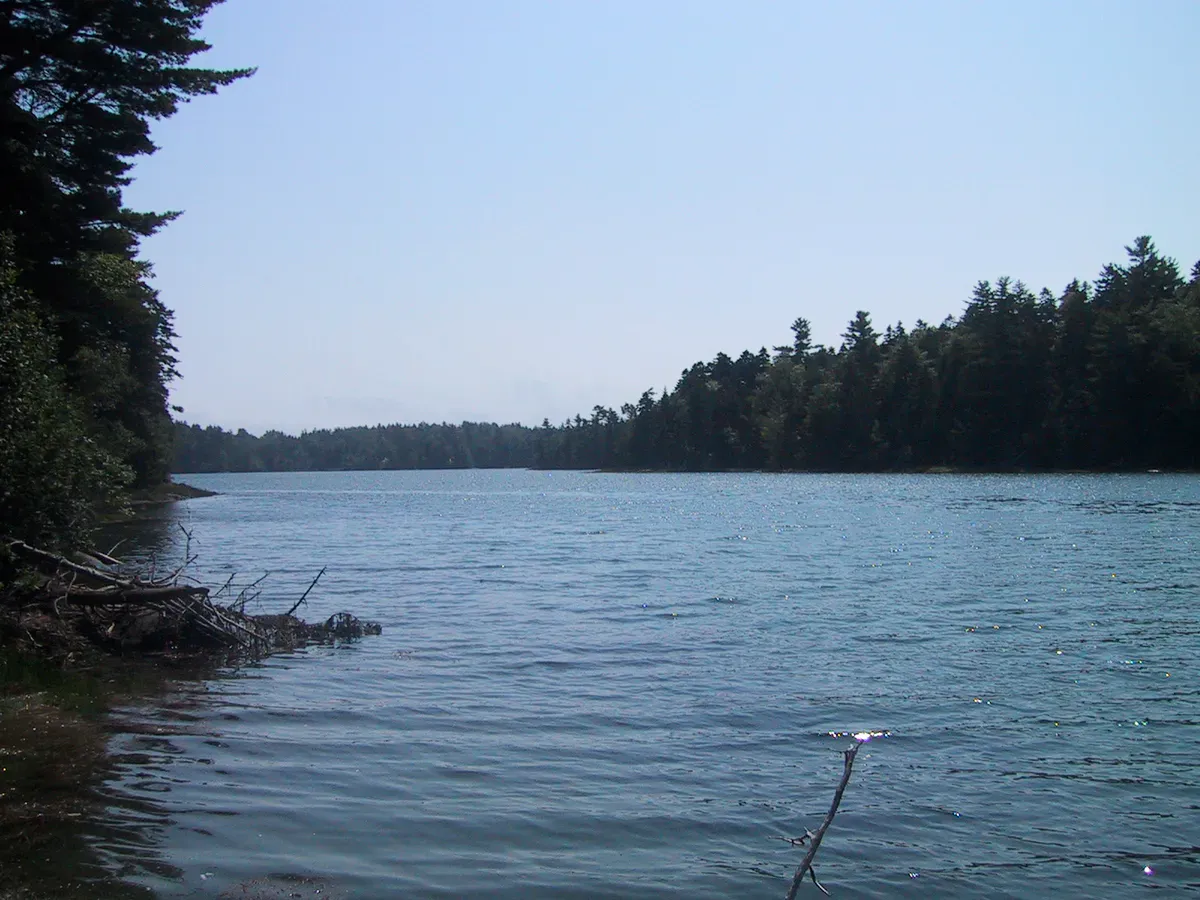
Cutler Coast covers 12,234 acres of headlands, peatlands, and spruce-fir forest along 4.5 miles of shoreline facing the Bay of Fundy. The land is managed by the Maine Bureau of Parks and Lands as public reserved land. There are no entrance fees, no buildings, no paved roads beyond the trailhead parking lot. Just trails, cliffs, cobblestone beaches, and some of the wildest coastal scenery east of the Rocky Mountains.
The pocket beaches appear where stream valleys meet the coast, creating small coves sheltered by rocky headlands. The largest and most accessible is Black Point Cove, reached by a 2.7-mile hike on the Coastal Trail. Others are scattered along the shore, some requiring scrambles down steep slopes to reach.
Black Point Cove
Black Point Cove is the primary beach destination on the Cutler Coast. The trail reaches it via the Black Point Brook Loop, a 5.4-mile round trip that takes five to six hours with time to explore. The beach is a crescent of smooth cobblestones in a protected cove, backed by spruce forest and flanked by rock headlands.
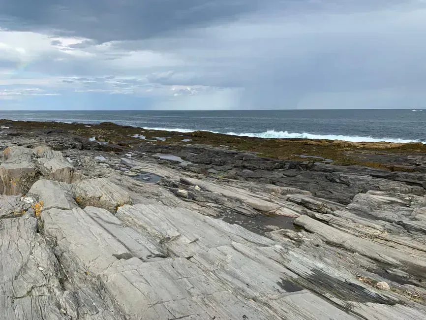
The stones are tumbled smooth by the tides, ranging from fist-sized to football-sized. The sound of waves washing over cobblestones is distinctive, a deep, rattling roar different from the hiss of sand beaches. At low tide, the cove expands and tide pools appear in the rock shelves.
Bring lunch and plan to spend time at Black Point Cove. The hike in is long enough that you want to enjoy the destination, so a comfortable daypack loaded with water, food, and layers is part of the plan. Sit on the cobblestones, watch the waves, and look for seals on the offshore rocks. This is not a place to rush.
A backcountry campsite sits above Black Point Cove, one of three designated campsites along the trail. Camping is first-come, first-served with a maximum of six people per site. Camping outside designated sites is prohibited.
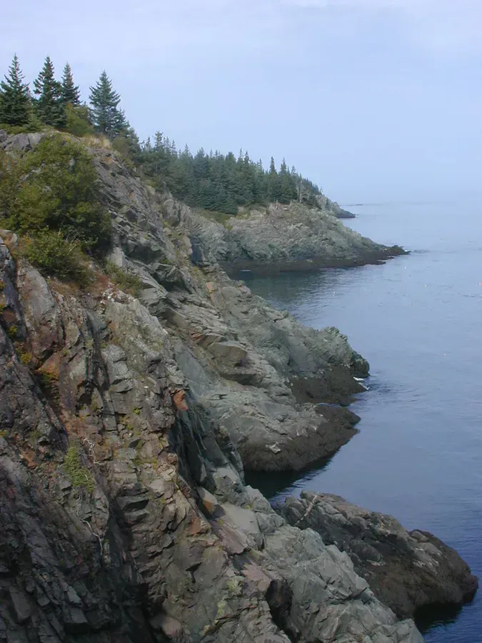
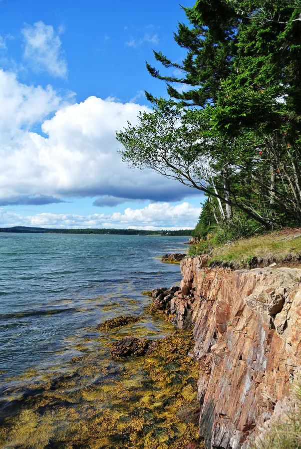
The Sea Cliffs
Between the pocket beaches, the Cutler Coast Trail follows the top of dramatic sea cliffs. The cliffs rise 60 to 100 feet above the water, with sheer drops to the churning ocean below. Stunted spruce trees cling to the cliff edges, shaped by decades of wind and salt spray into twisted, flag-like forms.
The cliff-top views run for miles. On clear days, you can see Grand Manan Island across the Bay of Fundy to the south, and the Machias Bay islands to the west. Bald eagles and peregrine falcons patrol the cliff line, and harbor seals haul out on the rocks below.
The sea cliffs are steep and unprotected. There are no guardrails or fences. The rock is often wet and slippery. Stay back from the edge, especially in fog or wet conditions. The drop is lethal.
The Trails
Three trail options reach the beaches and cliffs:
The Coastal Trail to Ocean Overlook is a 2.8-mile round trip through cedar swamp and spruce-fir forest to a promontory overlooking the ocean. This is the shortest option and does not reach the pocket beaches, but it provides cliff-top views.
The Black Point Brook Loop is a 5.4-mile round trip that reaches Black Point Cove and the cobblestone beach. Allow five to six hours. The trail passes through forest, along cliff tops, and descends to the cove.
The Fairy Head Loop is a 9.7-mile round trip that covers the most extensive shorefront hiking, with 3.4 miles along the coast. This reaches multiple pocket coves and the most dramatic cliff sections. Allow seven to eight hours.
The trail surfaces are rooty and rocky. Expect muddy sections, especially in spring and after rain. Wear sturdy boots, not sneakers, and a pair of trail-ready hiking boots with real tread pays off here. The footing is more challenging than the mileage suggests. Most hikers find the trails take longer than expected.
Practical Details
The trailhead parking lot is on Route 191, about 17 miles south of Machias. A large blue-and-white sign marks the entrance. The lot holds about 20 cars and is free. It can fill on summer weekends.
There are no restrooms, water, or facilities at the trailhead or along the trails. Bring everything you need and carry out all trash. Sign the trail register at the trailhead.
Dogs are generally permitted on trails and should be kept under control. Be respectful of other hikers and wildlife.
Cell service is nonexistent at the trailhead and along the coast. Do not rely on your phone for navigation. Download maps before you arrive or bring a paper map.
Swimming is not recommended. The water temperature is in the 40s even in summer, the cobblestone entry is steep and unstable, and the currents near the cliffs are strong.
When to Go
Spring
Trails muddy and buggy. Snow possible through April. Good for solitude.
Summer
Warmest and driest conditions. Long daylight. Parking lot fills weekends. Fog common.
Fall
Fewer hikers, crisp air. Fall color in the hardwoods. Best weather window is September.
Winter
Trails accessible but icy and exposed. Dramatic winter surf on the cliffs. Very cold. Short daylight.
Cutler Coast Essentials
- Sturdy hiking boots (rooty, rocky trails)
- Water (at least 2 liters, no sources on trail)
- Lunch and snacks (plan for a full day)
- Map (no cell service for GPS)
- Layers and windbreaker (exposed cliffs)
- Binoculars (seals, eagles, island views)
- Bug spray (blackflies in June, mosquitoes in July)
- Camera (sea cliffs and pocket beaches)
- Headlamp (if attempting the longer loops)
Getting There
From Machias, take Route 1 East to Route 191 South in East Machias. Follow Route 191 for about 17 miles through Cutler village. The trailhead parking lot is on the right, marked by a large blue-and-white sign. From Lubec, take Route 189 to Route 191 South. The trailhead is about 10 miles south on the left.
Cutler is a small fishing village with no services for hikers. Get gas and supplies in Machias before heading south. The drive from Bangor is about two hours and 10 minutes. From Portland, it is roughly five hours.
FAQ
Do you have to hike to reach the Cutler Coast beaches?
Yes. There is no road access to the shoreline. The closest beach, Black Point Cove, requires a 2.7-mile hike from the trailhead. The trails are moderate to strenuous.
Can you camp at Cutler Coast?
Yes. There are three designated backcountry campsites: Fairy Head, Long Point, and Black Point Cove. Sites are first-come, first-served with a maximum of six people per site. No fee and no permit required, but sign the trail register.
Is there cell service at Cutler Coast?
No. There is no cell service at the trailhead or along the trails. Download maps and inform someone of your plans before heading out.
How long is the hike to the pocket beaches?
The Black Point Brook Loop to the main cobblestone beach is 5.4 miles round trip, taking five to six hours. The Fairy Head Loop is 9.7 miles and reaches more of the coastline.
Can you swim at the Cutler Coast beaches?
Not practically. The water is in the 40s even in summer, the cobblestone entry is steep, and the currents near the headlands are strong. These are beaches for exploring and contemplating, not swimming.