A Hidden Gorge on the Appalachian Trail
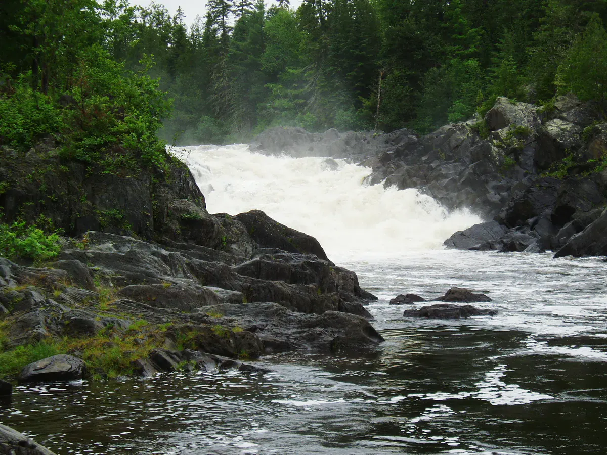
Little Wilson Falls is one of the most striking waterfalls in Maine, yet it remains far less visited than its statistics suggest it should be. The 57-foot cascade drops into a narrow gorge of vertically folded slate, creating a scene that feels more like Iceland than the Maine woods. The hike is short, roughly 1.5 miles each way, but follows a section of the Appalachian Trail through dense boreal forest, crossing Little Wilson Stream before arriving at the gorge rim.
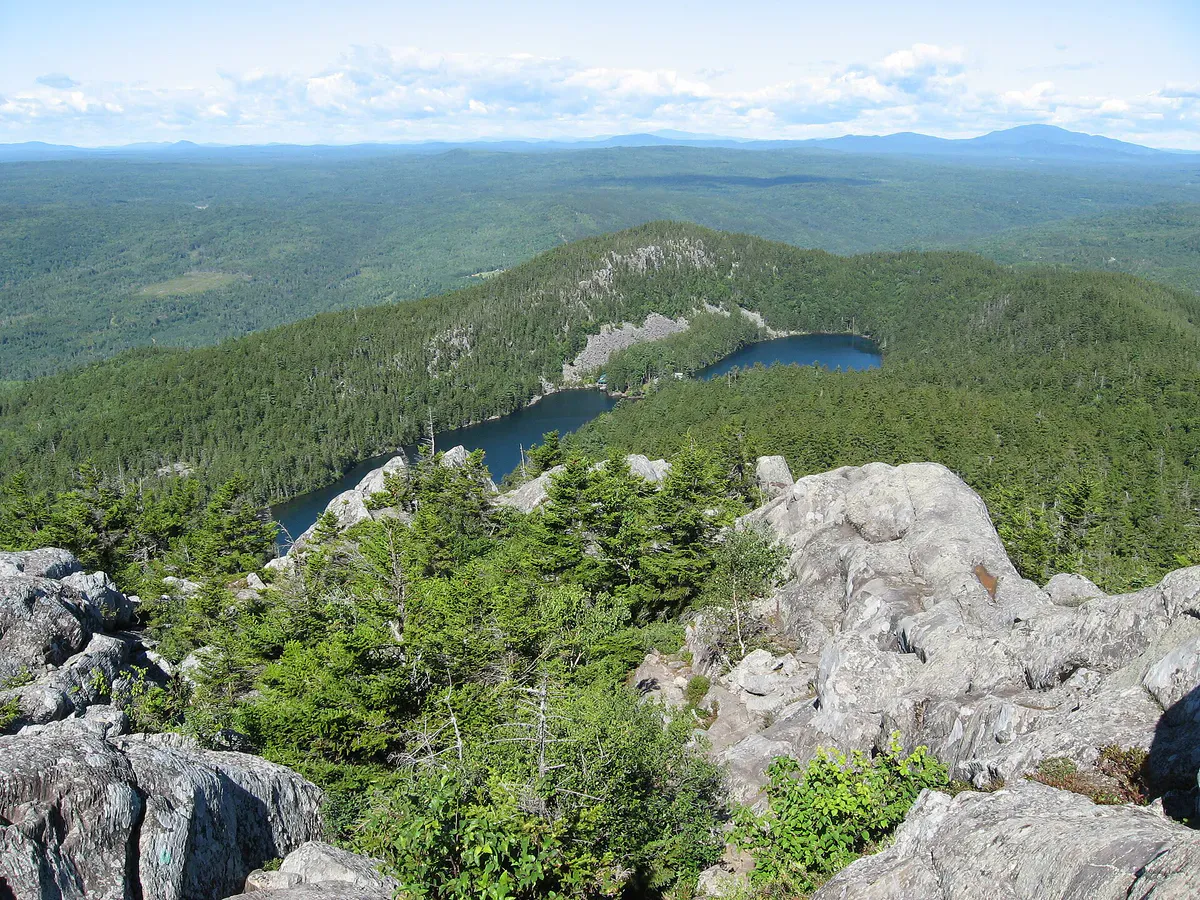
The falls sit just inside the southern boundary of the 100-Mile Wilderness, near the town of Monson. Monson itself is a key AT trailtown, the last resupply point for northbound thru-hikers before the final push to Katahdin. The Little Wilson Falls Trail is an excellent way to experience a taste of the 100-Mile Wilderness without committing to a multi-day backpacking trip.
The gorge below the falls extends for several hundred feet, with walls of dark Devonian slate rising 30 to 40 feet above the stream. The rock is folded and fractured at dramatic angles, and the water has carved smooth chutes and pools into the layered stone.
The Trail
The trailhead is on the Elliottsville Road, a few miles north of Monson. Parking is available at a small pulloff near the AT crossing. The trail follows the white-blazed Appalachian Trail northbound, descending gently through a forest of spruce, fir, and birch.
Within the first half-mile, you cross Little Wilson Stream on a series of stepping stones. This crossing is straightforward in summer but can be challenging during spring runoff, the stream runs fast and the rocks are slippery. If the water is high, consider water shoes for the crossing.
Beyond the stream crossing, the trail continues through mixed forest with some wet sections that can be muddy in spring. At roughly 1.2 miles, you begin to hear the falls. A spur trail on the left leads to the gorge rim, where the view opens up dramatically.
The falls themselves drop in two stages, an initial cascade over a ledge, then a longer free-fall into the gorge pool below. The slate walls are striated with bands of gray, green, and rust, folded at steep angles by the tectonic forces that built the Appalachian chain. Moss and ferns cling to every ledge where spray keeps the rock wet.
A rough scramble path leads down to the base of the gorge, where you can stand at the edge of the pool and look up at the falls from below. This scramble is steep and the rocks are slick, use caution and good judgment.
Continue downstream from the falls along the gorge rim trail. The slate canyon extends several hundred feet below the falls, with a series of smaller cascades, chutes, and swimming holes. The pools downstream are sheltered, warmer, and safer for swimming than the plunge pool directly below the main falls.
What You’ll See
The geology is the highlight. The slate here is part of the Seboomook Formation, Devonian-age sedimentary rock that has been tilted nearly vertical by ancient mountain-building events. The result is a series of thin, blade-like fins of rock that the stream has exploited and carved over millennia. The patterns in the rock, rippled layers, quartz veins, and iron-stained bands, tell a 400-million-year story.
The forest along the trail is typical of the 100-Mile Wilderness: dense boreal stands of balsam fir and red spruce in the upper elevations, transitioning to birch and maple near the stream. In spring, trillium and painted trillium bloom along the trail. In fall, the birch canopy turns brilliant gold against the dark spruce.
The stream holds native brook trout, and you may see them in the deeper pools. Warblers are abundant in spring migration, and hermit thrush song fills the forest in June and July.
The gorge rim is unfenced and the slate is extremely slippery when wet. The drop to the gorge floor is 30 to 40 feet in places. Stay well back from the edge, especially with children. The scramble to the base of the falls requires careful footing and is not suitable for everyone.
When to Go
Spring
Peak water flow in May and June makes the falls most impressive. The stream crossing can be difficult. Black flies are severe in June.
Summer
Lower water levels make the crossing easy and the swimming holes accessible. The falls are less dramatic but still beautiful.
Fall
Fall foliage along the stream and gorge is spectacular. Water levels are low, but the mix of fall color and dark rock stands out.
Winter
The falls partially freeze, creating dramatic ice formations. The trail is ungroomed and snowshoes are recommended. The stream crossing can be icy.
Getting There
From Monson, take the Elliottsville Road (also signed as Borestone Road) north for approximately 7 miles. The AT crossing and trailhead parking are on the right side of the road at a small pulloff. The road is paved but narrow.
From Bangor, take Route 15 west through Dover-Foxcroft to Guilford, then Route 6/15 north to Monson. Total drive time is about 1 hour 20 minutes. From Portland, take I-95 north to Newport, then Route 7/11 to Guilford and north to Monson. Total drive is about 3 hours 15 minutes.
Stop in Monson on your way back. This tiny AT trailtown has a surprising amount of character. Shaw’s Hiker Hostel is a legendary stop on the Appalachian Trail, and the town has a general store, a brewery, and a slate museum that documents Monson’s history as a quarrying center. The slate in the gorge at Little Wilson is the same formation that the town quarried for over a century.
Packing List
- Hiking boots with good traction
- Water shoes or sandals for the stream crossing
- Water bottle
- Camera
- Rain jacket
- Insect repellent (essential in June)
- Swimsuit for the downstream pools in summer
- First aid kit
- Snacks
- Trekking poles for the stream crossing
FAQ
How long does the Little Wilson Falls hike take?
Plan 1.5 to 3 hours for the round trip, depending on how much time you spend exploring the gorge and swimming holes.
Can I swim at Little Wilson Falls?
The pools downstream of the main falls are suitable for swimming in summer. Avoid the plunge pool directly below the falls, which has strong currents. Always test the depth before jumping.
Is this the same as Little Wilson Stream Falls?
Yes. The falls go by both names. They are located on Little Wilson Stream, a tributary of Wilson Stream.
Can I bring my dog?
Yes, dogs are welcome on the trail. Keep them leashed near the gorge rim and assist them at the stream crossing.
Is this trail part of the Appalachian Trail?
Yes. The trail to the falls follows a section of the AT. You may encounter thru-hikers, especially from June through September.