A Slate Gorge Gem
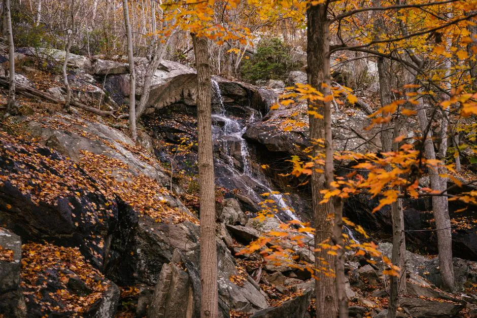
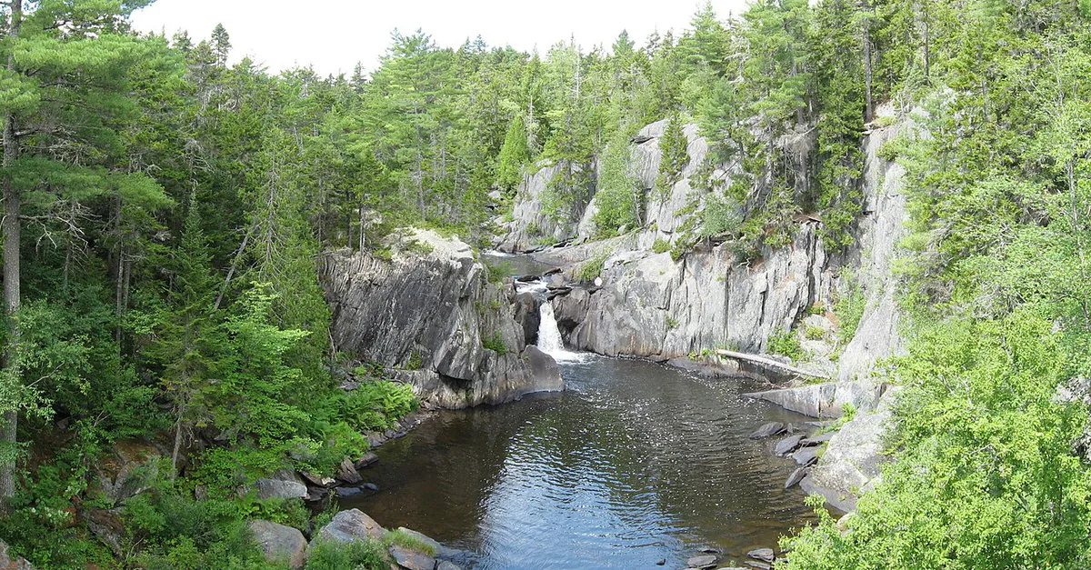
Big Wilson Falls is a powerful waterfall where Big Wilson Stream drops roughly 30 feet through a narrow gorge of layered slate in the town of Elliotsville, Piscataquis County. The falls are not the tallest in Maine, but the combination of the dramatic gorge, the dark banded slate, and the ease of access makes this one of the most rewarding waterfall visits in the Moosehead region.
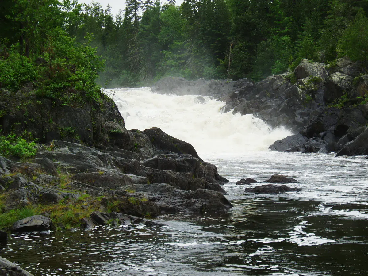
Big Wilson Stream drains a large watershed to the north and west, collecting flow from the hills around Borestone Mountain and the 100-Mile Wilderness section of the Appalachian Trail. By the time the stream reaches the falls, it is a substantial waterway with enough volume to be impressive even in late summer. In spring, the falls are thunderous.
The gorge at Big Wilson Falls has been carved through Devonian-age slate, roughly 400 million years old. The slate layers are tilted at a steep angle, creating the dramatic banded walls that frame the falls. The rock is dark gray to black, with occasional veins of white quartz cutting through. Moss and ferns cling to every ledge and crack, and the gorge stays damp and cool even on the hottest summer days.
The Appalachian Trail crosses Big Wilson Stream roughly a mile upstream from the falls. AT thru-hikers passing through this section in summer often make the short side trip to see the falls, and you may encounter hikers with trail-worn gear and thousand-mile stares at the trailhead.
Little Wilson Falls, one of the tallest waterfalls in Maine at roughly 57 feet, is located a few miles south of Big Wilson Falls on Little Wilson Stream. The two are close enough to visit in a single outing. Little Wilson Falls requires a longer hike (about 2 miles round trip) but is one of the most spectacular waterfalls in the state. Together, the two Wilson falls make an outstanding half-day waterfall trip.
The Walk to the Falls
The trailhead for Big Wilson Falls is on a gravel road off Route 11, south of Brownville Junction. From the small parking area, a trail leads roughly half a mile through mixed forest to the rim of the gorge. The trail is mostly flat with a short descent to the falls at the end.
At the gorge rim, you look down into the dark slot where the stream drops over the main falls and crashes into a deep pool. A rough path descends to the base of the gorge, where you can stand next to the pool and look up at the falls. The descent is steep and requires some rock scrambling, so hiking boots with sticky, lugged soles are worth their weight on the slick slate, but it is short and manageable for anyone in reasonable shape.
From the base of the falls, the gorge continues downstream for several hundred feet, with the stream flowing through a narrow channel between vertical slate walls. This lower section is worth exploring if the water level allows safe footing on the ledges.
The slate rocks around Big Wilson Falls are extremely slippery when wet, which is almost always. The layered nature of the slate means surfaces that look solid can flake apart underfoot. Wear shoes with good traction and take your time on the descent to the base of the gorge. A fall on wet slate can result in serious injury.
Swimming
The pool at the base of Big Wilson Falls is deep and cold, and it is a popular swimming hole for locals who know about it. The water is typically in the mid-50s to low 60s, cold enough to take your breath away but refreshing on a hot day. The pool is roughly 20 feet across and deep enough for swimming in the center.
Below the main pool, smaller pools in the gorge offer wading spots with less intense current. The smooth slate ledges around the pools provide natural seating and sunbathing spots when the sun reaches down into the gorge, which happens for a few hours around midday. The damp, sheltered gorge breeds mosquitoes well into summer, so pack bug and tick protection if you plan to linger.
Big Wilson Falls is well-known to locals in the Brownville Junction and Milo area but not heavily promoted in tourist guides. On weekdays, you will likely have the falls to yourself. Weekends in July and August may see a few other visitors, but it never gets crowded. If you want solitude at a beautiful waterfall, this is a reliable choice.
When to Go
Spring
Highest water flow. The falls are powerful and the gorge fills with mist. May and June offer the best volume. Muddy trail. Black flies.
Summer
Warm air. Good swimming conditions. Water flow is lower but still impressive due to the large watershed. Best light midday.
Fall
Foliage contrasts beautifully with the dark slate. Moderate water. Cooler temperatures keep the gorge comfortable.
Winter
Accessible with snowshoes. Ice formations on the gorge walls are dramatic. Dangerous footing on icy slate.
Spring is the best time for sheer waterfall power. Summer offers the most comfortable conditions for swimming and gorge exploration. Fall foliage against the dark slate is striking. Winter ice formations are beautiful but the gorge is treacherous.
Packing List
Big Wilson Falls Visit
- Sturdy shoes with good traction (slippery slate)
- Camera (the gorge is extremely photogenic)
- Swimsuit and towel for the plunge pool
- Water bottle and snacks
- Bug spray (mosquitoes in the sheltered gorge)
- Rain jacket (the gorge stays damp)
- Warm layer (gorge is cool even on hot days)
- Headlamp if exploring deeper into the gorge
Getting There
From Brownville Junction, take Route 11 south for approximately 7 miles. Turn west onto a gravel road (look for a small sign or cairn marking the turn). Follow the gravel road for about 1.5 miles to the parking area. The road is rough but passable for most vehicles.
From Bangor, take Route 11 north through Milo to Brownville Junction, about 1 hour 15 minutes. From Portland, the drive is about 3.5 hours via Interstate 95 to Newport, then Route 7 north to Dexter and Route 11 north.
GPS coordinates for Big Wilson Falls: 45.3870, -69.4920
FAQ
How tall is Big Wilson Falls?
Big Wilson Falls drops approximately 30 feet through a narrow slate gorge. The falls are a combination of a vertical drop and a steep cascade, with the water compressed through a narrow channel in the rock.
Can you swim at Big Wilson Falls?
Yes. The pool at the base of the falls is deep enough for swimming. The water is cold (mid-50s to low 60s) but refreshing in summer. Several smaller pools in the gorge downstream offer wading.
Is Big Wilson Falls near the Appalachian Trail?
Yes. The Appalachian Trail crosses Big Wilson Stream roughly a mile upstream from the falls. AT hikers often visit the falls as a side trip. The trail is in the 100-Mile Wilderness section.
How does Big Wilson Falls compare to Little Wilson Falls?
Big Wilson Falls is shorter (30 feet vs. 57 feet) but wider and more powerful due to the larger stream. Little Wilson Falls is taller and more dramatic as a single drop. Both are excellent and close enough to visit together.
Is there cell service at Big Wilson Falls?
No. There is no cell service at the falls or in the surrounding area. Download maps before you go and let someone know your plans.