Ledge Views Toward Acadia, Twenty Minutes from Bangor
Peaked Mountain rises to 1,160 feet in the town of Clifton, about 25 minutes east of Bangor on Route 9, the Airline Road. Locals know it as Chick Hill, one of a pair of hills (Big and Little Chick) that sit along the corridor between Bangor and Downeast Maine. The hike is roughly 1.5 miles to the summit with about 800 feet of elevation gain, and the open ledges near the top deliver views that stretch east toward the hills of Acadia National Park and south across the blueberry barrens and forests of eastern Maine.
This is the best moderate day hike within easy reach of Bangor. It is short enough for an after-work outing, interesting enough for experienced hikers, and the views from the ledges rival many longer hikes in the region.
The Trail
The trailhead is off Route 9 (Airline Road) in Clifton. A logging road, marked as Fire Road 32, serves as the initial approach. Follow the road past the turnoff for Little Peaked Mountain (the smaller of the two Chick Hills) until you reach utility pole 18, where the footpath turns into the woods on the right.
From there, the trail climbs steadily through mixed forest. The lower section is moderate, winding through hardwoods and softwoods on a well-worn path. As you gain elevation, the trail steepens and the forest opens up. The upper section crosses exposed ledge with some steep, loose rock that requires attention, especially on the descent.
The summit area has a cell tower and access road. Some hikers use the cell tower road as an alternate route, which is longer but less steep. The road approach adds about a mile but avoids the steepest scrambling.
The turn from the logging road onto the trail at utility pole 18 is not well marked. Download a map before you go, as cell service is inconsistent along Route 9. If you reach the cell tower access road without turning off, you have gone too far on the logging road.
The Views
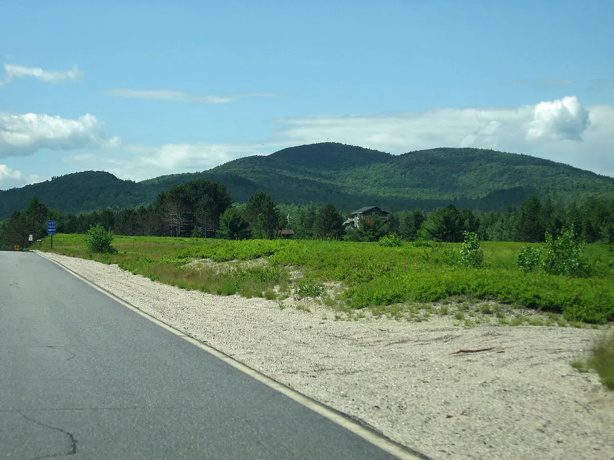
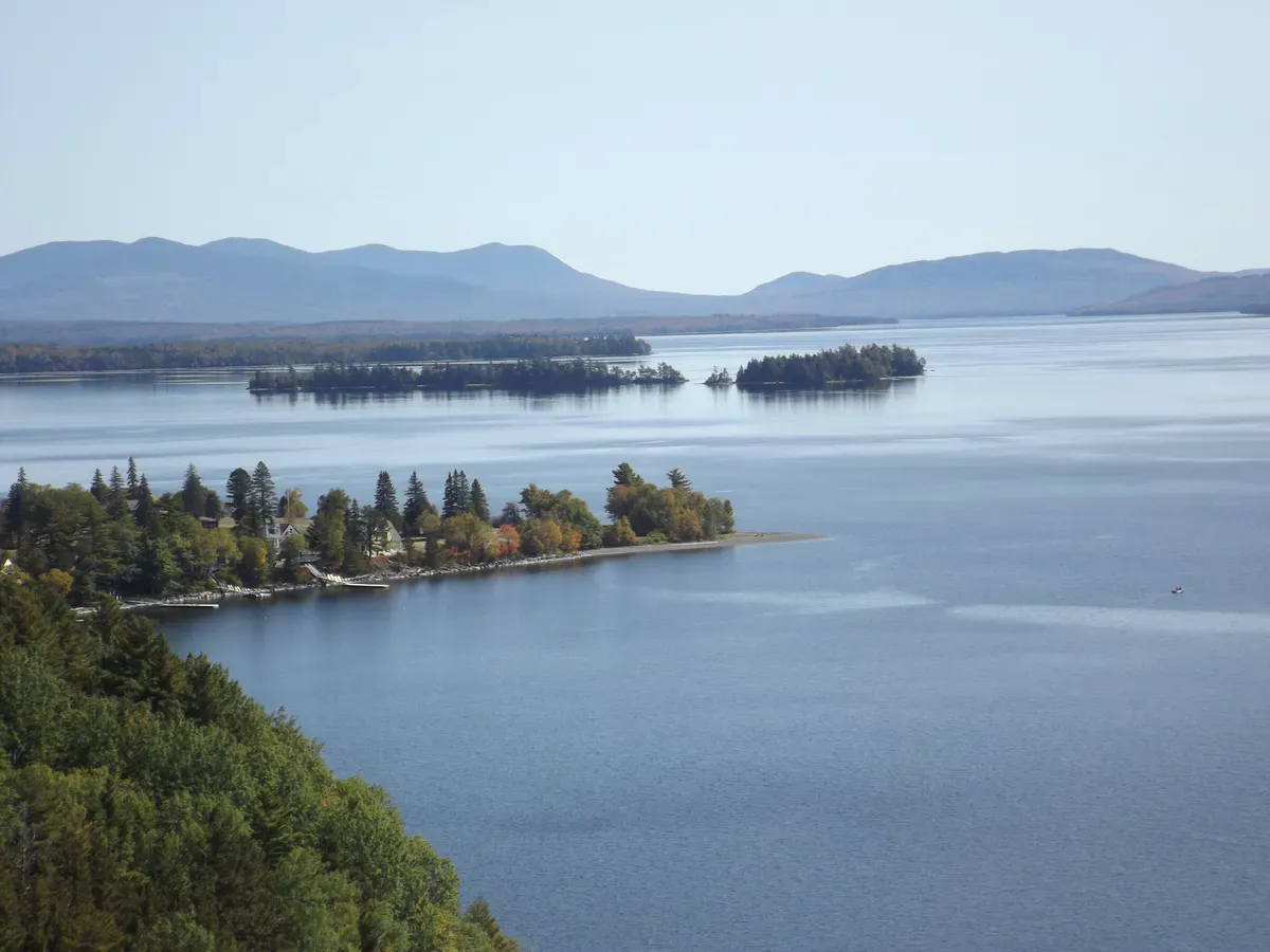
The open ledges below and around the summit are the highlight. Looking east, on clear days you can make out the hills of Mount Desert Island and the Acadia region, roughly 40 miles away. The foreground is a rolling carpet of forest, punctuated by lakes, streams, and the low granite hills that characterize Downeast Maine. To the south, blueberry barrens and bogs stretch toward the coast. To the west, the Penobscot River valley leads back toward Bangor.
Little Peaked Mountain, the smaller neighbor, is visible directly to the south and makes a good addition if you have the time and energy for a second summit.
For a longer outing, combine Peaked Mountain with Little Peaked Mountain. The trail to Little Peaked branches off from the logging road before the main trail and adds about 1.5 miles round trip with its own set of ledge views.
When to Go
Spring
Muddy and buggy in the lower woods. Black flies along Route 9 are intense in late May and June.
Summer
Full foliage cover in the woods. Bring bug spray. Start early to avoid afternoon heat on the ledges.
Fall
Blueberry barrens turn red in September. Foliage in the surrounding forest peaks in early October. Clear, cool air.
Winter
Exposed ledges are icy. The logging road approach can be snowy. Short enough for a winter outing with microspikes.
Late September is exceptional. The blueberry barrens that stretch across the Downeast landscape turn a deep crimson, and the surrounding forest adds layers of gold and orange. The view from the ledges during peak color is one of the best in eastern Maine.
Practical Notes
Route 9, the Airline Road, is the main corridor between Bangor and Downeast Maine. The road is fast and rural with limited services. There is no gas station or store between Bangor and Amherst. Fill your tank and bring what you need before heading out.
Parking is at a small pulloff along the logging road near Route 9. It fits about 6 to 8 cars. The trail is not heavily trafficked, so parking is rarely an issue except on the best fall weekends.
Dogs are welcome and do well on the lower trail. The steep, loose rock sections near the summit may be challenging for older or less agile dogs.
Peaked Mountain Day Hike
- 1.5 liters of water per person
- Bug spray (essential May through July)
- Sturdy shoes with grip for ledge sections
- Downloaded map (cell service unreliable)
- Snacks for the summit
- Light layer for wind on the ledges
- Camera
Getting There
From Bangor, take Route 9 East (Airline Road) for about 15 miles. The trailhead turnoff is on the right, onto an unpaved logging road. Look for a small clearing or pulloff near the start of Fire Road 32. From Ellsworth, take Route 9 West for about 30 miles. The drive from Portland is roughly 2.5 hours via I-95 to Bangor, then Route 9 East.
FAQ
How long does the Peaked Mountain hike take?
About 1.5 to 2.5 hours round trip, depending on your pace and how much time you spend on the ledges. The trail is roughly 1.5 miles to the summit with steady climbing.
Is this the same as Chick Hill?
Yes. Peaked Mountain in Clifton is locally known as Big Chick Hill. Little Peaked Mountain, its smaller neighbor, is called Little Chick Hill. Both names appear on maps and in hiking guides.
Can I see Acadia from the summit?
On clear days, yes. The hills of Mount Desert Island are visible to the east, roughly 40 miles away. Binoculars help. Hazy summer days may obscure the view.
Is the trail well marked?
The lower logging road is obvious, but the turn onto the footpath at utility pole 18 is not well signed. Download a trail map or GPS track before you go.
Are there other hikes nearby?
Little Peaked Mountain is directly adjacent and can be combined for a longer outing. Chick Hill in Clifton also has trails. For a full day, Acadia National Park is about an hour east.
For more in the region, see our guide to Acadia National Park.