A Steep Little Climb to a Big View
Spruce Mountain is one of the smaller summits in the cluster of hills that rises west of Rockport, but it earns its place because the top is a bare granite bald with nothing blocking the view. At 973 feet it is not a tall mountain, yet the open summit looks straight across at the long ridge of Ragged Mountain and out over the islands of Penobscot Bay. The whole hike is short, roughly 2.3 miles round trip, and the climb gains about 672 feet, most of it packed into one steep stretch near the top.
The trail is a section of the Georges Highland Path, a footpath network built and maintained by the Georges River Land Trust that links several of the hills in the Ragged Mountain area. There are no signs pointing the way from the highway and no big parking lot, which keeps Spruce Mountain quieter than the better-known summits nearby. It is a good choice when you want a real climb and a real view without committing to a half-day on the trail.
The Trail
The route starts in hardwood forest and stays gentle for the first stretch, winding through mixed woods and crossing a few wet, rooty sections that hold water after rain. Wear boots you do not mind getting muddy. After the easy opening, the trail reaches a fork where a spur breaks off toward the summit, and from there the grade kicks up hard.
The final push is the work of the hike. It is roughly a mile of climbing that gets steep and rugged near the top, with footing over rock and root that asks you to slow down and pick your line. Take rests on the way up; there is no shame in it on a pitch this steep. The reward comes quickly once the trees thin and the trail steps out onto open granite.
Rocky beaches & streams
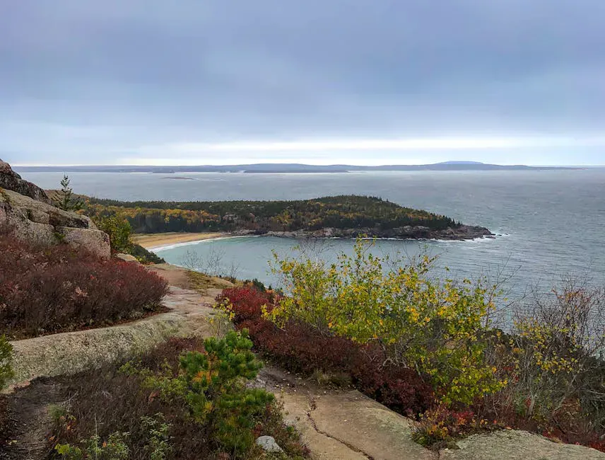
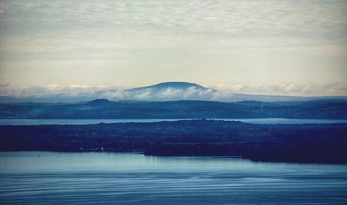
The bald summit gives you the payoff: an unobstructed look at Ragged Mountain across the valley and, beyond it, the island-speckled water of Penobscot Bay. On a clear day the Camden Hills stack up to the northeast. It is a small summit, so it does not take a crowd to feel full, which is another reason to come on a weekday or early in the morning.
Getting There
The most reliable trailhead access is from the Georges Highland Path parking on Route 17, about 2 miles north of the intersection of Routes 17 and 90 in West Rockport. This is the busiest launch point for the whole Ragged Mountain network, and the small lot can fill on summer weekends. There is also an informal pull-off on the western side along Mt. Pleasant Street, near the saddle between Mount Pleasant and Spruce Mountain, but parking there is tight and easy to miss.
Cell service in the area is spotty, so download a map or take a photo of the trailhead kiosk before you start.
Parking is the hardest part of this hike. The Route 17 lot is small and shared by people heading up Ragged Mountain too, so it can be full by mid-morning on a nice weekend. Arrive early, and if it is full, come back on a weekday rather than parking somewhere that blocks the road.
When to Visit
Spring
The steep upper trail holds mud and runoff well into May. Black flies arrive mid-May. Footing is slick on the rock.
Summer
Green and shaded on the lower trail, with a warm open summit. Go early to beat the heat and find parking.
Fall
Cool air, dry footing, fewer bugs, and foliage color across the Ragged Mountain valley. The clearest views of the year.
Winter
Doable with traction on the steep, icy upper pitch, but the open summit is cold and exposed to wind off the bay.
Fall is the standout season here. The bugs are gone, the footing on the steep section firms up, and the view across to Ragged Mountain takes on color. September and October mornings are about as good as midcoast hiking gets.
Packing List
Spruce Mountain Day Hike
- Sturdy boots with grip for the steep, rooty climb
- 1 to 2 liters of water
- A snack for the summit
- Bug spray from mid-May through summer
- A light layer for the breezy open top
- Offline map or trailhead photo (cell service is spotty)
- Sun protection for the exposed bald
FAQ
How long is the Spruce Mountain hike in Rockport?
About 2.3 miles round trip with roughly 672 feet of elevation gain. Most hikers do it in 1 to 1.5 hours, though the steep upper section slows people down.
How hard is Spruce Mountain?
Moderate. The lower trail is easy, but the final climb to the summit is steep and rugged with rock and root, and there are a few wet sections lower down.
Are dogs allowed on the Georges Highland Path?
Yes. Dogs are permitted on the Georges Highland Path. Keep them under control on the steep summit rock and clean up after them.
Where do you park for Spruce Mountain?
The main trailhead parking is on Route 17, about 2 miles north of the Routes 17 and 90 intersection in West Rockport. The lot is small and shared with Ragged Mountain hikers, so it fills on weekends.
What can you see from the summit?
The bare granite summit looks across at Ragged Mountain and out over the islands of Penobscot Bay, with the Camden Hills visible to the northeast on clear days.
For more midcoast hills nearby, see Ragged Mountain or the ledges of Bald Rock Mountain.