Through the Notch
Grafton Notch is one of Maine’s great mountain passes, a deep cut between Old Speck Mountain (4,170 feet) and Baldpate Mountain (3,812 feet) in the Mahoosuc Range of western Maine. Route 26 threads through the notch on a winding two-lane road, climbing from the Bear River valley near Newry up through the state park and over the height of land before dropping into the Androscoggin River valley at Upton.
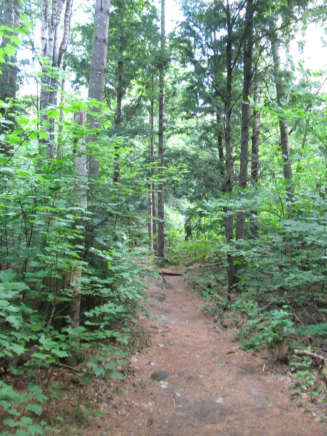
The drive is about 12 miles through the most dramatic section, and it packs in more roadside attractions than any similar stretch of road in Maine. Two waterfalls sit within a few steps of the parking area. Trailheads for Old Speck, Table Rock, and the Eyebrow Trail offer access to some of the finest hiking in the state. And the landscape itself, steep-walled valleys, dense spruce forest, exposed granite, and the wildness of the Mahoosuc Range, makes the drive worthwhile even if you never leave your car.
This is not Acadia. There are no visitor centers, no shuttle buses, no restaurant concessions. Grafton Notch is state park land in the western mountains, surrounded by private timberland and backed by the Appalachian Trail. The infrastructure is basic, the crowds are small, and the scenery is enormous.
Screw Auger Falls
The first major stop heading north through the notch is Screw Auger Falls, a series of cascades that have carved a narrow, twisting gorge through the granite bedrock of the Bear River. The falls drop about 25 feet through a corkscrew channel so narrow you could almost touch both walls at the widest point.
The viewing area is steps from the parking lot, literally a 30-second walk. This accessibility belies the dramatic beauty of the spot. The water spirals down through the polished rock chute, pooling in circular basins carved by centuries of turbulence. The geology is visible and tactile. You can see the swirl patterns in the rock that give the falls their name.
Most visitors stop at the viewing area above the main cascade. Walk the trail downstream for another few minutes to see additional cascades and pools that many people miss. The Bear River continues dropping through a series of smaller falls and chutes below the main attraction.
Mother Walker Falls
About a mile north of Screw Auger Falls, Mother Walker Falls drops through another narrow gorge in the bedrock. This waterfall is more of a slot canyon than a freefall, the river has cut a deep, narrow channel through the rock, and the water rushes through with impressive force during high flow.
The viewing area is again very close to the road, accessible via a short path from the parking pulloff. Mother Walker Falls is less dramatic than Screw Auger but interesting in a different way, the narrow rock walls, the compressed force of the water, and the ancient geology are all visible up close.
Trailheads
Grafton Notch is the starting point for several outstanding hikes:
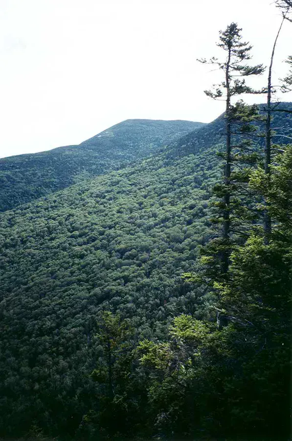
- Old Speck (4,170 feet): The highest peak in the Mahoosuc Range, accessible via the Old Speck Trail (3.8 miles, strenuous). An observation tower at the summit provides 360-degree views.
- Table Rock: A dramatic granite slab jutting out from the mountainside with views down into the notch. About 2.4 miles round trip, moderate-to-strenuous.
- Eyebrow Trail: A steep loop with cliff-edge views into the notch. Often combined with the Appalachian Trail for a circuit.
- Step Falls: A series of cascading falls on a tributary stream, accessed from a Nature Conservancy preserve near the southern entrance to the notch.
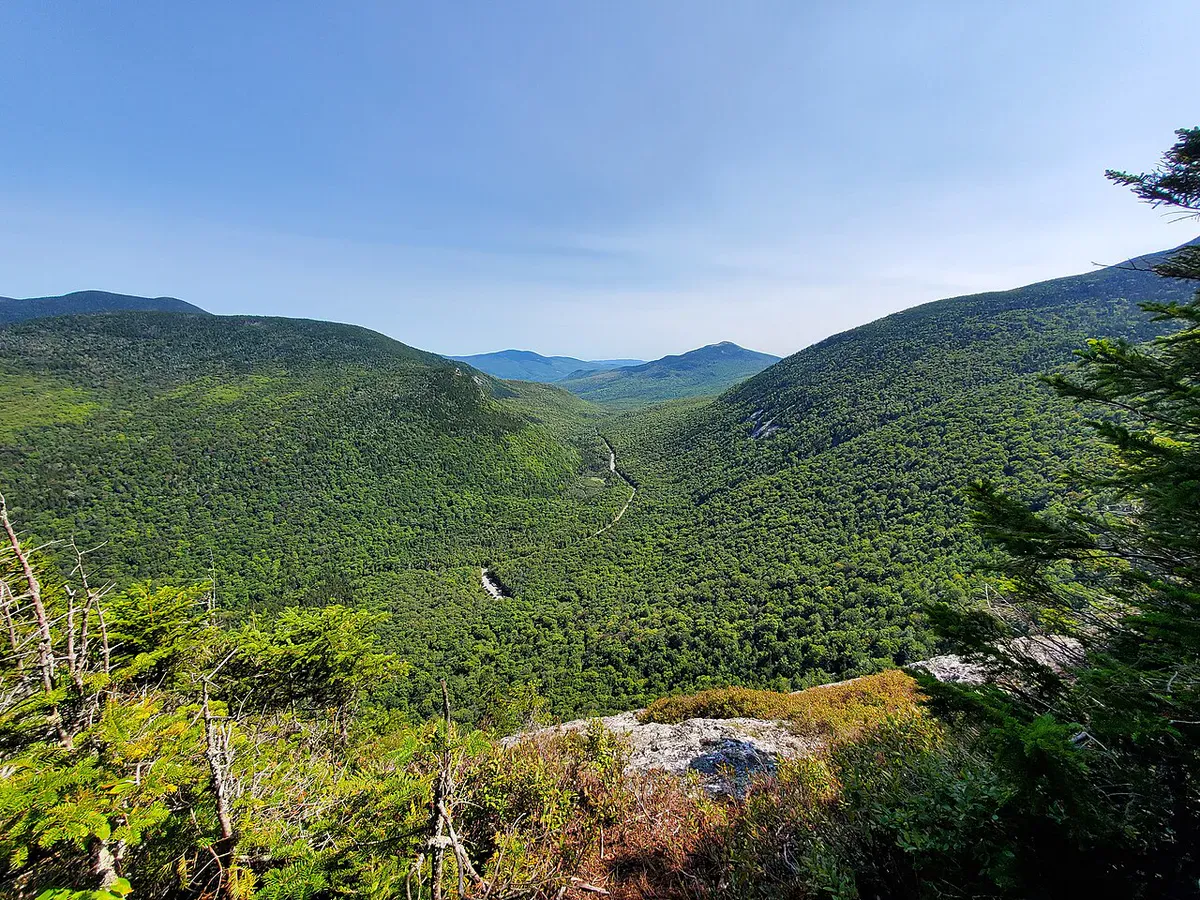
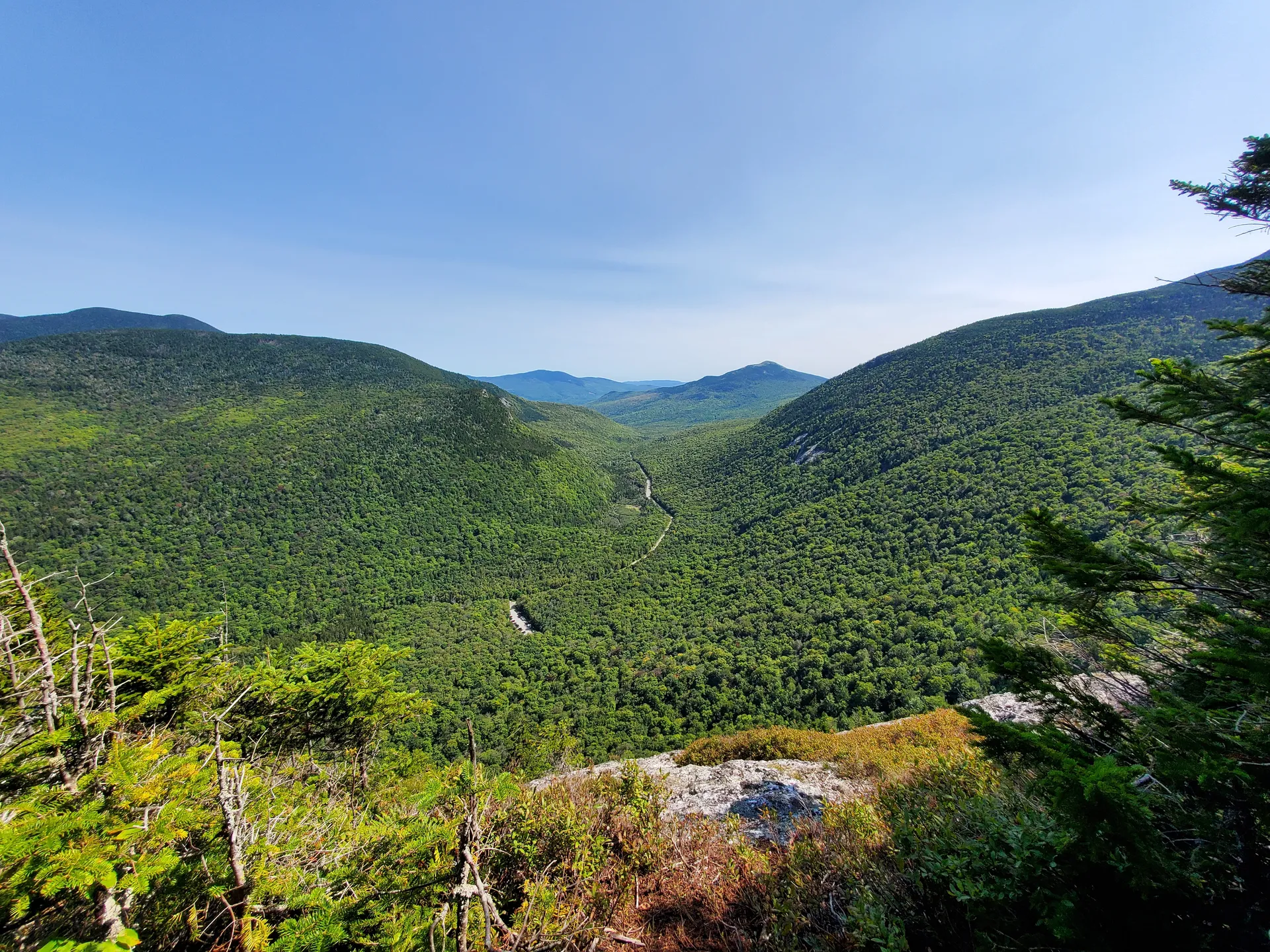
For the best combination of driving and hiking, drive through the notch stopping at both waterfalls, then park at the Table Rock trailhead and hike to the rock for the best overhead views of the notch you just drove through. Table Rock takes about 2 hours round trip and offers the single best viewpoint in the area.
The Drive
The road through Grafton Notch is a proper mountain highway, steep grades, sharp curves, and limited sight lines. The speed limit drops through the state park, and the road narrows in places. The driving is not difficult, but it demands attention, especially when pulling in and out of the waterfall parking areas.
The ascent from the south (Newry side) is gradual, following the Bear River through a valley that narrows as you climb. The forest transitions from mixed hardwood to dense spruce-fir as you gain elevation. At the height of land, the notch is a steep-sided V between the two mountains, and the views through the trees hint at the enormous landscape around you.
The descent on the north side (toward Upton and the Androscoggin) is steeper, with switchbacks and mountain views. The road emerges into the broad river valley at Upton, and the landscape changes to farmland and lake country.
Route 26 through Grafton Notch is maintained in winter but can be challenging. The road is steep, winding, and exposed to mountain weather. Snow, ice, and reduced visibility are common from November through April. Check road conditions before driving through in winter. Carry chains or have winter tires.
When to Go
Summer
Best hiking weather. Waterfalls running well. State park facilities open. Long days for combining the drive with a hike. The forest is lush and green.
Fall
Peak foliage makes this one of the best scenic drives in Maine. The hardwood forest blazes with color against the dark spruce. Waterfalls have lower flow but are still beautiful.
Winter
Road is open but conditions can be treacherous. The waterfalls may be frozen, ice formations are dramatic. No state park facilities. Cross-country skiing on some trails.
Spring
Snowmelt swells the waterfalls to their most powerful. The trails are often muddy and may have snow at higher elevations. The road can be wet. Park facilities open in late May.
FAQ
Is Grafton Notch State Park free?
No. There is a day-use fee of $4 for Maine residents and $6 for non-residents per vehicle. The fee covers access to the waterfall parking areas and trailheads within the park.
How long does the Grafton Notch drive take?
The drive through the notch takes about 20-30 minutes without stops. Plan 1 to 2 hours to stop at both waterfalls and enjoy the scenery. A full day if you add a hike.
Can you see Screw Auger Falls from the parking lot?
Almost. The falls are about 30 seconds' walk from the parking area on a paved path. It is one of the most accessible waterfalls in Maine.
Is Route 26 through Grafton Notch open in winter?
Yes. The road is maintained and plowed year-round, but winter driving conditions can be challenging with steep grades, curves, and mountain weather. Use caution and check conditions before traveling.
What is the best hike in Grafton Notch?
Table Rock is the most popular, about 2.4 miles round trip with a dramatic granite overlook above the notch. Old Speck (3.8 miles one way) is the biggest challenge and has summit views. The Eyebrow Trail offers cliff-edge drama in a shorter distance.