A Refuge Peninsula Where the Land Runs Out to an Island
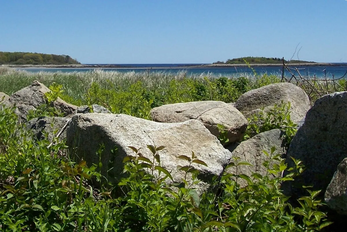
Timber Point is a quiet peninsula in Biddeford that belongs to the Rachel Carson National Wildlife Refuge, and it offers a lot of habitat in a short, easy loop. The trail, around a mile and a half, runs through freshwater wetland, coastal shrubland, salt marsh, and mixed forest before reaching the open shore, with views over the Little River estuary, the marsh, and the Atlantic. Sections are built as universally accessible boardwalk, and an observation platform looks out over the tidal flats.
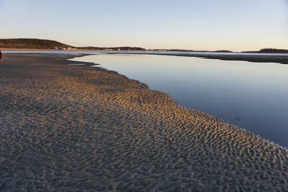
The headline feature waits at the end of the point. At low tide a gravel land bridge surfaces and connects the mainland to Timber Island just offshore, and you can walk across to explore a small, undeveloped island. At high tide the bridge is underwater and the island is cut off, so this is a tide-dependent walk. There is a tide clock posted at the trailhead to help you judge the timing before you set out.
This is a wildlife refuge first, so the rules protect the habitat. Dogs are not allowed on the trail, bikes are not permitted, and the preserve is open sunrise to sunset. The Little River is open to quiet paddling by kayak or canoe for those who launch nearby.
The Loop and the Estuary
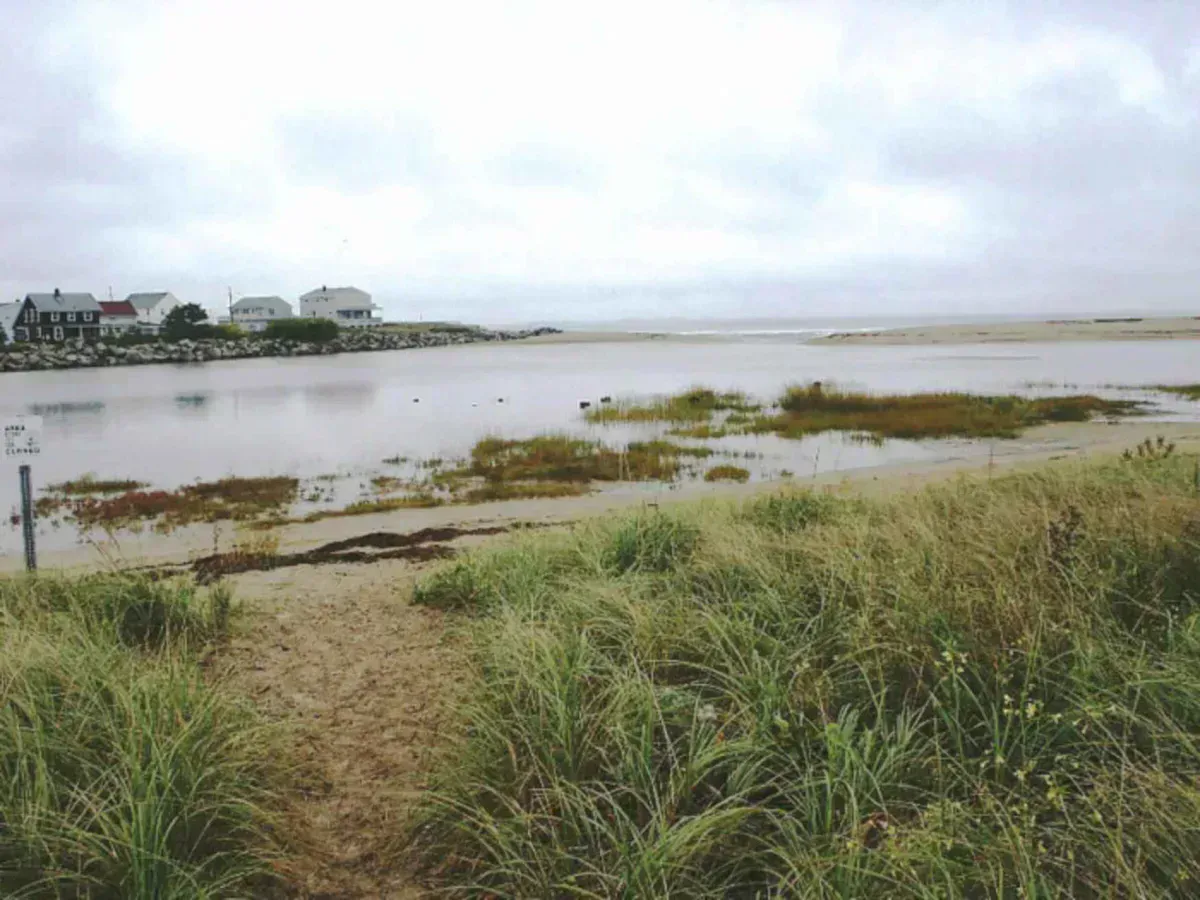
The trail itself is gentle and well suited to families and easy walkers, with boardwalk over the wetter ground. As you move out the point, the habitats shift from woods and shrubland to open salt marsh, and the observation platform gives a clear view across the Little River estuary to the islands and tidal flats. Birdlife is the main reason many people come: wading birds work the marsh, and the estuary draws shorebirds and waterfowl, especially in migration.
Bring binoculars. The salt marsh and the estuary flats are prime birding, and the observation platform is built for it. Early morning gives you the best bird activity and the calmest light over the water.
Crossing to Timber Island
When the land bridge is out, the walk across to Timber Island is short and straightforward over gravel and cobble. The island is small and wild, and from it you get an open look back at the mainland point and out to sea. As with any tidal crossing, the island only stays connected for a window around low tide.
The land bridge to Timber Island is only passable around low tide. Once the tide rises, the crossing floods and you cannot return until it drops again. Check the tide clock at the trailhead and a tide chart before crossing, and start back to the mainland in time. Do not get caught on the island by a rising tide.
Parking at the end of Granite Point Road is very limited, just a small lot. On summer weekends it fills early. Come on a weekday morning, ideally timed to a low tide, and you will have both a parking spot and the best shot at walking out to the island.
Getting There
From Route 9 in Biddeford, between the city and Kennebunkport, turn onto Granite Point Road and follow it to the end, where the small refuge parking lot and trailhead are. The road runs through a residential area, so drive slowly and park only in the designated lot.
Timber Point is one of several divisions of the Rachel Carson National Wildlife Refuge scattered along the southern Maine coast. There is no fee, and the trail is open sunrise to sunset year-round.
Wildlife & bird watching
When to Visit
Spring
Strong shorebird and waterfowl migration through the estuary. Cool walking and a greening marsh. Time the island crossing to low tide.
Summer
Warm weather and the fullest marsh life, though the small lot fills fast and biting insects can be active. Come early to a morning low tide.
Fall
Fall migration brings excellent birding, foliage edges the forest, and crowds thin out. Crisp, clear days over the flats.
Winter
Open and quiet, with wintering ducks on the estuary, but cold and exposed at the point. The crossing is risky in cold water.
Packing List
Timber Point Walk
- A tide chart, planned around low tide
- Binoculars for the marsh and estuary birds
- Sturdy shoes for the gravel crossing
- Bug spray for the wetland sections
- Water and a snack
- A watch to track the rising tide
- A field guide or bird app
FAQ
When can you walk to Timber Island?
The gravel land bridge to Timber Island is only exposed around low tide. At high tide it floods and the island is cut off. A tide clock at the trailhead and a tide chart help you time the crossing.
How long is the Timber Point Trail?
The loop is roughly a mile and a half through wetland, shrubland, salt marsh, and forest, rated easy, with universally accessible boardwalk sections and an observation platform over the estuary.
Are dogs allowed on the Timber Point Trail?
No. Timber Point is part of the Rachel Carson National Wildlife Refuge, and dogs are not permitted on the trail. Bikes are also not allowed.
Is there a fee or are there set hours?
There is no fee. The trail is open sunrise to sunset year-round. Parking at the end of Granite Point Road is very limited, so arrive early.
What wildlife might I see?
The salt marsh and Little River estuary are excellent for birding, with wading birds, shorebirds, and waterfowl, especially during spring and fall migration. Early morning is the best time to watch.
For more of this stretch of coast, see the other Rachel Carson NWR divisions or the sand of Goose Rocks Beach.