A Waterfall on the Way to the Grand Canyon
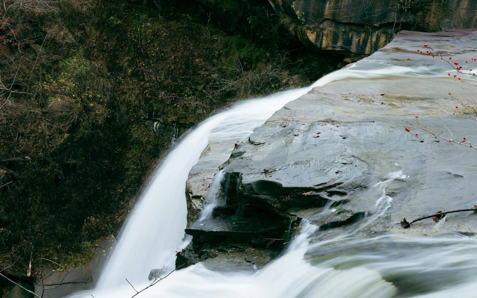
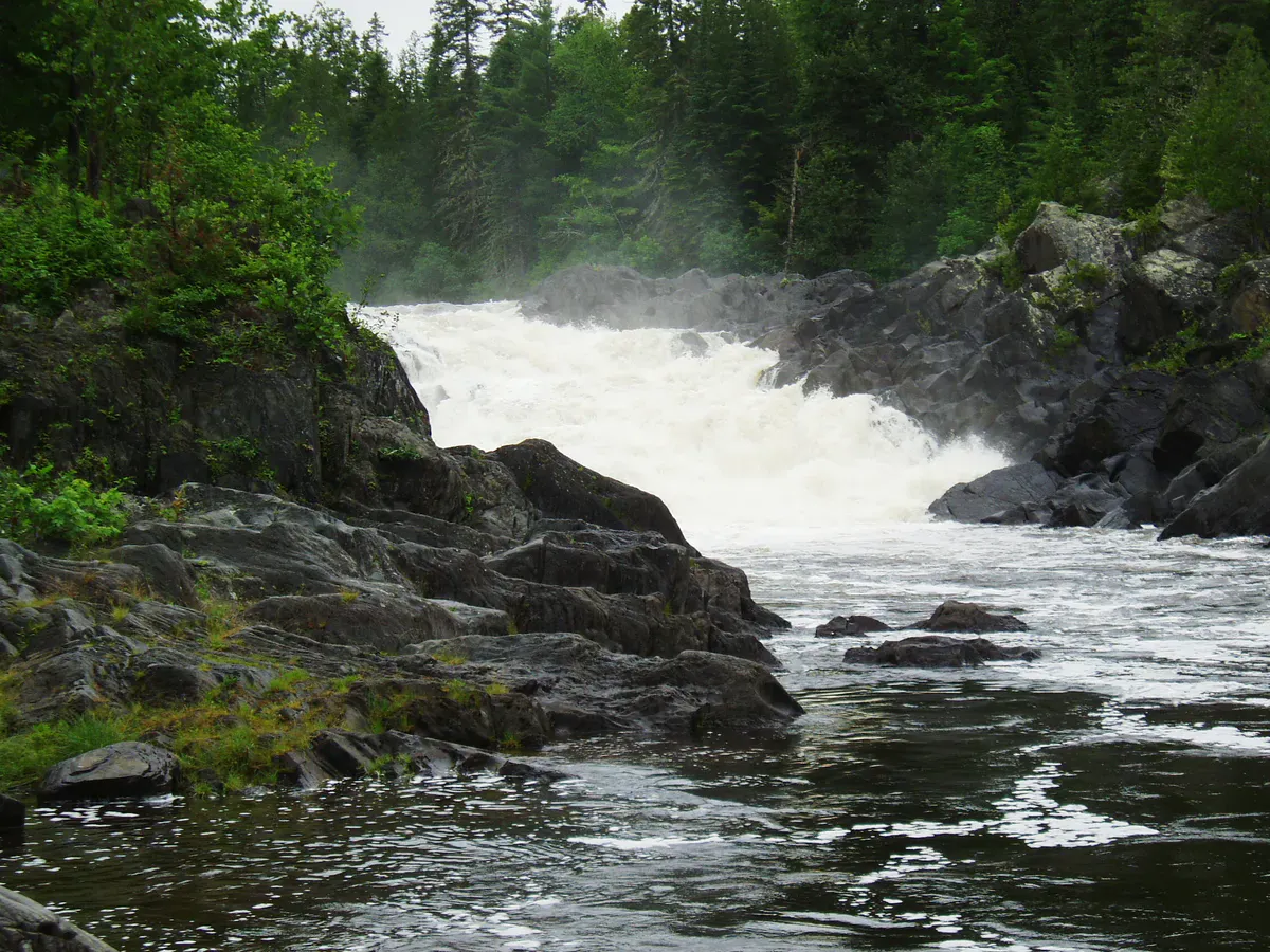
Hay Brook Falls is one of those waterfalls that people walk right past on their way to something bigger. Most hikers who come to this part of the Maine woods are headed for Gulf Hagas, the three-mile slate gorge known as the Grand Canyon of Maine. Hay Brook Falls sits on the approach trail, a 25-foot horsetail plunge that drops into a dark pool surrounded by moss-covered rock. It is easy to miss if you are focused on the miles ahead, and that would be a mistake.
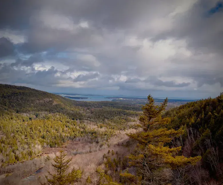
The falls are tucked inside the KI Jo-Mary Multiple Use Forest, a privately owned tract of working timberland that allows public recreation for a gate fee. The road in is unpaved, the nearest services are far away, and cell phones are useless out here. This is deep Maine woods.
There is no cell service anywhere in this area. The access roads are gravel logging roads that can be rough and confusing. Carry a printed map or download offline maps before you leave pavement. Tell someone your plans and expected return time.
Finding the Falls
From the Hay Brook trailhead parking area, the falls are a short walk of roughly a quarter mile. The trail crosses Hay Brook and follows it briefly before the falls come into view. The path is not heavily maintained but is easy enough to follow, and grippy hiking boots handle the rooty footing and wet rock near the plunge. You will hear the falls before you see them.
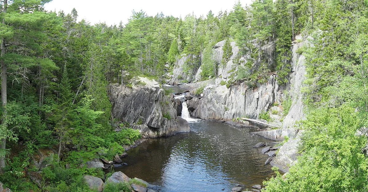
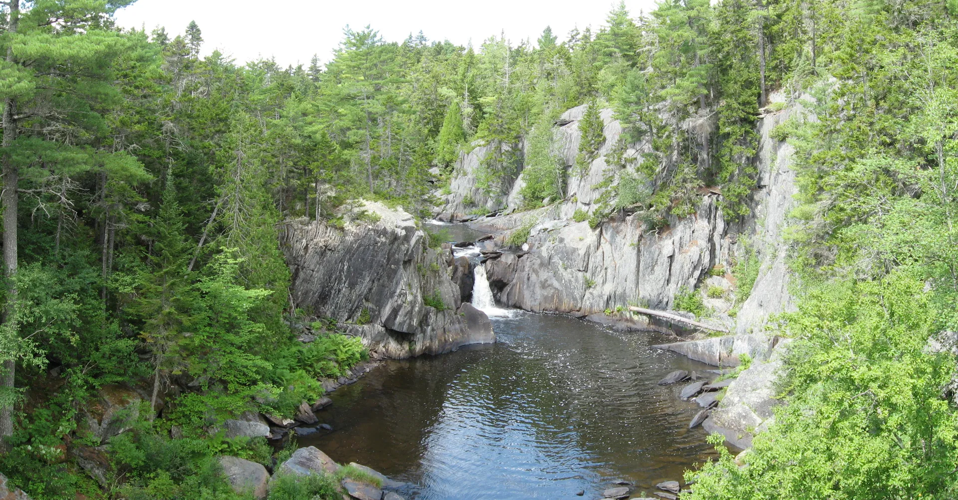
The waterfall is a single horsetail drop of about 25 feet, with the water fanning out over dark slate before collecting in a pool at the base. Moss and ferns cover the surrounding rock, and the canopy overhead keeps the area shaded and cool even on hot summer days. That same damp, shaded canopy breeds black flies and mosquitoes through June and July, so do not forget bug and tick protection. The pool is not deep enough for swimming, but the setting is photogenic and quiet.
Most visitors spend 10 to 15 minutes here before continuing to the Gulf Hagas trailhead, which requires fording the West Branch of the Pleasant River. Hay Brook Falls works as a warm-up, a preview of the water features waiting in the gorge ahead.
The Gulf Hagas parking area fills on summer weekends by mid-morning. If you arrive early, you will have Hay Brook Falls entirely to yourself. Take your time here before the crowds arrive and everyone pushes past toward the gorge.
The Gulf Hagas Connection
Hay Brook Falls is essentially the appetizer for a Gulf Hagas day trip. The full Gulf Hagas loop, including the approach from the Hay Brook trailhead, covers 8 to 9 miles round trip and passes four named waterfalls inside the gorge: Screw Auger Falls, Buttermilk Falls, Billings Falls, and Stair Falls. The Rim Trail follows the edge of the slate gorge with overlooks down to the Pleasant River.
The Appalachian Trail crosses through this area as part of the 100-Mile Wilderness, the longest stretch of the AT without a road crossing. Thru-hikers pass through in summer, and you may encounter them at the river ford.
The river ford at the West Branch of the Pleasant River is the crux of the approach. In spring and after heavy rain, the water can be thigh-deep and fast. By late summer it is usually knee-deep or less. Bring trekking poles for balance and wear shoes you do not mind getting wet.
Getting There
From Brownville Junction, take Route 11 north. Turn left onto Ebeemee Road, which leads to Katahdin Iron Works Road. Follow signs for the KI Jo-Mary checkpoint. There is a gate fee (currently around $15 per vehicle for non-residents, less for Maine residents). The road beyond the gate is gravel and can be rough in spots, but a regular car can handle it in dry conditions.
From Greenville, head east on gravel roads through the KI Jo-Mary system. The drive takes about an hour from Greenville. From Bangor, the drive is roughly 100 minutes via Route 11.
The gate attendants at KI Jo-Mary are a good source of information about road conditions, water levels, and trail status. Ask them about the Pleasant River ford depth before you commit to the hike. They talk to hikers all day and know what conditions are like.
When to Go
Spring
High water makes the falls impressive but the river ford to Gulf Hagas can be dangerous. Black flies in June.
Summer
Best trail conditions. River ford manageable. Warm enough to enjoy the water. Busy weekends.
Fall
Foliage in the hardwood canopy is beautiful. Cooler temps, fewer bugs, lower water.
Winter
Gate is closed. Roads not maintained. Not accessible.
Late June through early October is the window. Summer offers the easiest river crossing and the warmest weather. September brings foliage color to the hardwood canopy around the falls and through the Gulf Hagas gorge. Spring has the highest water volume, which makes Hay Brook Falls more dramatic, but the Pleasant River ford can be unsafe in May and early June.
Packing List
Hay Brook Falls & Gulf Hagas
- Hiking boots with ankle support (rocky trail)
- Water shoes or sandals for the river ford
- Trekking poles (essential for the ford)
- Water filter or purification (no treated water sources)
- Bug spray (June and July are intense)
- Camera
- Printed map or downloaded offline map (no cell service)
- Lunch and snacks (full day if doing Gulf Hagas loop)
FAQ
How tall is Hay Brook Falls?
Hay Brook Falls drops approximately 25 feet in a single horsetail plunge over dark slate into a pool at the base.
Do I need to pay to see Hay Brook Falls?
Yes. The falls are inside the KI Jo-Mary Multiple Use Forest, which charges a gate fee of approximately $15 per vehicle for non-residents. Maine residents pay a reduced rate.
Can I see Hay Brook Falls without hiking Gulf Hagas?
Absolutely. The falls are only about a quarter mile from the parking area. You can visit them as a standalone stop without continuing to the Gulf Hagas gorge.
Is there cell service at Hay Brook Falls?
No. There is no cell service anywhere in the KI Jo-Mary area. Plan accordingly, bring maps, and tell someone where you are going.
When is the best time to visit Hay Brook Falls?
July through September offers the best combination of trail conditions, manageable river fording, and pleasant weather. September adds fall foliage. Spring has higher water but the river ford can be dangerous.