The Grand Canyon of Maine
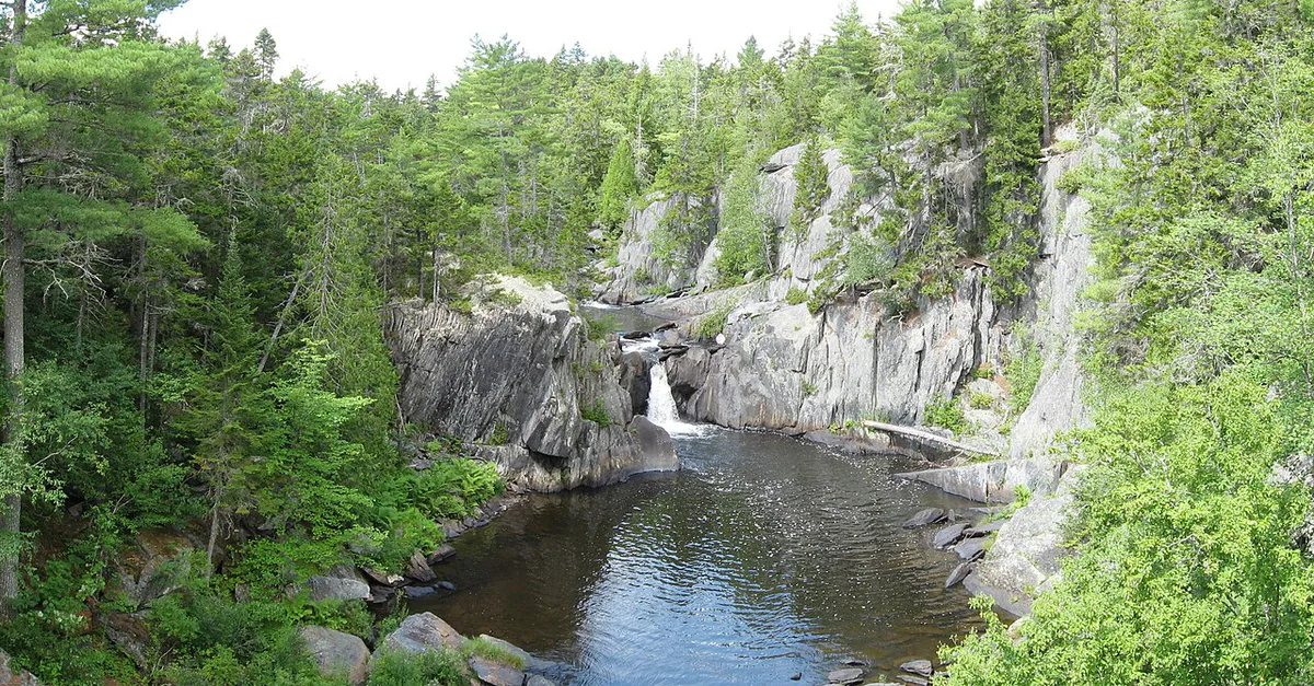
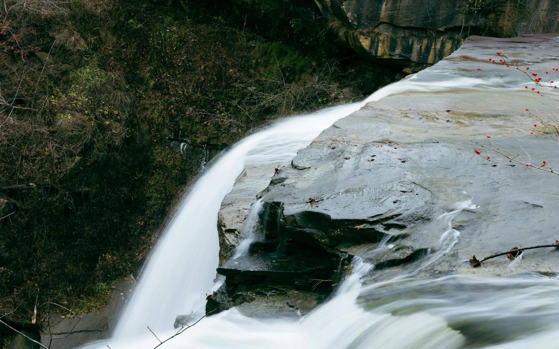
Gulf Hagas does not look like it belongs in Maine. A 3.5-mile slate gorge carved by the West Branch of the Pleasant River, with walls rising nearly 130 feet, five named waterfalls dropping through narrow chutes, and pools so deep the water turns emerald green. The Appalachian Trail passes through the area, but the gorge itself feels like a different world. People call it the Grand Canyon of Maine. The scale is smaller than Arizona, obviously, but the beauty is concentrated into every turn.
Getting here takes commitment. The gorge sits deep in the Katahdin Iron Works region of Piscataquis County, behind a network of gravel logging roads. You will pass through a North Maine Woods checkpoint, ford a river that may be knee-deep, and hike several miles before you reach the rim. That remoteness is the point. On a Tuesday in September, you might have the entire canyon to yourself.
The Hermitage Old-Growth Forest
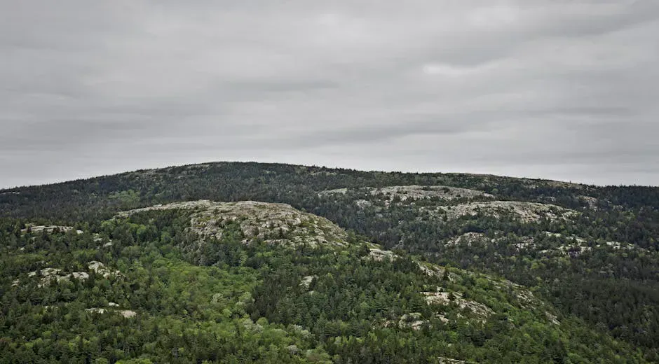
Before you even reach the gorge, the trail passes through The Hermitage, a 35-acre stand of old-growth eastern white pines that has been designated a National Natural Landmark. Some of these trees are over 130 feet tall and more than 200 years old. The canopy blocks out most of the sky, and the forest floor is quiet in a way that second-growth woods never are.
Most hikers walk right through The Hermitage focused on reaching the gorge. Slow down. This is one of the last old-growth white pine stands in New England, and the trees here are genuinely massive. The stand sits right along the trail about a half-mile before the river ford. Look up.
The Hermitage was preserved by The Nature Conservancy and is worth spending 15 to 20 minutes exploring on its own. The combination of ancient pines and the gorge makes Gulf Hagas one of the most ecologically significant hikes in the state.
The Route
The standard Gulf Hagas loop covers approximately 8 miles and takes most hikers 5 to 7 hours. The terrain is not overly steep, but roots, rocks, mud, and several stream crossings keep the pace slow and honest.
The trail to Gulf Hagas requires fording the West Branch of the Pleasant River. In normal summer conditions, the water is knee-deep and the current is moderate. After heavy rain, it can be waist-deep and dangerous. Drownings have occurred at this crossing. Wear water shoes or sandals with good grip, use trekking poles for stability, and unbuckle your pack’s hip belt before crossing so you can shed it if you lose your footing. Do not attempt the ford during spring runoff or after major storms.
From the Head of the Gulf parking area, the trail follows a gravel road and then a footpath to the river ford. After crossing, you follow the Appalachian Trail north briefly, then turn east onto the Gulf Hagas Rim Trail. The rim trail runs along the south edge of the gorge, with spur paths dropping to overlooks at each major waterfall.
After Head of the Gulf (the last and most powerful waterfall), the trail turns south and follows the Pleasant River Tote Road back to the ford. This return section is flat and fast, a welcome relief after the rough rim trail.
Complete Waterfall Guide
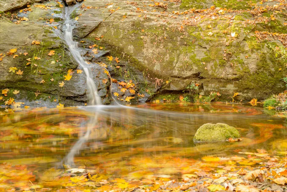
The waterfalls are the heart of this hike. There are five major ones, each with its own personality.
| Waterfall | Character | Swimming Potential |
|---|---|---|
| Screw Auger Falls | Twisting cascade through a narrow slot in the slate; not the Grafton Notch version | Small pool below, very cold |
| Billings Falls | Widest fall, spreading across the full gorge width with a broad pool | Best swimming spot, deep pool |
| The Jaws | Narrow chute where the river squeezes between tight rock walls | Too narrow and fast for swimming |
| Buttermilk Falls | Multi-tiered cascade over smooth slate ledges | Shallow wading only |
| Head of the Gulf | Powerful plunge over a ledge into a deep, dark pool surrounded by moss-covered walls | Deep pool, very cold, experienced swimmers only |
Between the named falls, the river runs through a continuous series of cascades, slides, and pools. Every few hundred yards offers another viewpoint. Spur trails to water-level viewpoints are steep and can be slippery when wet. Watch your footing on exposed roots and wet rock.
Can You Swim in Gulf Hagas?
Yes, but with caveats. The pools below Billings Falls and Head of the Gulf are deep enough for swimming, and on a hot July afternoon, people do swim there. The water is cold year-round, typically in the 50s to low 60s even in August. There are no lifeguards, no beaches, and no easy exits from some of the deeper pools.
The best swimming is at Billings Falls, where a broad, relatively calm pool sits below the wide cascade. You can wade in gradually and the bottom is smooth slate. Head of the Gulf has a deeper, darker pool that experienced swimmers enjoy, but getting in and out requires scrambling over slippery rocks.
Brook trout live in these pools, and the fishing in the Pleasant River corridor is solid if you carry a rod and have a Maine fishing license.
Step-by-Step Driving Directions
Getting to Gulf Hagas is half the adventure. The trailhead sits behind the KI Road (Katahdin Iron Works Road) checkpoint, and navigation can be confusing if you have not been before.
From Brownville Junction:
- Take the road toward Katahdin Iron Works (follow signs). It turns to gravel after about 6 miles.
- At roughly mile 7, you will reach the North Maine Woods checkpoint. Pay the access fee: $11 per vehicle for Maine residents, $16 for non-residents, plus a per-person fee (typically $8 to $10 per person). Cash or check preferred, though some checkpoints now accept cards.
- Continue past the checkpoint, following signs for Gulf Hagas / Head of the Gulf. The gravel road continues for about 5 more miles.
- Turn at the signed intersection for Head of the Gulf parking area. The total drive from paved road to trailhead takes about 30 to 40 minutes on gravel.
The roads are maintained for logging trucks and are passable in a standard car, but drive slowly and yield to oncoming trucks. High clearance helps but is not required. The parking area is small and fills on fall weekends.
Fill your gas tank in Brownville Junction or Greenville before heading in. There are no services past the checkpoint, and cell service dies well before you reach the trailhead. The closest gas station to the trailhead is about 20 miles away.
When to Go
Spring
River ford unsafe due to snowmelt. Roads may be gated.
Summer
Mid-June through August. Warm temps, full water flow, swimming possible. Black flies brutal in June.
Fall
Late Sept to early Oct is peak foliage. Bugs gone, fewer people, ideal conditions.
Winter
Access roads closed. Deep snow. Not a winter hike.
The river ford makes early-season visits risky. Snowmelt and spring rains can raise the water to unsafe depths. By mid-June, levels typically drop enough for a safe crossing, though you should always check recent conditions before heading out.
Summer brings warm temperatures and full water flow over the falls. Black flies are brutal in June and can persist into early July. Mosquitoes are present all summer. Bring strong bug spray and consider a head net if visiting before mid-July. Check our tick and bug protection guide for recommendations.
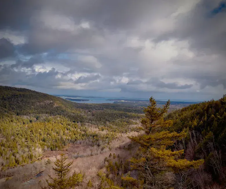
Fall is the best time for most people. The hardwood forest surrounding the gorge turns brilliant orange, gold, and red, and the contrast against dark slate walls and white water is something you will think about for a long time. Late September through early October is peak foliage in this part of Maine.
Camping Nearby
There is no camping at the Gulf Hagas trailhead itself, but several options are close:
- Lily Bay State Park on Moosehead Lake is about 30 miles north of the trailhead and has waterfront campsites, showers, and boat access. Reserve through Maine’s state park system.
- Primitive campsites along the Appalachian Trail in the KI corridor are available on a first-come, first-served basis.
- Greenville has motels, cabins, and vacation rentals if you prefer a roof. It is the commercial hub of the Moosehead Lake region.
The AT connection means thru-hikers pass through this area regularly. If you are backpacking, you can link Gulf Hagas with a section of the AT heading north toward Whitecap Mountain or south toward the Chairback Range.
What to Bring
Gulf Hagas Day Hike Packing List
- 3 liters of water (no sources you should drink from untreated)
- Water shoes or sandals for the river ford
- Trekking poles (essential for the ford and helpful on the rim trail)
- Lunch and snacks for a 5-7 hour day
- Bug spray and/or head net (June through mid-July especially)
- Rain gear (weather changes fast in the Maine woods)
- First aid kit
- Map or downloaded trail map (no cell service)
Good hiking boots with ankle support are important here. The rim trail is rough, with roots and rocks that will punish trail runners or light sneakers. Bring a dry bag or plastic bag for your phone and wallet during the ford.
Safety
The river ford is the single biggest safety concern. Do not cross if the water is above your knees and moving fast. The rim trail has exposure in places, with steep drop-offs above the gorge. Spur trails to water-level viewpoints are steep and slippery when wet. Stay on marked trails.
Cell service is completely absent. This is deep Maine woods. Let someone know your plans, carry a whistle, and consider a satellite communicator for emergencies. The nearest hospital is in Dover-Foxcroft, about 45 minutes from the trailhead by car.
FAQ
Can you swim in Gulf Hagas?
Yes, swimming is possible in the deeper pools below Billings Falls and Head of the Gulf during summer. The water stays cold (50s-60s F) even in August. There are no lifeguards or easy exits, so swim at your own risk and only if you are a confident swimmer.
How do you get to Gulf Hagas?
From Brownville Junction, take the Katahdin Iron Works Road (gravel) about 7 miles to the North Maine Woods checkpoint. Pay the access fee ($11 Maine residents / $16 non-residents plus per-person fees), then continue about 5 miles to the Head of the Gulf parking area. Total drive from pavement to trailhead is about 30-40 minutes on gravel.
Is Gulf Hagas dog friendly?
Dogs are allowed on the trail and most dogs can handle the terrain, but the river ford is the main concern. Your dog will need to swim or wade through knee-deep (or deeper) water. The gorge rim trail also has steep drop-offs in places. Keep your dog leashed and under control near the cliff edges.
How long does the Gulf Hagas hike take?
The full 8-mile loop takes most hikers 5 to 7 hours, including time spent at the waterfalls and overlooks. Strong hikers who move quickly and do not linger can finish in 4 hours. If you plan to swim or explore side trails to water level, budget the full 7 hours.