The Last Camp Before the Notch
Full Goose Shelter sits at about 3,000 feet on the Appalachian Trail deep in the Mahoosuc Range, in a saddle between Goose Eye Mountain and Fulling Mill Mountain. It matters mostly because of what lies just to the north: Mahoosuc Notch, the boulder-choked slot that is regularly called the hardest mile on the entire Appalachian Trail. Full Goose is the closest spot to the Notch where camping is legal, so hikers stage here before tackling it or stop to recover after coming through.
The site has a backcountry shelter, a few tent sites, a privy, and a water source reached by a short side trail to a clearing below the shelter. It is an unstaffed, no-fee site maintained by the Appalachian Mountain Club. Because the trail runs right past the shelter, most hikers stop here at least to sign the log, even if they push on.
The Terrain Around It
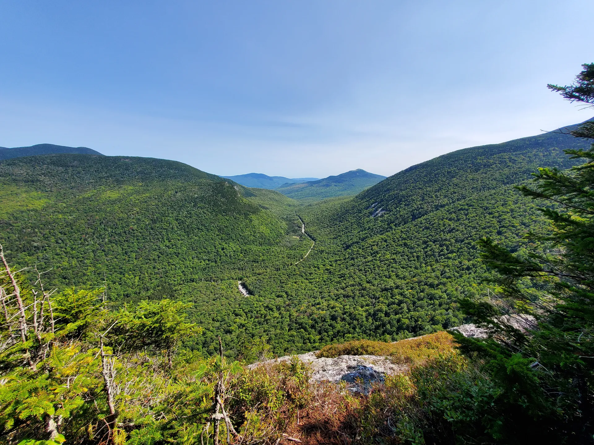
This stretch of the Mahoosucs is relentless. South of the shelter, the AT crosses the peaks of Goose Eye, with its bare, ledgy summits, and the climbing in either direction is steep and rough. The Mahoosucs are famous for being slow going: short distances on the map translate into long, exhausting days because of the constant up-and-down over rock, roots, and bog bridges.
To the north, the trail drops toward Mahoosuc Notch, where you spend a full mile clambering over, under, and between car-sized boulders, sometimes removing your pack to squeeze through. Whether you camp at Full Goose before or after, plan for the Notch to take far longer than a normal mile.
Backcountry water filtration
Camping Here
Full Goose is first-come and tent-only beyond the shelter itself, with a handful of sites. The water source below the shelter must be filtered or treated. There is no caretaker and no fee, which means it is on every camper to follow Leave No Trace: pack out all trash, use the privy, and keep food secured away from your sleeping area.
This is committing, remote terrain. The Mahoosucs are physically punishing, weather at 3,000 feet turns cold and wet fast, and Mahoosuc Notch is genuinely dangerous when wet or icy because the boulders are slick and the drops between them are real. There is no cell service and no quick way out. Carry warm layers, filter all water, give yourself far more time than the mileage suggests, and never rush the Notch.
Plan your day around the Notch, not the miles. Many hikers stage at Full Goose specifically so they hit Mahoosuc Notch first thing in the morning, with full energy and dry rock, rather than at the end of a long, tired day. Going through the Notch fresh and in daylight is far safer than pushing into it late.
When to Visit
Spring
Snow and ice linger in the Notch and on the shaded ledges into late spring. The footing is treacherous and the trail very wet.
Summer
The main hiking season. Drier rock in the Notch and the most settled weather, though it can still be cold and wet up high.
Fall
Crisp, bug-free, and clear, with foliage on the lower slopes. Cold nights at the shelter; carry a warm bag.
Winter
Snow and ice make the Mahoosucs and the Notch a serious mountaineering proposition, not a casual trip.
Packing List
Full Goose Overnight
- Tent for the tent sites (shelter space is limited)
- Warm sleeping bag for cold high-elevation nights
- Water filter or purifier
- Waterproof shell and warm midlayer
- Trekking poles for the relentless ups and downs
- Headlamp and spare batteries
- Map and compass or offline map (no cell service)
- Trash bag to pack everything out
Getting There
Full Goose is reached on foot only. Most hikers access this section of the Mahoosuc Trail / AT from trailheads off Success Pond Road, a gravel logging road out of Berlin, New Hampshire, or as part of a longer point-to-point that starts or ends in Grafton Notch on Maine Route 26 in Newry. There is no road to the shelter and no easy day-hike approach; this is backpacking terrain. Grafton Notch is roughly two and a half hours from Portland.
FAQ
Why is Full Goose Shelter important?
It is the closest legal campsite to Mahoosuc Notch, the boulder-filled slot often called the hardest mile on the Appalachian Trail. Hikers stage here before the Notch or stop after.
Is there a fee or caretaker?
No. Full Goose is an unstaffed, no-fee AMC shelter. Follow Leave No Trace, pack out all trash, and secure your food.
Where is the water source?
A short side trail leads from the shelter to a water source in a clearing below it. Filter or treat all of it.
How hard is the surrounding trail?
Very hard. The Mahoosucs are notoriously slow and rugged, with steep ledges and bog. Mahoosuc Notch just to the north can take hours to cover a single mile.
Can you drive to the shelter?
No. There is no road access. Reaching Full Goose requires backpacking in from Success Pond Road or as part of a longer Mahoosuc traverse.
For the next camp north, see Speck Pond Campsite, and for the full range, the Mahoosuc guide.