Maine’s Wild Edge
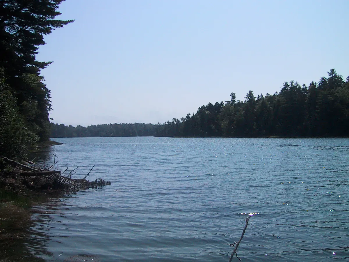
The Cutler Coast Public Reserved Land sprawls across 12,234 acres of Washington County coastline, encompassing some of the most dramatic coastal scenery in the eastern United States. This is the Bold Coast, a stretch of Downeast Maine where dark volcanic cliffs rise 150 feet above the crashing Atlantic and the Bay of Fundy. The landscape shifts between peatlands, dense spruce forest, blueberry barrens, and exposed headlands where the wind never seems to stop. It is remote, rugged, and largely unchanged from the coastline Samuel de Champlain described when he sailed past in 1604.
The property is managed by the Maine Bureau of Parks and Lands and is open to the public year-round with no entrance fee. Ten miles of trails wind through the preserve, including the celebrated Bold Coast Trail, which follows 3.4 miles of oceanside cliffs that rank among the finest coastal hiking in New England. Three backcountry campsites offer overnight stays within earshot of the surf. More than 200 bird species have been documented here, including boreal chickadees, numerous warbler species, and six species of owls.
The Bold Coast Trail
The Bold Coast Trail is the centerpiece of the Cutler Coast, a 5.7-mile loop (or roughly 10 miles if you walk the full inland return) that traces the cliff edge above the Bay of Fundy. From the trailhead on Route 191, the path enters dense coastal spruce forest and reaches the ocean in about 1.5 miles. What follows is 3.4 miles of cliff-top walking with views that are difficult to overstate.
The cliffs here are composed of dark volcanic rock, formed during the Silurian period when underwater volcanic eruptions deposited layers of basalt and rhyolite. Erosion and wave action have carved the coastline into headlands, sea stacks, cobble coves, and narrow inlets where the ocean surges in with each tide. The scale is immense. Standing on the cliff edge at Fairy Head or Black Point, you look down 100 to 150 feet to the water below, with nothing between you and the open Atlantic but air.
Backcountry Campsites
Three primitive campsites are located along the Coastal Trail at Fairy Head, Long Point, and Black Point Cove. The sites are first-come, first-served with no reservations and no fees. Each has a fire ring and space for a few tents. There are no privies, no water sources, and no other facilities. Campers must pack out all trash and practice Leave No Trace principles.
Camping along the Bold Coast is one of the great backcountry experiences in Maine. You fall asleep to the sound of waves hitting the cliffs below and wake up to fog burning off the headlands. The remoteness is genuine. There is no cell service, no road noise, and very few other people.
Wildlife and Ecology
The Cutler Coast supports an unusual diversity of habitats for its size. Coastal raised bogs near the headlands host subarctic plant species including sundews, pitcher plants, and Labrador tea. Dense spruce-fir forest dominates the interior, with thick carpets of moss and lichen covering the forest floor. Blueberry barrens on the higher ground produce wild blueberries in August that you can pick and eat as you hike.
Birding is exceptional. The spruce forest supports boreal species that are at or near the southern edge of their range, including boreal chickadees, spruce grouse, and black-backed woodpeckers. Offshore, look for razorbills, Atlantic puffins, black guillemots, and common eiders. Bald eagles patrol the cliffs regularly, and peregrine falcons have been seen hunting along the headlands.
Harbor seals haul out on the ledges below the cliffs, visible from above. Whale sightings are possible from the clifftops, particularly in late summer when humpbacks and finback whales feed in the Bay of Fundy.
When to Go
Summer
Best weather for hiking and camping. Fog is common, especially in June and July. Wild blueberries ripen in August. Bring bug spray for the forest sections.
Fall
Clear air, fewer bugs, and dramatic light on the cliffs. The spruce forest stays green but blueberry barrens turn crimson. Fewer visitors than summer.
Spring
Trails can be muddy and waterlogged. Black flies are at their worst in late May and June. Migrating birds make it worthwhile for birders.
Winter
Trails are accessible but can be icy and treacherous near the cliffs. Winter ocean storms produce spectacular surf. Only for experienced hikers prepared for harsh coastal conditions.
Getting There
From Route 1 in East Machias, take Route 191 south toward Cutler. The trailhead parking area is on the right side of Route 191, about 3 miles past the village of Cutler. A large blue-and-white sign marks the entrance. The parking lot is unpaved with room for about 20 vehicles.
From Bangor, the drive takes about 2.5 hours via Route 1A to Route 1 to Route 191. From Portland, expect about 4.5 hours.
GPS coordinates for the trailhead: 44.6987, -67.1582
Cutler Coast Essentials
- Sturdy hiking boots (roots, rocks, and mud throughout)
- Layers and windbreaker (exposed cliffs are windy and cold)
- Plenty of water (no sources on trail)
- Bug spray (essential June through August)
- Camera with charged battery (no power sources)
- Offline maps and compass (no cell service)
- Food and snacks for the full day
- Binoculars for wildlife and offshore birding
FAQ
Is the Cutler Coast Bold Coast Trail a loop?
Yes. The full loop is about 10 miles, combining the Coastal Trail along the cliffs with the Inland Trail returning through the forest. You can also do an out-and-back on the Coastal Trail for a shorter hike of about 5.7 miles.
Is there an entrance fee for the Cutler Coast?
No. The Cutler Coast Public Reserved Land is free to visit and open year-round. There are no gates, no fees, and no permits required.
Can I camp at the Cutler Coast?
Yes. Three primitive backcountry campsites at Fairy Head, Long Point, and Black Point Cove are available first-come, first-served with no fee and no reservation. Pack out all trash.
How difficult is the Bold Coast Trail?
Moderate to difficult. The trail is well-marked but rough, with roots, rocks, and mud. The cliff sections are exposed and unprotected. Total elevation gain over the full loop is about 500 feet spread across many ups and downs.
Is there cell service at the Cutler Coast?
No. There is no reliable cell service at the trailhead, on the trail, or at the campsites. Download offline maps and tell someone your plans before heading out.