A True Alpine Summit
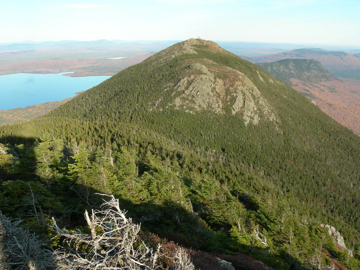
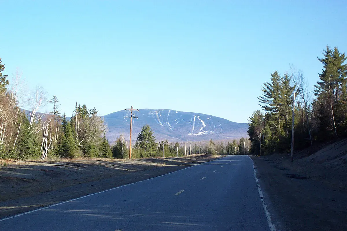
Mount Abraham is one of Maine’s fourteen peaks above 4,000 feet, standing at 4,049 feet in the western mountains near Kingfield. What makes Abraham special is its alpine zone. At roughly 350 acres, it is the second-largest alpine area in the state, surpassed only by Katahdin. Above treeline, the summit ridge is a broad expanse of boulders, lichens, and fragile alpine vegetation that looks more like the high peaks of New Hampshire than typical Maine.
The mountain sits in Salem Township, Franklin County, with the Appalachian Trail passing about 1.5 miles to the northwest via a connecting side trail. The Bigelow Range rises to the north and Saddleback Mountain to the northeast, forming a dramatic chain of high peaks along the AT corridor.
The Trail
The Fire Warden Trail is the standard route and the only maintained path to the summit. It begins off a logging road accessible from Route 142 south of Kingfield. The total round trip is approximately 9.3 miles with about 3,054 feet of elevation gain.
The lower trail follows an old fire warden’s jeep road through hardwood forest, climbing gradually for the first couple of miles. The grade increases through the middle section as the forest transitions from hardwood to dense spruce and fir. Footing becomes rougher, with roots and rocks underfoot.
At about 3,500 feet, the trail breaks above treeline. The change is sudden and dramatic. One moment you are in thick spruce, and the next you are standing on an open boulder field with views in every direction. The remaining climb to the summit follows cairns across the alpine zone, picking a route through the boulders.
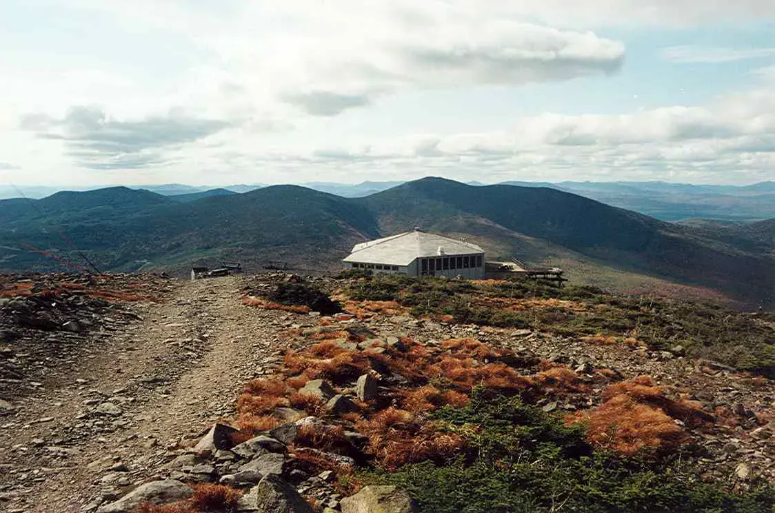
The old fire tower foundation sits on the summit. The tower itself was removed years ago, but the concrete pad remains as a convenient lunch spot with unobstructed views.
Mount Abraham’s alpine zone contains rare and fragile plants that survive extreme conditions on exposed rock and thin soil. Stay on the marked trail and walk only on bare rock. A single footstep on alpine vegetation can kill plants that took decades to grow. This ecosystem is irreplaceable.
The Summit
The summit of Mount Abraham delivers one of the finest mountain panoramas in Maine. On clear days, the view extends to Katahdin in the northeast, the Bigelow Range immediately to the north, Sugarloaf across the valley, and Saddleback Mountain to the east. To the south and west, the peaks of western Maine and northern New Hampshire roll to the horizon.
The alpine zone itself is part of the experience. Diapensia, alpine bilberry, and Bigelow’s sedge grow in sheltered pockets between the boulders. These are the same species found on Katahdin’s Tableland, and they exist on Abraham because the summit is high enough and exposed enough to prevent tree growth.
The AT Side Trail leaves the summit of Abraham and descends northwest to meet the Appalachian Trail in about 1.5 miles. If you are a peak-bagger, this connection allows you to combine Abraham with a traverse of the AT, but it adds serious mileage and requires a car shuttle.
When to Go
Spring
Snow and ice persist in the alpine zone through May. The access road may be gated during mud season. Blackflies are intense from late May through mid-June.
Summer
Best access. Long days give plenty of time for the 9+ mile round trip. Start early to avoid afternoon thunderstorms on the exposed summit.
Fall
Foliage peaks mid-September to early October. The alpine zone takes on golden and russet tones. Clear air and the best distant views.
Winter
A serious winter mountaineering objective. The alpine zone is brutal in wind and cold. Snowshoes, crampons, and full winter gear required.
Practical Notes
There is no cell service on the mountain or at the trailhead. The nearest town is Kingfield, about 20 minutes north on Route 142. Kingfield has a general store, restaurants, and fuel. For fuller services, Farmington is about 30 minutes south.
The access road to the trailhead is unpaved and can be rough. Most vehicles can make it in summer, but high-clearance is helpful. In spring and after heavy rain, conditions deteriorate.
This is a long hike. Budget 6 to 7 hours for the round trip at a steady pace. The first few miles feel easy, but the upper mountain is slow going on rough trail and exposed rock. Carry more food and water than you think you need.
Packing List
Mount Abraham Day Hike
- 3 liters of water per person
- Lunch and plenty of snacks (6+ hour hike)
- Wind layer and rain jacket (alpine exposure)
- Warm layer (summit temperatures can be 20 degrees colder than the trailhead)
- Bug spray (June through July)
- Sturdy hiking boots (boulder field on summit)
- Sunscreen and hat
- Map and compass (no cell service)
- Headlamp (in case the day runs long)
Getting There
From Kingfield, take Route 142 South for approximately 5 miles. Turn right onto a logging road (look for a small sign or cairn marking the turn). Follow the road roughly 4 miles to the trailhead parking area. The access road is unpaved and can be rough. From Portland, the drive takes about 2.5 hours via Farmington. From Bangor, allow about 2.5 hours via Route 2 West.
FAQ
Is Mount Abraham one of the hardest hikes in Maine?
It is among the more demanding day hikes. The 9.3 miles and 3,054 feet of gain are significant, and the upper mountain is slow going on rough terrain. But it is well within reach for fit hikers with a full day.
Is Mount Abraham on the Appalachian Trail?
Not directly. The AT passes about 1.5 miles northwest of the summit, connected by the Mount Abraham Side Trail. The standard hiking route uses the Fire Warden Trail, which is not part of the AT.
How big is the alpine zone?
Approximately 350 acres, making it the second-largest alpine zone in Maine after Katahdin. It is home to rare arctic-alpine plants and should be treated with extreme care.
Is the fire tower still there?
No. The fire tower was removed. The concrete foundation remains on the summit and serves as a useful landmark and wind shelter.
Are dogs allowed?
Yes, but they must stay on the trail in the alpine zone to protect fragile vegetation. Consider whether your dog can handle the 9+ mile round trip and the exposed summit before bringing them.