A New Trail by the Penobscot Narrows
Mount Tuck is a wooded 565-foot hill that sits just west of the Penobscot River, about a mile south of the Penobscot Narrows Bridge. The summit straddles the town line between Prospect to the north and Stockton Springs to the south, and most people approach it from the Stockton Springs side. It is a recent addition to the area’s hiking options. Coastal Mountains Land Trust purchased the summit area in 2019 and has since pieced together most of the mountain, building a trail that opened the hill to the public for the first time.
What makes Mount Tuck worth the drive is not the height but the position. From the overlook past the wooded summit, the view opens toward Blue Hill, the mountains of Acadia, and Penobscot Bay, with the Penobscot River winding below. It is a quiet, low-traffic hike in a part of the midcoast where Fort Knox and the narrows bridge get all the attention, so you often have the woods to yourself.
The Trail
The Summit Trail is the main route, running about 1.8 miles one way for a 3.6-mile round trip with roughly 425 feet of climbing. It is a long, steady ramble through a mixed-age forest rather than a sharp climb, so the grade stays moderate for most of the way. The footing is good in dry weather, and the woods are pleasant and shaded.
The trail rises gradually to the wooded top of Mount Tuck, where the summit itself is treed in and does not give a view. Keep going. A short distance past the summit, the trail reaches a scenic overlook that is the real destination, with the open look toward Blue Hill, Acadia, and the bay. A second route, the South Slope Trail, climbs about 1.3 miles one way and is steeper and rated more difficult, which makes a loop possible if you want to vary the descent.
#1Budget
Ranger Ready Picaridin 20%
Who it’s forSkin-safe picaridin, no smell
Why we picked it12-hour protection against ticks and mosquitoes
Pros
- Does not damage gear or synthetic fabrics
- No greasy residue, pleasant scent
- Safe for use on skin and clothing
Know before you buy
- Slightly less effective than DEET in extreme conditions
- More expensive per ounce than DEET
Because this is a newer trail through working forest, expect the occasional muddy stretch and keep an eye on the blazes where old woods roads cross the path.
Getting There
From the junction of US Route 1 and US Route 1A in Stockton Springs, drive north on US Route 1 for 4.1 miles, then turn left onto Meadow Road. Continue 0.6 miles and park along the road at the pull-off by the trailhead kiosk. There is no formal lot, just a dirt pull-off, so space is limited and you may need to park carefully on the side of Meadow Road.
Cell service is spotty out here. Note the directions and the kiosk map before you head into the woods.
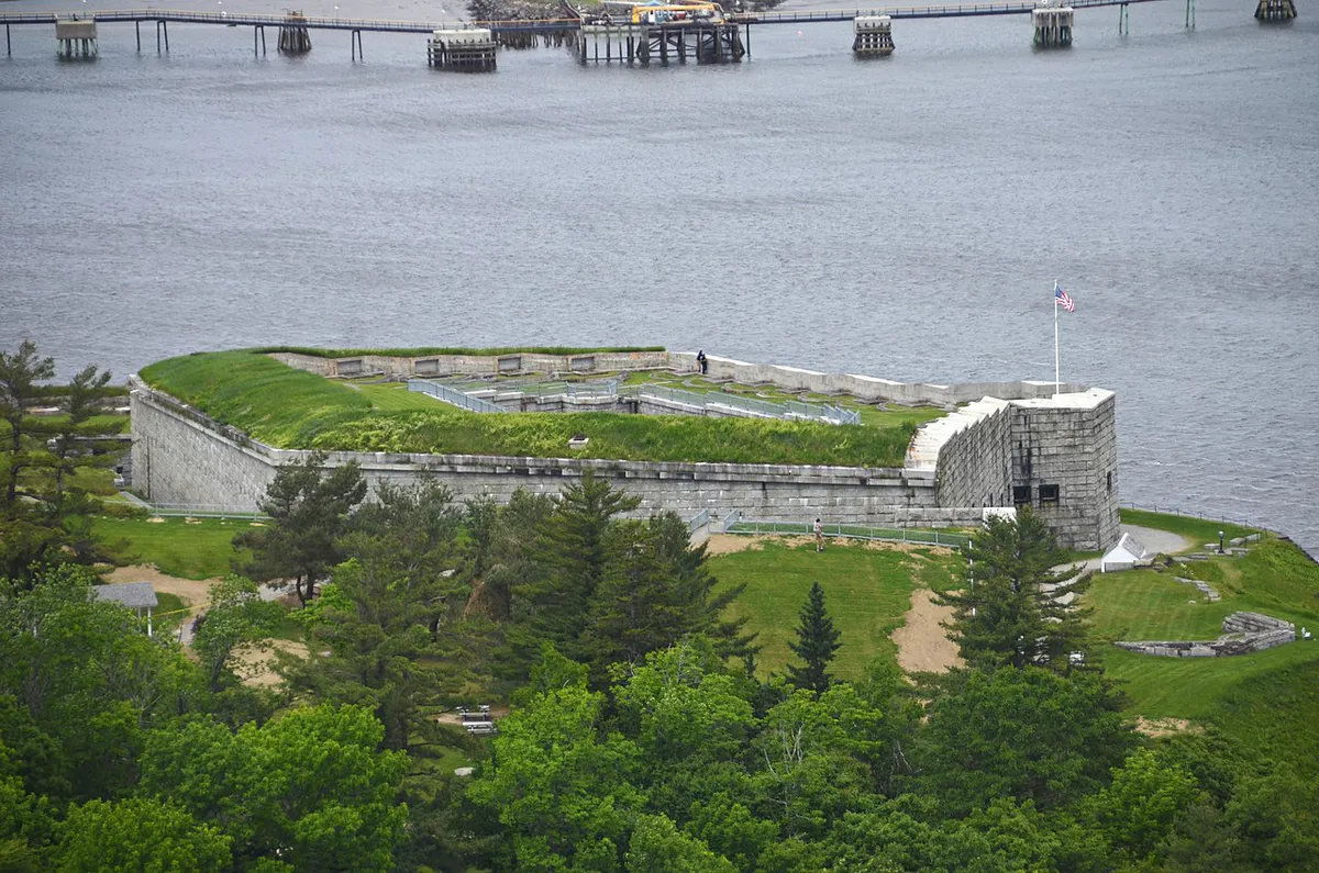
Pair Mount Tuck with a stop at the Penobscot Narrows Bridge observatory and Fort Knox, both just a couple of miles north. The hike is short enough that you can climb Mount Tuck in the morning and still ride the elevator up the bridge tower the same afternoon.
When to Visit
Spring
The forest trail holds mud through mud season, and black flies arrive in mid-May. Footing improves as the ground dries.
Summer
Shaded and cool under the canopy. Bring bug spray, since the woods hold mosquitoes near the wet sections.
Fall
Dry trail, fewer bugs, and the clearest views from the overlook toward Acadia and the bay. The best time to go.
Winter
Hikeable with traction on packed snow. The overlook stays scenic, but the pull-off may not be plowed.
Fall gives you the firmest footing and the longest views from the overlook. Summer is fine if you start early and come prepared for bugs in the wet sections.
Packing List
Mount Tuck Day Hike
- Boots or trail shoes with grip for muddy spots
- 1 to 2 liters of water
- Bug spray from mid-May into summer
- A snack for the overlook
- A light layer for the breezy lookout
- Offline map or photo of the kiosk
FAQ
How long is the Mount Tuck hike?
The Summit Trail is about 3.6 miles round trip with roughly 425 feet of elevation gain. Most hikers finish in about 1.5 to 2 hours.
Is there a view at the summit?
The wooded summit itself does not have a view. The overlook is a short distance past the top, and that is where the trail opens toward Blue Hill, Acadia, and Penobscot Bay.
Are dogs allowed at Mount Tuck Preserve?
Yes. Dogs are welcome and should be leashed at all times per the Coastal Mountains Land Trust trail rules. Clean up after them.
Where do you park for Mount Tuck?
Park at the pull-off by the trailhead kiosk on Meadow Road, reached by driving 4.1 miles north on US Route 1 from the Stockton Springs junction, then 0.6 miles down Meadow Road. Space is limited.
Who manages the trail?
Coastal Mountains Land Trust owns and manages Mount Tuck Preserve. The trail is free to hike.
For more in the area, climb Fort Knox Historic Site or take in the view from the Penobscot Narrows Bridge Observatory.