The West End of the Leuthold Preserve
Number 6 Mountain is a 3,315-foot peak at the western end of The Nature Conservancy’s Leuthold Forest Preserve, a sprawling block of nearly 17,000 acres of forest southwest of Jackman, just south of the Moose River. It is paired with its taller neighbor, the 3,156-foot Number 5 Mountain, and the two summits anchor opposite ends of the preserve in the remote Moose River country of Somerset County. From the higher ground of the preserve, Number 6 looks out toward Attean Pond and the rolling forest that stretches toward the Canadian border.
This is wild, lightly visited land. The preserve protects shoreline on Hall Pond and Upper Tobey Pond and provides habitat for brook trout, waterfowl, and wading birds, alongside the two mountains. The Nature Conservancy keeps the preserve open to the public sunrise to sunset, but it is far from any town and has no facilities, so a trip here is a true backcountry outing.
The Mountain and the Country
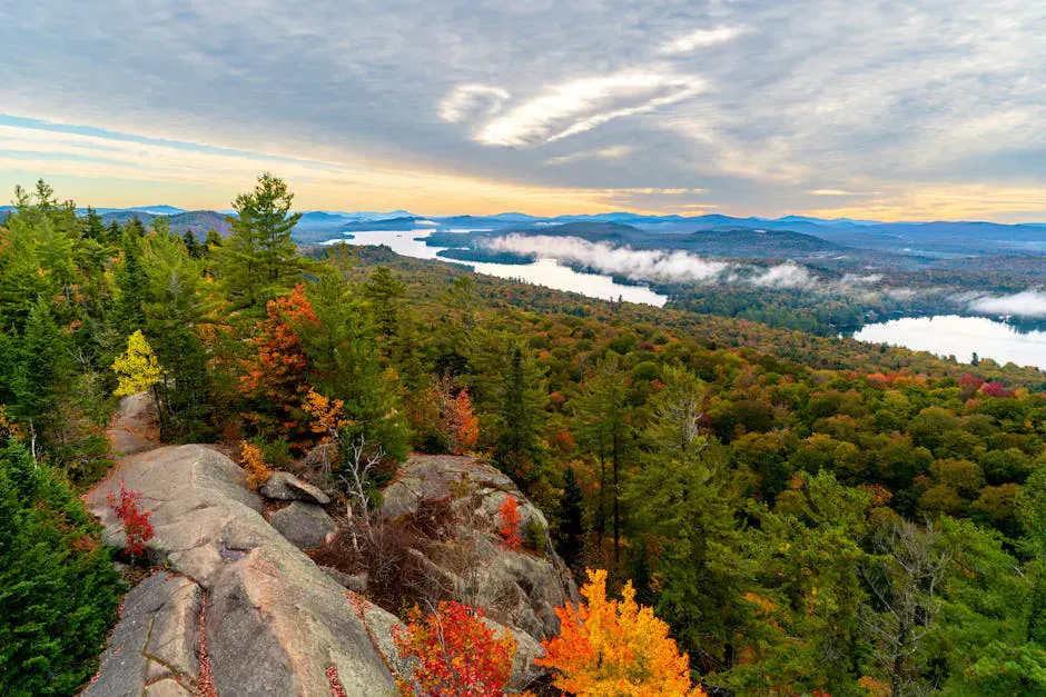
The maintained hiking on the preserve centers on Number 5 Mountain, where an old fire warden’s trail climbs to an old fire tower with sweeping views of Number 5 Bog, Attean Pond, and Number 6 Mountain across the way. Number 6 itself is the wilder of the two, the bare-topped western peak you see from the Number 5 summit, and reaching it is a remote, route-finding objective rather than a signed day hike.
Because Number 6 is so far back in the woods and the marked routes focus on Number 5, treat any attempt on Number 6 as a navigation-heavy bushwhack and a long day. Most visitors to the preserve climb Number 5 for the tower view and take in Number 6 from there, which is the simplest way to experience this country.

#1Mid-range
Osprey Talon 22
Who it’s forDay hikes & scrambles
Why we picked itExcellent ventilation with AirScape backpanel
Pros
- Body-hugging fit stays stable on scrambles
- Versatile 22L capacity hits the sweet spot
- Hipbelt pockets for snacks and phone
Know before you buy
- Not enough space for overnight gear
- Mesh back collects sweat in high humidity
Getting There
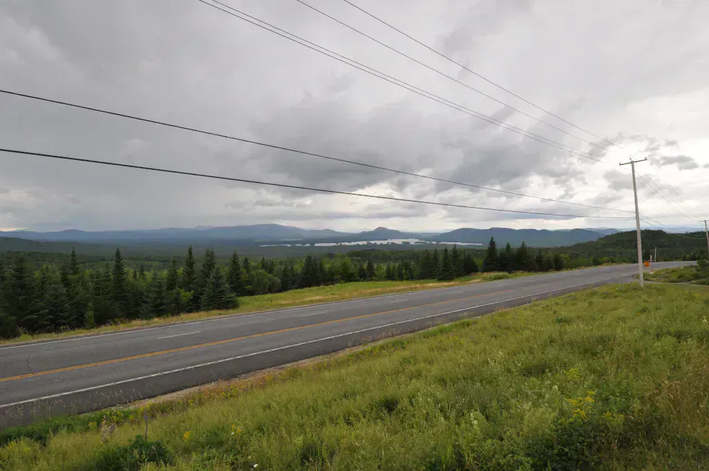
The preserve is reached via Spencer Road off State Route 201, south of Jackman. The access is over gravel logging roads that run well back into the Moose River region, and the drive in is a meaningful part of the trip. Roads are rough in places, conditions change with logging and weather, and a vehicle with good clearance helps.
There is no cell service anywhere out here, and no services past Jackman. Carry a paper map and a downloaded offline map, fuel up before you leave town, and leave a trip plan with someone.
This is deep, roadless backcountry with no cell coverage and no nearby help. Number 6 Mountain has no signed, maintained trail, so anyone heading for its summit needs solid map and compass skills and a willingness to turn back. Do not rely on your phone for navigation or for calling out, and tell someone your route and return time before you go.
For most people, the realistic way to enjoy this corner is to hike the marked Number 5 Mountain trail to its fire tower and look across at Number 6 from there. It gives you the big view, the bog, and Attean Pond without the route-finding gamble of pushing on to the trail-less western peak.
When to Visit
Spring
Logging roads run muddy and rough, snow lingers up high, and black flies are fierce once the snow melts. A bad time to attempt the remote peak.
Summer
The realistic season. Long days, the most stable weather, and the driest roads, though bugs are heavy in the woods.
Fall
Cool, clear, and bug-free with foliage color across the Moose River country. The sharpest views from the high ground.
Winter
The gravel roads are not maintained for winter, making access impractical and the remote summit a serious objective.
Late June through early October is the window, and September offers the best mix of clear air, firm roads, and no bugs.
Packing List
Leuthold Preserve Day Hike
- 3 liters of water minimum
- Calorie-dense food for a long, remote day
- Sturdy boots for rough, trail-less terrain
- Trekking poles for steep and uneven ground
- Map and compass plus a downloaded offline map
- Bug spray and a head net
- Warm layer and shell for the exposed high ground
- Full gas tank and a left-behind trip plan
FAQ
Is there a marked trail to Number 6 Mountain?
Not a signed, maintained one. The marked trail in the Leuthold Forest Preserve climbs Number 5 Mountain to its fire tower. Number 6 is the remote western peak, best reached by experienced hikers with map and compass skills.
How tall is Number 6 Mountain?
About 3,315 feet. It is the western peak of the Leuthold Forest Preserve, paired with the slightly lower Number 5 Mountain at the other end.
How do you get to the preserve?
Via Spencer Road off State Route 201, south of Jackman, then over gravel logging roads. The roads can be rough, and a high-clearance vehicle helps.
Is there cell service?
No. There is no cell service on the preserve or along the access roads. Carry a paper map and an offline map, and leave a trip plan with someone.
Are dogs allowed?
Yes, dogs are allowed on this Nature Conservancy preserve. Given the remoteness and lack of marked trail to Number 6, keep them close and under control.
The easier companion climb is Number 5 Mountain, which has the fire tower and the marked trail. For the gateway town, see Jackman.