Wilderness Paddling Off the West Branch
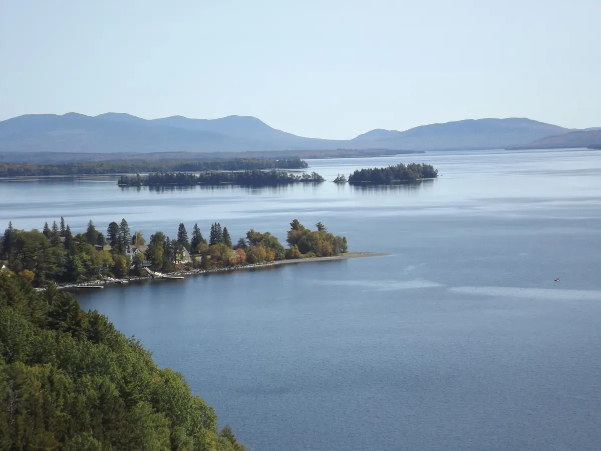
Lobster Lake sits deep in the North Maine Woods, just off the West Branch of the Penobscot River in Lobster Township, Piscataquis County. You reach it by paddling up Lobster Stream from the West Branch, a gentle approach of about two miles with little or no current that delivers you to a big, undeveloped lake ringed by forest. This is true backcountry water, managed by the Maine Bureau of Parks and Lands within the Penobscot River Corridor, with no development on the shoreline and no road right to the water.
The draw is the combination of easy paddling and genuine remoteness. The lake has sandy beaches, numerous primitive campsites, and enough shoreline to keep you busy for days from a single base camp. Many paddlers aim for Ogden Point, one of the more popular sites, and use it as a hub for exploring coves, swimming off the sand, and hiking Lobster Mountain, which rises right above the lake. To the north and west, Big Spencer Mountain stands over the country, a landmark you can climb on a separate trip if you want a summit to go with the paddle.
Because it sits beside the West Branch, Lobster Lake is also a natural side trip for canoeists running the bigger Penobscot River Corridor route, and plenty of multi-day trips fold it into a longer journey.
The Route
From the launch at the confluence of the West Branch and Lobster Stream, the trip begins with about two miles up the stream. The current is negligible, so it is an easy paddle in either direction, and it leads you into the lake itself. Once on Lobster Lake you can shape the day however you like: a loop of the main lake runs in the neighborhood of 10 miles, and side arms and points add more. Adding the Lobster Mountain hike puts another few miles of round-trip walking onto the outing.
For an overnight, settle into one of the lakeside campsites and explore from there. The sandy beaches make for good swimming on a warm afternoon, and the quiet coves are ideal for poking around in a canoe at dawn when wildlife is moving.
There is no cell service here and no quick way out. The nearest real services are back in Greenville, hours away over gravel logging roads. Bring a paper map and compass or a GPS, tell someone your plan, and consider carrying a satellite communicator. Logging trucks have the right of way on the access roads, so drive cautiously and yield.
Access Points
The boat launch is at the confluence of the West Branch and Lobster Stream, at the end of Poulin Road, with a parking area and room for a trailerable boat. This is the standard put-in for both the lake and West Branch corridor trips.
Camping on the lake is at primitive Bureau of Parks and Lands sites, which require a camping fee, and the access roads run through North Maine Woods, which charges a use fee at its checkpoint. Plan to stop and pay at the checkpoint on the way in.
Getting There
From Greenville, follow the Lily Bay Road and Baxter State Park Road onto the Golden Road, the main logging artery, for roughly 33 miles, then continue about 15 miles farther on the Golden Road to Poulin Road. Turn onto Poulin Road and drive about 3.4 miles to the launch. You will pass a North Maine Woods checkpoint, located about 9.6 miles north of Caribou Lake, where you stop to pay the use fee.
These are active gravel logging roads with no services. Fuel up in Greenville, carry a spare tire, and give yourself plenty of daylight for the drive.
When to Visit
Spring
Ice goes out late, often into May. High water on the West Branch and heavy blackflies make early trips less pleasant. Roads can be soft.
Summer
Warm water for swimming off the sand beaches, settled weather, and the prime stretch for camping trips. Bugs ease by midsummer.
Fall
Crisp, bug-free paddling with foliage and excellent solitude. Dress warm and watch the shortening daylight on the access drive.
Winter
The lake freezes and the logging roads are not maintained for casual access. Not a paddling season.
Summer is the heart of the season here, with warm water and stable weather for camping. Fall is quieter and bug-free but cold, with less daylight for the long drive in and out. Spring trips are possible but contend with high water, soft roads, and intense blackflies.
Packing List
Lobster Lake Wilderness Trip
- Canoe or kayak with a PFD for each paddler
- Tent and full overnight camping kit
- Dry bags for gear, food, and clothing
- Water filter or purification for drinking water
- North Maine Woods fee and cash for the checkpoint
- Paper map, compass, or GPS (no cell service)
- Satellite communicator for emergencies
- Bug spray, sunscreen, and warm layers
- Full fuel tank and a spare tire for the logging roads
FAQ
How do you get to Lobster Lake?
Paddle up Lobster Stream from the West Branch of the Penobscot, about two miles of gentle water. The launch is at the end of Poulin Road, reached over the Golden Road logging route from Greenville.
Can you camp at Lobster Lake?
Yes. The lake has numerous primitive Bureau of Parks and Lands campsites with a camping fee. Ogden Point is one of the most popular. There are sandy beaches and good base-camp sites.
Do I need to pay a fee to visit?
Yes. The access roads run through North Maine Woods, which charges a use fee at its checkpoint, and the lakeside campsites carry a Bureau of Parks and Lands camping fee.
Is there cell service at Lobster Lake?
No. There is no cell service. Carry a paper map and compass or a GPS, and consider a satellite communicator, since the nearest services are hours away in Greenville.
Can I climb a mountain from the lake?
Yes. Lobster Mountain rises right above the lake and can be hiked from a lakeside camp. Big Spencer Mountain, a separate climb nearby, stands over the surrounding country.