The Grand Canyon of Maine
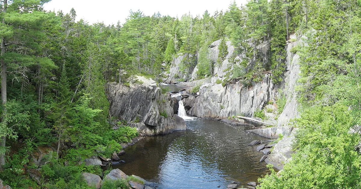
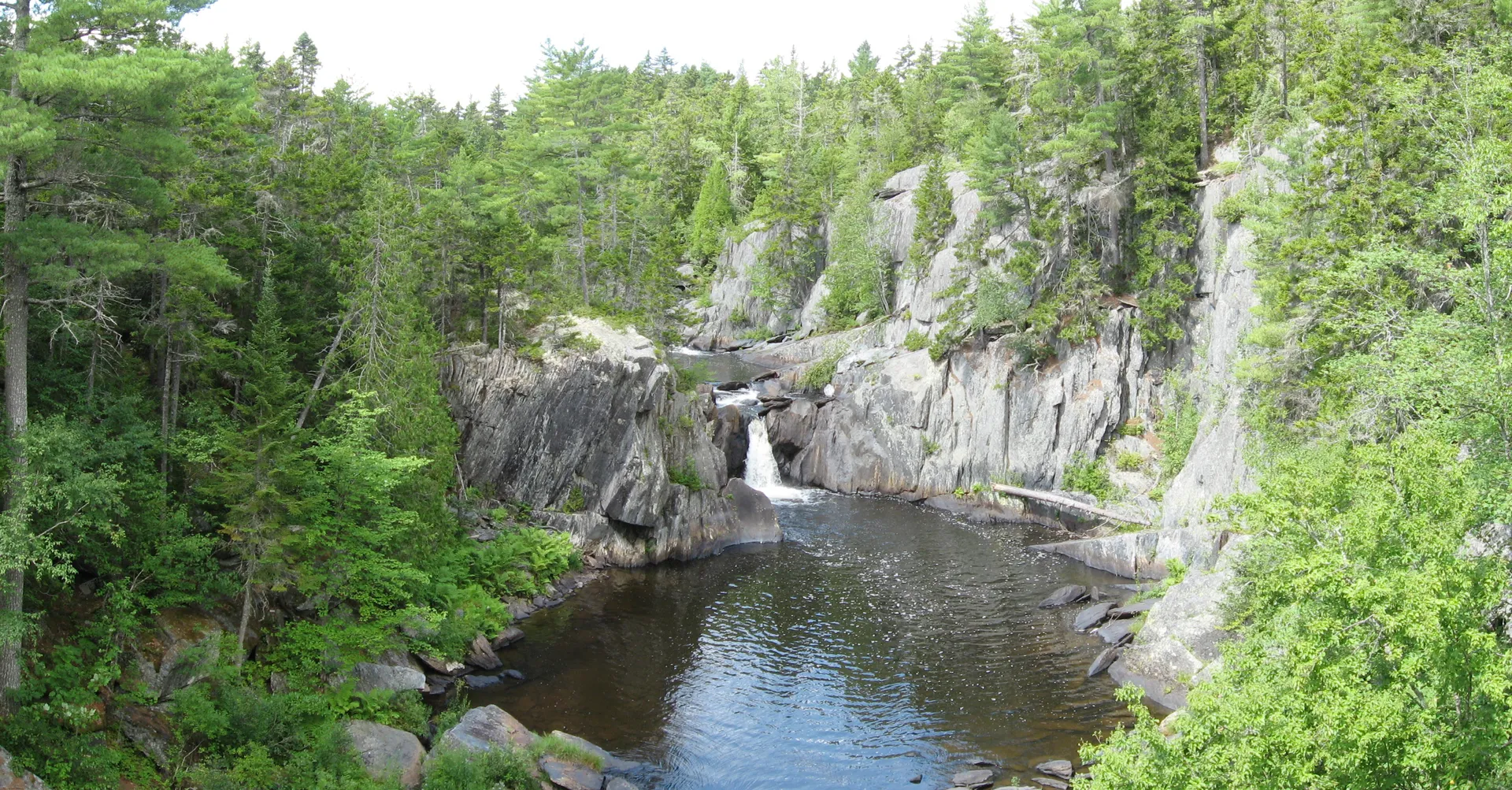
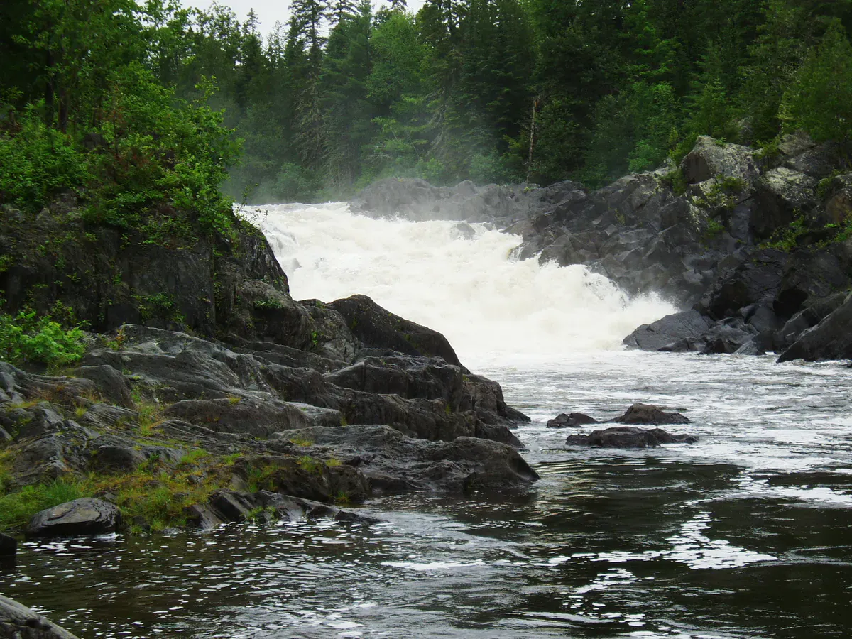
Gulf Hagas is a three-mile gorge carved by the West Branch of the Pleasant River through the slate bedrock of the Maine North Woods. The river drops 370 feet over that distance, pouring through a narrow canyon with walls that rise as high as 130 feet above the water. A series of waterfalls, cascades, and pools punctuate the gorge, each named and each with its own character. The gorge was designated a National Natural Landmark in 1969, and a 500-acre preserve protects the most dramatic section. It is one of the most spectacular natural features in the eastern United States, hidden deep in the woods of Piscataquis County where most people will never see it.
The bedrock that forms Gulf Hagas is slate from the Carrabassett formation, a fine-grained metamorphic rock that fractures cleanly along bedding planes. The river has exploited these fractures over millennia, carving a sinuous channel through the stone that narrows in places to just a few yards across. Where harder bands of rock resist erosion, the river has created waterfalls. Where softer bands gave way, the gorge has widened into amphitheaters with deep pools at their base.
The Hike
The Gulf Hagas Rim Trail follows the top of the gorge for roughly 3 miles, with spur trails descending to viewpoints above each major waterfall and feature. The full loop, including the approach from the trailhead at the end of the logging road beyond Katahdin Iron Works, is approximately 8 miles and takes 6 to 8 hours. This is a full-day commitment in rugged terrain.
The trail begins with a ford of the West Branch of the Pleasant River at the Head of the Gulf. In summer, the ford is typically knee-deep and manageable with care, but it can be dangerous during high water. After the crossing, the Rim Trail follows the canyon edge with a series of named viewpoints:
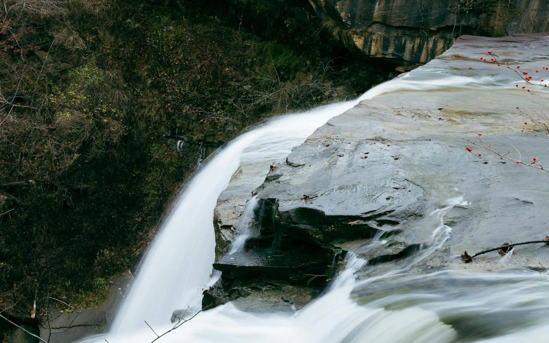
- Screw Auger Falls: A twisting corkscrew waterfall where the river spirals through a narrow channel in the slate.
- Hammond Street Pitch: A broad cascade dropping into a wide pool.
- The Jaws: Where the gorge narrows to its tightest point and the walls press close above the churning water.
- Buttermilk Falls: A long, frothing cascade that gives the water a milky appearance.
- Stair Falls: Where the river drops over a series of slate steps.
- Billings Falls: The largest and most dramatic waterfall in the gorge, a powerful drop into a deep pool framed by high walls.
The River Ford
The hike begins with a ford of the West Branch of the Pleasant River, which is unavoidable. In normal summer conditions, the water is knee-deep and the current is moderate, flowing over a rocky bottom. Water shoes or sandals with straps are essential for the crossing. After the ford, you can change back into your hiking boots on the far bank.
Geology and Ecology
The slate walls of Gulf Hagas are a geological textbook. The layers of the Carrabassett formation are tilted and folded, visible in cross-section along the canyon walls. In places, you can see where harder quartzite bands have resisted erosion while the surrounding slate has worn away, creating overhangs, shelves, and buttresses. The waterfalls form where these resistant bands cross the river channel.
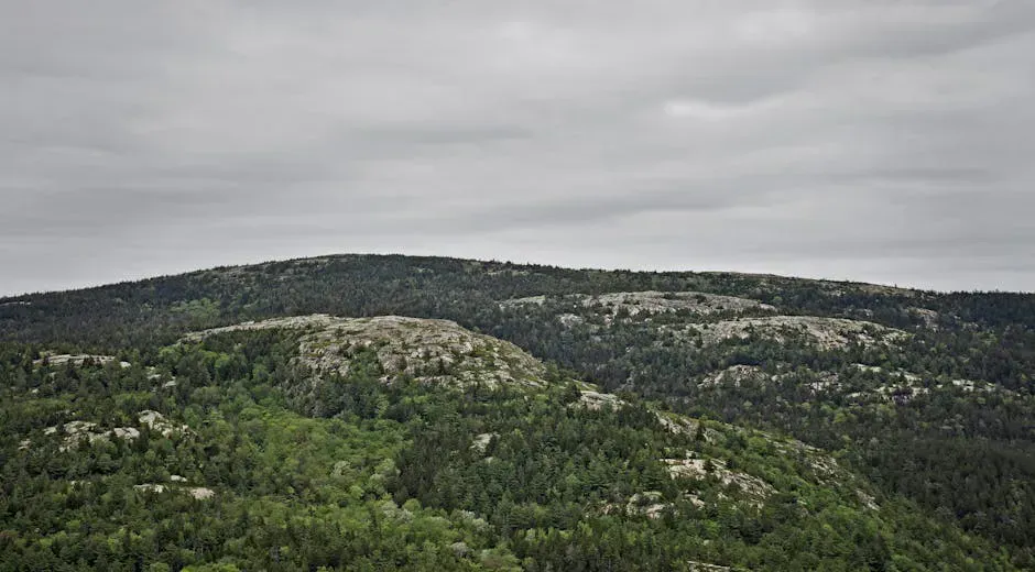
The surrounding forest is mature northern hardwood and spruce-fir, with old-growth characteristics in the protected gorge. Hemlock, yellow birch, and red spruce grow to impressive sizes on the slopes above the canyon. The understory is thick with mosses, ferns, and wildflowers. The gorge microclimate, cool and moist from the river spray, supports plant communities that differ from the surrounding upland forest.
When to Go
Summer
Best season for the river ford and trail conditions. Water levels are typically at their lowest in July and August. Black flies can be fierce in June. Bring bug spray.
Fall
Spectacular foliage in the hardwood forest above the gorge. Cooler temperatures and fewer bugs. Water levels can rise after autumn rains, making the ford more challenging.
Spring
Road opens late May. River is high and fast, making the ford dangerous or impossible. Waterfalls are at their most powerful. Only for experienced hikers who can assess water conditions.
Winter
Road is not maintained and access is not practical. The gorge is ice-filled and the trail is buried in snow. Not accessible for most visitors.
Getting There
From I-95, take Exit 199 to Route 11 North toward Brownville and Brownville Junction. Follow signs for Katahdin Iron Works Road. Pass through the North Maine Woods checkpoint and continue on the logging road to the Gulf Hagas trailhead. The road is rough gravel beyond the checkpoint, and high-clearance vehicles are recommended. From Bangor, the drive to the trailhead takes about 1 hour and 45 minutes. From Portland, expect 4 hours.
GPS coordinates for the trailhead area: 45.4925, -69.3317
Gulf Hagas Essentials
- Sturdy hiking boots (roots, rocks, and wet surfaces throughout)
- Water shoes or strapped sandals for the river ford
- Dry bag for boots during the crossing
- Trekking poles (helpful for ford and rocky trail)
- 3+ liters of water (no reliable sources)
- Full day's food and snacks
- Bug spray (essential June through August)
- Offline map and compass (no cell service)
- Headlamp (in case the hike takes longer than planned)
- Cash for the North Maine Woods gate fee ($15)
FAQ
How long does the Gulf Hagas hike take?
The full loop is approximately 8 miles and takes 6 to 8 hours, depending on pace and how long you spend at the viewpoints. This is a full-day hike. Start early.
Do I have to ford the river?
Yes. The hike begins with a ford of the West Branch of the Pleasant River. In normal summer conditions, it is knee-deep with a rocky bottom. Water shoes are essential. The ford can be dangerous in high water.
Is Gulf Hagas really the Grand Canyon of Maine?
It has carried that nickname for over a century. The gorge is 3 miles long with walls up to 130 feet high. It is not comparable in scale to the Grand Canyon in Arizona, but it is the deepest and most dramatic gorge in Maine.
Is there a fee to visit Gulf Hagas?
A $15 per vehicle gate fee is charged at the North Maine Woods checkpoint at Katahdin Iron Works. This covers access to the logging road network that leads to the trailhead.
Can I swim in Gulf Hagas?
Some of the pools below the waterfalls are deep enough for swimming, and people do swim in them. The water is very cold, even in summer. Be cautious of currents near the falls and slippery rock.