New England’s Hidden Giant
Moxie Falls drops roughly 90 feet in a single dramatic plunge on Moxie Stream, deep in the forests of Somerset County near the tiny hamlet of The Forks. It is one of the tallest waterfalls in New England, a claim it shares with Angel Falls in Township D about 60 miles to the southwest. What sets Moxie Falls apart is the combination of height, volume, and accessibility. A well-maintained trail of just 0.7 miles leads from the parking area to two viewing platforms above the gorge, making this one of the easiest major waterfall hikes in Maine.
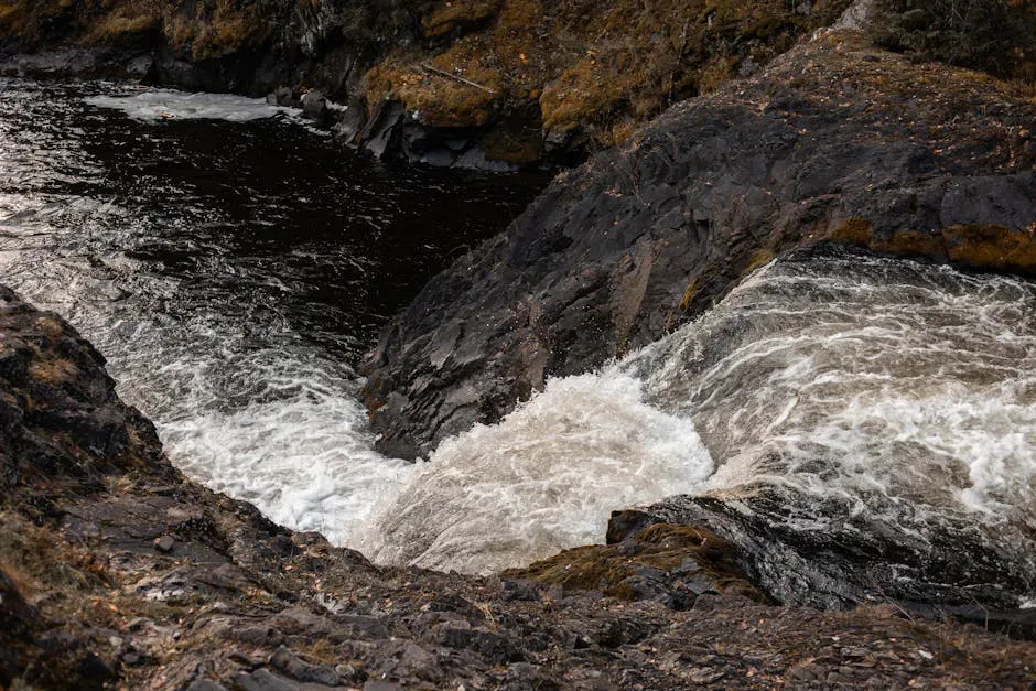
The falls pour over a ledge of resistant rock into a deep, narrow gorge carved by Moxie Stream over thousands of years. The gorge walls are dark slate and schist, draped in moss and ferns, with mist rising from the pool at the base. The sound is constant and immersive. On a warm summer day, the mist cloud at the base of the falls catches sunlight and throws rainbows across the gorge.
The Trail
The Moxie Falls Trail begins at a parking area off Lake Moxie Road, about 3 miles south of The Forks. The trail is 0.7 miles one way, well-marked with blue blazes, and follows a mostly level path through mixed spruce and hardwood forest. The footing is good for most of the way, with wooden boardwalks and steps in the wetter sections near the falls.
The trail ends at two viewing platforms perched on the rim of the gorge above the falls. The upper platform gives you a view looking down at the full drop of the waterfall. The lower platform, reached by a steep set of wooden stairs, brings you closer to the base of the gorge and the pool below the falls.
The Gorge Below
Below the main falls, Moxie Stream continues through a slate gorge for several hundred yards, dropping over smaller cascades and into pools. An informal trail descends to the base of the gorge from the lower viewing platform, though it is steep, rocky, and requires careful footing. The pools below the falls are popular swimming holes in summer, with deep, cold water surrounded by rock walls. The water temperature is bracing even in August, typically in the 50s or low 60s.
History and Name
The name Moxie comes from the Abenaki language and likely refers to the dark water of Moxie Stream or Moxie Lake above. The same word gave its name to Moxie soda, one of the first mass-produced soft drinks in the United States, which was invented in 1884 by Dr. Augustin Thompson of Union, Maine. The soda was named for Moxie Nerve Food, a patent medicine that Thompson had marketed earlier, and the word “moxie” eventually entered the English language to mean courage or determination. The connection to the falls is indirect but part of Maine cultural lore.
The Forks, the nearest settlement, sits at the confluence of the Dead River and the Kennebec River. The area is known for whitewater rafting, and many visitors combine a trip to Moxie Falls with a rafting day on the Kennebec or Dead River.
When to Go
Spring
The most powerful water flow of the year as snowmelt feeds Moxie Stream. The falls are at their most dramatic. Trail can be muddy and black flies emerge in late May.
Summer
Best trail conditions and warmest weather for swimming in the pools below. Water flow decreases through the season. Mornings are less crowded than afternoons.
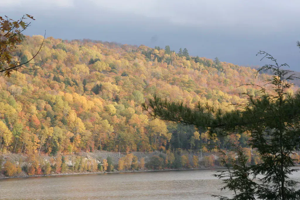
Fall
Beautiful foliage along the trail and around the gorge. Cooler temperatures and fewer bugs. Water flow varies with autumn rains.
Winter
The falls partially freeze in dramatic ice formations. The trail may be icy or snow-covered. Bring traction devices. The frozen falls are spectacular but access requires winter hiking preparation.
Practical Notes
The parking area at the trailhead is unpaved with room for about 30 vehicles. There are no restrooms, water, or services. The nearest gas station and general store are in The Forks, about 3 miles north on Route 201. Cell service is spotty in the area.
The trail is suitable for all ages and fitness levels, though the stairs to the lower viewing platform and the informal descent to the gorge floor require steady footing. Dogs are allowed on leash.
Getting There
From Portland, take the Maine Turnpike to I-95 north, exit at Waterville, and follow Route 201 north through Bingham and Caratunk to The Forks. Just south of The Forks, turn onto Lake Moxie Road and follow it about 3 miles to the trailhead parking area. The drive from Portland takes about 3 hours. From Bangor, take Route 15 west to Route 201 north, about 1 hour and 45 minutes.
GPS coordinates for the trailhead: 45.3640, -69.9377
FAQ
How tall is Moxie Falls?
Moxie Falls is approximately 90 feet tall, making it one of the tallest waterfalls in New England. It shares this distinction with Angel Falls in western Maine. Both are roughly the same height depending on measurement method.
Is the Moxie Falls trail suitable for kids?
Yes. The 0.7-mile trail is mostly level and well-maintained. Children should be supervised at the viewing platforms and kept away from the gorge edge. The stairs to the lower platform may be challenging for very young children.
Can I swim at Moxie Falls?
People do swim in the deep pools below the falls, but it is at your own risk. The water is very cold, even in summer. The descent to the gorge floor is steep and rocky. There are no lifeguards.
Is Moxie Falls the tallest waterfall in Maine?
Moxie Falls and Angel Falls in Township D are both approximately 90 feet tall and compete for the title. Both are among the tallest waterfalls in the state and in New England.
Is there a fee to visit Moxie Falls?
No. There is no entrance fee, no gate, and no permits required. The trailhead parking area is free.